
Discover Mallorca’s Tramuntana
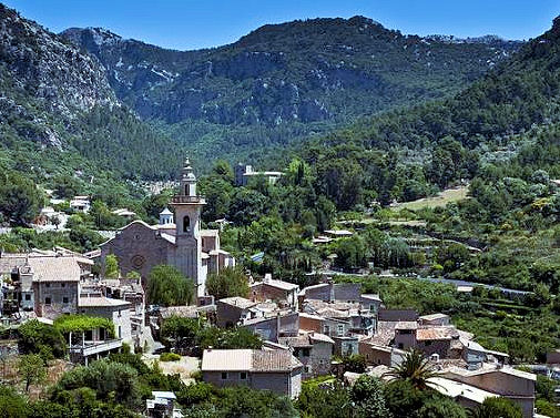
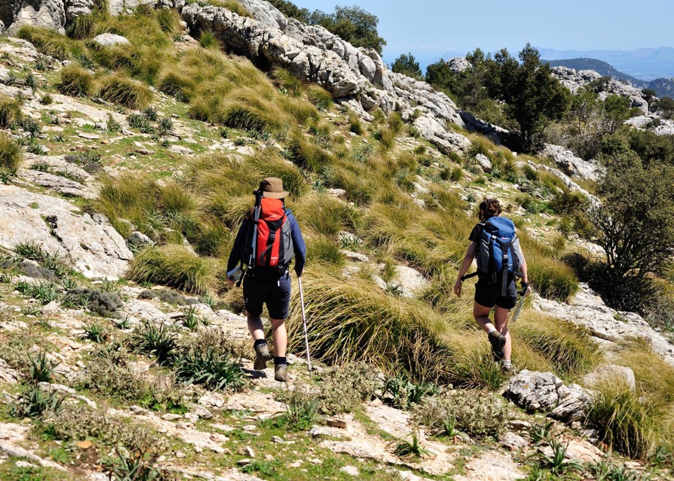
Mallorca’s mighty Tramuntana mountain range offers a wealth of walking adventures, with easy strolls all the way to challenging hikes for experienced walkers.
To get the best out of a trip to the Tramuntanas, a large scale and up-to-date map is essential. The best maps you will find are published by Discovery Walking Guides, who have just released two large scale maps to cover the North Tramuntana and the South Tramuntana.
Mallorca – Tramuntana North Tour & Trail Map
ISBN: 9781782750895
960mm by 694mm
1:30,000 scale
(Price held at £10.99)
The map section below shows the area covered by the north map.
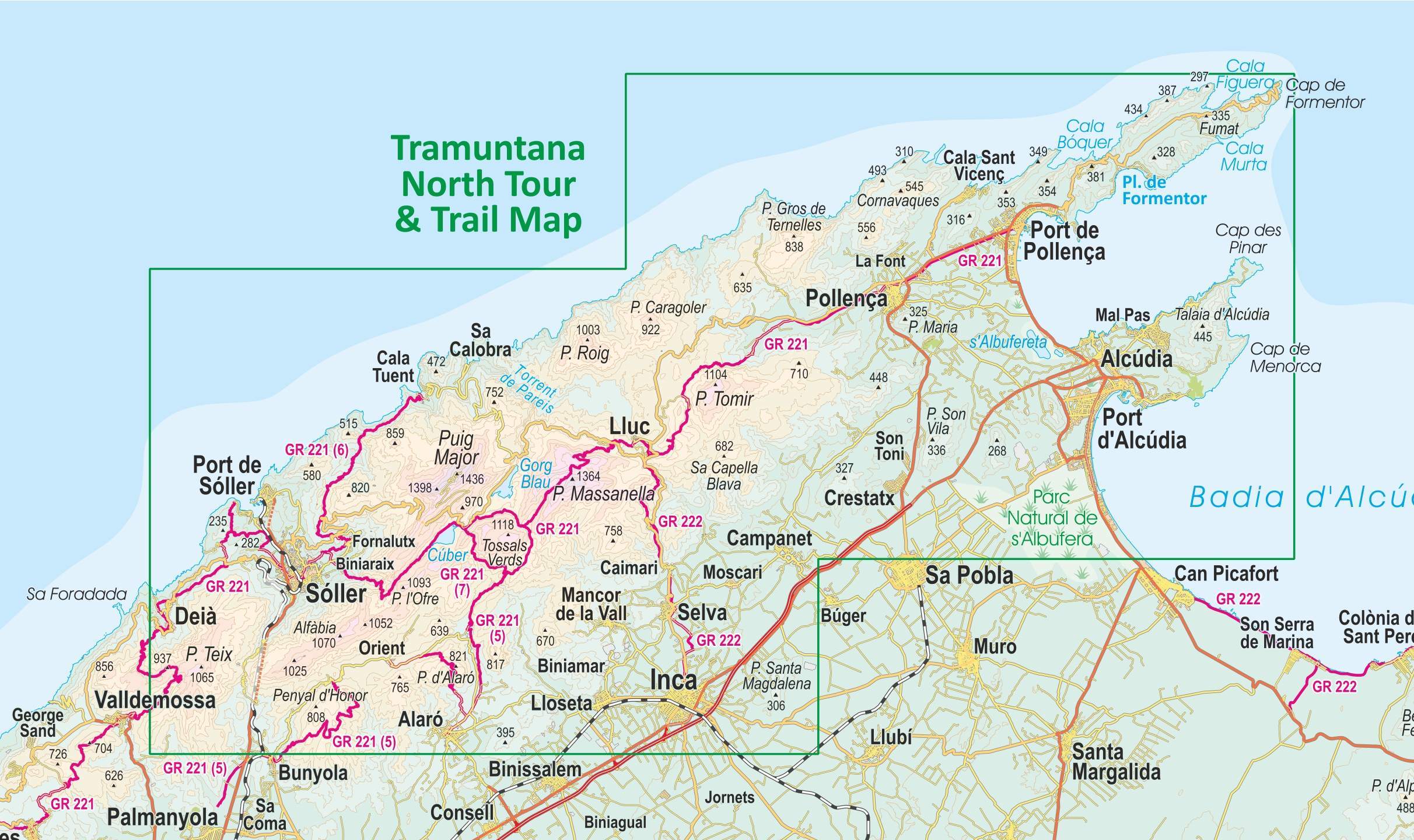
This double sided map sheet covers the northern half of Serra de Tramuntana at 1:30,000 scale.
This map covers a continuous area from Tramuntana’s northern-most Cap de Formentor, including all the coastal resorts such as Port de Pollença and Port d’Alcúdia, all the way to Sóller and Deià at the opposite end of the map (for the area from Sóller further due south-west to Magaluf, Peguera and Port d’Andratx, see our second title: Mallorca – Tramuntana South Tour & Trail Map).
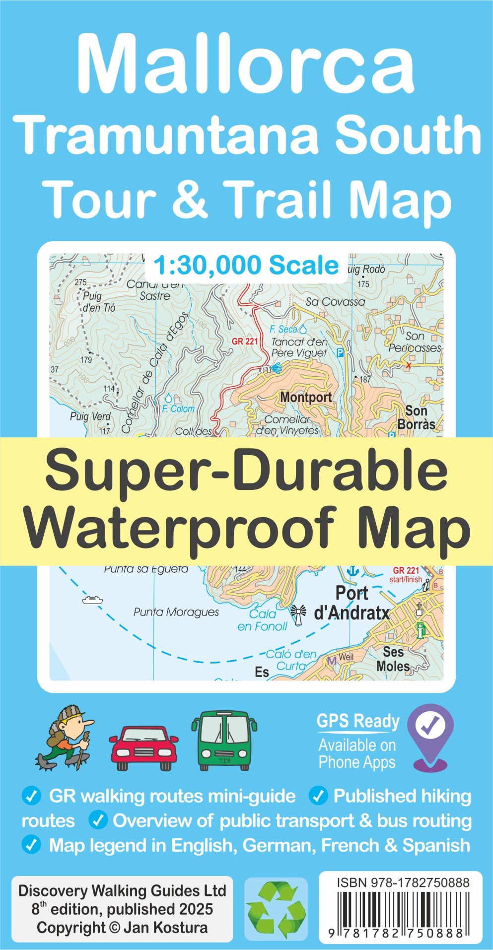
Mallorca – Tramuntana South Tour & Trail Map
ISBN: 9781782750888
960mm by 694mm
1:30,000 scale
(Price held at £10.99)
The map section below shows the coverage of the south map.
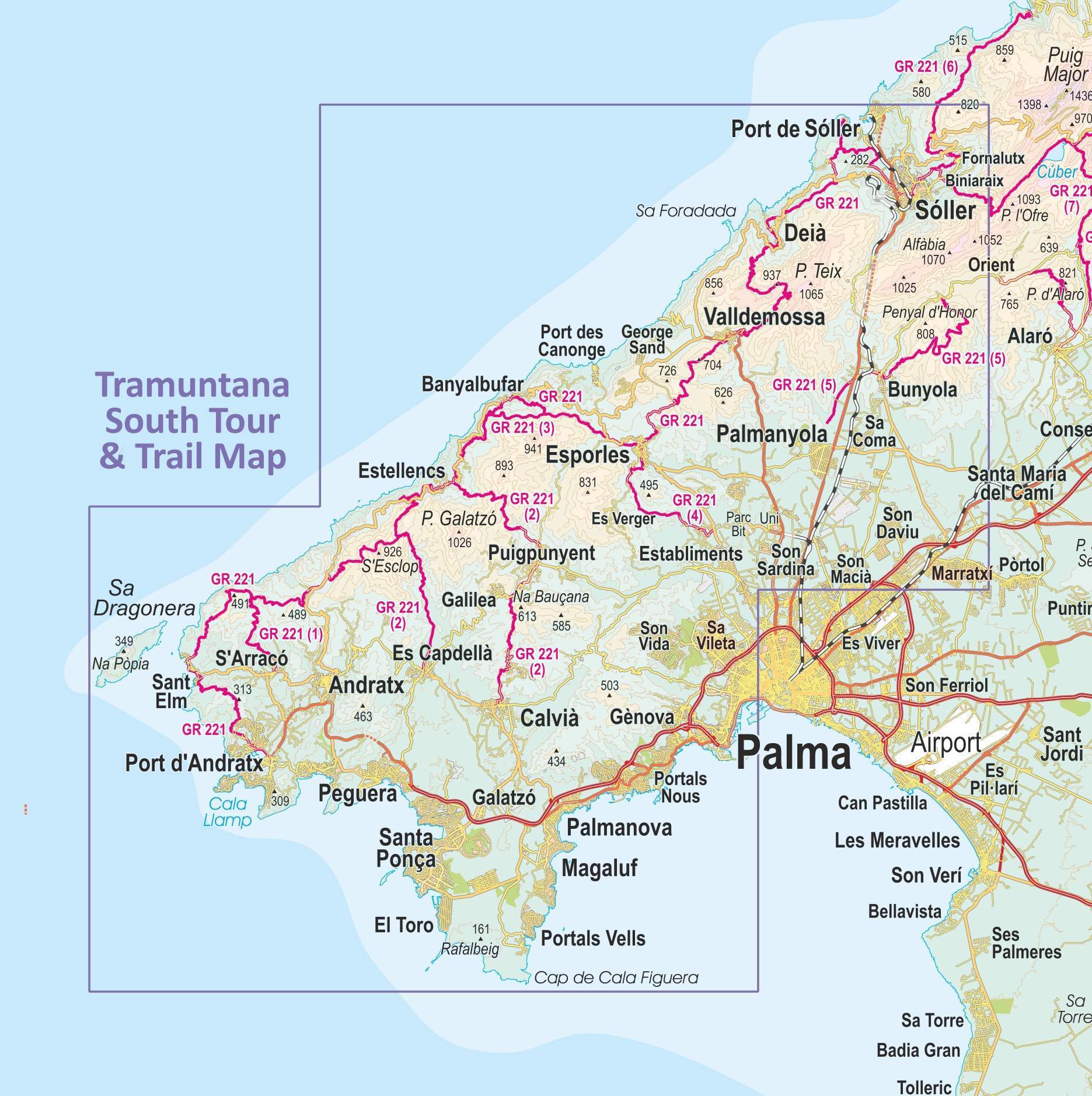
This double sided map sheet covers the southern half of Serra de Tramuntana at 1:30,000 scale.
Covering a continuous area from Tramuntana’s southern-most point Cap de Cala Figuera, this map includes all the coastal resorts such as Magaluf, Santa Ponça and Peguera, with Port d’Andratx and Sa Dragonera islet also covered, all the way to Sóller and Port de Sóller at the opposite end of the map (for the area from Sóller further due north-east to Pollença and Cap de Formentor, see our second title: Mallorca – Tramuntana North Tour & Trail Map).
What’s included?
- GR 221 long-distance route is specially highlighted in the map (red), with a boxed mini-guide to the GR 221 and GR 222, summarizing the most important aspects of the main route, its variants and accommodation.
- Highlighted in the map (green) are also published walking routes by Sunflower and Rother, helping you identify routes that are open to walkers, on an island where private properties along trails may sometimes pose a challenge to hikers.
- Also included is a small dictionary or frequently used Catalan words appearing in the map.
- The legendary ‘Tour & Trail’ level of detail ranges from railways, motorways, main roads, secondary roads, minor roads, streets and narrow country lanes, dirt tracks to walking trails and faint/difficult paths.
- Altitude shading is designed to clearly show the altitude range when travelling across the island by car, bus, or on foot. 20-metre and 100-metre contours combined with the altitude shading bring this beautiful landscape to life.
- There are plenty of individual height points and all of the official ‘Trig’ points are on the map. Tour & Trail attention to detail includes our useful symbol range such as viewpoints, picnic areas, petrol stations, bar/restaurants and parking areas where you can pull off the road safely. You will easily identify springs, caves, sports grounds, museums, churches, chapels, crosses, cemeteries, lighthouses, forts, wind turbines, windmills, hotels and tourist attractions. It all adds up to the most detailed and most durable map of Mallorca’s Tramuntana North that you can get.
- The guide to Mallorca’s public transport will help you get oriented with the various service providers that operate buses, trains, metro and tram, to make the most of your adventures. Bus stops along with actual bus numbers are then highlighted in the map to help you see where each bus runs. Those relying on a hire car will appreciate kilometre markers plotted each kilometre in the map on most roads, aiding you track progress and show where you are. Symbols indicate features such as viewpoints, picnic areas, petrol stations, bar/restaurants and parking areas where you can pull off the road safely. You will easily identify springs, caves, sports grounds, museums, churches, chapels, crosses, cemeteries, lighthouses, forts, wind turbines, windmills, hotels and tourist attractions.


Maps are available through all booksellers, online and in your high street.
