
Ready For Some Tenerife Sunshine?

Cold enough for you yet? Are you already tired of the short, dark winter days? How about Tenerife? About four and a half hours’ flight from the UK and western Europe could see you in the picture; big, impossibly blue skies, clear seas and everything from beaches, shopping, walking and snow-capped mountains (including Mount Teide, Spain’s highest point).

Typical temperatures in winter reach the low 20s centigrade, with an average of 6 hours of wonderful sunshine a day. Hike the trails, climb a mountain, laze around a pool or relax with a cerveza watching the sun slip into the dark blue Atlantic.


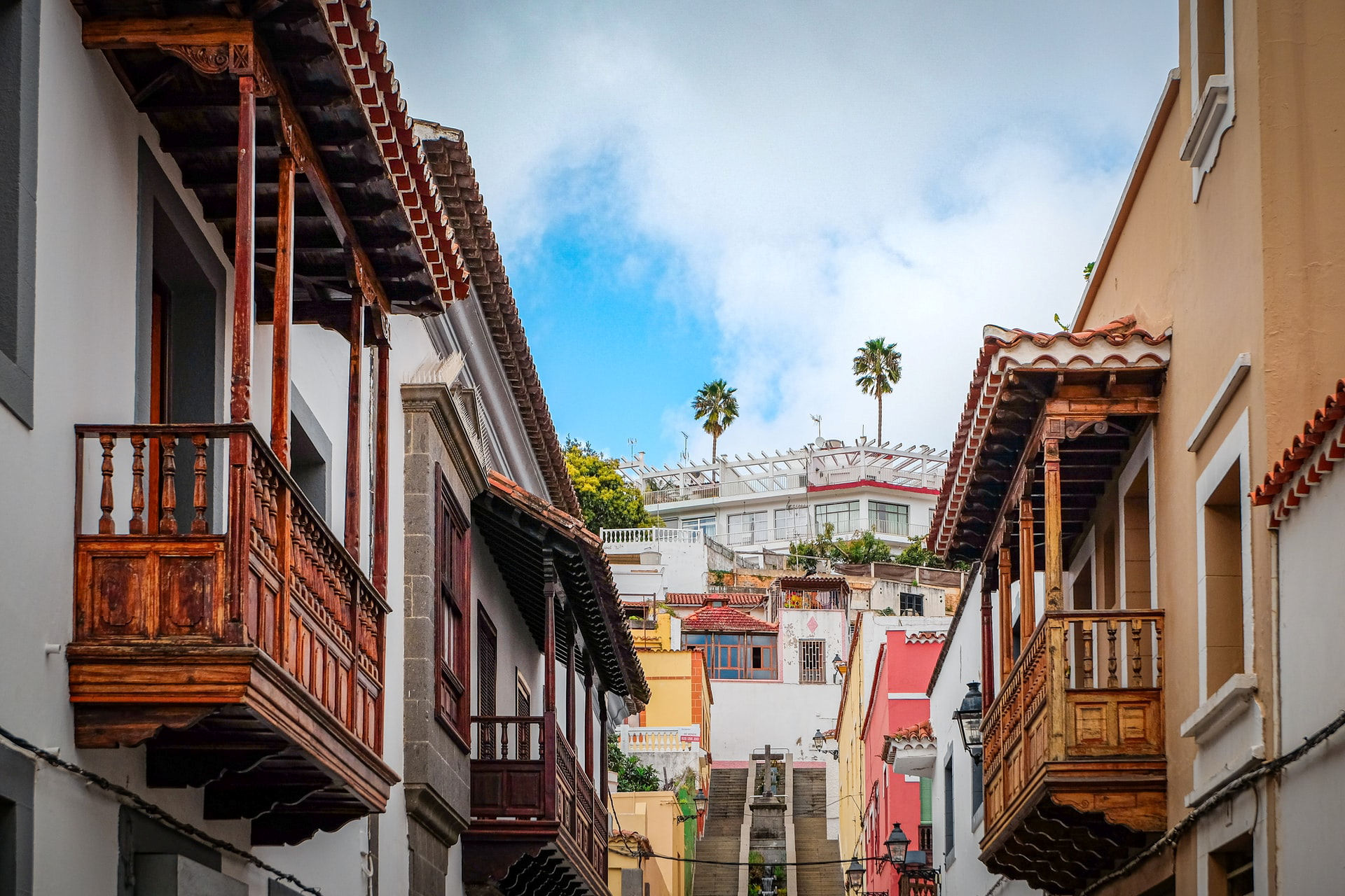
Leave the coastal resorts behind and explore the small towns, villages and hamlets. Car hire is good value, or use the local buses for a more relaxing adventure.
It’s well worth taking a good guidebook, detailed walking map and a bus map with you to get the most value and fun out of your adventures. See HERE for more information.
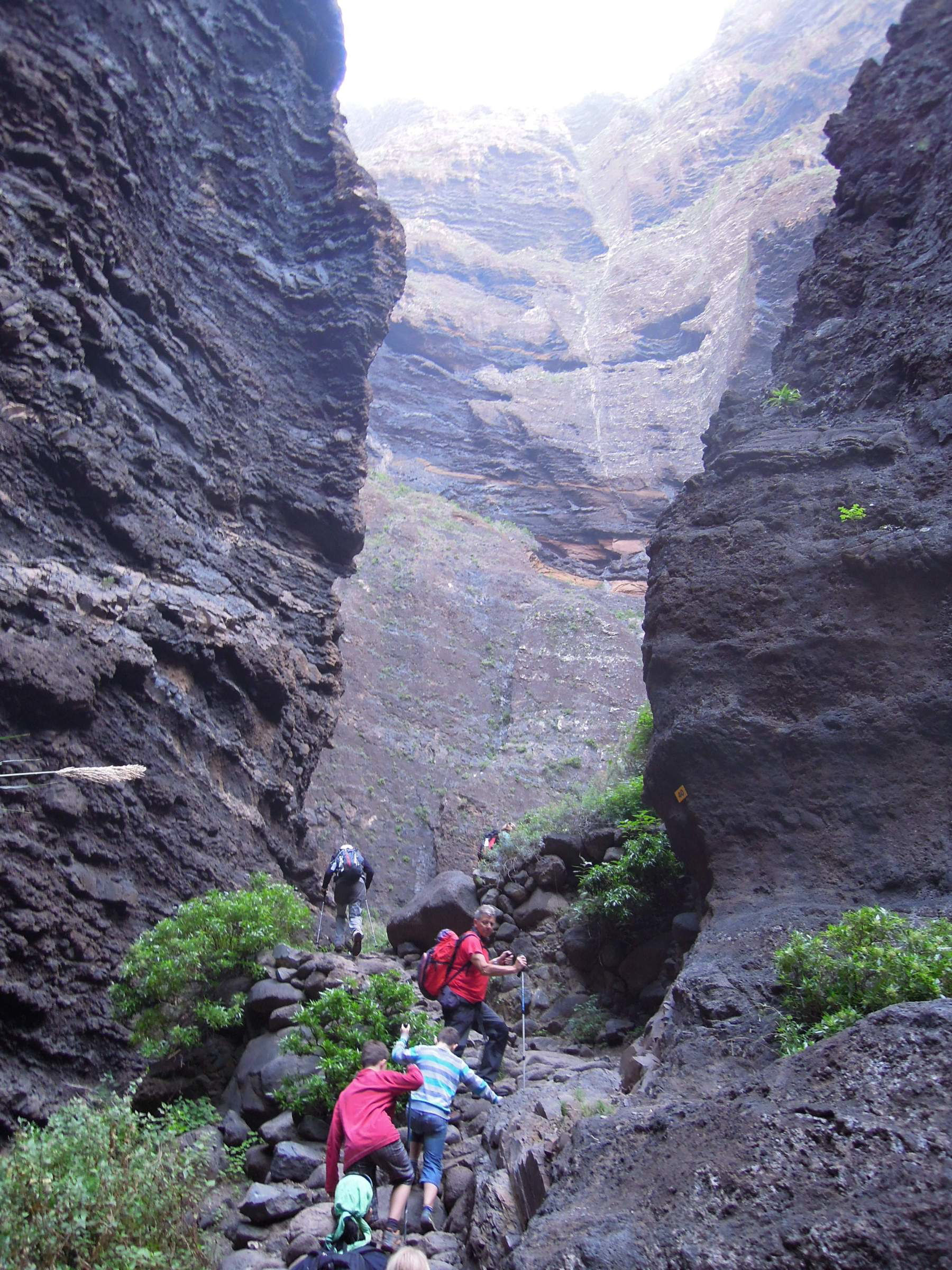
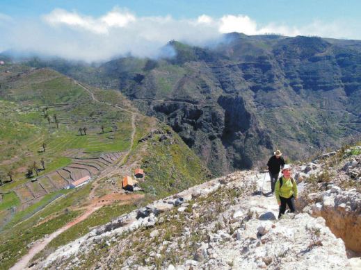
Majestic Barranco de Masca (Tenerife) Reopens!
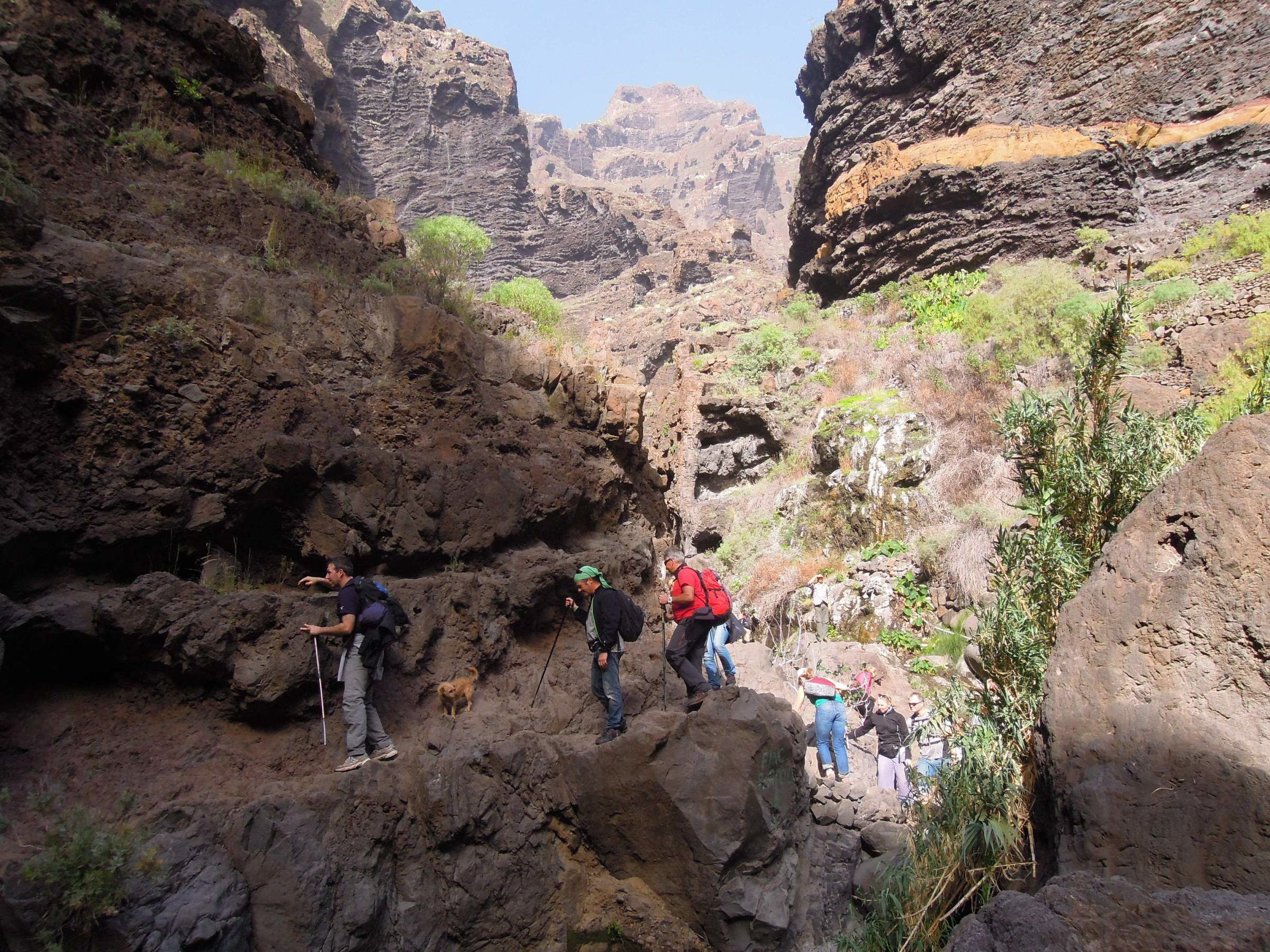
27 March is the long awaited date for the re-opening of this majestic and challenging barranco (ravine) walk on Tenerife’s north-west coast.
However, the option of doing only the downhill walk from Masca village to the beach and hopping on a boat to get back to civilisation is not (for now) available as the jetty isn’t yet refurbished. This means you need to be fit enough to walk it both ways and this is challenging for many.

To walk the ravine, Masca can be accessed in public transport from Buenavista del Norte or from Santiago del Teide.
In order to access the ravine, pre-booking is advised at http://www.barrancodemasca.com.
You can also book at the Masca Visitors Center, although availability is not guaranteed for walking the ravine on the same day.
At the moment, entry is free, although in the future (presumably when all work is completed on the jetty), a fee of 8 euros (residents) and 16 euros (visitors) will be charged (Check the official website for the latest entry information.)
The ravine is not recommended for under 8 year olds.
Safety helmets must be worn.
Access will be in groups of 25 walkers, every half hour.
Opening hours of the ravine will be 8:00 to 18:00 in summer, and from 8:00 to 17:00 in winter (though for now, it will only be open weekends and holidays).
Three checkpoints have been established at the beginning, halfway point and on the beach.
Active tourism companies will be allocated 50 % of tickets. For more information and to book your place, go to the official website HERE.
Lockdown Blues? Get ready to travel.
With vaccinations well under way in many parts of the world, there’s real belief that travel restrictions will gradually ease in the next few months. We make no apology for offering the information about our free digital maps once again; last time we posted this information we were pleased and surprised at how many people enjoyed them and started planning ahead to travel.
We’d like to help you get planning. Where to next? Why not start by getting your hands on our Free Digital Maps.
Read all about it HERE.
There are free maps to 19 tempting walking destinations to check out, including :
CANARY ISLANDS
La Gomera & El Hierro, Lanzarote, La Palma, Tenerife, Fuerteventura, Gran Canaria


BALEARIC ISLANDS
Mallorca, Menorca, Ibiza, Formentera

GREEK ISLANDS
Zakynthos (Zante), Corfu
SPANISH MAINLAND
Costa Blanca Mountains, Costa del Sol (Axarquia), Alpujarras, Sierra de Aracena

– and also:
Malta & Gozo
Madeira
Azores
To see more details about the free digital maps and how to get them, LOOK HERE
Plan Your Next Walking Adventure With our FREE Digital Maps
With the real hope of vaccines within reach, we can look forward to planning walking adventures again. Once travel freedom returns, there’s going to be a lot of pent-up desire to get away, so this could be the best time to make some plans.
We’d like to help you get planning. Where to next? Why not start by getting your hands on our Free Digital Maps.
Read all about it HERE.
There are free maps to 19 tempting walking destinations to check out, including :
CANARY ISLANDS
La Gomera & El Hierro, Lanzarote, La Palma, Tenerife, Fuerteventura, Gran Canaria
BALEARIC ISLANDS
Mallorca, Menorca, Ibiza, Formentera
GREEK ISLANDS
Zakynthos (Zante), Corfu
SPANISH MAINLAND
Costa Blanca Mountains, Costa del Sol (Axarquia), Alpujarras, Sierra de Aracena
– and also:
Malta & Gozo
Madeira
Azores
To see more details about the free digital maps and how to get them, LOOK HERE
Canary Islands – Here We Come!
At last the Canary Islands are back on the British Government’s unrestricted travel list. The Canaries offer so much variety, each island unique and unforgettable, and with a warm, welcoming climate, the perfect choice as northern hemispheres feel the first shivers of winter.
Gran Canaria – the miniature continent, a roughly circular island of ravines and 60 kilometres of beaches, winding forest roads and criss-crossed with walking routes. Plenty to discover, day and night.
For more information click here.
Want the Gran Canaria Tour & Trail Super-Durable Map? Look here.
La Gomera, just west of Tenerife and easily reached via a short ferry crossing – plunging barrancos and soaring forest-topped mountains sprinkled with hamlets and farmsteads clinging to the slopes. Walk, bike, swim, explore – enjoy.

El Hierro, small, fascinating, the most remote and westerly Canary Island promises rugged terrain, narrow winding roads and great walking. A world-class marine reserve, free island-wide wifi and electric car charge ports contrast with the traditional feel of the island. Yet, there are very few tourists – for now.

There’s more information on La Gomera and El Hierro here.
La Gomera and El Hierro Tour & Trail Super-Durable Maps can be bought onlime including HERE.
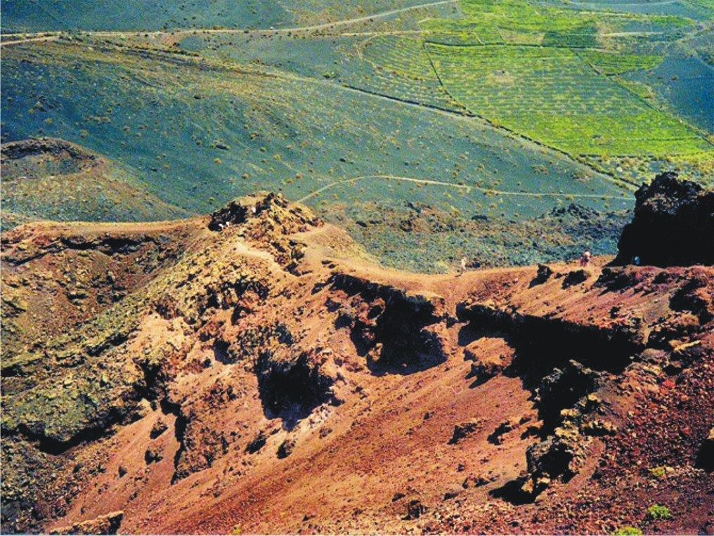
Lanzarote – the Fire Island; volcanic, mysterious and mesmerising terrain, lava seas and alpine meadows. Other-worldly. Once visited, never forgotten.


Find out more about Lanzarote here.
Buys the map from online selllers including HERE.
Fuerteventura, known for beautiful beaches and great water sports, also offers a surprising variety of fascinating walking adventures. Wild coastlines contrast with traditional towns and views across pristine seas.


See more information about Fuerteventura here.
Maps can be foundfrom online sellers including here.
La Palma – La Isla Bonita; dramatic landscapes; a breathtaking mountain spine splits this volcanic island. Black beaches, Lush vegetation and 1080 kilometres of waymarked walking paths.
There’s more information about walking on La Palma here.
Buy La Palma maps online including here.
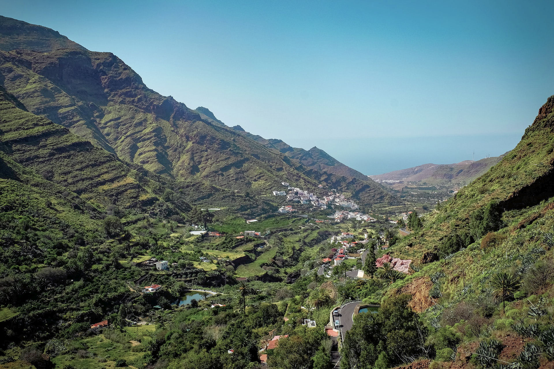
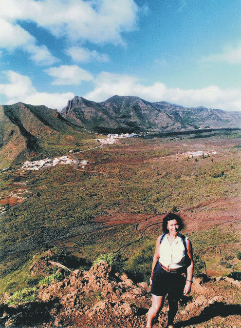
Tenerife – a Walker’s Island There’s so much to Tenerife. 2034 square kilometres offer coastal adventures, mountain hikes, pine and laurel forest trails, strolls and strenuous challenges including Spain’s highest peak (Mount Teide).The choice is almost endless.
You can buy the walking guide, walking maps and bus map online.
Travel Gets The Green Light
The British Government has published the list of countries you can travel from, into England, with no quarantine needed. At last, the brakes are off and all of us who want to get away have a tempting array of countries to choose from.

Of course, keeping safe is important, so what better than getting out and about on airy mountain walks or breezy coastal trails, well away from the crowds.

Greece and its lovely islands is on the ‘good to go’ list, along with all of Spain including the Canary Islands and the Balearic Islands.
How about the quiet beauty of Brittany (France), or fascinating Malta and Gozo?


There’s plenty of information to help you choose your getaway destination here.
Have a look at our free digital maps, fully detailed and just what you need for adventuring away from the crowds. Take a look at our printed maps and walking guidebooks too.
We can offer maps (many also available as free digital downloads) and guidebooks for most of the following destinations which are all on the UK Governments ‘free to travel‘ list:
FRANCE
Brittany
SPAIN
Canary Islands: Gran Canaria
La Palma
Tenerife
Lanzarote
La Gomera & El Hierro
Fuerteventura
Mainland Spain: Costa Blanca Mountains
Sierra de Aracena
Costa del Sol
Alpujarras
Balearic Islands: Mallorca
Ibiza
Formentera
Menorca
GREECE
Zakynthos (Zante)
Corfu
Malta & Gozo


A Little Good News – Free Digital Maps For Everyone
We may not be able to go adventuring for a while yet. However, we can plan ahead for when we can travel again. Have a look at our digital maps, clear and fully detailed for adventure planning of all kinds, including walking, climbing, biking or maybe daydreaming about your next big trip.

There’s a whole hatful of exciting free maps to be had. Take a look at this list of adventure destinations.
Balearic Islands
Mallorca
Menorca
Ibiza
Formentera
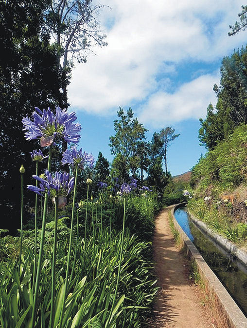
Madeira
Azores
Greek Islands
Corfu
Zante (aka Zakynthos)
Malta, Gozo & Comino
Spanish Mainland
Axarquia / Costa del Sol
Costa Blanca
Alpujarras
Sierra de Aracena

Canary Islands
Gran Canaria
La Palma
Tenerife
La Gomera & El Hierro
Lanzarote
Fuerteventura
We hope that we’ve inspired you to think about your next big adventure. To get your free digital maps, please look here https://www.dwgwalking.co.uk
2019 – a good year to go back to the Canaries?
2019 looks like being a good year for bargain holidays. Apparently, the unusually long, sunny summer of 2018 in the UK and large parts of Europe made staycationing a logical choice. As a result, travel companies, airlines and hotels offering holidays in many popular European resorts had a lean time of it last year. As a result, there are some attractive prices around for 2019.
If you’re looking at a Canary Islands break, there’s additional good news. The islands’ president wants a special deal for British tourists and hopes to get rid of IGIC (VAT) to make the islands even more attractive.
Each of the islands offers different experiences. Flight time from the UK is approximately 4 hours. And the blue skies and sunshine? Ah, that’s what keeps most visitors coming back again and again.
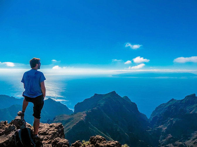
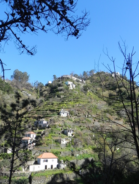
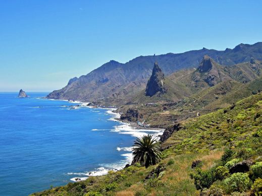
Tenerife, walking above the west coast
The best known of the Canaries is, perhaps Tenerife, offering something for everyone. The highest peak in Spanish territory, great beaches, wonderful walks and bike rides, seafood, local fruit, vegetables, cheese and wine .. if you’ve not been, you’re missing out.

Want more reasons to take a trip to Tenerife ? Have a look at ‘Tenerife – antidote to the winter blues‘ and ‘Tenerife South Walks – Back To The Future‘.
Tenerife – antidote to the winter blues

Some folk don’t mind the short, dark days of northern European winters. If you’re like me and you really DO mind them, how about hopping over to Tenerife? With temperatures to 23C and 6 hours of sunshine daily, it’s just the place to recharge your batteries. If you’re able to travel just before or just after the Christmas and New Year rush, you can get good value all-inclusive or full board deals that won’t cost much more than paying your home heating costs and food bills at home.
Ifyou tire of the sun and sea of the coastal resorts, you can visit the mountainous interior of Tenerife where there’s often snow in the winter months on the highest peaks, then go back down to the coast by sunset to warm up again.
Tenerife is a great destination for relaxing – and for hiking and biking too.
For more information and reasons to be on Tenerife this winter, take a look HERE.
Tour and Trail Maps Go To Sea
We know that most people use our Tour & Trail maps for hiking and biking, for driving and occasionally while horse riding. Their strength, toughness, foldability and waterproof qualities make our maps ideal for all these pursuits.

Look at those magical blues! Paddle Boarding off Northern Menorca
But here’s a first! We received an interesting email from Oliver, a kayak, open canoe and paddle board guide. He uses our maps to navigate around coastlines and sent us a couple of photos showing how he does it.
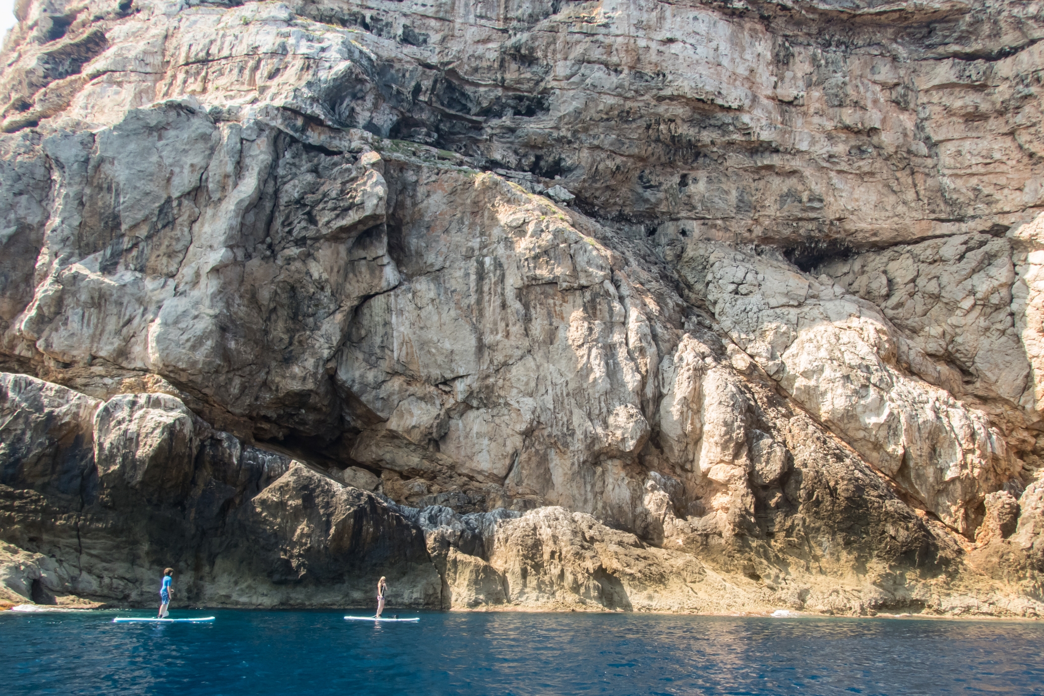
Paddle Boarding off Menorca’s North Coast
“Just wanted to say how impressed I am with the quality of your maps, I use them to navigate our way around coastlines, most recently around some of the awesome north coast of Menorca on Stand Up Paddle Boards, (I guide in both sea kayak and Open canoe too).
Your maps definitely make life easy while afloat …
Oliver”
(Received 24 August 2018)
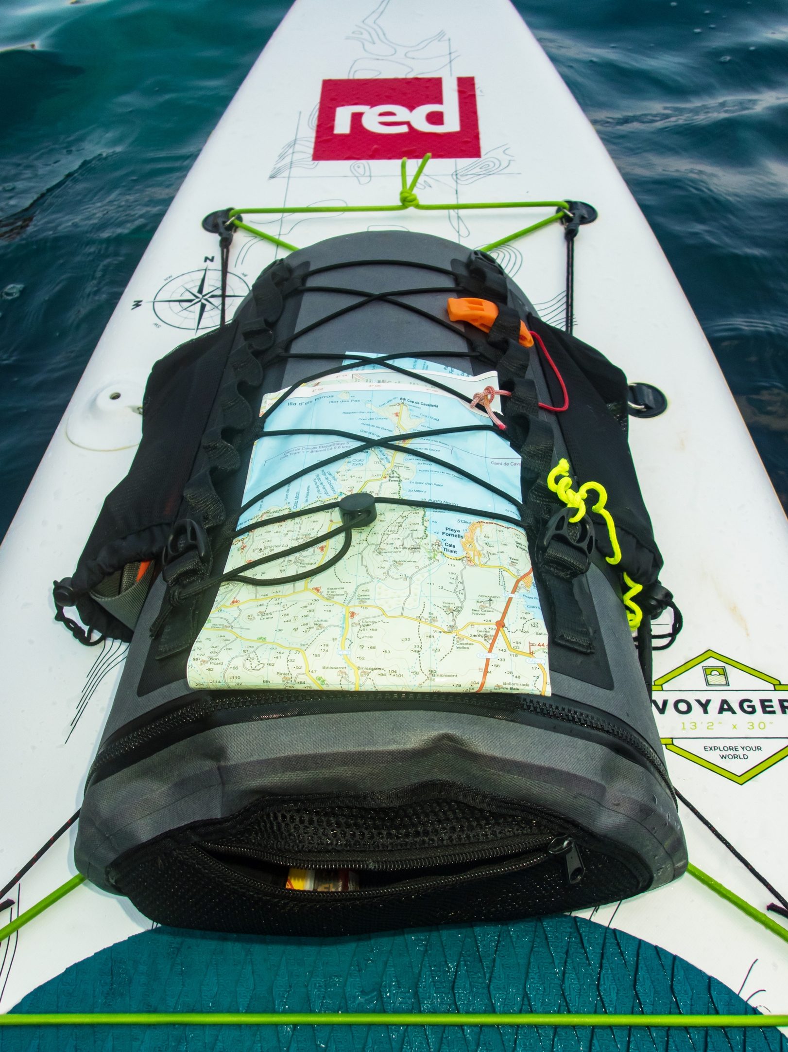
And here’s how to use your Tour & Trail map while paddle boarding.
Thanks Oliver!
You can see that map and many others from Discovery Walking Guides here.
