
Malta, Gozo (and Comino) get the green light!

Great news! Last night (24 June 2021) the UK Government moved Malta to the green list for travellers from England. You’re free to go! Malta and sister island Gozo offer a wealth of experiences. The tiny limestone islet & bird sanctuary of Comino sits between them and is home to Blue Lagoon bay; there’s also a 17th century tower & chapel. The climate is kind and there’s plenty of walking adventures to explore.
The islands are rich in history (there are three UNESCO World Heritage Sites), having been inhabited since around 5900 BC.

Many of the powers that ruled the islands, from the Phoenicians to the British, have left their marks, making the islands a living museum.
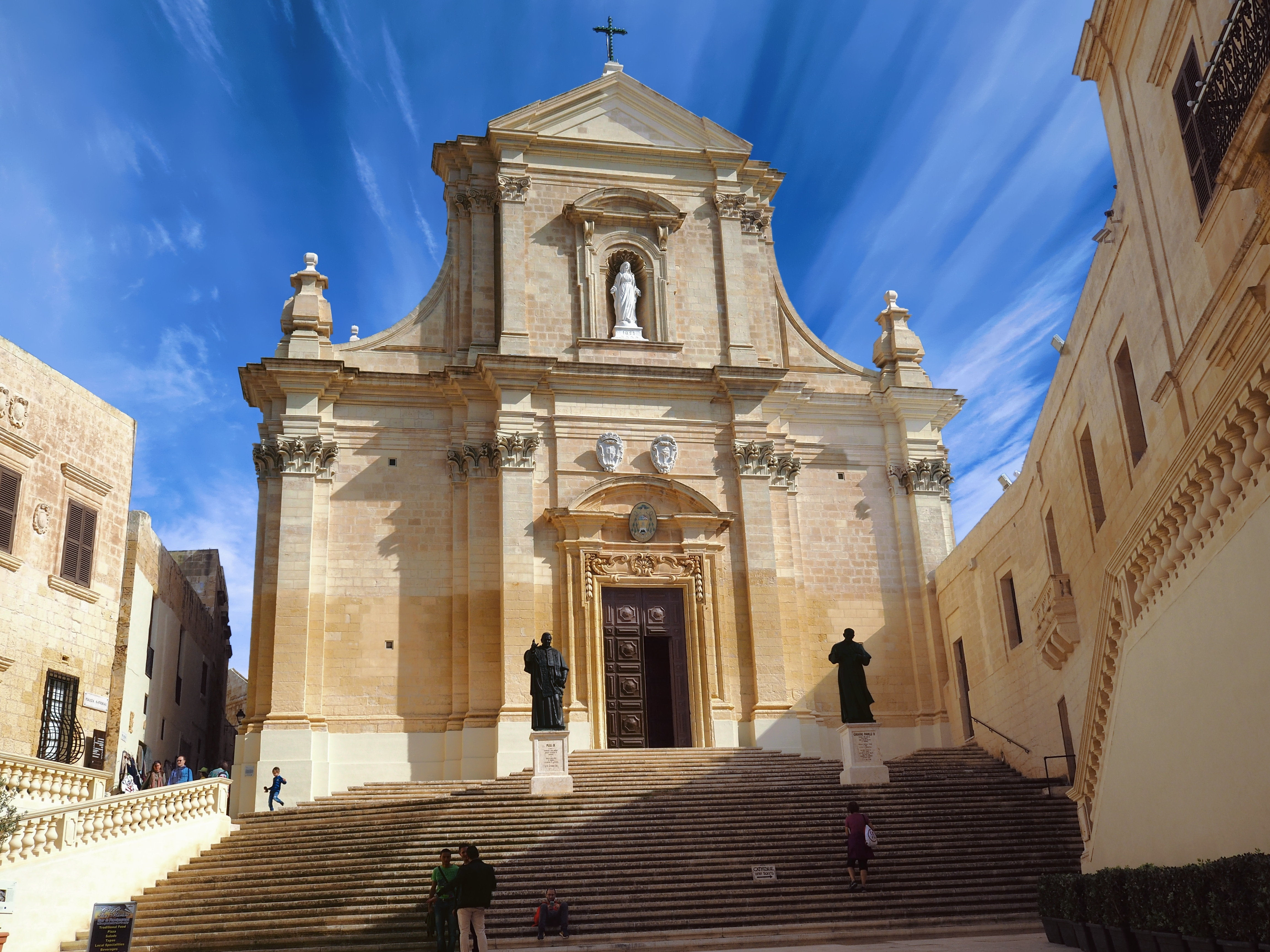
With unique flora, architecture and beaches, a visit to the islands (25 minutes ferry connection between Malta and Gozo) offers plenty to interest and fascinate.
Discovery Walking Guides have published their Malta & Gozo Tour & Trail Super-Durable Map, ideal for walkers, bikers, adventurers and visitors. The map is also available for use on some GPS devices; click here for details.
Canary Islands – Here We Come!
At last the Canary Islands are back on the British Government’s unrestricted travel list. The Canaries offer so much variety, each island unique and unforgettable, and with a warm, welcoming climate, the perfect choice as northern hemispheres feel the first shivers of winter.
Gran Canaria – the miniature continent, a roughly circular island of ravines and 60 kilometres of beaches, winding forest roads and criss-crossed with walking routes. Plenty to discover, day and night.
For more information click here.
Want the Gran Canaria Tour & Trail Super-Durable Map? Look here.
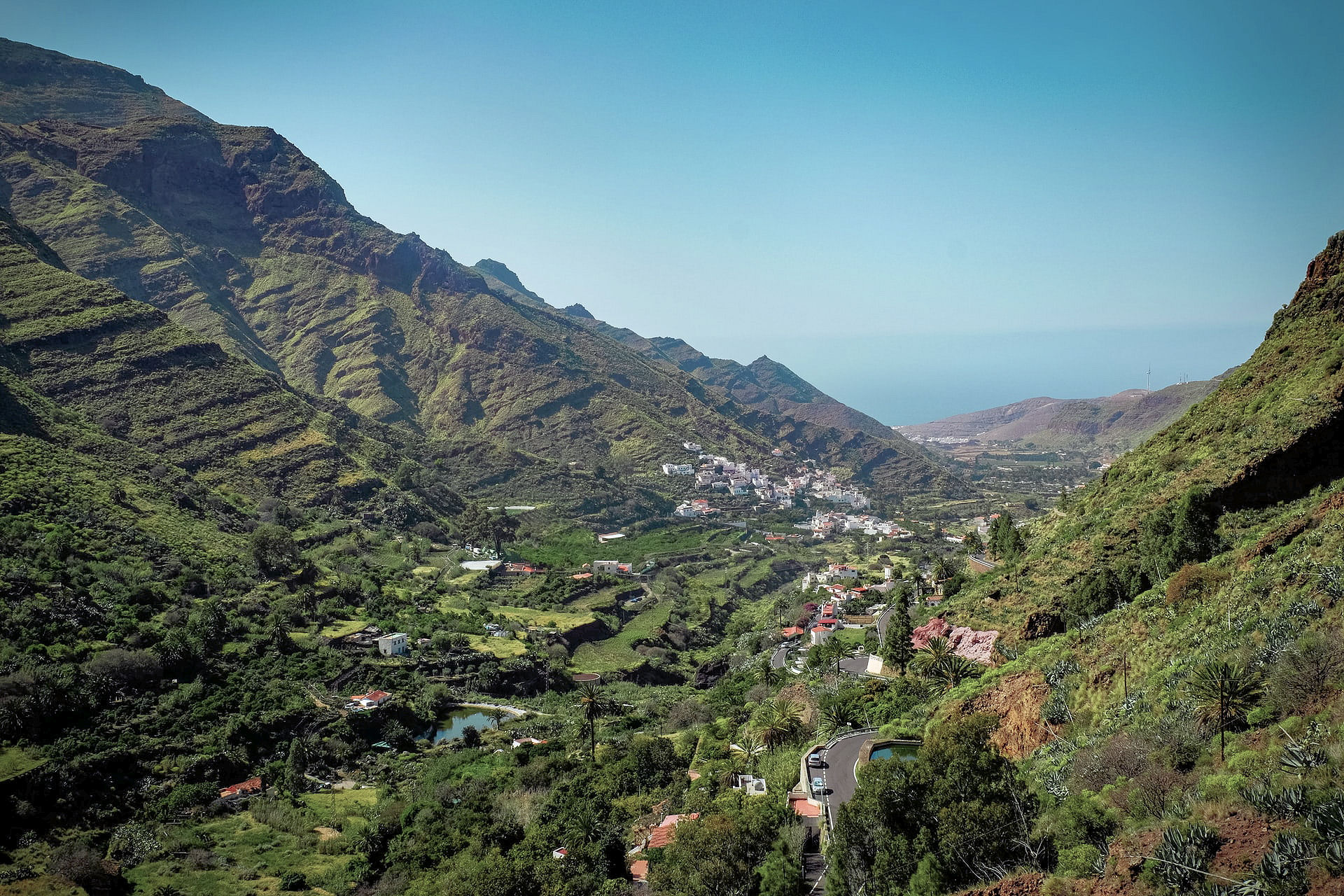
La Gomera, just west of Tenerife and easily reached via a short ferry crossing – plunging barrancos and soaring forest-topped mountains sprinkled with hamlets and farmsteads clinging to the slopes. Walk, bike, swim, explore – enjoy.

El Hierro, small, fascinating, the most remote and westerly Canary Island promises rugged terrain, narrow winding roads and great walking. A world-class marine reserve, free island-wide wifi and electric car charge ports contrast with the traditional feel of the island. Yet, there are very few tourists – for now.

There’s more information on La Gomera and El Hierro here.
La Gomera and El Hierro Tour & Trail Super-Durable Maps can be bought onlime including HERE.
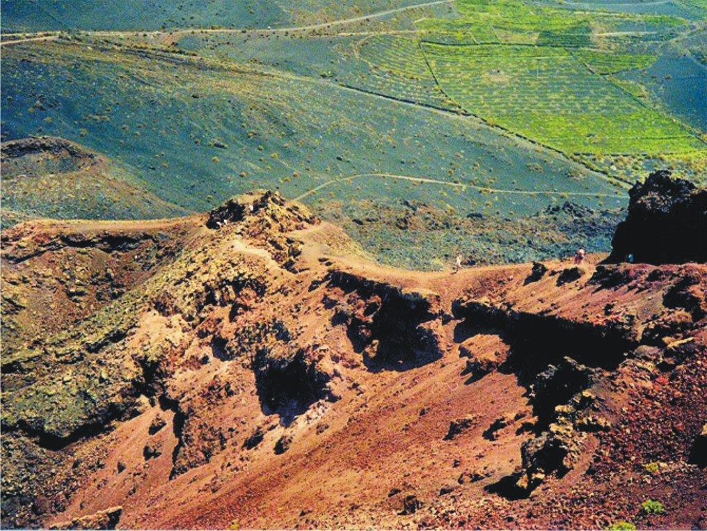
Lanzarote – the Fire Island; volcanic, mysterious and mesmerising terrain, lava seas and alpine meadows. Other-worldly. Once visited, never forgotten.


Find out more about Lanzarote here.
Buys the map from online selllers including HERE.
Fuerteventura, known for beautiful beaches and great water sports, also offers a surprising variety of fascinating walking adventures. Wild coastlines contrast with traditional towns and views across pristine seas.


See more information about Fuerteventura here.
Maps can be foundfrom online sellers including here.
La Palma – La Isla Bonita; dramatic landscapes; a breathtaking mountain spine splits this volcanic island. Black beaches, Lush vegetation and 1080 kilometres of waymarked walking paths.
There’s more information about walking on La Palma here.
Buy La Palma maps online including here.
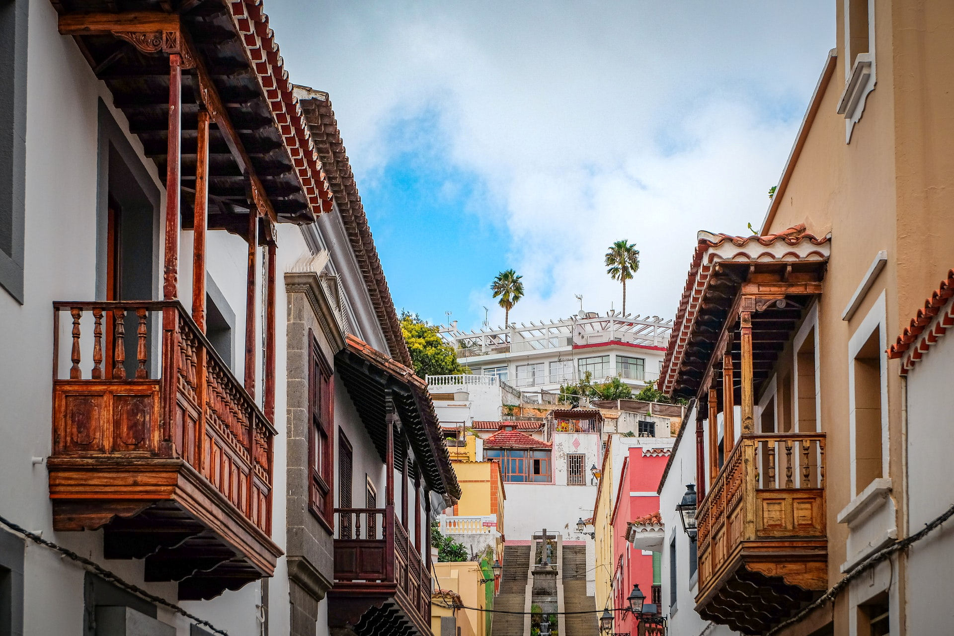
Tenerife – a Walker’s Island There’s so much to Tenerife. 2034 square kilometres offer coastal adventures, mountain hikes, pine and laurel forest trails, strolls and strenuous challenges including Spain’s highest peak (Mount Teide).The choice is almost endless.


You can buy the walking guide, walking maps and bus map online.
Tour and Trail Maps Go To Sea
We know that most people use our Tour & Trail maps for hiking and biking, for driving and occasionally while horse riding. Their strength, toughness, foldability and waterproof qualities make our maps ideal for all these pursuits.

Look at those magical blues! Paddle Boarding off Northern Menorca
But here’s a first! We received an interesting email from Oliver, a kayak, open canoe and paddle board guide. He uses our maps to navigate around coastlines and sent us a couple of photos showing how he does it.
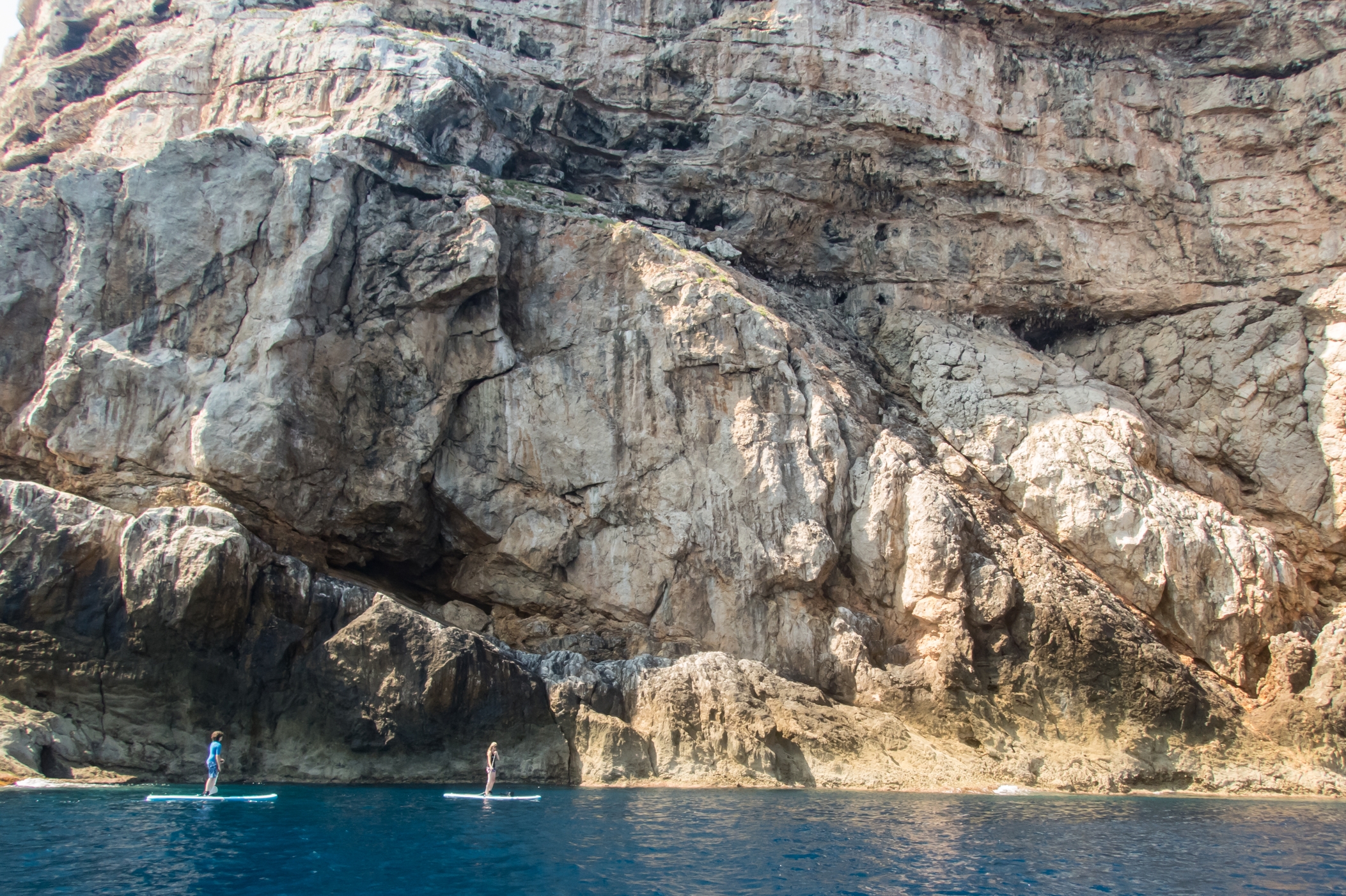
Paddle Boarding off Menorca’s North Coast
“Just wanted to say how impressed I am with the quality of your maps, I use them to navigate our way around coastlines, most recently around some of the awesome north coast of Menorca on Stand Up Paddle Boards, (I guide in both sea kayak and Open canoe too).
Your maps definitely make life easy while afloat …
Oliver”
(Received 24 August 2018)
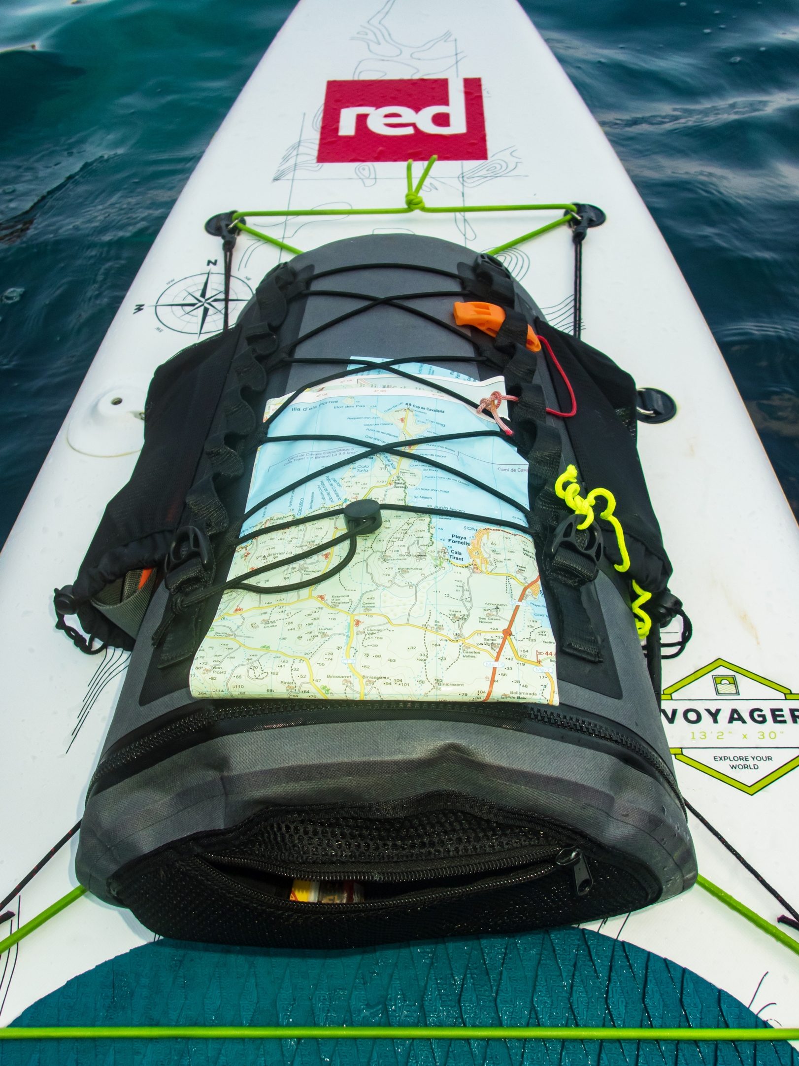
And here’s how to use your Tour & Trail map while paddle boarding.
Thanks Oliver!
You can see that map and many others from Discovery Walking Guides here.
Guess The Island

“The steepest island in the world, the deepest crater, the clearest skies: volcanoes you can climb without being shot into orbit; a subtropical forest minus the slimy things slinking up your trouser leg; black beaches, blue seas, high mountains, vegetation that is literally flamboyant, everything linked by 1080 kilometres of waymarked paths, and all virtually untouched by tourism.” (Author/researcher Charles Davis)

More clues? Okay then – it takes under 5 hours to fly there from the UK. It’s a whole lot warmer and sunnier than most of northern Europe, definitely so for more than half the year. Sometimes it is referred to as, ‘La Isla Bonita’.
 So, have you guessed the location of this alluring destination? Check if you are correct, or give in and find out by looking HERE.
Which Mediterranean holiday island destination has no traffic lights?
Which Mediterranean holiday island destination has no traffic lights?
Got the answer yet? No? Here’s a few more clues:
- The island is 19km long
- There are plenty of white, clean natural beaches. (Look here for beach information.)
- It has no airport
- There are no fast-food places
- There are no discos
- Residents are unmoved by celebrity visits (for example, recent visits from Kate Moss, Jade Jagger, Philippe Starck , Naomi Campbell)
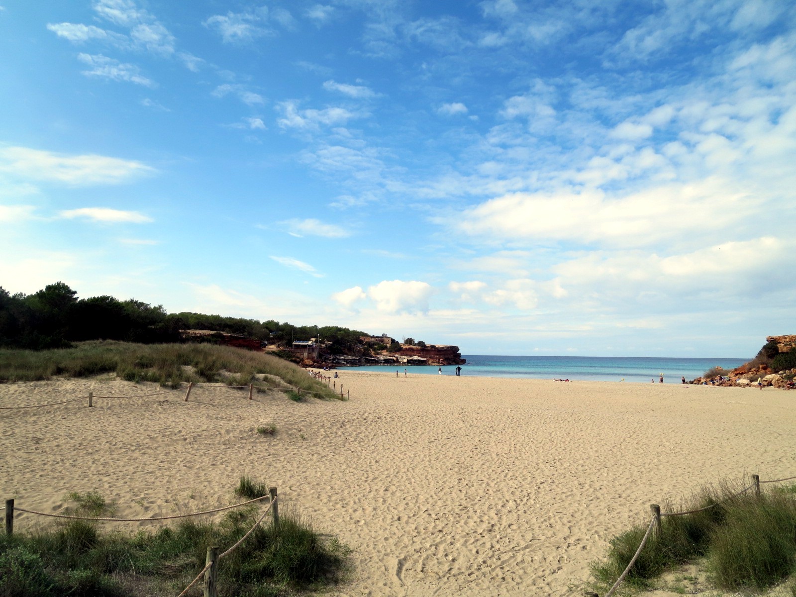
The answer is Formentera, Ibiza’s little sister.
Despite its laid back ambience there are some great places to stay (and eat). See this article from the New York Times.
There’s a great highly-detailed map of Formentera (a short ferry ride from Balearic island Ibiza) – for details of the map look here.
Beautiful Madeira – Walking Route Updates (Oh, and Porto Santo)
Madeira – a firm favourite

Stunning views to Encumeada, Madeira (copyright author/researcher Shirley Whitehead)
Madeira is beautifully green and floriferous but sometimes the necessary abundant rainfall (or in high summer, forest fires) lead to temporary walking route closures. Thankfully, the island authorities are quick to pinpoint problem sections and repair them. In any case, there are so many great walks that you’ll always find plenty to choose from anytime that you visit.
Have a look HERE for walking information and suggested walking guidebooks and detailed walking maps.
Approaching Ribeira Fundo, Madeira (copyright author/researcher Shirley Whitehead)
At the time of writing, the official PR walking routes currently affected by temporary closures are:
PR12 – Caminho Real da Encumeada
PR14 – Levada dos Cedros
PR16 – Levada Fajã do Rodrigues
PR17 – Caminho do Pináculo e Folhadal
PR19 – Caminho Real do Paul do Mar
Go to the official pages for up-to-date information regarding route closures.
-0-
Descent to the land Bridge, São Lourenço Madeira (copyright author/researcher Shirley Whitehead).
Going to Madeira? Hop to Porto Santo
If you’re going to Madeira, why not take a day or two take a look at little sister island Porto Santo?
Walkers can try the two official PR walking routes, PS PR1 – Vereda do Pico Branco e Terra Chã and the PS PR2 – Vereda do Pico Castelo
For the official Porto Santo tourist information including walking look HERE.
The ferry from Funchal, Madeira to Porto Santo takes about 2 hours 15 minutes. Please check the freey information website for departure times and note that in early January each year ferries are often out of service for regular maintenance. Ferry information HERE.
-0-
Porto Santo Nature Trail Event 03/04 March 2018
This event is the 5th stage of the “Circuit Trail Madeira 2017/2018”. As you can see, the adult routes look pretty challenging – though you do have until March 2018 to get into shape!
- Porto Santo Nature Trail (PSNT) – 42.3 km and 1926m climb (circular format);
- Trail do Porto Santo (TPS) – 21.9 km and 107m climb (linear format);
- Mini Trail do Porto Santo (MTPS) – 8.9 km and 395m climb (linear format);
There’s also a children’s event:
Kids Trail do Porto Santo (KTPS) between 1 km and 3 km (linear format).
For all the information, look HERE.
-0-
You might also find this post useful for getting out and about on Madeira.
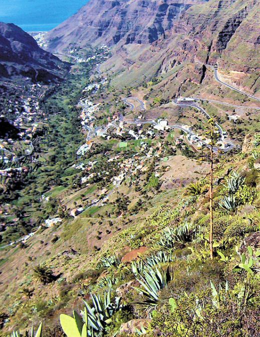
La Gomera – New Ferry Services Make Adventuring Easier

Simplified map of La Gomera by kind permission of David Brawn
La Gomera is a remarkable, almost circular island, a hop away from Tenerife, (Canary Islands) which rises like a giant cake to central forest-cloaked rugged heights, cut by barrancos (ravines) running to the sea. The island is still largely unspoiled which makes it a wonderful destination for hikers and bikers, though getting around takes time as there are few roads. If you don’t wish to get too energetic, simply amble about, dropping into cafés and fish restaurants and breathing in the pure air and beautiful views, enjoying the contrast between this quiet island and its busier big sister Tenerife.
This makes the introduction of not just one but two new sets of ferry services opening up some of the island’s best coastal towns really interesting. You could, for example, take the new car ferry Volcán de Teno from Tenerife’s Los Cristianos at 08.45 and be in Valle Gray Rey 90 minutes later, making a day out in this wonderful ‘Great King’s Valley’ feasible, heading back to Tenerife on the 16.30.
For all the details and to make a booking, see Naviera Armas website.
San Sebastian, La Gomera
It’s around five years since three of La Gomera’s most interesting and important coastal towns were linked by ferry services.
Now Fred Olsen has begun 3 services per day (becoming known as the ‘interior ferry line’), linking San Sebastián, Playa de Santiago and Valle Gran Rey, aboard the Benchi Express. If you’re starting from Tenerife you can do the first ferry hop from Los Cristianos. The Benchi can take bicycles, light motorbikes and pets! It also has a small cafeteria and is wheelchair accessible.
For details of the Fred Olsen services, look HERE.
La Gomera – in the south -Tenerife’s Teide visible
Valle Gran Rey
If you’re starting from Tenerife you can do the first ferry hop from Los Cristianos. The Benchi can take bicycles, light motorbikes and pets! It also has a small cafeteria and is wheelchair accessible. Take a look at their website for all the details and to book.
There’s a well- informed and highly readable blog with more La Gomera travel information here.
MAPS AND WALKING GUIDE BOOKS FOR LA GOMERA
For information about large-scale maps, digital mapping information and walking guidebooks, take a look HERE.
Island Hopping – Twice The Adventure Nº2 – Tenerife to La Gomera
Hop From Tenerife to La Gomera
There’s no doubt that Tenerife is one of the most popular island destinations, easily reached in around 5 hours from much of Europe and enticing with sunny skies, warm temperature, beaches and mountains and (if you want it) plenty of nightlife.
Looking down to San Sebastian (La Gomera), Pico del Teide on Tenerife in the distance
If you fancy a complete contrast, sample a day on the island of La Gomera, so close to Tenerife yet oh! so different – rugged, shaped like a well-risen circular cake topped by ancient laurel forests and with mighty ravines slicing down to the sea.
It’s laid back, offering astounding views and walks, little tipico cafés and restaurants, flamboyant plant life and stunning geology. Oh, and it has beaches.

Valle Gran Rey, La Gomera
Frequent ferries mean you can be there in under an hour from Los Cristianos, Tenerife, landing in Gomera’s capital San Sebastián, where public buses await in the harbour to take you onward. Car hire ofices and taxis are located here too.
Journey time: The fastest crossing from Tenerife to La Gomera goes via the harbours Los Cristianos de Tenerife to San Sebastián de La Gomera. The Benchijigua Express Ferry covers this distance in about 50 minutes. Other (slower) ferry services are offered by Naviera Armas. Pre-booking is essentail.
What to do? In one day, you’ll need to be selective. Take a look at these Trip Advisor suggestions.
For lots more information about La Gomera, including maps, look here.
There’s a brand-new edition of Walk! La Gomera, just published; look here.
