
Lockdown Blues? Get ready to travel.
With vaccinations well under way in many parts of the world, there’s real belief that travel restrictions will gradually ease in the next few months. We make no apology for offering the information about our free digital maps once again; last time we posted this information we were pleased and surprised at how many people enjoyed them and started planning ahead to travel.
We’d like to help you get planning. Where to next? Why not start by getting your hands on our Free Digital Maps.
Read all about it HERE.
There are free maps to 19 tempting walking destinations to check out, including :
CANARY ISLANDS
La Gomera & El Hierro, Lanzarote, La Palma, Tenerife, Fuerteventura, Gran Canaria


BALEARIC ISLANDS
Mallorca, Menorca, Ibiza, Formentera

GREEK ISLANDS
Zakynthos (Zante), Corfu
SPANISH MAINLAND
Costa Blanca Mountains, Costa del Sol (Axarquia), Alpujarras, Sierra de Aracena

– and also:
Malta & Gozo
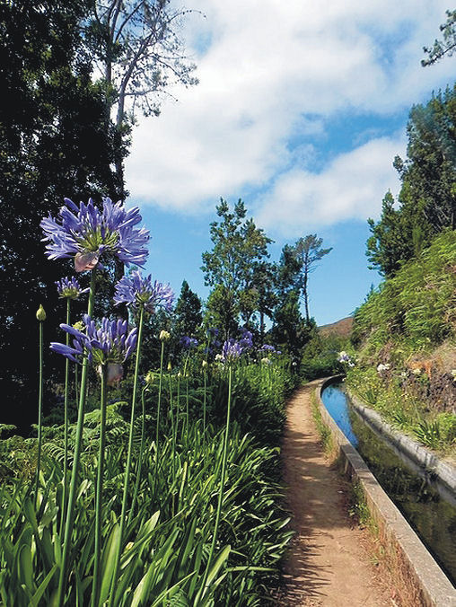
Madeira
Azores
To see more details about the free digital maps and how to get them, LOOK HERE
Plan Your Next Walking Adventure With our FREE Digital Maps
With the real hope of vaccines within reach, we can look forward to planning walking adventures again. Once travel freedom returns, there’s going to be a lot of pent-up desire to get away, so this could be the best time to make some plans.
We’d like to help you get planning. Where to next? Why not start by getting your hands on our Free Digital Maps.
Read all about it HERE.
There are free maps to 19 tempting walking destinations to check out, including :
CANARY ISLANDS
La Gomera & El Hierro, Lanzarote, La Palma, Tenerife, Fuerteventura, Gran Canaria
BALEARIC ISLANDS
Mallorca, Menorca, Ibiza, Formentera
GREEK ISLANDS
Zakynthos (Zante), Corfu
SPANISH MAINLAND
Costa Blanca Mountains, Costa del Sol (Axarquia), Alpujarras, Sierra de Aracena
– and also:
Malta & Gozo
Madeira
Azores
To see more details about the free digital maps and how to get them, LOOK HERE
Travel Gets The Green Light
The British Government has published the list of countries you can travel from, into England, with no quarantine needed. At last, the brakes are off and all of us who want to get away have a tempting array of countries to choose from.

Of course, keeping safe is important, so what better than getting out and about on airy mountain walks or breezy coastal trails, well away from the crowds.

Greece and its lovely islands is on the ‘good to go’ list, along with all of Spain including the Canary Islands and the Balearic Islands.
How about the quiet beauty of Brittany (France), or fascinating Malta and Gozo?


There’s plenty of information to help you choose your getaway destination here.
Have a look at our free digital maps, fully detailed and just what you need for adventuring away from the crowds. Take a look at our printed maps and walking guidebooks too.
We can offer maps (many also available as free digital downloads) and guidebooks for most of the following destinations which are all on the UK Governments ‘free to travel‘ list:
FRANCE
Brittany
SPAIN
Canary Islands: Gran Canaria
La Palma
Tenerife
Lanzarote
La Gomera & El Hierro
Fuerteventura
Mainland Spain: Costa Blanca Mountains
Sierra de Aracena
Costa del Sol
Alpujarras
Balearic Islands: Mallorca
Ibiza
Formentera
Menorca
GREECE
Zakynthos (Zante)
Corfu
Malta & Gozo


A Little Good News – Free Digital Maps For Everyone
We may not be able to go adventuring for a while yet. However, we can plan ahead for when we can travel again. Have a look at our digital maps, clear and fully detailed for adventure planning of all kinds, including walking, climbing, biking or maybe daydreaming about your next big trip.

There’s a whole hatful of exciting free maps to be had. Take a look at this list of adventure destinations.
Balearic Islands
Mallorca
Menorca
Ibiza
Formentera
Madeira
Azores
Greek Islands
Corfu
Zante (aka Zakynthos)
Malta, Gozo & Comino
Spanish Mainland
Axarquia / Costa del Sol
Costa Blanca
Alpujarras
Sierra de Aracena

Canary Islands
Gran Canaria
La Palma
Tenerife
La Gomera & El Hierro
Lanzarote
Fuerteventura
We hope that we’ve inspired you to think about your next big adventure. To get your free digital maps, please look here https://www.dwgwalking.co.uk
Tour and Trail Maps Go To Sea
We know that most people use our Tour & Trail maps for hiking and biking, for driving and occasionally while horse riding. Their strength, toughness, foldability and waterproof qualities make our maps ideal for all these pursuits.

Look at those magical blues! Paddle Boarding off Northern Menorca
But here’s a first! We received an interesting email from Oliver, a kayak, open canoe and paddle board guide. He uses our maps to navigate around coastlines and sent us a couple of photos showing how he does it.
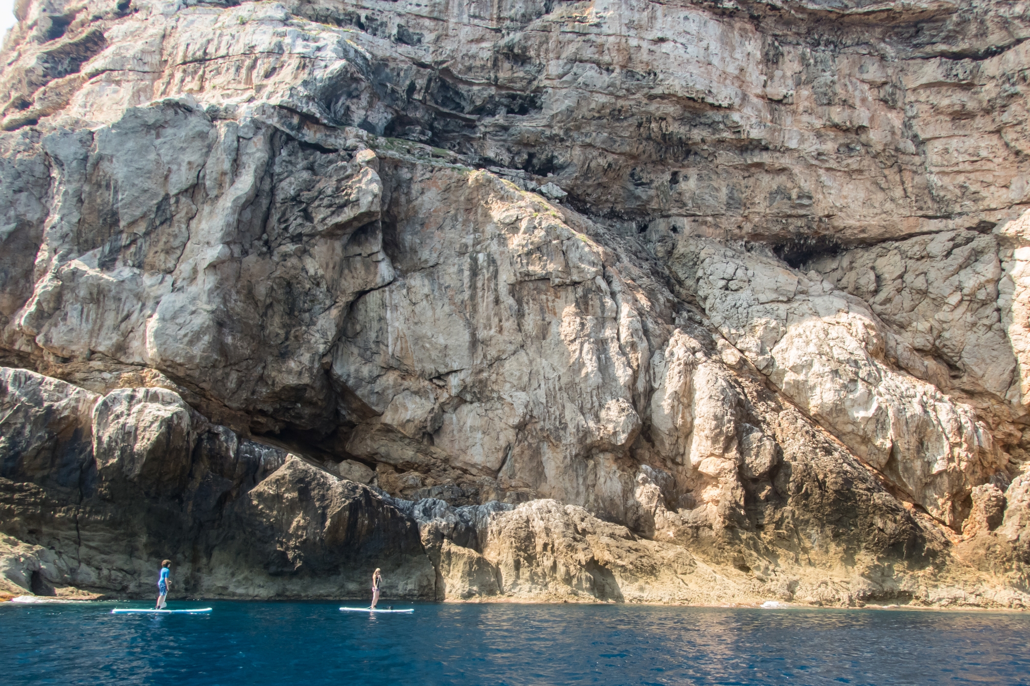
Paddle Boarding off Menorca’s North Coast
“Just wanted to say how impressed I am with the quality of your maps, I use them to navigate our way around coastlines, most recently around some of the awesome north coast of Menorca on Stand Up Paddle Boards, (I guide in both sea kayak and Open canoe too).
Your maps definitely make life easy while afloat …
Oliver”
(Received 24 August 2018)
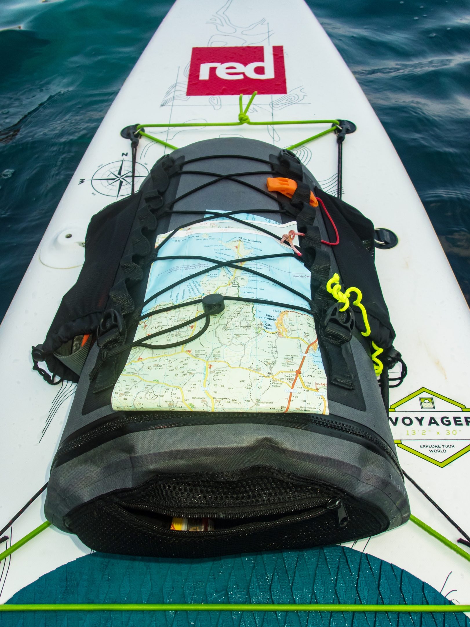
And here’s how to use your Tour & Trail map while paddle boarding.
Thanks Oliver!
You can see that map and many others from Discovery Walking Guides here.
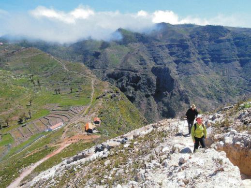
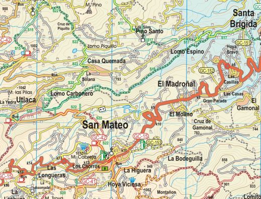
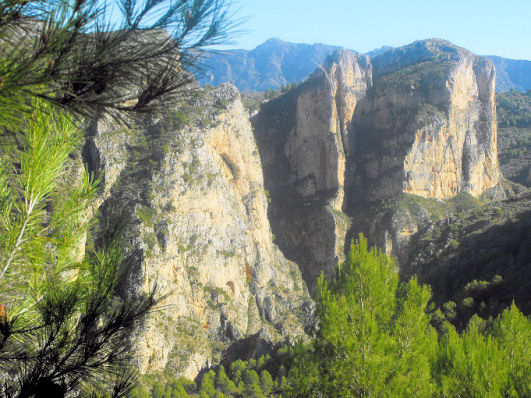
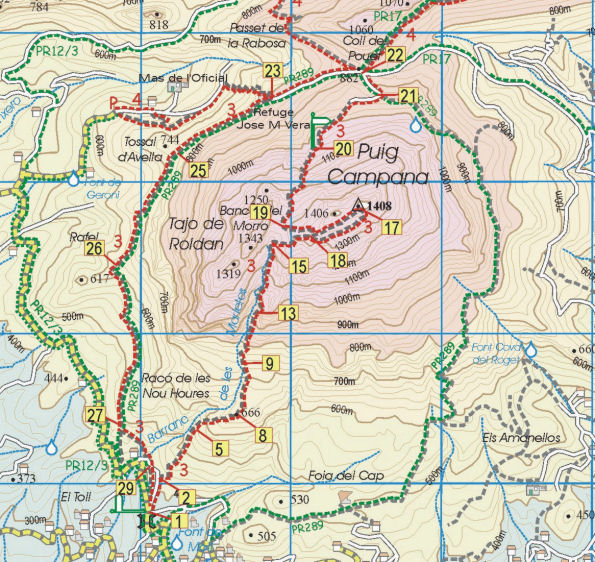
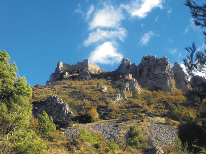
More Than A Coastline – Costa Blanca’s Mountains
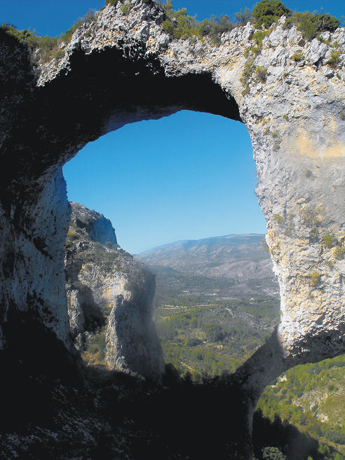
Costa Blanca Mountains – Castell de Castells
Behind Spain’s Costa Blanca with its tourist resorts lies a mountainous region waiting to be explored.
When you’ve had enough of beaches, turn and look inland. Those rugged peaks are more accessible then you might assume. First impressions might suggest an arid, austere region; prepare to be surprised.
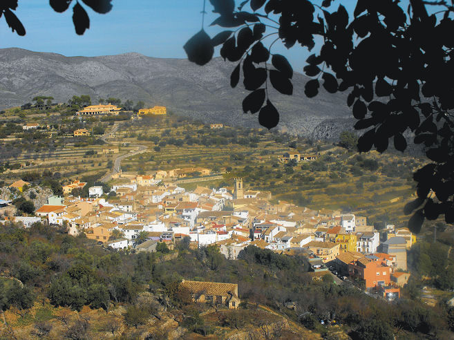
Costa Blanca Mountains – Vall de Laguar
But, once you make the decision to explore on foot, bike or horseback, you’ll find green valleys between the rocky peaks. Villages and hamlets nestle in the mountain folds.
Costa Blanca Mountains – Puig Campana
There are many walking tracks and paths, some signposted. To get the most from adventuring here, get hold of Costa Blanca Mountains Tour & Trail Map and Walk! The Costa Blanca Mountains.
Who got a Garmin for Christmas?
If you are one of the many who found a Garmin GPS in their Christmas stocking, this post is for you.
Get your hands on a free sample ‘real-time’ map and see your Garmin come to life. You can choose a sample map of Graciosa ( off Lanzarote, Canary Islands) or Sierra de Aracena (Andalucia, Spain).
What you’ll get is a highly detailed real-time Tour & Trail digital download map, which you can save on your hard drive, transfer to your Garmin GPS CustomMap memory or onto a micro-SD card; you can also use the maps in Garmin Basecamp and Google Earth.
CANARY ISLANDS
Sample segment, Gran Canaria.
Gran Canaria
Tenerife
La Palma
La Gomera
Lanzarote
Fuerteventura
MAINLAND SPAIN
Alpujarras (Sierra Nevada, Andalucia, southern Spain)
Costa Blanca Mountains (Alicante, southern Spain)
Axarquia (Andalucia, southern Spain)
Sierra de Aracena (Helva province, southern Spain)
BALEARIC ISLANDS
Mallorca
Menorca
Formentera
Ibiza
PORTUGUESE ISLANDS
Madeira
For more information about Tour & Trail Maps take a look HERE.
Costa Blanca Mountains – thank you Erik, for your valuable feedback.
A tour of Raco Roig (Walk 20)
We welcome all user feedback – and in particular for our new downloadable maps for Garmin GPS.
Erik is a Costa Blanca Mountains expert and guides walks in the region. https://www.walking-holiday-in-spain.com
See the maps he’s referring to here:-http://www.dwgwalking.co.uk/CBM.htm
Here’s what he told us about his experiences using both our printed maps and our maps for Garmin GPS:-
 “Over the last month my walking customers have been testing the Discovery Walking Guides sheet map (Costa Blanca Mountains Tour & Trail Map) and downloadable basemaps on the eTrek Garmin 20 GPS for the treks and walking holidays we organise in the Costa Blanca Mountains.
The sheet maps are useful, although the 1:40,000 scale in the Spanish countryside is at the limit for precise navigating, the roads on the map translate as 55 metres wide on the ground – easily enough to get misplaced for a while. Some of what appear as roads are overgrown dirt tracks that are now footpaths, you can still get through but it can be a bit confusing so if you want to go off the marked routes you will need to be patient.
The marking of existing official routes and recommended routes is very good, there are some minor omissions and in one case replicating an error found on the local 1:20,000 topo. Not perfect but a very good approximation and an improvement on the local maps. The problem here is still the abysmal way marking of routes on the ground.
The area covered is quite extensive, although some of my routes fall outside the eastern margin of the coverage.
The basemaps for the Garmin GPS are very good, despite an initial problem with the download (for some reason Windows 7 stripped off the filetype which you had to add manually) they are now installed on all my Garmins. The image is very clear, much better than my own 1:25,000 basemaps that blur on zooming in.
The maps load relatively quickly on start-up and as you are walking the change from one tile to another is very smooth, in fact it is barely perceptible.
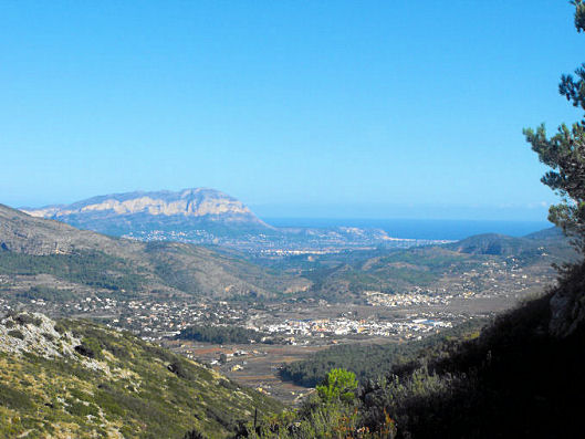
View over the coastal plain from the Costa Blanca Mountains
All in all a great improvement for those of us who have been struggling with Spanish maps for years, My only reservation is the 1:40,000 scale, I would love it if you would considering publishing 1:20,000 or 1:25,000 maps as a future upgrade.”
Costa Blanca Mountains – how would you like a free walk?
 Inland of the famous holiday coast of Spain’s Costa Blanca lies an unspoilt walker’s paradise.
Do you want a taste? Take a look at this free sample walk. Click on this link to access the download:-
http://www.dwgwalking.co.uk/CBM.htm
Walk 7 ‘Castell de Confrides’ lies not far from Benidorm – here’s the objective, the remains of a stronghold hundreds of years old from which there are amazing views.
Walk! The Costa Blanca Mountains – now as a pdf
Spain’s Costa Blanca is so much more than the coastal strip – look inland – you could be up on those white mountains!
Walk! The Costa Blanca Mountains is available as a printed book – from today you can also download the pdf version. Perfect if there’s no time to get the printed copy before you head off adventuring. It’s also handy if you want to print off one or two pages to carry for the day, saving weight in your pack.
FInd out more here:
