
Discover Mallorca’s Tramuntana
Mallorca’s mighty Tramuntana mountain range offers a wealth of walking adventures, with easy strolls all the way to challenging hikes for experienced walkers.
To get the best out of a trip to the Tramuntanas, a large scale and up-to-date map is essential. The best maps you will find are published by Discovery Walking Guides, who have just released two large scale maps to cover the North Tramuntana and the South Tramuntana.
Mallorca – Tramuntana North Tour & Trail Map
ISBN: 9781782750895
960mm by 694mm
1:30,000 scale
(Price held at £10.99)
The map section below shows the area covered by the north map.
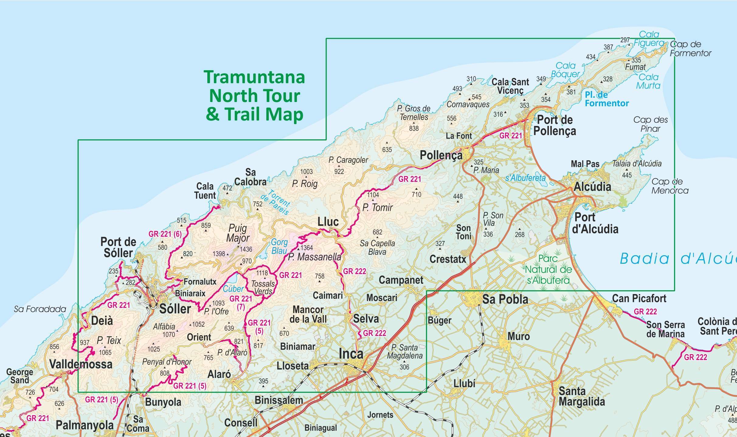
This double sided map sheet covers the northern half of Serra de Tramuntana at 1:30,000 scale.
This map covers a continuous area from Tramuntana’s northern-most Cap de Formentor, including all the coastal resorts such as Port de Pollença and Port d’Alcúdia, all the way to Sóller and Deià at the opposite end of the map (for the area from Sóller further due south-west to Magaluf, Peguera and Port d’Andratx, see our second title: Mallorca – Tramuntana South Tour & Trail Map).
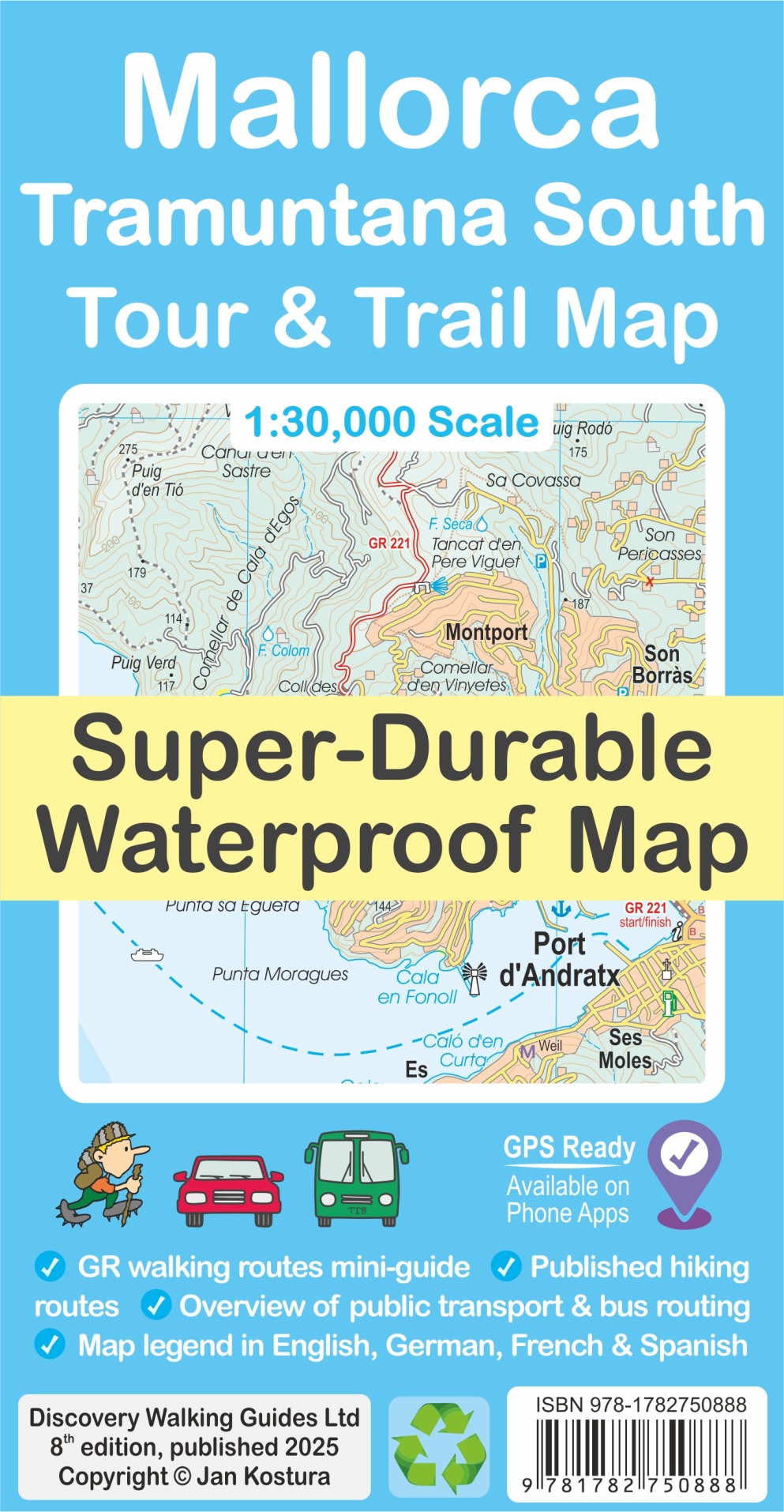
Mallorca – Tramuntana South Tour & Trail Map
ISBN: 9781782750888
960mm by 694mm
1:30,000 scale
(Price held at £10.99)
The map section below shows the coverage of the south map.
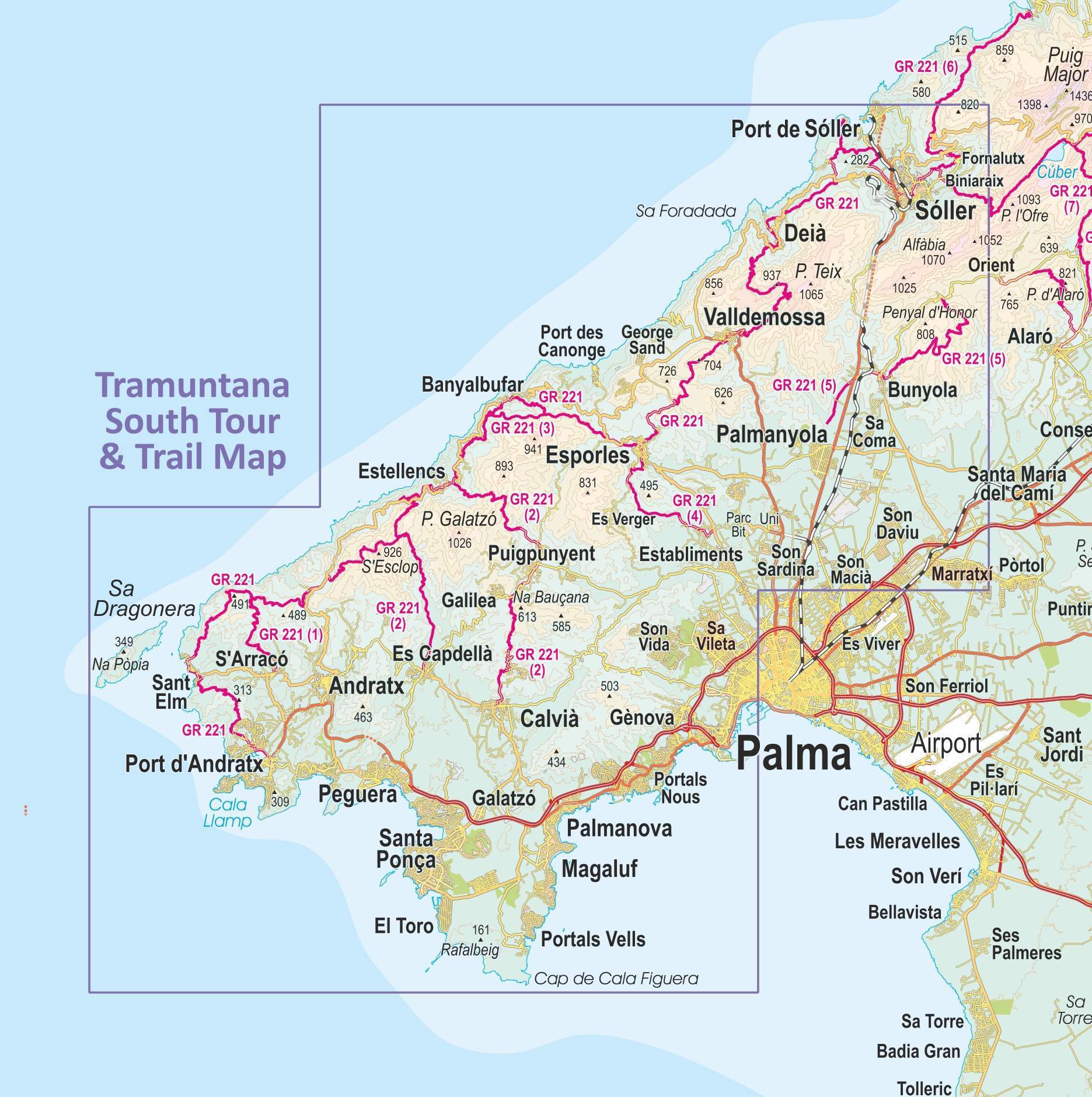
This double sided map sheet covers the southern half of Serra de Tramuntana at 1:30,000 scale.
Covering a continuous area from Tramuntana’s southern-most point Cap de Cala Figuera, this map includes all the coastal resorts such as Magaluf, Santa Ponça and Peguera, with Port d’Andratx and Sa Dragonera islet also covered, all the way to Sóller and Port de Sóller at the opposite end of the map (for the area from Sóller further due north-east to Pollença and Cap de Formentor, see our second title: Mallorca – Tramuntana North Tour & Trail Map).
What’s included?
- GR 221 long-distance route is specially highlighted in the map (red), with a boxed mini-guide to the GR 221 and GR 222, summarizing the most important aspects of the main route, its variants and accommodation.
- Highlighted in the map (green) are also published walking routes by Sunflower and Rother, helping you identify routes that are open to walkers, on an island where private properties along trails may sometimes pose a challenge to hikers.
- Also included is a small dictionary or frequently used Catalan words appearing in the map.
- The legendary ‘Tour & Trail’ level of detail ranges from railways, motorways, main roads, secondary roads, minor roads, streets and narrow country lanes, dirt tracks to walking trails and faint/difficult paths.
- Altitude shading is designed to clearly show the altitude range when travelling across the island by car, bus, or on foot. 20-metre and 100-metre contours combined with the altitude shading bring this beautiful landscape to life.
- There are plenty of individual height points and all of the official ‘Trig’ points are on the map. Tour & Trail attention to detail includes our useful symbol range such as viewpoints, picnic areas, petrol stations, bar/restaurants and parking areas where you can pull off the road safely. You will easily identify springs, caves, sports grounds, museums, churches, chapels, crosses, cemeteries, lighthouses, forts, wind turbines, windmills, hotels and tourist attractions. It all adds up to the most detailed and most durable map of Mallorca’s Tramuntana North that you can get.
- The guide to Mallorca’s public transport will help you get oriented with the various service providers that operate buses, trains, metro and tram, to make the most of your adventures. Bus stops along with actual bus numbers are then highlighted in the map to help you see where each bus runs. Those relying on a hire car will appreciate kilometre markers plotted each kilometre in the map on most roads, aiding you track progress and show where you are. Symbols indicate features such as viewpoints, picnic areas, petrol stations, bar/restaurants and parking areas where you can pull off the road safely. You will easily identify springs, caves, sports grounds, museums, churches, chapels, crosses, cemeteries, lighthouses, forts, wind turbines, windmills, hotels and tourist attractions.


Maps are available through all booksellers, online and in your high street.
Lockdown Blues? Get ready to travel.
With vaccinations well under way in many parts of the world, there’s real belief that travel restrictions will gradually ease in the next few months. We make no apology for offering the information about our free digital maps once again; last time we posted this information we were pleased and surprised at how many people enjoyed them and started planning ahead to travel.
We’d like to help you get planning. Where to next? Why not start by getting your hands on our Free Digital Maps.
Read all about it HERE.
There are free maps to 19 tempting walking destinations to check out, including :
CANARY ISLANDS
La Gomera & El Hierro, Lanzarote, La Palma, Tenerife, Fuerteventura, Gran Canaria


BALEARIC ISLANDS
Mallorca, Menorca, Ibiza, Formentera
GREEK ISLANDS
Zakynthos (Zante), Corfu
SPANISH MAINLAND
Costa Blanca Mountains, Costa del Sol (Axarquia), Alpujarras, Sierra de Aracena

– and also:
Malta & Gozo
Madeira
Azores
To see more details about the free digital maps and how to get them, LOOK HERE
Plan Your Next Walking Adventure With our FREE Digital Maps
With the real hope of vaccines within reach, we can look forward to planning walking adventures again. Once travel freedom returns, there’s going to be a lot of pent-up desire to get away, so this could be the best time to make some plans.
We’d like to help you get planning. Where to next? Why not start by getting your hands on our Free Digital Maps.
Read all about it HERE.
There are free maps to 19 tempting walking destinations to check out, including :
CANARY ISLANDS
La Gomera & El Hierro, Lanzarote, La Palma, Tenerife, Fuerteventura, Gran Canaria
BALEARIC ISLANDS
Mallorca, Menorca, Ibiza, Formentera
GREEK ISLANDS
Zakynthos (Zante), Corfu
SPANISH MAINLAND
Costa Blanca Mountains, Costa del Sol (Axarquia), Alpujarras, Sierra de Aracena
– and also:
Malta & Gozo
Madeira
Azores
To see more details about the free digital maps and how to get them, LOOK HERE
Travel Gets The Green Light
The British Government has published the list of countries you can travel from, into England, with no quarantine needed. At last, the brakes are off and all of us who want to get away have a tempting array of countries to choose from.

Of course, keeping safe is important, so what better than getting out and about on airy mountain walks or breezy coastal trails, well away from the crowds.

Greece and its lovely islands is on the ‘good to go’ list, along with all of Spain including the Canary Islands and the Balearic Islands.
How about the quiet beauty of Brittany (France), or fascinating Malta and Gozo?


There’s plenty of information to help you choose your getaway destination here.
Have a look at our free digital maps, fully detailed and just what you need for adventuring away from the crowds. Take a look at our printed maps and walking guidebooks too.
We can offer maps (many also available as free digital downloads) and guidebooks for most of the following destinations which are all on the UK Governments ‘free to travel‘ list:
FRANCE
Brittany
SPAIN
Canary Islands: Gran Canaria
La Palma
Tenerife
Lanzarote
La Gomera & El Hierro
Fuerteventura
Mainland Spain: Costa Blanca Mountains
Sierra de Aracena
Costa del Sol
Alpujarras
Balearic Islands: Mallorca
Ibiza
Formentera
Menorca
GREECE
Zakynthos (Zante)
Corfu
Malta & Gozo


A Little Good News – Free Digital Maps For Everyone
We may not be able to go adventuring for a while yet. However, we can plan ahead for when we can travel again. Have a look at our digital maps, clear and fully detailed for adventure planning of all kinds, including walking, climbing, biking or maybe daydreaming about your next big trip.

There’s a whole hatful of exciting free maps to be had. Take a look at this list of adventure destinations.
Balearic Islands
Mallorca
Menorca
Ibiza
Formentera
Madeira
Azores
Greek Islands
Corfu
Zante (aka Zakynthos)
Malta, Gozo & Comino
Spanish Mainland
Axarquia / Costa del Sol
Costa Blanca
Alpujarras
Sierra de Aracena

Canary Islands
Gran Canaria
La Palma
Tenerife
La Gomera & El Hierro
Lanzarote
Fuerteventura
We hope that we’ve inspired you to think about your next big adventure. To get your free digital maps, please look here https://www.dwgwalking.co.uk
Tour and Trail Maps Go To Sea
We know that most people use our Tour & Trail maps for hiking and biking, for driving and occasionally while horse riding. Their strength, toughness, foldability and waterproof qualities make our maps ideal for all these pursuits.

Look at those magical blues! Paddle Boarding off Northern Menorca
But here’s a first! We received an interesting email from Oliver, a kayak, open canoe and paddle board guide. He uses our maps to navigate around coastlines and sent us a couple of photos showing how he does it.
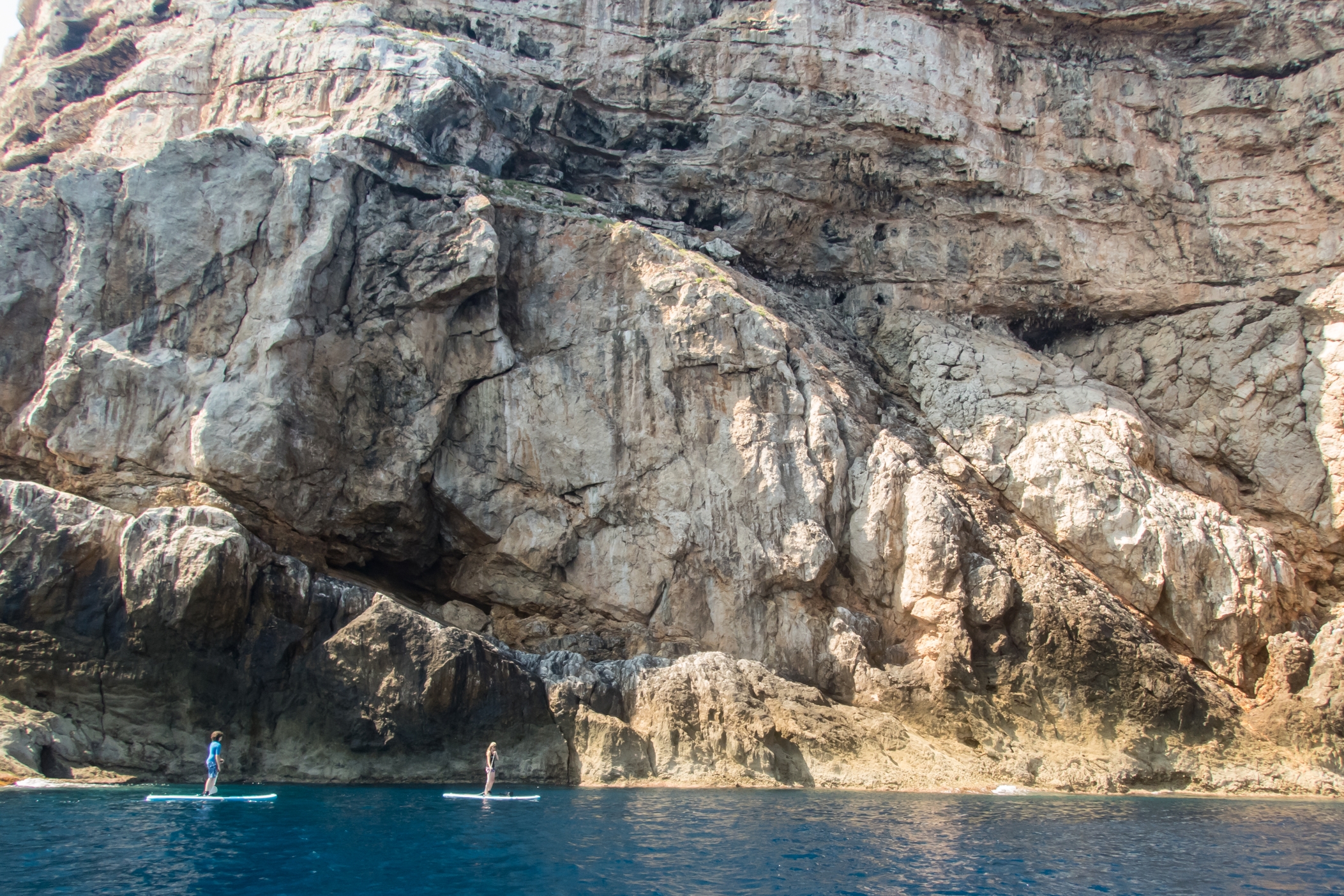
Paddle Boarding off Menorca’s North Coast
“Just wanted to say how impressed I am with the quality of your maps, I use them to navigate our way around coastlines, most recently around some of the awesome north coast of Menorca on Stand Up Paddle Boards, (I guide in both sea kayak and Open canoe too).
Your maps definitely make life easy while afloat …
Oliver”
(Received 24 August 2018)
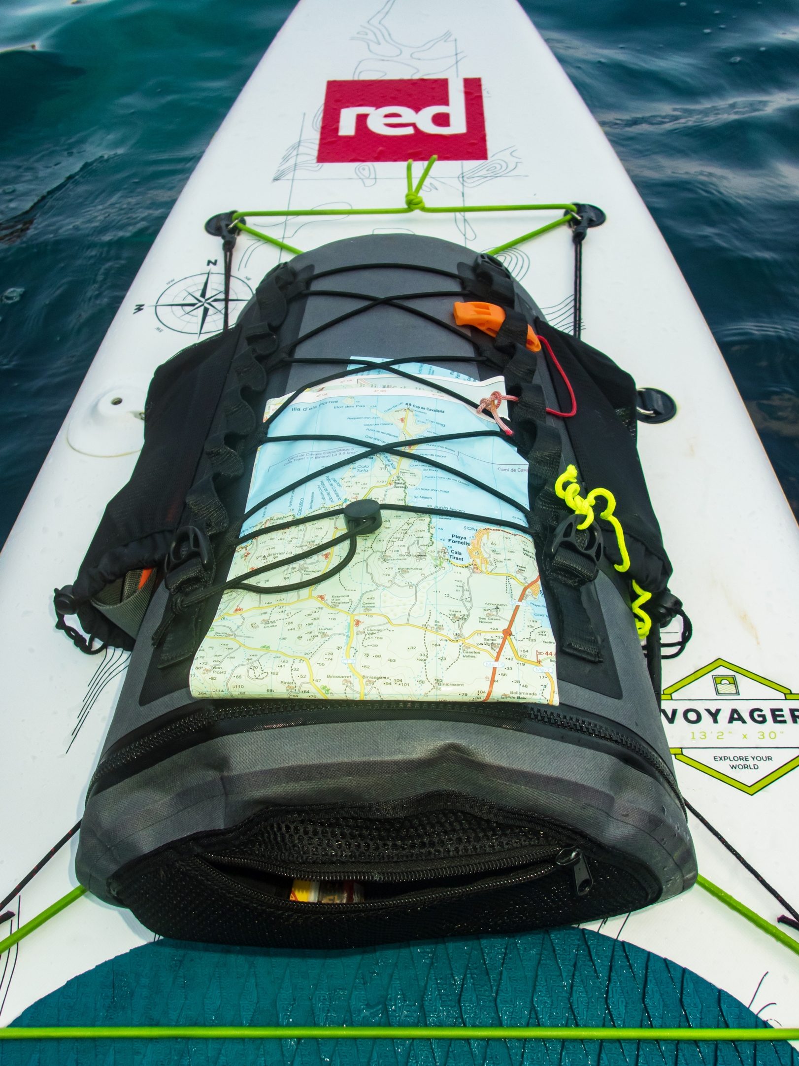
And here’s how to use your Tour & Trail map while paddle boarding.
Thanks Oliver!
You can see that map and many others from Discovery Walking Guides here.
Maps for Corfu, Mallorca and Costa del Sol (Axarquia)

Costa del Sol (La Axarquia)
Are you off to any of these destinations soon?
Or maybe you’re thinking of planning a trip for later in the year, when the summer heat subsides and most visitors disappear, leaving all that space (almost) all yours.
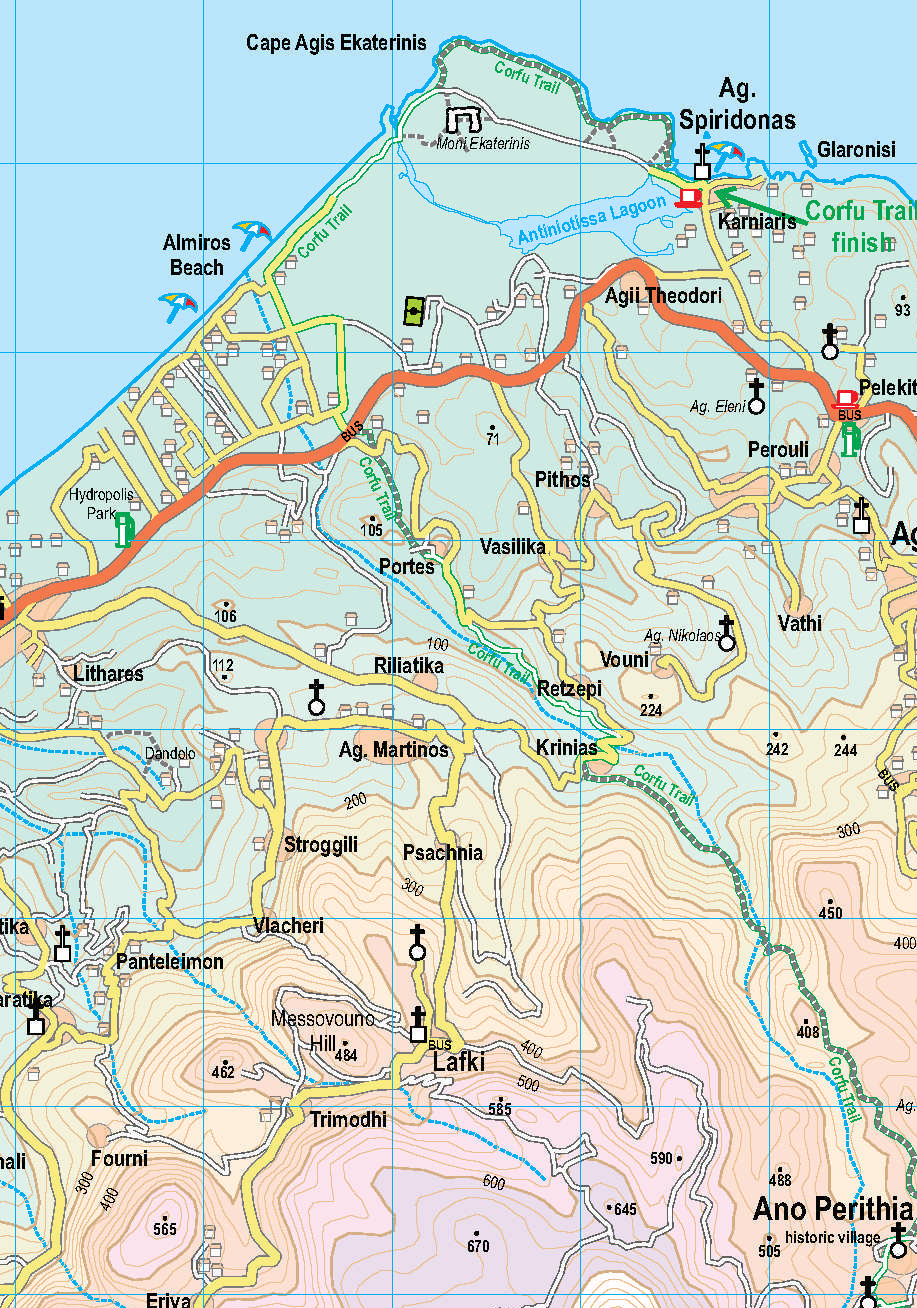
Corfu Tour & Trail Map section
If so, then here’s a great opportunity to get hold of digital Custom Maps free to download.
If you’ve ever used (or seen) one of DWG’s Tour & Trail maps you already know how detailed, clear and up to date they are.
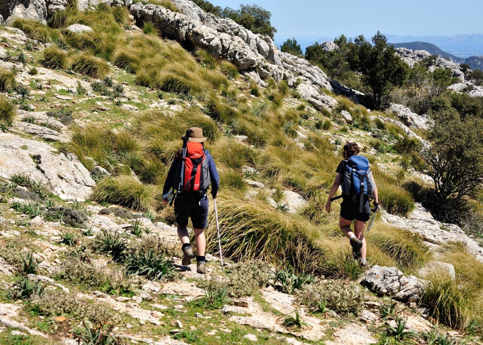
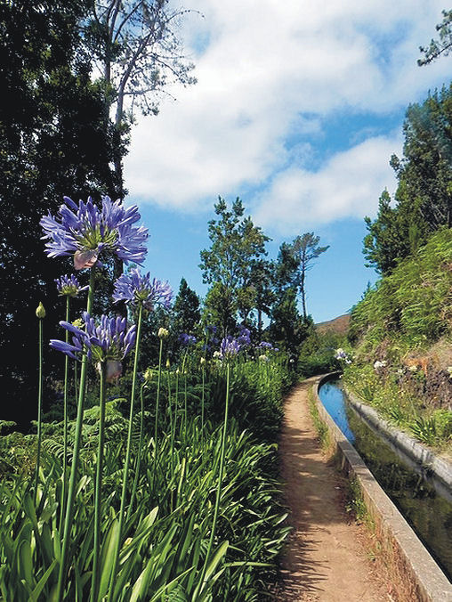
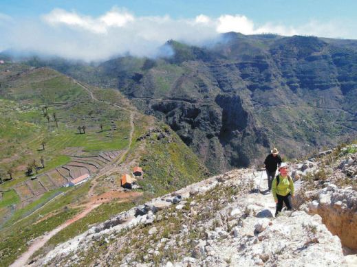
On Mallorca’s north-west coast
Take a look at Discovery Walking Guides’ latest ENews to get hold of yours!
Mallorca; sun, sea, mountains – and Bird Watching too

On Mallorca’s north-west coast
Say ‘Mallorca’ and most people think, “Sun, beaches, mountains, walks, sea-food, sangria …..

Avocet
There’s another excellent reason for visiting this beautiful Balearic island, set in the blue Mediterranean.
Mallorca is home to a surprising number of bird species and acts as a passing-through stop-off for even more bird groups.
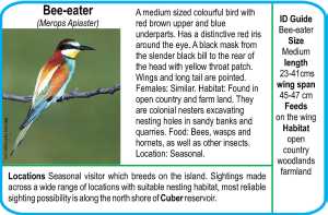
Bee-eater
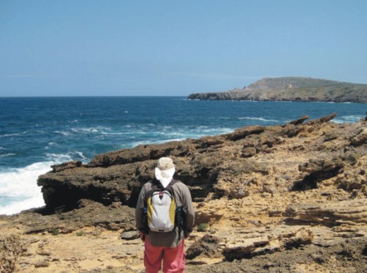
The island’s varied geography, from coastal cliffs to rugged mountains, from wetlands, reservoirs and coastal areas, offer bird life of many kinds a welcoming place to live, rest, feed and breed.
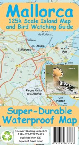
It’s an excellent and up-to-date detailed map (waterproof, tear resistant and guaranteed) perfect for touring the island, with a wealth of details such as best beaches, picnic areas, miradors – plus the locations of the best bird-spotting places.
The map reverse details 51 bird species together with photos and ID information.
Who got a Garmin for Christmas?
If you are one of the many who found a Garmin GPS in their Christmas stocking, this post is for you.
Get your hands on a free sample ‘real-time’ map and see your Garmin come to life. You can choose a sample map of Graciosa ( off Lanzarote, Canary Islands) or Sierra de Aracena (Andalucia, Spain).
What you’ll get is a highly detailed real-time Tour & Trail digital download map, which you can save on your hard drive, transfer to your Garmin GPS CustomMap memory or onto a micro-SD card; you can also use the maps in Garmin Basecamp and Google Earth.
CANARY ISLANDS
Sample segment, Gran Canaria.
Gran Canaria
Tenerife
La Palma
La Gomera
Lanzarote
Fuerteventura
MAINLAND SPAIN
Alpujarras (Sierra Nevada, Andalucia, southern Spain)
Costa Blanca Mountains (Alicante, southern Spain)
Axarquia (Andalucia, southern Spain)
Sierra de Aracena (Helva province, southern Spain)
BALEARIC ISLANDS
Mallorca
Menorca
Formentera
Ibiza
PORTUGUESE ISLANDS
Madeira
For more information about Tour & Trail Maps take a look HERE.
Mallorca: Update on the GR221 – thanks Eryk Grant
These notes were sent by Eryk Grant re the GR221, while using Charles Davis’ book ‘The GR221 – Mallorca’s Drystone Way’
http://www.dwgwalking.co.uk/mallGR221Spec.htm , notably the stretch between Esporles and Valldemossa.
“Hi Charles
Walked this section last Sunday (6th April) without any problem.
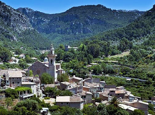
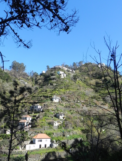
The Mallorcan town of Valldemossa
There were five other walkers on the route and it looks like the obstructions placed by the landowner (notices and fence) are largely ignored. I saw no attempt to ‘repair’ the fence and it was easy to negotiate-there are cairns galore and helpful green/yellow spots on rocks. The track has not become overgrown suggesting it is really well used. There is also a shiny new GR route map in Esporles town centre showing the route going through and all the subsequent wayposts except one refer to it. I guess there may be some tacit acceptance that walking will continue and I would not hesitate to walk this part again.
Up by the Tossals refuge there is a fair amount of building material but not much sign that anything is happening! Last time we stayed there in 2012 we had a conversation with a Dutch couple who were using your DWG guide, and making their way based on “what does Charles say?” – your directions and supporting commentary have never let us down either and in fact have really added to the enjoyment in places.”
Thanks Erik – feedback from walkers who’ve been there is valuable both for those who come after you, as well as providing us with valuable information for new editions.
