
Madeira – good to go from May 17 2021!
It’s been a long wait but at last, people may travel from England to green-list Portugal from May 17. This includes the beautiful island of Madeira (and its little sister Porto Santo).
Here’s the link to the British government’s official website detailing coutries on each of the lists and what this means for English travellers.

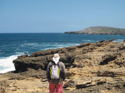
Madeira is a classic destination for keen walkers, though you don’t need to be an expert. There are plenty of lovely strolls as well as high end challenges for experts, with a wealth of variety in between. Or, why not explore by bus, a pocket-money way to experience the island. For plenty more information on discovering Madeira, take a look HERE.
There’s useful information for visitors to the Garden Island of Madeira regarding arriving on the island and the safety measures that are in place HERE.
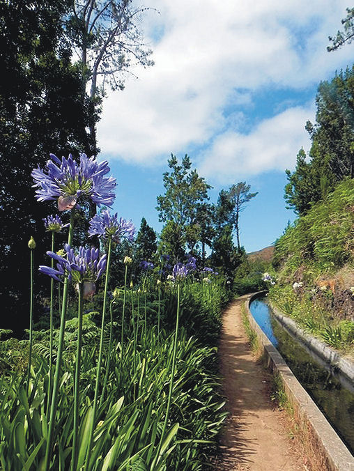
Late Spring and early Summer are perfect times to visit Madeira. The rugged terrain is graced with an abundance of native trees and unique endemic flowers, easily enjoyed on many of the levada walks which also lead you into Madeira’s heart from village to hamlet.


Our thanks go to walking researcher and author-in residence, Shirley Whitehead, for her beautiful photos of Madeira.
Lockdown Blues? Get ready to travel.
With vaccinations well under way in many parts of the world, there’s real belief that travel restrictions will gradually ease in the next few months. We make no apology for offering the information about our free digital maps once again; last time we posted this information we were pleased and surprised at how many people enjoyed them and started planning ahead to travel.
We’d like to help you get planning. Where to next? Why not start by getting your hands on our Free Digital Maps.
Read all about it HERE.
There are free maps to 19 tempting walking destinations to check out, including :
CANARY ISLANDS
La Gomera & El Hierro, Lanzarote, La Palma, Tenerife, Fuerteventura, Gran Canaria


BALEARIC ISLANDS
Mallorca, Menorca, Ibiza, Formentera

GREEK ISLANDS
Zakynthos (Zante), Corfu
SPANISH MAINLAND
Costa Blanca Mountains, Costa del Sol (Axarquia), Alpujarras, Sierra de Aracena

– and also:
Malta & Gozo
Madeira
Azores
To see more details about the free digital maps and how to get them, LOOK HERE
Plan Your Next Walking Adventure With our FREE Digital Maps
With the real hope of vaccines within reach, we can look forward to planning walking adventures again. Once travel freedom returns, there’s going to be a lot of pent-up desire to get away, so this could be the best time to make some plans.
We’d like to help you get planning. Where to next? Why not start by getting your hands on our Free Digital Maps.
Read all about it HERE.
There are free maps to 19 tempting walking destinations to check out, including :
CANARY ISLANDS
La Gomera & El Hierro, Lanzarote, La Palma, Tenerife, Fuerteventura, Gran Canaria
BALEARIC ISLANDS
Mallorca, Menorca, Ibiza, Formentera
GREEK ISLANDS
Zakynthos (Zante), Corfu
SPANISH MAINLAND
Costa Blanca Mountains, Costa del Sol (Axarquia), Alpujarras, Sierra de Aracena
– and also:
Malta & Gozo
Madeira
Azores
To see more details about the free digital maps and how to get them, LOOK HERE
Madeira – good to go!
Although many parts of the UK enjoyed some warm sunny September days, the switch seems to have suddenly flipped to full Autumn. Chilly, windy and rain that sets in for hours on end. Overseas travel is still tricky to plan, though Madeira remains one of the Government’s ‘green list’ destinations.
How does the weather in Madeira compare to London’s at this time of year? A quick check of BBC weather services for October 03 2020 has London’s temperature range as 10C – 15C, heavy rain, zero sun. Madeira should enjoy 19C to 25C, little chance of a shower and plenty of sunny intervals. Madeira gets plenty of rain too; look at those beautiful forests, trees and flowers. But the island’s sunshine and temperature figures look tempting as winter beckons.

Madeira is a classic destination for keen walkers, though you don’t need to be an expert. There are plenty of lovely strolls as well as high end challenges for experts, with plenty of variety in between. Or, why not explore by bus, a pocket-money way to experience the island. For plenty more information on discovering Madeira, take a look HERE.
Thanks to author-researcher Shirley Whitehead for these beautiful photos of her home island.
A Little Good News – Free Digital Maps For Everyone
We may not be able to go adventuring for a while yet. However, we can plan ahead for when we can travel again. Have a look at our digital maps, clear and fully detailed for adventure planning of all kinds, including walking, climbing, biking or maybe daydreaming about your next big trip.

There’s a whole hatful of exciting free maps to be had. Take a look at this list of adventure destinations.
Balearic Islands
Mallorca
Menorca
Ibiza
Formentera
Madeira
Azores
Greek Islands
Corfu
Zante (aka Zakynthos)
Malta, Gozo & Comino
Spanish Mainland
Axarquia / Costa del Sol
Costa Blanca
Alpujarras
Sierra de Aracena

Canary Islands
Gran Canaria
La Palma
Tenerife
La Gomera & El Hierro
Lanzarote
Fuerteventura
We hope that we’ve inspired you to think about your next big adventure. To get your free digital maps, please look here https://www.dwgwalking.co.uk
MADEIRA WALKS, UPDATES

MADEIRA WALKS VOLUME ONE AND VOLUME TWO
IMPORTANT CHANGES TO WALKING ROUTES
20th FEBRUARY 2020
Volume One – Walk 10 – Levada dos Tornos – Monte – Curral Romeiros – Circular
Whilst this route remains open, is it should be noted that the forest section between Wp.3 and Wp.4 is currently in a poor condition. Therefore it is recommended that anyone finding difficulty ascending this path should turn back immediately and follow the lower route via the João Gomez valley. Once in Romeiros there is an option to walk out and back along Levada dos Tornos between Wp.7 and Wp.4 before returning again via the João Gomez valley. This is an extremely pretty section of levada and remains in good condition but does retain the grade 3 risk of vertigo due to a number of unprotected sections. There is also a very short section at Wp.4 where the channel shoulder has suffered some erosion, but this can be totally avoided by walking on the opposite banking crossing and re-crossing the two concrete slabs over the channel.
Volume Two – Walk 55 – Levada do Caldeirão Verde
This route is shown as ‘Conditioned’ on the official Tourism website due to a substantial rock fall around the green pool. Therefore at the present time walkers can either continue along the suggested extension to reach Caldeirão do Inferno or turn around after Wp.9 and return to the starting point where a new café facility has recently been opened in the Parque das Queimadas
Volume Two – Walk 58 – Camacha to Monte
After reaching the Choupana Hills Resort (this hotel was closed in 2016 following the fires in that area), we follow the path through the gardens, which remain open and continue along the levada to Romeiros, where you leave the channel descending steps at (Wp.13). Here follow the road right for a short distance to reach more steps ascending back to the levada. At this point we recommend that you consider the options for continuing on to Monte, either via the levada or by following the trail into the João Gomez valley. Both these options are described clearly in Madeira Walks Volume Two. However, you should note that due to some problems on the descent after leaving the levada (Wp.4) until reaching the point where both options rejoin at (Wp.3) it may be preferable, and much safer for some people, to take the lower route back to Monte. (Refer to the update above for Walk 10)

Volume Two – Walk 65 – Rabaçal Lagoa do Vento
This trail has recently been refurbished providing stepped ascents and descents along its whole length making for a much easier terrain. The upgrade also includes new signage and diverts the path away from the previous wet and slippery sections referred to in the original text in Madeira Walks Volume Two.
Madeira Walks – important updates
Things change, of course and our walking guidebooks for the garden island of Madeira are no exception. From time to time, erosion or weather events mean that parts of a walking route need to be changed, or other safety issues prompt the authorities to make route changes. If you have either of our guidebooks ‘Madeira Walks’ volume one or two, please take a look at these notes sent to us by our resident author/researcher, Shirley Whitehead.
Volume One – Walk 35 – Levada das 25 Fontes – Via Calheta Tunnel (PR6)
Volume Two – Walk 68 – Rabaçal – Levada das 25 Fontes & Levada do Risco (PR 6.1)
The following update applies to both the above routes along the final section between the Ribeira Grande Bridge and the 25 Fontes.
“Around 400m beyond the Ribeira Grande Bridge, a stairway appears on our right; this is a new return route recently constructed to improve safety to walkers by reducing the volume of traffic along the narrowest part of the levada which is subject to serious erosion.

Walkers are therefore asked to respect this safer diversion on their return to Casa do Rabaçal. The new route starts around 120 metres from the 25 Fontes. The stairway is approximately 250m in length with an ascent and descent of 50m therefore reducing the original return journey by around one kilometre.”
Volume Two – Walk 76 – Loreto to Madalena do Mar
Due to a large landslide below the levada around Wp.8, the right hand pathway descending to Lombo da Achada is now closed. As an alternative route to connect with Wp.10 and enable continuation down to Madalena do Mar, we suggest the following:
Just beyond Wp.2, turn right following the cobbled lane as it descends through the woodland. Around 100 m ahead, swing right onto a tarred road. This is “Impasso de Cova da Arco” which winds down the hillside towards Arco da Calheta. Shortly after a right and left bend around 800m ahead, go left down “Caminho das Paredes” to rejoin with “Impasso de Cove da Arco”. Turning left here, follow the road for around 500 metres to reach a T-junction. The total descent to this point is around 263 m. You are now on “Rua da Achada do Santa Antonio” and turning left the route ascends towards Santa Antonio. 700 m ahead take a left turn following “Caminho do Lombo” the lane bends left around100m ahead. Another 50m ahead, you will arrive at a well on your left.

This is Wp.10 of the original route where you now drop down steps on the right of the road to continue on to Madalena do Mar. The variances in timings and distance between the original route and this detour are negligible. The increase in ascents and descents is around 25m.”
Madeira Walking – get the latest updates
MADEIRA WALKS VOLUME ONE AND VOLUME TWO

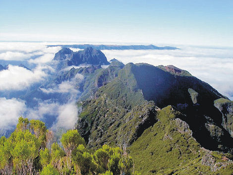
High above the world on Madeira’s peaks
The good news is that there are dozens of excellent walks of all types on this beautiful island. As the summer heat abates and the August visitors leave, it’s an ideal time for a walking holiday. Our resident researcher/author on the island, Shirley Whitehead, has just sent in the following important updates affecting a few routes; some changes are temporary while Shirley suggests alternative detours for some of the walks.
Volume One – Walk 9 – Monte – Bom Sucesso – Funchal
This trail is temporarily closed due to erosion of the pathways and levada following severe fire damage in 2016. Unlike most other water channels, this levada is privately owned and therefore repair work is not at the discretion of the authorities.
Volume Two – Walk 6l – Pico do Areeiro – Pico Ruivo (PR1 Vereda do Areeiro)
This route is shown as ‘Conditioned’ on the official Tourism website describing the trail as accessible along the whole length of the western footpath which passes through tunnels to arrive at Pico Ruivo. However, the route along the eastern part of the trail via Pico das Torres is temporarily closed. This situation has been apparent for some considerable time but our notes will be updated as and when the alternative route reopens.
Volume One and Volume Two – Walks 27 – 64 – 66
Due to the construction of a large reservoir on the Paúl da Serra plateau, scheduled for completion in 2020, the following walking routes are shown as amended or closed. Those affected are as follows:
Walk 27 – Levada do Paúl – Cristo Rei – Fatima Chapel, Rabaçal
This route is closed from Wp.7 where the channel crosses the regional road until it reaches the chapel of Nossa Senhora de Fátima and the Rabaçal car park on the ER105 at Wp.8.
As an alternative route, follow the notes until reaching the regional road at Wp.7 turning right for 300 metres to the junction with the ER105. Turning left from here, it’s around 1 kilometre to Wp.8 at the Rabaçal car park.
Note: the changes to the timings and distance from the original notes are negligible.
Walk 64 – Calheta Slopes – Levada da Rocha Vermelha – Levada Nova – Estrela da Calheta
This route is temporarily closed due to extensive construction work around Wp.3 where the trail becomes impassable in the area of the riverbed and Levada da Rocha Vermelha.
Walk 66 – Rabaçal: Ribeira Grande -Lajeado – Paúl da Serra
This walking trail is impassable beyond Wp. 10. As an alternative we suggest two options: (1) to follow the trail to Pico Rabaçal as a (linear out and back) or, (2) to head in an easterly direction from Wp.9 following the broad moorland path until it reaches the ER209. Turning right here, it is around 800 metres to the cross roads with the ER105 and turning right, passing the Jungle Rain Restaurant, the original trail can be picked up again from Wp.17 to return to the starting point. This alternative section is around 4.8 kms in total making the timings and distances with the original notes negligible.
For further information of closures and conditioned sections of the Officially Recommended Walking Routes go to www.visitmadeira.pt “Notice to Walkers”
For walking map and guidebook information, look here.

A spectacular waterfall on the Levada da Ribeira da Janela
Tour and Trail Maps Go To Sea
We know that most people use our Tour & Trail maps for hiking and biking, for driving and occasionally while horse riding. Their strength, toughness, foldability and waterproof qualities make our maps ideal for all these pursuits.

Look at those magical blues! Paddle Boarding off Northern Menorca
But here’s a first! We received an interesting email from Oliver, a kayak, open canoe and paddle board guide. He uses our maps to navigate around coastlines and sent us a couple of photos showing how he does it.
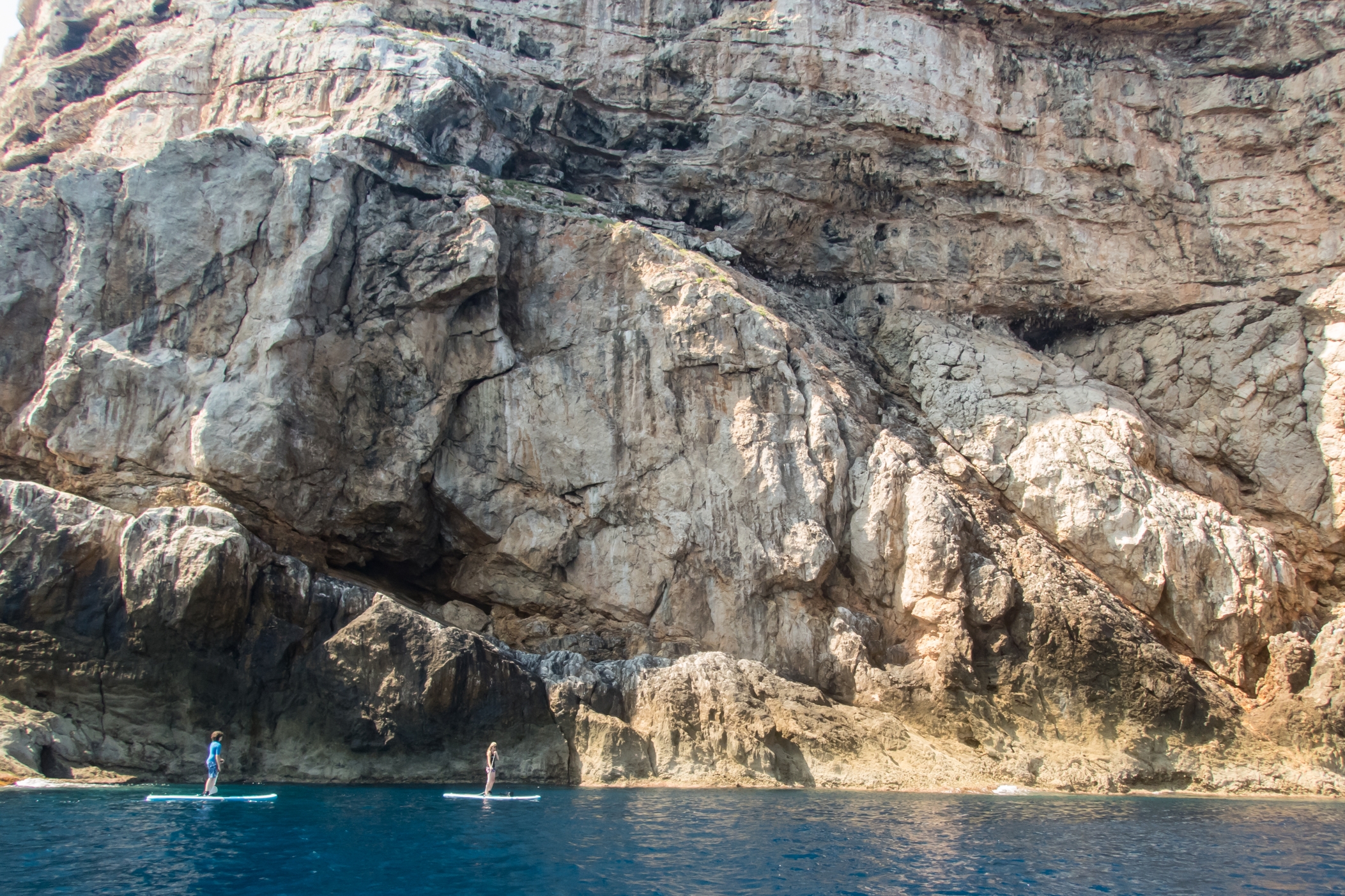
Paddle Boarding off Menorca’s North Coast
“Just wanted to say how impressed I am with the quality of your maps, I use them to navigate our way around coastlines, most recently around some of the awesome north coast of Menorca on Stand Up Paddle Boards, (I guide in both sea kayak and Open canoe too).
Your maps definitely make life easy while afloat …
Oliver”
(Received 24 August 2018)
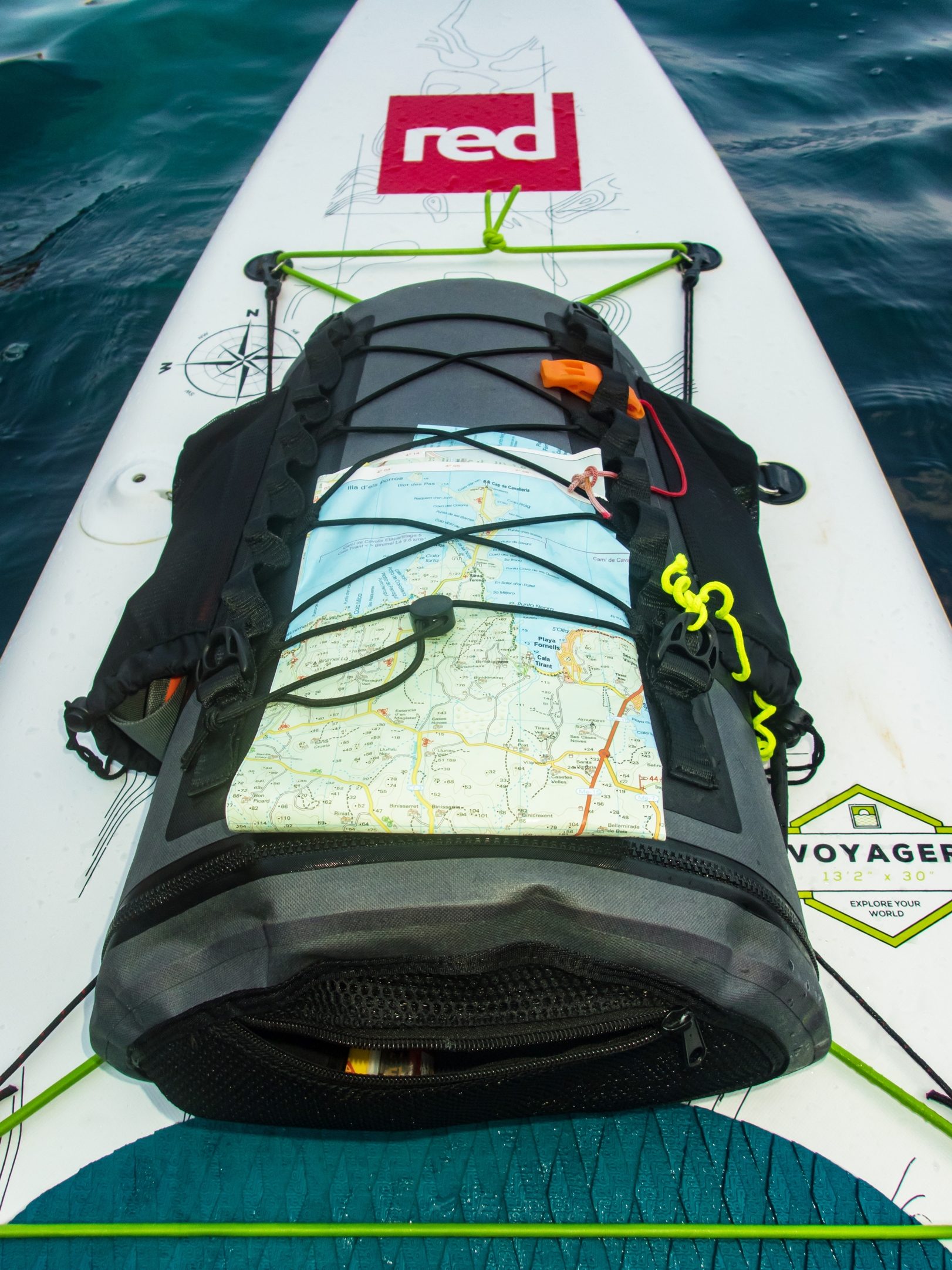
And here’s how to use your Tour & Trail map while paddle boarding.
Thanks Oliver!
You can see that map and many others from Discovery Walking Guides here.
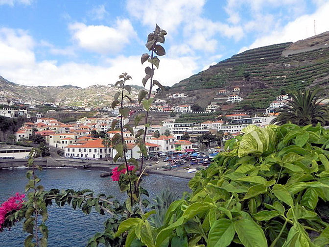
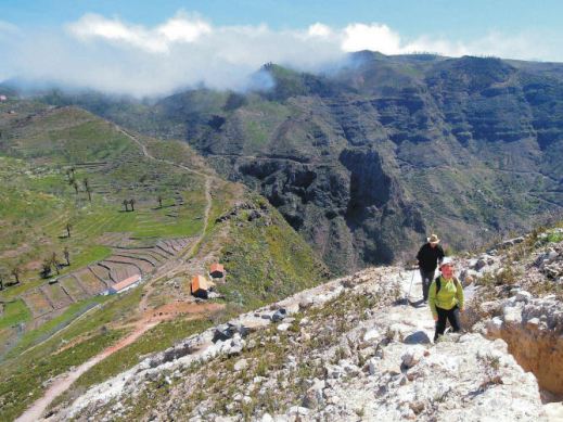
Madeira – Garden Isle

Taken by author/researcher Shirley Whitehead – stunning views from Encumeada.
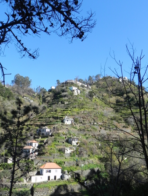
Ah, Madeira! It’s an island that draws visitors back again and again, with its unique plant life, a wide range of wonderful walking from strolls to challenging mountain routes, and a benign climate, making it a year-round destination.
One of the best things about walking here is the sheer variety of routes. If you want gentle, level paths, there are many levada-side routes taking you through lush, natural green scenery. Mountain-lovers have a wealth of inspiring options to choose from. You want views? Wild flowers? Unspoilt villages? Short strolls? Challenging all-day routes? They’re all here.
Madeiran island authorities are well aware of the importance of walking to many of their visitors and do a great job of maintaining routes, keeping them open and safe.

If you’re thinking of a visit to the island, you’ll get much more value from your visit with a good guide book and map in your pocket. Have a look HERE for recommendations.
