
Beaches, Snow-Capped Mountains and Wonderful Walking – has to be Tenerife

Majestic Mount Teide, Tenerife
One of the great things about Tenerife is that you can enjoy the snow-capped peaks in the morning and have time to watch the sun go down from a warm, sunny beach that same day.
If you like lively resorts, Tenerife has them; if you prefer quiet settlements and small towns, you’ll find plenty of choice also.

Tenerife Bus & Touring Map
The bus service on the island is pretty good. If you have to drive while back in your ‘real life’, it’ll be so relaxing to discover Tenerife by bus.
If you want to drive, there are car hire companies galore.
And the walking – it’s varied and surprising. If you fancy country strolls or want to scale the mighty Mount Teide (or anything in between), Tenerife will not disappoint you.
Tenerife’s south is drier than the north, mostly due to massive Mount Teide dominating the island’s centre and affecting the island’s micro-climates.
Teide stands above the vast volcanic peaks and plains of Las Cañadas. The easy way to get to this highest point on Spanish territory is via the exciting cable-car ride. On A clear day you’ll see for many kilometres with fine views of some of the other Canary Islands.
The verdant north includes the capital of Santa Cruz, home to some fine old buildings and modern shopping. One of the original resorts, Puerto de la Cruz, sits on the north coast with plenty to
occupy visitors. Further west along the coast lies the ancient settlement of Garachico. It’s a fascinating old town with an unusual black natural rock-pool coastal area and a swathe of petrified lava remaining from Mount Teide’s eruption in 1706.

The Anaga, Tenerife
To the north-east is the wild area of Anaga, a walker’s delight.

Masca, western Tenerife
Dramatic and extreme geology on the west coast makes for plenty of ‘wow’ factor. The tiny settlement of Masca has to be seen to be believed though only drive yourself there (and back) if you have nerves of steel and no fear of narrow, winding mountain roads.
Los Gigantes is farther down the west coast, a larger and more modern settlement with a huge vertical set of cliffs plunging seawards with a narrow beach at their feet.
Inland from the west coast are walking paths and small settlements far from the tourist crowds.

Inland from Tenerife’s west coast
The sun-baked south of the island offers wide choices of accommodation, beaches, night-life, sports facilities and shopping. There are also some great walks in this region too. For more information about the island of Tenerife take a look at Discovery Walking Guides’ website
There’s a brand-new edition of the highly recommended Tenerife Hikers’ Maps, out now. Find out more by clicking HERE.

Tenerife Hikers’ Maps (3rd Super-Durable edition)
Choosing A Winter Walking Destination
What do you need for an enjoyable walking holiday when winter closes in on the northern hemisphere?
RELIABLE WARMTH AND SUNSHINE

On La Gomera – Tenerife’s Teide visible
A 5 hour flight south (from the UK) gets you to the Canary Islands, off the coast of Africa. You can expect about six hours of sunshine per day (average) with highs of 20C in December though of course there are variations depending on the island and location.

Levada Nova, Madeira
Madeira is a bit closer and almost as sunny (around 5 hours) and almost as warm though the chance or rain is higher. That’s why Madeira is so green and floriferous!
A GOOD CHOICE OF HOTELS, NIGHT LIFE, SHOPS and RESTAURANTS
The Canary Islands and Madeira don’t really have a ‘closed’ season for tourism so you will find a wide range of accommodation, eating places, shops and night life. There are quieter, smaller places to stay if you want to get away from the ‘bright lights’.
EASY TO GET TO
There are plenty of flights all year round to the Canaries and to Madeira.
WHAT’S THE WALKING LIKE?
Each of the Canaries is unique, offering a wide choice of walks and challenging hikes. If you are looking for a pleasant stroll for an hour or two, a coastal discovery route or a full day in the mountains (or something inbetween), the Canaries are an ideal choice.
Madeira is rugged and steep, though the many levada walks (mostly level walks alongside narrow water canals) make it a walking destination with plenty of choice for all.
FIND OUT MORE ABOUT CANARY ISLANDS WALKING HERE:-
FOR MORE ABOUT WALKING ON THE GARDEN ISLE OF MADEIRA, LOOK HERE:-
Madeira
Gran Canaria, Canary Islands – New 3rd Edition Tour & Trail Map
It may not be as well-known as some of the other Canary Islands – that means there’s plenty of room for you to explore this bold, beautiful and dramatic island.
You want mountains and ravines? You want remote, unspoiled sleepy villages? You want abundant verdant woodlands, paths and tracks? You want endemic plant life found nowhere else? You’ve got them all on the island of Gran Canaria.
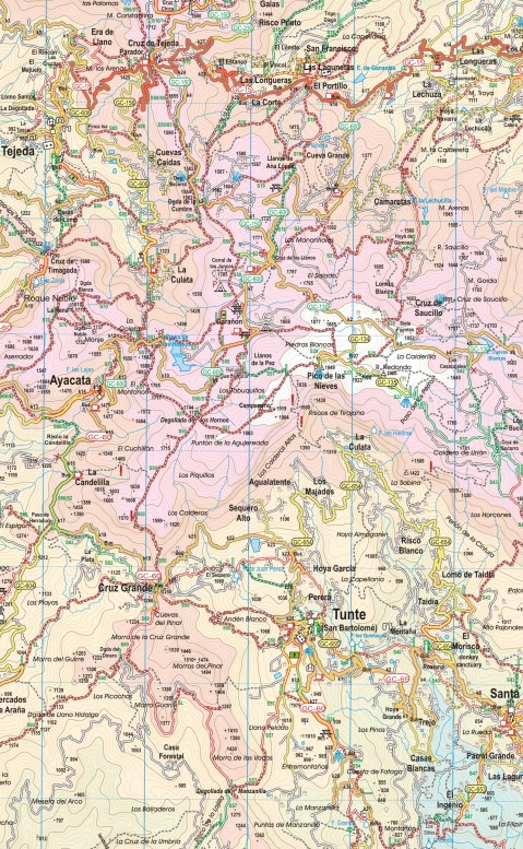
Map section, Gran Canaria
This third edition includes new walking routes, even clearer ways to show routes and other map features and all the detailed cartographic information that afficionadoes of the Tour & Trail series have come to expect and rely upon. Take a look at this small extract (left).
Detailed updating and addition of new walking routes and additional data have been researched by our ‘on the ground’ walking expert, ‘Rambling Roger‘ and his fellow walking researchers who know the island like the backs of their hands.
If you’re looking for an adventure away from the European winter, with almost guaranteed good weather and great walking (definitely guaranteed) then take a look at Gran Canaria.
(Custom Map digital edition for Garmin Users is available from Discovery Walking Guides’ website. Digital editions are available for 3G/4G GPS apps from Viewranger and My Trails.
Walking Newsletter Now Available
Take a look at Discovery Walking Guides latest newsletter; topics include Menorca, Lanzarote, free digital maps and Walk! books and more. Click the link to read all about it.
Discovery Walking Guides ENews

Breathtaking views on the island of Madeira.
Take a look at our latest ENews featuring Ibiza, Formentera, Corfu, Madeira and Dartmoor.

Dartmeet stepping stones
Ibiza! Formentera!

Ibizan sunset
Hot off the press are two great new maps, highly detailed and just the thing whatever you want to do on this lovely isle; bikers, hikers and beach-lovers will find just what they seek on Ibiza and its little sister, Formentera.
There’s a special offer on for either (or both) maps :-

Just one of Formentera’s perfect beaches
Dartmoor – discover the magic
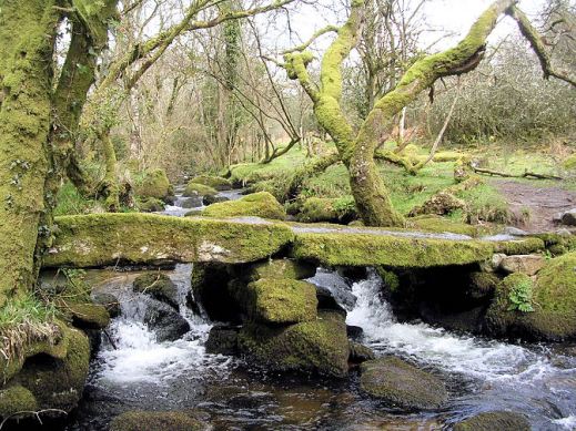

Devonport Leat
Dartmoor – a place of history, myths and legends.

Blackingstone Rock (Walk 22)
The best way to experience its wild and wonderful moors and ancient stone villages is on foot.
Dartmoor residents and author-researchers Kate & Alan Hobbs know the moors well and are your step-by-step guides through forty wonderful walks, strolls and adventures. They know the best places to call in for a pub lunch along the route too!
Detailed walk descriptions, Ordnance Survey mapping and waypoints at decisions points, along with frequent timings, ensure you’ll find your way.

Dartmoor Ponies
Each walk is illustrated with photos taken along the route. Walks are graded for difficulty, distance, time required, ascents and descents and refreshments.

Walk! Dartmoor (2nd edition) arrives on the planet 18 January 2016.
For more details look HERE.

Dartmeet Stepping Stones (Walk 36)
Formentera? Where’s that? UPDATE
You’d be forgiven for not knowing the location of this little gem of an island. It’s surprisingly easy to reach and has a delightful personality all its own.
Formentera is one of the Balearic Islands to the east of mainland Spain, in the Meditteranean. It’s the little sister island to Ibiza and is only a 30-minute ferry trip away.
Here’s a few facts and figures:
- Beaches, beaches – so many of them for such a small island and white, clean and beautiful.
- The island had been occupied by the Carthaginians, then the ancient Romans, the Visigoths, the Byzantines, the Vandals, and the Arabs.
- Eventually the island added to the Crown of Aragon and later became part of the medieval Kingdom of Majorca.
- The main island of Formentera is 19 kilometres (12 miles) long and is located about 6 kilometres (4 miles) south of Ibiza in the Mediterranean Sea.

San Francesc, Formentera
- The major villages are Sant Francesc Xavier, Sant Ferran de ses Roques, El Pilar de la Mola and La Savina.
- Formentera comprises one municipality, also called Formentera, and has a population of 9,962 (as at 1 January 2010).
- Its land area is 83.24 square kilometres (32.1 sq mi).
- Cars are easily hired in the port and there’s a good choice of conventional or electric vehicles. There are more electric vehicle charging points here than anywhere else in the world, given its land area.
- Mopeds and bicycles are available to hire; the terrain is mostly flat and there are dedicated cycle lanes in some areas.
- The island has four Martello towers.
- Ferries to Formentera from Ibiza operate every half hour in high season.
- A local Ibizan (eivissenc) variant of the Balearic dialect of the Catalan language is spoken in Formentera though English and other European languages are frequently heard too.
Discovery Walking Guides carried out an intensive cartographic survey on Formentera a few weeks back and design of the new Formentera Tour & Trail Super-Durable Map is well under way.
For full details about the new Formen tera map, click here.
KICKSTARTER PROJECT
How would you like to be part of the launch of this exciting new map project? For a modest pledge you can help this project to fly – and receive free maps too.
There’s still time to be a part of this exciting project.
Take a look at DWG’s Kickstarter Project here.
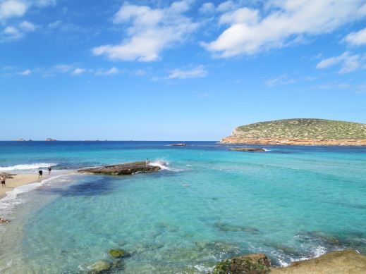
Ibiza – white beaches, azure seas, verdant pine forests UPDATE
Forget the tabloid image of all-night clubbing, loud music and young visitors in various states of inebriation and undress.
The real Ibiza is a beautiful place, blessed by a wonderful climate with many hours of sunshine each month.
Numerous fine white beaches and little coves tempt the swimmer and sun-worshipper, while walking/biking trails meander through wild flowers underneath a canopy of fragrant pine woods.
A few Ibizan facts:
- Ibiza is one of the Balearic Islands, in the Mediterranean east of the Spanish mainland.
- It’s a naturally beautiful island with white sand beaches, turquoise seas and verdant pine woods, olive groves and wild flowers.
- The island has a long history of invasion by various forces including the Ancient Romans, the Vandas, Byzantines, the Moors, the Norwegians and were finally claimed by Spain. Nowadays, the ‘invaders’ are tourists.
- Ibiza is 572.56 square kilometres (221.07 sq miles) land area.
- The highest point of the island is Sa Talaiassa, at 475 metres (1,558 ft).
- The population is estimated at approximately 132,500.
- Eivissenc, a dialect of Catalan, is spoken on Ibiza, as is Spanish. English is widely spoken in tourist areas.
- Though renowned for its clubbing scene, there are beautiful beaches, pine woods and walking/biking routes across the island.
One of Ibiza’s beautiful coves (on the west coast)
Until now, the maps available for the island of Ibiza have been basic and without the kind of detail you need to enjoy exploring.
That’s all set to change as Discovery Walking Guides has completed their ‘on the ground’ mapping survey. Design of the new Ibiza Tour & Trail Super-Durable Map is well under way.
Click HERE for all the details of the new Ibiza map.

KICKSTARTER PROJECT
How would you like to be part of the launch of this exciting new map project? For a modest pledge you can help this project to fly – and receive free maps too.
There’s still time to part of this exciting project.
Take a look at DWG’s Kickstarter project here:
Dartmoor News – New research shows Sittaford Tor as Old as Stonehenge
 Did you see this interesting article in the Telegraph yesterday, 16 May 2015?
Dartmoor has a long and fascinating history; this new research suggests that some areas have an even longer history than was previously understood. See for yourself – take the walk.
The weather is perfect now for exploring British walking. If you want to take a look at the ancient stone circle of Sittaford Tor then follow Walk 9 in Walk! Dartmoor. The walk is a pleasant three and a half hour circular route which includes plenty of interest including the Tor.
For more information see:-
