
Lockdown Blues? Get ready to travel.
With vaccinations well under way in many parts of the world, there’s real belief that travel restrictions will gradually ease in the next few months. We make no apology for offering the information about our free digital maps once again; last time we posted this information we were pleased and surprised at how many people enjoyed them and started planning ahead to travel.
We’d like to help you get planning. Where to next? Why not start by getting your hands on our Free Digital Maps.
Read all about it HERE.
There are free maps to 19 tempting walking destinations to check out, including :
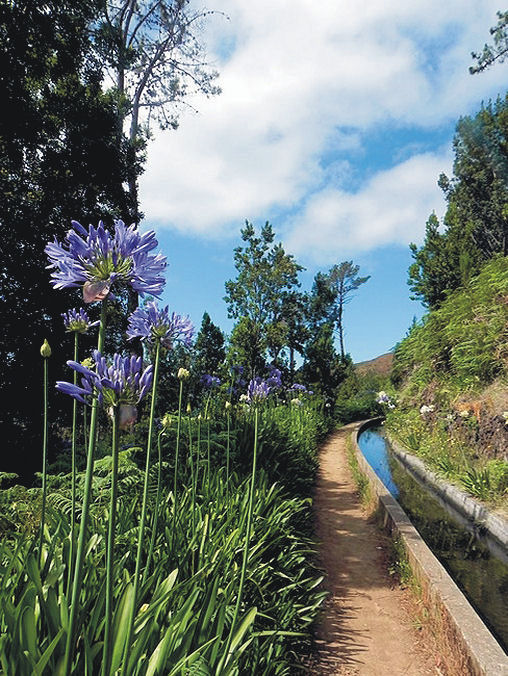
CANARY ISLANDS
La Gomera & El Hierro, Lanzarote, La Palma, Tenerife, Fuerteventura, Gran Canaria


BALEARIC ISLANDS
Mallorca, Menorca, Ibiza, Formentera

GREEK ISLANDS
Zakynthos (Zante), Corfu
SPANISH MAINLAND
Costa Blanca Mountains, Costa del Sol (Axarquia), Alpujarras, Sierra de Aracena

– and also:
Malta & Gozo
Madeira
Azores
To see more details about the free digital maps and how to get them, LOOK HERE
Plan Your Next Walking Adventure With our FREE Digital Maps
With the real hope of vaccines within reach, we can look forward to planning walking adventures again. Once travel freedom returns, there’s going to be a lot of pent-up desire to get away, so this could be the best time to make some plans.
We’d like to help you get planning. Where to next? Why not start by getting your hands on our Free Digital Maps.
Read all about it HERE.
There are free maps to 19 tempting walking destinations to check out, including :
CANARY ISLANDS
La Gomera & El Hierro, Lanzarote, La Palma, Tenerife, Fuerteventura, Gran Canaria
BALEARIC ISLANDS
Mallorca, Menorca, Ibiza, Formentera
GREEK ISLANDS
Zakynthos (Zante), Corfu
SPANISH MAINLAND
Costa Blanca Mountains, Costa del Sol (Axarquia), Alpujarras, Sierra de Aracena
– and also:
Malta & Gozo
Madeira
Azores
To see more details about the free digital maps and how to get them, LOOK HERE
Who got a Garmin for Christmas?
If you are one of the many who found a Garmin GPS in their Christmas stocking, this post is for you.
Get your hands on a free sample ‘real-time’ map and see your Garmin come to life. You can choose a sample map of Graciosa ( off Lanzarote, Canary Islands) or Sierra de Aracena (Andalucia, Spain).
What you’ll get is a highly detailed real-time Tour & Trail digital download map, which you can save on your hard drive, transfer to your Garmin GPS CustomMap memory or onto a micro-SD card; you can also use the maps in Garmin Basecamp and Google Earth.
CANARY ISLANDS
Sample segment, Gran Canaria.
Gran Canaria
Tenerife
La Palma
La Gomera
Lanzarote
Fuerteventura
MAINLAND SPAIN
Alpujarras (Sierra Nevada, Andalucia, southern Spain)
Costa Blanca Mountains (Alicante, southern Spain)
Axarquia (Andalucia, southern Spain)
Sierra de Aracena (Helva province, southern Spain)
BALEARIC ISLANDS
Mallorca
Menorca
Formentera
Ibiza
PORTUGUESE ISLANDS
Madeira
For more information about Tour & Trail Maps take a look HERE.
Mallorca: Update on the GR221 – thanks Eryk Grant
These notes were sent by Eryk Grant re the GR221, while using Charles Davis’ book ‘The GR221 – Mallorca’s Drystone Way’
http://www.dwgwalking.co.uk/mallGR221Spec.htm , notably the stretch between Esporles and Valldemossa.
“Hi Charles
Walked this section last Sunday (6th April) without any problem.
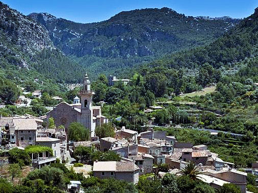
The Mallorcan town of Valldemossa
There were five other walkers on the route and it looks like the obstructions placed by the landowner (notices and fence) are largely ignored. I saw no attempt to ‘repair’ the fence and it was easy to negotiate-there are cairns galore and helpful green/yellow spots on rocks. The track has not become overgrown suggesting it is really well used. There is also a shiny new GR route map in Esporles town centre showing the route going through and all the subsequent wayposts except one refer to it. I guess there may be some tacit acceptance that walking will continue and I would not hesitate to walk this part again.
Up by the Tossals refuge there is a fair amount of building material but not much sign that anything is happening! Last time we stayed there in 2012 we had a conversation with a Dutch couple who were using your DWG guide, and making their way based on “what does Charles say?” – your directions and supporting commentary have never let us down either and in fact have really added to the enjoyment in places.”
Thanks Erik – feedback from walkers who’ve been there is valuable both for those who come after you, as well as providing us with valuable information for new editions.
Costa Blanca Mountains – thank you Erik, for your valuable feedback.
A tour of Raco Roig (Walk 20)
We welcome all user feedback – and in particular for our new downloadable maps for Garmin GPS.
Erik is a Costa Blanca Mountains expert and guides walks in the region. https://www.walking-holiday-in-spain.com
See the maps he’s referring to here:-http://www.dwgwalking.co.uk/CBM.htm
Here’s what he told us about his experiences using both our printed maps and our maps for Garmin GPS:-
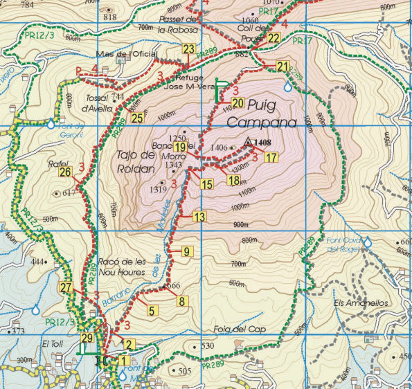 “Over the last month my walking customers have been testing the Discovery Walking Guides sheet map (Costa Blanca Mountains Tour & Trail Map) and downloadable basemaps on the eTrek Garmin 20 GPS for the treks and walking holidays we organise in the Costa Blanca Mountains.
The sheet maps are useful, although the 1:40,000 scale in the Spanish countryside is at the limit for precise navigating, the roads on the map translate as 55 metres wide on the ground – easily enough to get misplaced for a while. Some of what appear as roads are overgrown dirt tracks that are now footpaths, you can still get through but it can be a bit confusing so if you want to go off the marked routes you will need to be patient.
The marking of existing official routes and recommended routes is very good, there are some minor omissions and in one case replicating an error found on the local 1:20,000 topo. Not perfect but a very good approximation and an improvement on the local maps. The problem here is still the abysmal way marking of routes on the ground.
The area covered is quite extensive, although some of my routes fall outside the eastern margin of the coverage.
The basemaps for the Garmin GPS are very good, despite an initial problem with the download (for some reason Windows 7 stripped off the filetype which you had to add manually) they are now installed on all my Garmins. The image is very clear, much better than my own 1:25,000 basemaps that blur on zooming in.
The maps load relatively quickly on start-up and as you are walking the change from one tile to another is very smooth, in fact it is barely perceptible.
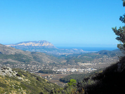
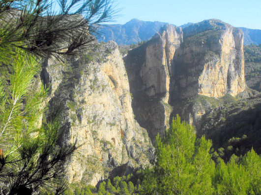
View over the coastal plain from the Costa Blanca Mountains
All in all a great improvement for those of us who have been struggling with Spanish maps for years, My only reservation is the 1:40,000 scale, I would love it if you would considering publishing 1:20,000 or 1:25,000 maps as a future upgrade.”
Costa Blanca Mountains – how would you like a free walk?
 Inland of the famous holiday coast of Spain’s Costa Blanca lies an unspoilt walker’s paradise.
Do you want a taste? Take a look at this free sample walk. Click on this link to access the download:-
http://www.dwgwalking.co.uk/CBM.htm
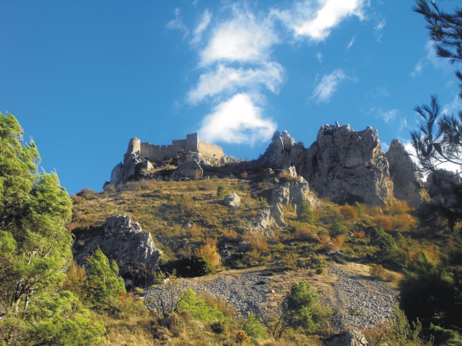
Walk 7 ‘Castell de Confrides’ lies not far from Benidorm – here’s the objective, the remains of a stronghold hundreds of years old from which there are amazing views.
