
Fuerteventura Super-Durable Map is here!
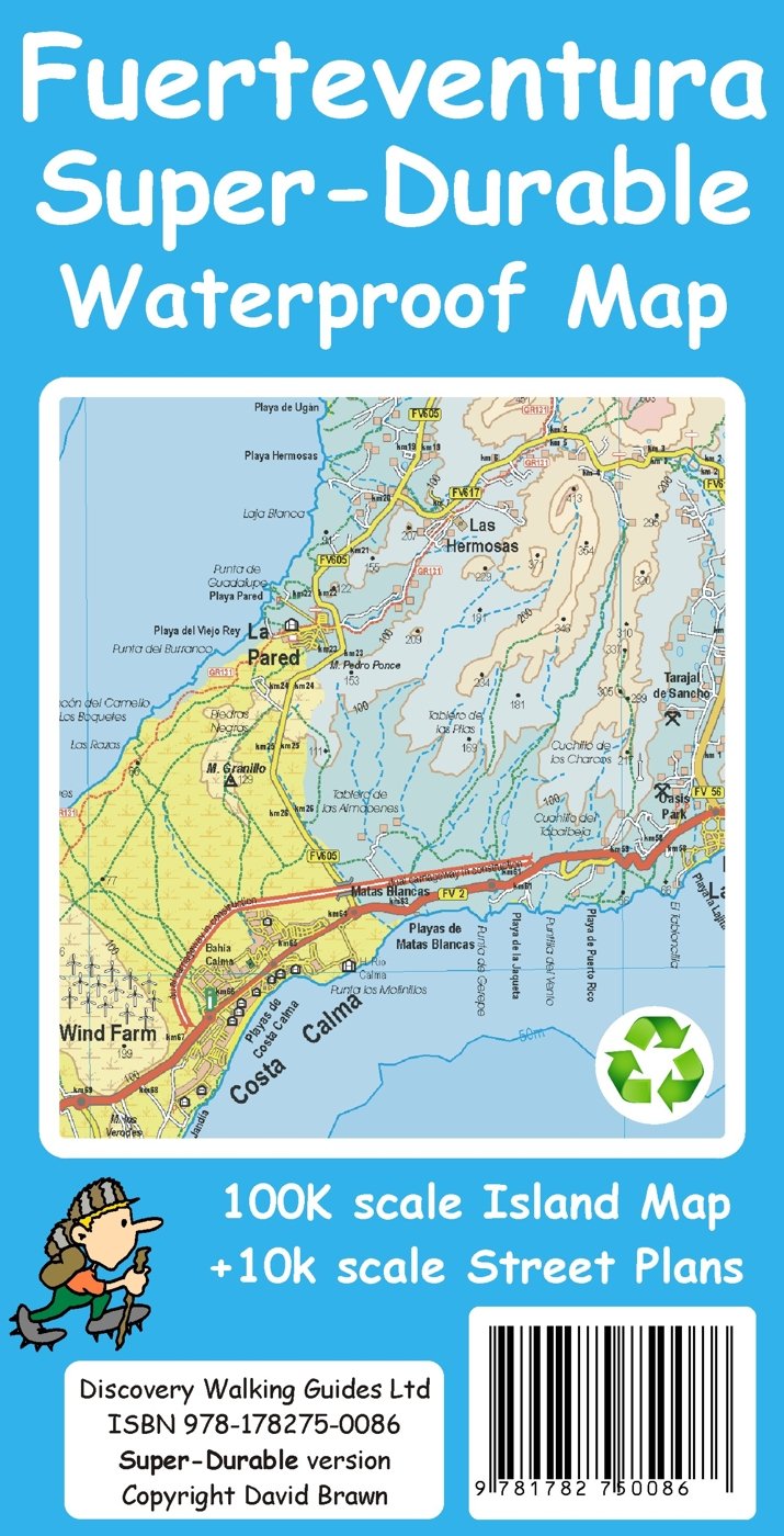
Fuerteventura Super-Durable Map 2015
Just arrived – Fuerteventura Super-Durable Map. HIghly detailed and right up-to-date and printed on a special polymer withstanding rain, wind and folding many times. The island appeals to windsurfers, cyclists, walkers and adventurers, and has miles and miles of pure, clean beaches too.
It’s an intriguing island with a timeless quality, the raw bones of the island shaped by a volcanic past. Unique – once experienced, never forgotten. Read more here

Aloe Vera thrives in Fuerteventura’s desert conditions.
http://www.dwgwalking.co.uk/fuerteventura.htm

On Fuerteventura’s east coast

Wind and Watersports on Fuerteventura
Gran Canaria – wonderful walking
 Thanks to Chris Kurton who has just had a wonderful walking holiday on the dramatic Canary Island of Gran Canaria.
Here’s one of Chris’ photos taken while walking; a view from a col towards Gui Gui.
See the GPS record of one of Chris’ routes, a circuit of Mount Tauro, http://connect.garmin.com/modern/activity/695801198/share/0?lang=en
See lots more images taken by Chris while walking the island in Walking The World group on Facebook; click https://www.facebook.com/groups/discovery.walking/
And for information on maps and walking on Gran Canaria see http://www.dwgwalking.co.uk/gcan.htm
The Sierra de Aracena – walking in Spain
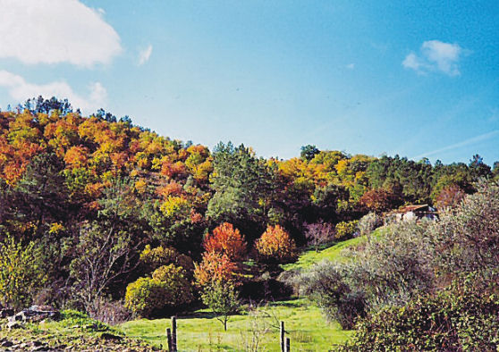
Uunspoiled, green countryside near Galaroza.
Having explored Spain’s Sierra de Aracena some years back for a walking guide and map, it was interesting to see a long and enticing piece in today’s Saturday Telegraph magazine about this little-visited region:-
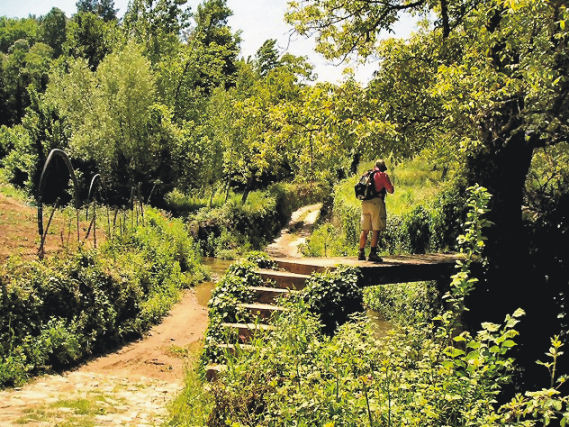
Another green and beautiful walking route, near the little town of Fuenteheridos.
Spain offers so many wonderful walking regions, yet Sierra de Aracena remains little-known – which is of course, part of its charm. If you want dramatic mountains, look elsewhere. If you like wonderful green, natural walking interspersed with hamlets and little characterful towns, you’ll enjoy this area. It’s the perfect ‘get away from it all’ place.

The little town of Cortelazor.
If your interest has been sparked, take a look at map and walking information from DIscovery Walking Guides: http://www.dwgwalking.co.uk/sierradearacena.htm
Lanzarote – walking the Caldera Blanca

Wow! The interior of the crater, Walk 39, Lanzarote.
Our thanks to Robert and Penny, recently returned from walking on Lanzarote. Here’s what they told us:-
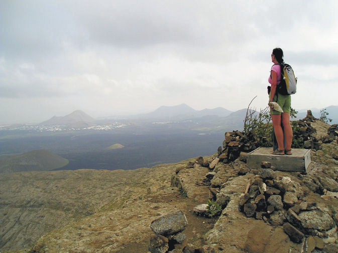
Standing on the volcanic crater rim of Caldera Blanca, Lanzarote.
We have just returned from 10 days walking in Lanzarote. Your book was a great help as there is little in the way of signs or clear path markers. Without your book we would have frequently got on the wrong
route.
One comment, on walk 39, Caldera Blanca, We agree this was a
fantastic walk and the view from the crater rim were fantastic.
However, if we were to do this walk again we would have gone round the
other way (anti clockwise). The decent from the top was much steeper
and the path was full of small stones which required great care to
safely negotiate. We would have been much happier going up that way.
We walked in La Palma a few years ago and again found the guide great.
Thanks again for a great guide.
Robert and Jenny P
Fuerteventura – the wild, windy desert island
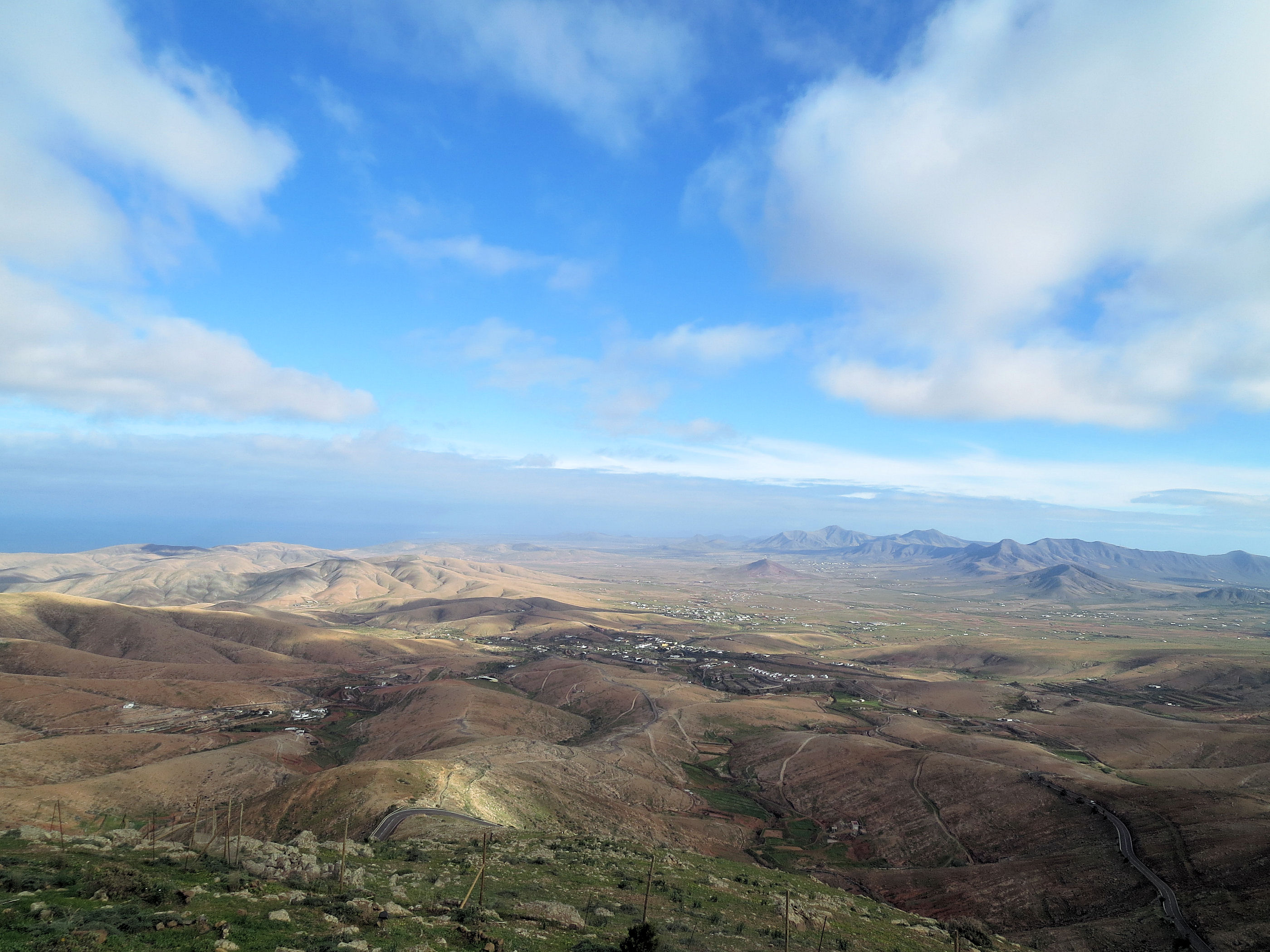
A surreal, wild and mostly empty landscape
We’ve just returned from completing a cartographic survey of this surreal island. Once your eye and mind adjust to the fact that most of it is a vast, volcanic desert, you begin to appreciate its surreal beauty.
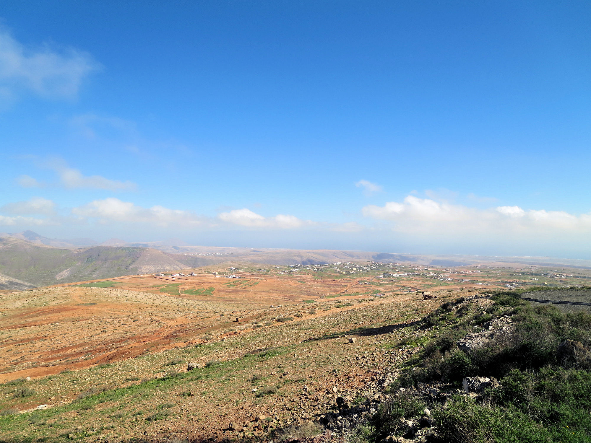
Central north Fuerteventura from the settlement of Time.
There are few towns and settlements, so if volcanic cones, calderas and barrancos are your thing, it is a ‘must-see’ destination.
Fuerte+ventura translates as ‘strong wind’ and this eastern Canary Island lives up to its name.
No wonder, then, that the island pulls in watersports people from all over the world, enjoying the challenge of the winds alongside the serene beauty of miles and miles of pure white beaches.

Watersport heaven on Fuerteventura’s east coast
The island has a long history. Wandering the streets of the original capital of Betancuria (founded 1405) is a journey back in time.

Established in 1405, Fuerteventura’s origianl capital of Betancuria is a step back in time.
Get up high on one of the mirador viewpoints to see amazing views of the scattering of volcanic cones with a few precious patches of green in the valleys. There’s very little rainfall here so agriculture is an uphill battle.
Aloe Vera thrives in Fuerteventura’s desert conditions.
Goat farmers (delicious white local cheeses) and growers of aloe vera are more in tune with the harsh terrain and climate.
Now we have the raw data, our cartographer David is working on Discovery Walking Guides ‘Fuerteventura Super-Durable Map’ which we hope to publish in April 2015.
Walk! Lanzarote :- Updates and Notes

Los Cocoteros to Costa Teguise – best views on route
Our thanks go to Howard and Penny who recently returned from a walking holiday on the Canary Island of Lanzarote and have sent us these useful notes and updates for those who walk after them.
For more information about the book and map they used, see http://www.dwgwalking.co.uk/lanz.htm
Dear David and Ros,We have just returned from 2 weeks in Lanzarote guided by your excellent version 3 of Walk! Lanzarote. (We visited in 2008 with version 1)
We had a wonderful time and really had no issues at all in finding our way though a few little changes have arisen which we suspect arose after your visit. We particularly enjoyed some of the new routes.
Walk 13 The path from wp13 to wp17 has now been bulldozed out as part of the Orzola to Playa Blanca formal route so is now very easy to follow
Walk 22 This has now been upgraded into a defined path with illustrative notice boards and you are advised that stepping off the path is punishable. The English version of the notices are written in best Brussels Eurocrat speak so it is quite entertaining but the beauty of the place is not lost.
Walk 36 After the quite treacherous drop down to wp6 it was clear we were not wanted on the stone wall so we made a direct line for the extreme right end of the wall where we picked up the path. Looking at the footsteps we were not alone.
Walk 33 We set off up the path from the Recycling Bins at the start only for a lady from one of the houses to shout across to say we were on the wrong path. Clearly we were not the first walkers she had re-routed. The bins have been moved ca 75m up the road. The route begins from the path by the bus stop. How you got to wp 4 in 29 minutes amazed us, we were fairly close to your timings throughout the island but it took us close to an hour for this part of the route. We also struggled from wp 4-6 turning left far too early, it would have been clearer if wp5 had not been detailed and the route was described simply as aiming from wp 4 to the right hand side of the saddle where the track is clear at wp6.
Walking in the Haria region
Walk 39 Wonderful.
For those with restricted time we would combine walks 29 and 30 starting at wp1 in Haria and going directly to wp13 (a quick trip up to wp12 is well worth while) then continue to wp17 where you join walk 29 at wp4 and complete walk 29 from there.
Finally we wondered if anyone else had the same experience as us in Ye (walk 36). We were met at the church by two delightful small dogs who befriended us for the day, sticking with us all the way round. Sitting with us when we stopped to eat and then on return trotted off. They seemed to treat us as their dog walkers for the day. Has anyone else performed this service?
We see you are planning Fuerteventura, we have not been there so look forward to you guiding us around that island soon. One request though, please can you publish this with a ring bound spine, they are so much easier to work with.
Many thanks again
Howard and Penny
PS. Note for David, there is a new roundabout on the LZ30 where the LZ402 joins from Famara – a Cartologists work is never done.

The Garden Isle of Madeira – escape from winter!
Winter has finally arrived in northern Europe and the days are short and dark. It’s the ideal time to enjoy Madeira. Lush vegetation, mountains and levadas await your discovery.

Aloe aborescens

Madeira Tour & Trail Map
Discovery Walking Guides have released their 8th editions of their Tour & Trail Maps to the Garden Isle (a choice of map-paper or Super-Durable polymer). Walkers keep on buying these for their accuracy, clarity and wealth of up-to-date detail.
Ask for them in your favourite bookshop or get them online from your choice of stockists.
Here’s a link to amazon UK’s information page about the Super-Durable edition:

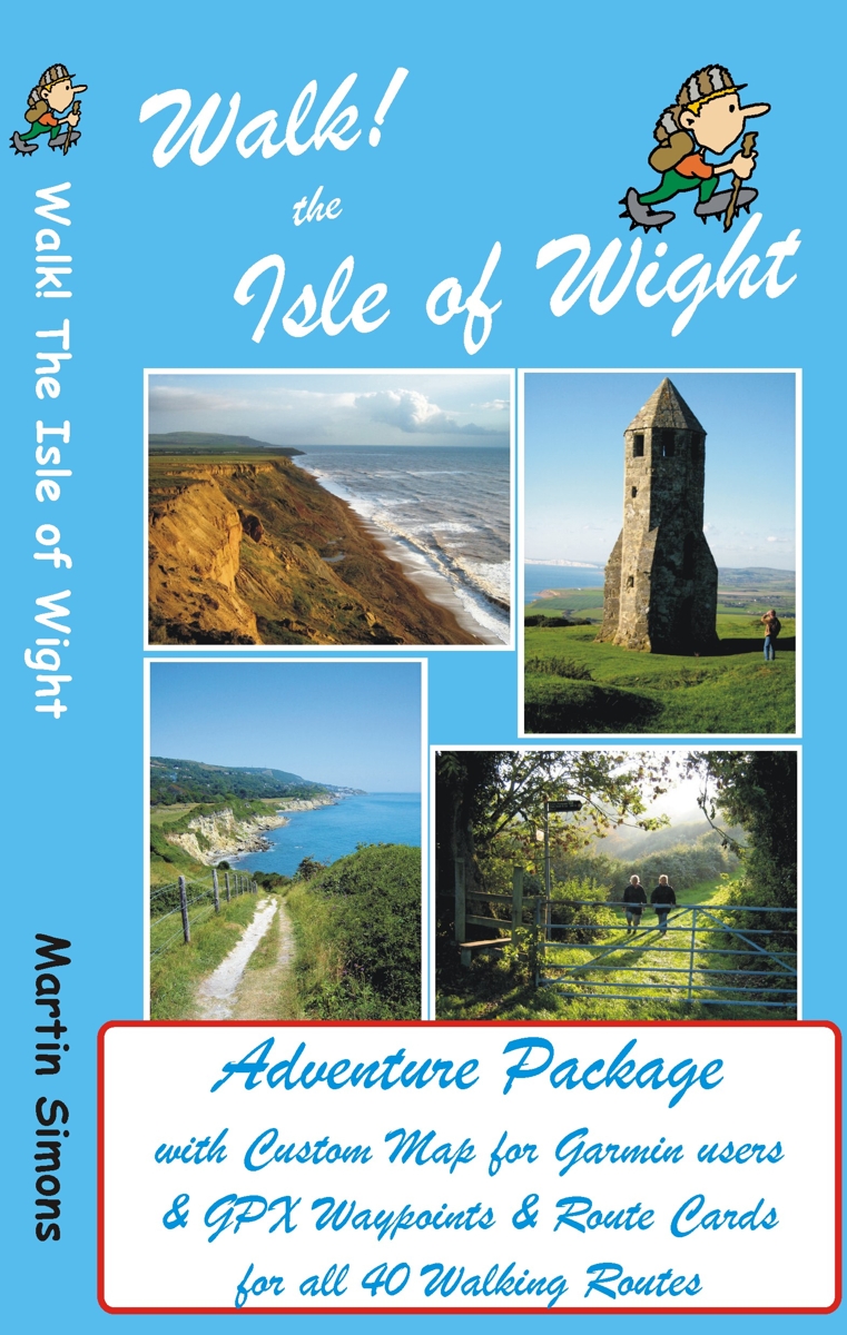
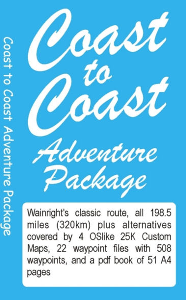
Isle Of Wight Adventure Package – now released
GPS users take note; our latest edition Walk! The Isle of Wight walks have been transformed into pdf route cards and re-packaged with ‘OSlike’ digital mapping for the Isle of Wight and gpx waypoints.
This is a great time to explore the Isle Of Wight; school holidays are almost over and there’s always the chance of some late summer sunshine.
Isle of Wight Adventure Package:-
Isle of Wight ‘OSlike’ Custom Map
gpx waypoints,
pdf ebook of 41 A4 pages
– all delivered as a ZIP file download for £11.99
See all the details here:-
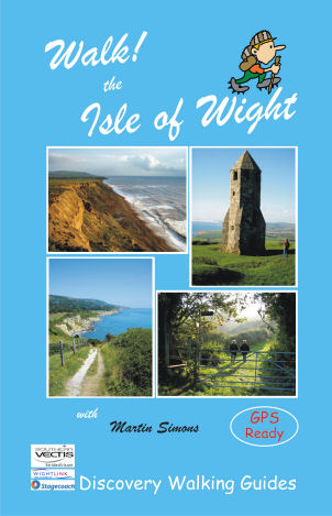
Walk! The Isle Of Wight – new edition is here!
 There’s no doubt that the Isle Of Wight is a wonderful place to visit and the best way to experience the island is on foot and by bus.
Walk! The Isle Of Wight (3rd edition) details 40 step-by-step walking routes, most accessed using public bus services.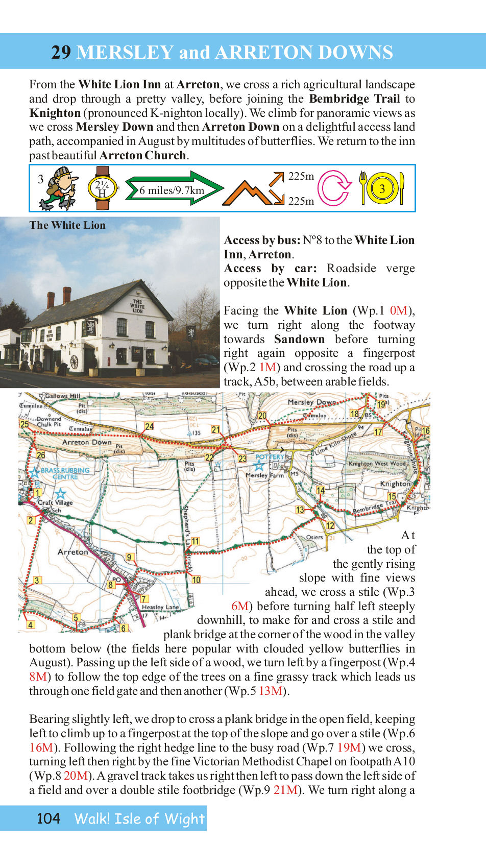
Each walk has its own colour OS Map, with the walking route and waypoints highlighted.
Here’s a sample page from the book so you can see what you’re getting:-
Good pubs (author tested) are recommended at the end of many of the routes.
See all the info here:-
Walk England Coast to Coast – a new approach to a classic adventure
 This classic route, pioneered by Alfred Wainwright, crosses northern England from – you guessed it – coast to coast. There are other books available – so what makes this one different?
Here’s what the author and researcher of this new take on a favourite challenge, has to say:-
“On a fortnight’s adventure with my mates Keith and Nigel from St Bees to Robin Hood’s Bay (July 2012) I talked to loads of C2Cers subtly asking what would make the route better. What everyone wanted was accurate navigation along the route, especially if it included ‘real time’ mapping.
There are loads of guide books about the Coast to Coast so rather than adding another book I have produced what every C2Cer wants:-
A system of accurate navigation for the whole route using ‘real time’ mapping on a Garmin gps or Viewranger phone app.
The result is a Stage by Stage guide, with alternatives, that gives you a real time mapping gps unit showing exactly where you are on the route along with the walking instructions that will ensure that you stay on the correct route.
On your Garmin, or Viewranger app, you will be on the right track every step of the way for all of the 198.5 miles (320km) from St Bees until you arrive at The Bay Hotel in Robin Hood’s Bay; where you will find the Wainright Bar with its C2C ‘sign in’ book.” David Brawn, author/researcher
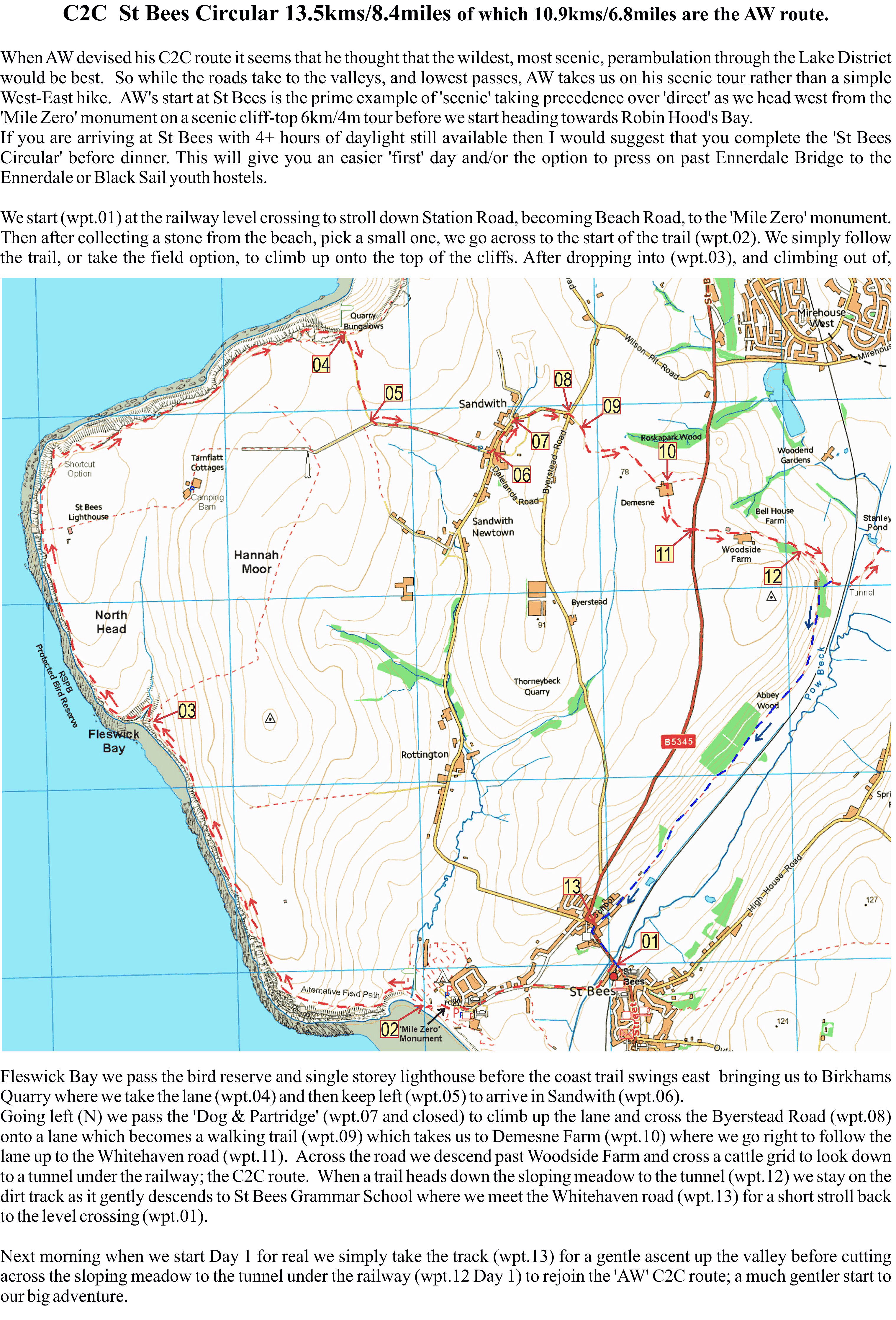
A sample page from the start of the adventure.David Brawn, author/researcher
For more information go to http://www.dwgwalking.co.uk/c2coast.htm
