
Walking on La Gomera, Canary Islands – a User Review
Thanks go to David L, just back from walking (and golfing) on the Canary Island of La Gomera. He’s been there before and knows the walking pretty well, and has sent us a detailed review of some of the walks he did (self-adapted in part) using Walk! La Gomera guidebook and La Gomera Tour & Trail map along with digital mapping which he accessed on his smart phone.
Here’s part of David’s walking report:
On 18 December 2017 at 20:24 David L wrote:
“Where? La Gomera – Jardin Tecina Hotel
Walks 2017.11-12.
We did three – or perhaps more accurately, 2.5. We took golf clubs and tennis rackets, too – and my wife is not a bad walker, but not as keen as I am.
We were looking for walks with the least amount of travelling possible, avoiding those with vertigo warnings, and ideally, in the sun.
The walks we did were:
- Playa Santiago to Targa With Variation (Walk 10)
- Degollada de Peraza to San Sebastian (Walk 1)
- Playa Santiago – Baja de Guane – El Aguila – La Trinchera – Playa Santiago (Short Walk)
- Navigational Aids
All walks were undertaken with benefit of the digital version of the Tour & Trail Map on iphone via Memory Map, and hard copy print of the relevant area – one side with route marked – the other unmarked. Full hard copy Tour & Trail Map and Walk! La Gomera Book taken but not referred to en route.
- Weather
Previous visits/walks have been in February and December. In comparison, the countryside was far more burnt up on this occasion, with virtually no greenery, and noticeably warmer than Christmas, but cooler than Feb. We have had NE Alisio weather patterns on previous visits, but, on this occasion, the wind was between south and west.
- Walks
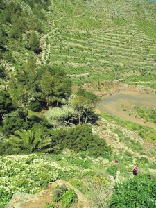
4.1 Playa Santiago To Targa With Variation (Walk 10)

Looking down to Playa Santiago
I had done this walk twice previously, so knew roughly what was involved. The part through the former cultivation terraces is probably fair enough for one experience but, in my view, not more.
So we headed up your down route, which was hot work in mid 20s C, but OK.
The route to the climb up the Playa Santiago cliff is completely different to the map – but more similar to the blow up on the reverse.
Had lunch in the shade close to the FRANCISCO DIAZ BARROSO NAMEPLATE Waypoint. Waypoint beyond this particularly useful as otherwise not clear when to head up the hill to the right – though clearer looking back on it.
Turned left to Targa itself and then along a couple of paths to Alajero. Bar where second path joins road up from Playa Santiago closed. Turned off into central Alajero, where found an open bar with Bus Stop opposite. Perfect! Bus turned up on time and dropped us off by Jardin Tecina for next to nothing.
Conclusion on 1. I think the route we did is better than the one in the book – but I was looking for something different to the route through the cultivation terraces. Probably worth including as an alternative. The variation at the top was not planned in advance, but evolved when we got there.
The leg adjacent to the stream south of Targa is tricky/ steep sided in places with few foot/handholds.
An unexpected hazard was the local authority painting some of the bus stop benches – but not warning of this! My wife wrote off a pair of trousers! Not sure whether this is a seasonal event!
Overall, an enjoyable and rewarding walk. Nice to get up into the cool – and amongst some genuine village life.
4.2 Degollada de Peraza to San Sebastian (Walk 1)

San Sebastian port, La Gomera
This is one of the more accessible walks from Jardin Tecina without vertigo risk- although, by analysis of non-vertigo walks, I have since found a more accessible one, at least to start.
We had toyed with which is gazetted as a’ vertigo trial’ but I had done the bottom 75% of this on my own on a previous visit, and had backed off when I reached a very sheer slope; furthermore, a section of this looked very sheer on Google Earth. It also looked pretty aggressive from the top of Degollada de Peraza.
Up here, we were in cloudy conditions, but the cloud base was well above us.
Shortly after the start, there was no observable issue with the landslide you mention. The path is quite steep sided in places and flat sided in others. Throughout the first 75 % or so, it is dominated by views of the main road from San Sebastian up to Degollada – and traffic noise from it, which was a pity.
On the plus side, we had some good views, and encountered a watchful raven, which I had not previously seen on the island.
The run down into San Sebastian was hard work, along a made up but very uneven ‘donkey’ track.
To return, we had the options of buses or the Fred. Olsen Ferry. We chose the latter, to give us a chance to relax a bit, an opportunity to see this section of coast, and avoid the lengthy/somewhat tedious road route.
We enjoyed the ferry ride, albeit that it was late starting by half an hour, it appeared because of a mechanical issue.
Conclusion on 2. We enjoyed the walk, but were disappointed by the main road/traffic noise impact and the extent of uneven donkey tracks on the descent. Probably good for anyone to do once, but I do not think we would do it again.
4.3 Playa Santiago – Baja de Guane – El Aguila – La Trinchera – Playa Santiago (Short Walk)
This was really a ‘fill in’ while my wife wanted to sunbathe – which I cannot do. I have a friend who has a holiday Property Bond Investment and had stayed at ‘Balcon de Santa Anna’ – and wanted to have a look at this – and the walk round the cliffs outside shown on the map looked interesting.
All went according to plan – having your map on my iphone proved ever useful, as I was not sure how long I was along the walk, on several occasions. Good views of the cliffs and breaking seas – and a pleasantly made up path. Also a short link at the end down to Playa Santiago.
Conclusion on 3. An enjoyable and worthwhile short walk which it might be worth mentioning.
- Overall Conclusion On Walks
We expanded our horizons – though did not visit the Valle Gran Rey/El Cercado area this time.
We enjoyed our walks – which were much aided by your materials and, particularly, the digital functions, which had either not been available or we hadn’t been aware of before. The map on the iphone with the flashing curser and marked waypoints really is a massive help.
We were surprised how warm the weather was – particularly having experienced quite a cool Christmas here once. The countryside was much the most frazzled we had ever seen it.
I am quite a keen bird watcher. I missed the plain swifts over the mountains and villages, normally in abundance. On checking, I see they return to Africa for November and most of December. On the plus side, we had a hoopoe in the hotel grounds, where there were singing chiffchaff and blackcap, and the aforementioned raven.
I attach copies of our tracks, in case of interest. As your book suggests, we took a good bit longer than you did! I also include some vehicle/ferry tracks and one round of the golf course, in case of interest. The speed the ferries travel at is notable – and the time saving from San Sebastian to Playa Santiago by sea, as opposed to land. The golf round was quicker than for an average UK course – because the hole sequence was downhill?”
-0-
Thanks David! User feedback is like gold!
Warm Weather Walker – or Intrepid Snow-Hopper?

Blackstone Ridge, England’s South Pennines
On flicking through outdoor activity magazines, you’ll see plenty of photographs of fit-looking intrepid types posing on rugged, windswept mountain peaks wearing plenty of layers. Is this you? Do you wish you were here? Or do you long to get away to kinder climates?
Do you fit fairly neatly into one of the following groups?
THE INTREPIDS, striding through winter landscapes, dealing with biting winds and snow-capped hills in full weather-defying gear, and feeling invigorated as you finally reach a cosy country pub for a well-earned lunch.
How about England’s rugged and beautiful South Pennines? They’ve had quite a bit of a snow-dusting already this winter, although this pic taken on Corn Du was taken in summer.

Tenerife, walking above the west coast
WARM WEATHER WALKERS, escaping to warmer climes when winter bites at home, exploring in t-shirt, shorts, sunhat and sun-cream under a blue sky, sweating as they gain the heights, then
relaxing on a beach as the sun goes down.
There’s a whole lot of destinations within a 4-6 hour flight from northern Europe; Tenerife is ideal for pretty reliable gentle temperatures with several sunny hours per day.
For lots of walking destination ideas and inspiration, take a look HERE.
Of course, you might well have a boot in each camp so to speak, getting the best of all walking worlds. It would be great to know your opinions.
Beautiful Madeira – Walking Route Updates (Oh, and Porto Santo)
Madeira – a firm favourite

Stunning views to Encumeada, Madeira (copyright author/researcher Shirley Whitehead)
Madeira is beautifully green and floriferous but sometimes the necessary abundant rainfall (or in high summer, forest fires) lead to temporary walking route closures. Thankfully, the island authorities are quick to pinpoint problem sections and repair them. In any case, there are so many great walks that you’ll always find plenty to choose from anytime that you visit.
Have a look HERE for walking information and suggested walking guidebooks and detailed walking maps.

Approaching Ribeira Fundo, Madeira (copyright author/researcher Shirley Whitehead)
At the time of writing, the official PR walking routes currently affected by temporary closures are:
PR12 – Caminho Real da Encumeada
PR14 – Levada dos Cedros
PR16 – Levada Fajã do Rodrigues
PR17 – Caminho do Pináculo e Folhadal
PR19 – Caminho Real do Paul do Mar
Go to the official pages for up-to-date information regarding route closures.
-0-

Descent to the land Bridge, São Lourenço Madeira (copyright author/researcher Shirley Whitehead).
Going to Madeira? Hop to Porto Santo
If you’re going to Madeira, why not take a day or two take a look at little sister island Porto Santo?
Walkers can try the two official PR walking routes, PS PR1 – Vereda do Pico Branco e Terra Chã and the PS PR2 – Vereda do Pico Castelo
For the official Porto Santo tourist information including walking look HERE.
The ferry from Funchal, Madeira to Porto Santo takes about 2 hours 15 minutes. Please check the freey information website for departure times and note that in early January each year ferries are often out of service for regular maintenance. Ferry information HERE.
-0-
Porto Santo Nature Trail Event 03/04 March 2018
This event is the 5th stage of the “Circuit Trail Madeira 2017/2018”. As you can see, the adult routes look pretty challenging – though you do have until March 2018 to get into shape!
- Porto Santo Nature Trail (PSNT) – 42.3 km and 1926m climb (circular format);
- Trail do Porto Santo (TPS) – 21.9 km and 107m climb (linear format);
- Mini Trail do Porto Santo (MTPS) – 8.9 km and 395m climb (linear format);
There’s also a children’s event:
Kids Trail do Porto Santo (KTPS) between 1 km and 3 km (linear format).
For all the information, look HERE.
-0-
You might also find this post useful for getting out and about on Madeira.
La Gomera – New Ferry Services Make Adventuring Easier
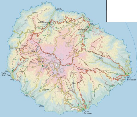
Simplified map of La Gomera by kind permission of David Brawn
La Gomera is a remarkable, almost circular island, a hop away from Tenerife, (Canary Islands) which rises like a giant cake to central forest-cloaked rugged heights, cut by barrancos (ravines) running to the sea. The island is still largely unspoiled which makes it a wonderful destination for hikers and bikers, though getting around takes time as there are few roads. If you don’t wish to get too energetic, simply amble about, dropping into cafés and fish restaurants and breathing in the pure air and beautiful views, enjoying the contrast between this quiet island and its busier big sister Tenerife.
This makes the introduction of not just one but two new sets of ferry services opening up some of the island’s best coastal towns really interesting. You could, for example, take the new car ferry Volcán de Teno from Tenerife’s Los Cristianos at 08.45 and be in Valle Gray Rey 90 minutes later, making a day out in this wonderful ‘Great King’s Valley’ feasible, heading back to Tenerife on the 16.30.
For all the details and to make a booking, see Naviera Armas website.

San Sebastian, La Gomera
It’s around five years since three of La Gomera’s most interesting and important coastal towns were linked by ferry services.
Now Fred Olsen has begun 3 services per day (becoming known as the ‘interior ferry line’), linking San Sebastián, Playa de Santiago and Valle Gran Rey, aboard the Benchi Express. If you’re starting from Tenerife you can do the first ferry hop from Los Cristianos. The Benchi can take bicycles, light motorbikes and pets! It also has a small cafeteria and is wheelchair accessible.
For details of the Fred Olsen services, look HERE.

La Gomera – in the south -Tenerife’s Teide visible

Valle Gran Rey
If you’re starting from Tenerife you can do the first ferry hop from Los Cristianos. The Benchi can take bicycles, light motorbikes and pets! It also has a small cafeteria and is wheelchair accessible. Take a look at their website for all the details and to book.
There’s a well- informed and highly readable blog with more La Gomera travel information here.
MAPS AND WALKING GUIDE BOOKS FOR LA GOMERA
For information about large-scale maps, digital mapping information and walking guidebooks, take a look HERE.
Mallorca; sun, sea, mountains – and Bird Watching too

On Mallorca’s north-west coast
Say ‘Mallorca’ and most people think, “Sun, beaches, mountains, walks, sea-food, sangria …..

Avocet
There’s another excellent reason for visiting this beautiful Balearic island, set in the blue Mediterranean.
Mallorca is home to a surprising number of bird species and acts as a passing-through stop-off for even more bird groups.

Bee-eater
The island’s varied geography, from coastal cliffs to rugged mountains, from wetlands, reservoirs and coastal areas, offer bird life of many kinds a welcoming place to live, rest, feed and breed.

It’s an excellent and up-to-date detailed map (waterproof, tear resistant and guaranteed) perfect for touring the island, with a wealth of details such as best beaches, picnic areas, miradors – plus the locations of the best bird-spotting places.
The map reverse details 51 bird species together with photos and ID information.
Madeira – news just in – Levada Nova
Thanks to Peter and Ginny, just back from a walking holiday on the isle of Madeira, we are passing on their update:
“Levada Nova has had rock falls along an extensive section near the start so that virtually all the safety barriers have disappeared. This makes the walk dangerous! We tried to carefully continue thinking the damage would be limited to a short section but it seemed to go on for a long distance so we turned back.”

Levada Nova, Madeira (Walk 73)
Levada Nova is a popular walking route; if you are using Madeira Walks Volume Two, it is Walk 73.
Do check before setting out, either by asking at Tourist Offices or by looking on the island’s official website walking pages.
Are You Off To Walk Madeira? Check Before You Walk.

Aloe aborescens clinging to Madeiran cliffs
Madeira! What a great desination, especially at this time of year.
Swapping the dark and cold of Northern Europe for Madeira’s green and spring-like mountains is a popular choice at this time of year.
If you are planning to walk there, it’s worth checking that the paths you’re planning on following are open. The best place to look for information is on the official ‘Visit Madeira’ tourism website. To see which routes are open or temporarily closed, LOOK HERE.
If you are already on the island, you can also ask in Tourist Offices who usually have up to date information on walks that are open/closed.

A spectaculat waterfall on the Levada da Ribeira da Janela
At the moment only three of the official routes are temporarily closed. The authorities are vigilant and usually restore routes quickly; often, the problem is a landslip after heavy rain.
The three routes to avoid at the time of writing this are:
PR1 – Vereda do Areeiro
Temporarily closed
PR12 – Caminho Real da Encumeada
Temporarily closed
PR19 – Caminho Real do Paul do Mar
Temporarily closed

Levada Nova, Madeira
There’s so much great walking on Madeira that you’ll find plenty to tempt you, from strolls to all-day high altitude challenges. Even if you aren’t keen to do much walking, it’s a great idea to use the local buses which give you brilliant (sometimes a bit hairy!) adventures around the island for pocket-money prices.
There’s a great bus map available, also really useful as a driving map; LOOK HERE for details of the Madeira Bus & Touring Map.
For more information including details our two Madeira Walks guidebooks Madeira Tour & Trail Map and digital mapping for Madeira, take a look at Discovery Walking Guides; Madeira pages.
Lanzarote; rains bring the desert to colourful life!
Barranco del Malpaso, Lanzarote
Residents on the Island of Lanzarote tell us that more visitors than usual have been enjoying the great outdoors on this unique island during November and December this year. The dramatic volcanic landscape is unforgettable, though is usually desert-dry with little natural green to see.
It doesn’t rain much (or often) on this arid Canary Island, so recent falls have been most welcome, bringing colour and plant life back to otherwise arid areas.

Helechos, Lanzarote
What a great time to visit! Warm days and sunshine (average of six hours per day in December, even more in January), plus the chance to see the colourful green swathes and flower carpets that happen for only a few weeks each year. Walk, hire a bike or car, or jump on a bus.
La Geria, Lanzarote
There’s plenty of interesting information about the island on the Lanzarote Information website; use the link below.
Take a look at the really useful Lanzarote Information website.
For more on this fascinating and often surprising island, including printed and digital mapping and walking information, take a look here:-
Montaňa Corona, Lanzarote
Choosing A Winter Walking Destination
What do you need for an enjoyable walking holiday when winter closes in on the northern hemisphere?
RELIABLE WARMTH AND SUNSHINE

On La Gomera – Tenerife’s Teide visible
A 5 hour flight south (from the UK) gets you to the Canary Islands, off the coast of Africa. You can expect about six hours of sunshine per day (average) with highs of 20C in December though of course there are variations depending on the island and location.
Levada Nova, Madeira
Madeira is a bit closer and almost as sunny (around 5 hours) and almost as warm though the chance or rain is higher. That’s why Madeira is so green and floriferous!
A GOOD CHOICE OF HOTELS, NIGHT LIFE, SHOPS and RESTAURANTS
The Canary Islands and Madeira don’t really have a ‘closed’ season for tourism so you will find a wide range of accommodation, eating places, shops and night life. There are quieter, smaller places to stay if you want to get away from the ‘bright lights’.
EASY TO GET TO
There are plenty of flights all year round to the Canaries and to Madeira.
WHAT’S THE WALKING LIKE?
Each of the Canaries is unique, offering a wide choice of walks and challenging hikes. If you are looking for a pleasant stroll for an hour or two, a coastal discovery route or a full day in the mountains (or something inbetween), the Canaries are an ideal choice.
Madeira is rugged and steep, though the many levada walks (mostly level walks alongside narrow water canals) make it a walking destination with plenty of choice for all.
FIND OUT MORE ABOUT CANARY ISLANDS WALKING HERE:-
FOR MORE ABOUT WALKING ON THE GARDEN ISLE OF MADEIRA, LOOK HERE:-
Madeira
Dartmoor – discover the magic
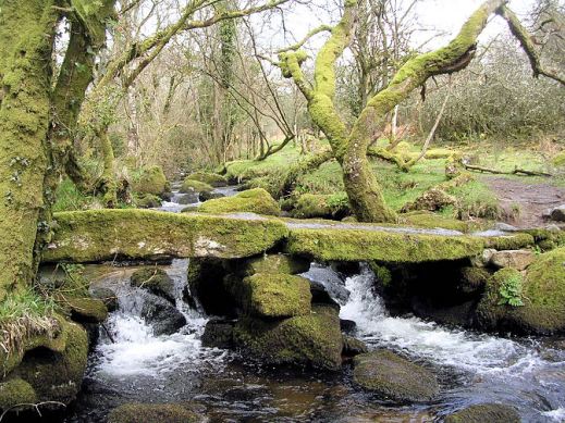

Devonport Leat
Dartmoor – a place of history, myths and legends.

Blackingstone Rock (Walk 22)
The best way to experience its wild and wonderful moors and ancient stone villages is on foot.
Dartmoor residents and author-researchers Kate & Alan Hobbs know the moors well and are your step-by-step guides through forty wonderful walks, strolls and adventures. They know the best places to call in for a pub lunch along the route too!
Detailed walk descriptions, Ordnance Survey mapping and waypoints at decisions points, along with frequent timings, ensure you’ll find your way.

Dartmoor Ponies
Each walk is illustrated with photos taken along the route. Walks are graded for difficulty, distance, time required, ascents and descents and refreshments.

Walk! Dartmoor (2nd edition) arrives on the planet 18 January 2016.
For more details look HERE.

Dartmeet Stepping Stones (Walk 36)
