
Canary Islands – Here We Come!
At last the Canary Islands are back on the British Government’s unrestricted travel list. The Canaries offer so much variety, each island unique and unforgettable, and with a warm, welcoming climate, the perfect choice as northern hemispheres feel the first shivers of winter.
Gran Canaria – the miniature continent, a roughly circular island of ravines and 60 kilometres of beaches, winding forest roads and criss-crossed with walking routes. Plenty to discover, day and night.
For more information click here.
Want the Gran Canaria Tour & Trail Super-Durable Map? Look here.
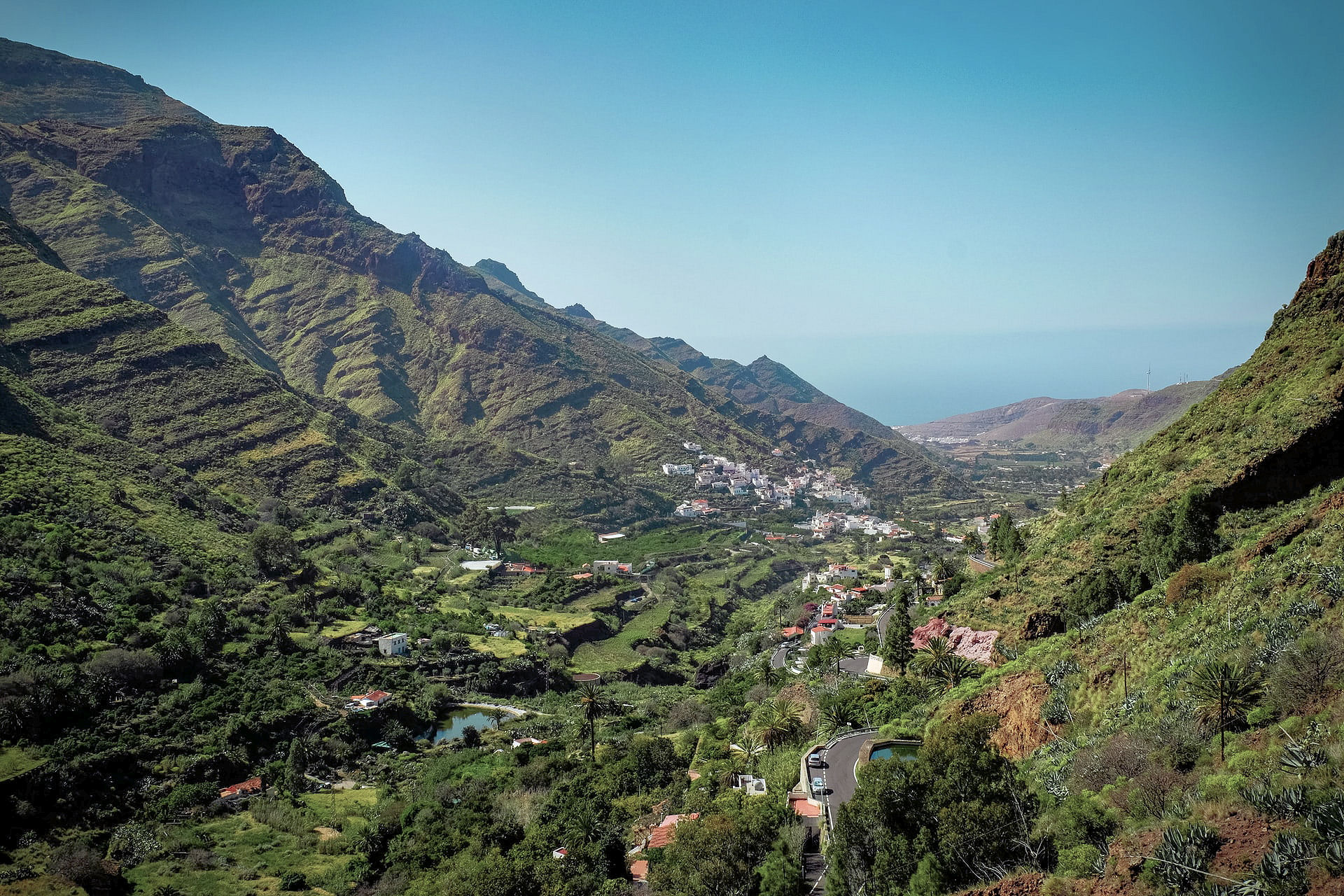
La Gomera, just west of Tenerife and easily reached via a short ferry crossing – plunging barrancos and soaring forest-topped mountains sprinkled with hamlets and farmsteads clinging to the slopes. Walk, bike, swim, explore – enjoy.

El Hierro, small, fascinating, the most remote and westerly Canary Island promises rugged terrain, narrow winding roads and great walking. A world-class marine reserve, free island-wide wifi and electric car charge ports contrast with the traditional feel of the island. Yet, there are very few tourists – for now.

There’s more information on La Gomera and El Hierro here.
La Gomera and El Hierro Tour & Trail Super-Durable Maps can be bought onlime including HERE.
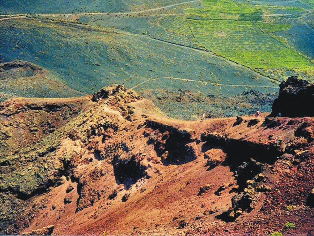
Lanzarote – the Fire Island; volcanic, mysterious and mesmerising terrain, lava seas and alpine meadows. Other-worldly. Once visited, never forgotten.


Find out more about Lanzarote here.
Buys the map from online selllers including HERE.
Fuerteventura, known for beautiful beaches and great water sports, also offers a surprising variety of fascinating walking adventures. Wild coastlines contrast with traditional towns and views across pristine seas.


See more information about Fuerteventura here.
Maps can be foundfrom online sellers including here.
La Palma – La Isla Bonita; dramatic landscapes; a breathtaking mountain spine splits this volcanic island. Black beaches, Lush vegetation and 1080 kilometres of waymarked walking paths.
There’s more information about walking on La Palma here.
Buy La Palma maps online including here.
Tenerife – a Walker’s Island There’s so much to Tenerife. 2034 square kilometres offer coastal adventures, mountain hikes, pine and laurel forest trails, strolls and strenuous challenges including Spain’s highest peak (Mount Teide).The choice is almost endless.


You can buy the walking guide, walking maps and bus map online.
A Little Good News – Free Digital Maps For Everyone
We may not be able to go adventuring for a while yet. However, we can plan ahead for when we can travel again. Have a look at our digital maps, clear and fully detailed for adventure planning of all kinds, including walking, climbing, biking or maybe daydreaming about your next big trip.


There’s a whole hatful of exciting free maps to be had. Take a look at this list of adventure destinations.
Balearic Islands
Mallorca
Menorca
Ibiza
Formentera
Madeira
Azores
Greek Islands
Corfu
Zante (aka Zakynthos)
Malta, Gozo & Comino
Spanish Mainland
Axarquia / Costa del Sol
Costa Blanca
Alpujarras
Sierra de Aracena

Canary Islands
Gran Canaria
La Palma
Tenerife
La Gomera & El Hierro
Lanzarote
Fuerteventura
We hope that we’ve inspired you to think about your next big adventure. To get your free digital maps, please look here https://www.dwgwalking.co.uk
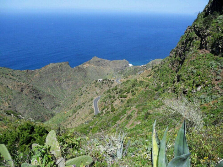
Walking on La Gomera, Canary Islands – a User Review
Thanks go to David L, just back from walking (and golfing) on the Canary Island of La Gomera. He’s been there before and knows the walking pretty well, and has sent us a detailed review of some of the walks he did (self-adapted in part) using Walk! La Gomera guidebook and La Gomera Tour & Trail map along with digital mapping which he accessed on his smart phone.
Here’s part of David’s walking report:
On 18 December 2017 at 20:24 David L wrote:
“Where? La Gomera – Jardin Tecina Hotel
Walks 2017.11-12.
We did three – or perhaps more accurately, 2.5. We took golf clubs and tennis rackets, too – and my wife is not a bad walker, but not as keen as I am.
We were looking for walks with the least amount of travelling possible, avoiding those with vertigo warnings, and ideally, in the sun.
The walks we did were:
- Playa Santiago to Targa With Variation (Walk 10)
- Degollada de Peraza to San Sebastian (Walk 1)
- Playa Santiago – Baja de Guane – El Aguila – La Trinchera – Playa Santiago (Short Walk)
- Navigational Aids
All walks were undertaken with benefit of the digital version of the Tour & Trail Map on iphone via Memory Map, and hard copy print of the relevant area – one side with route marked – the other unmarked. Full hard copy Tour & Trail Map and Walk! La Gomera Book taken but not referred to en route.
- Weather
Previous visits/walks have been in February and December. In comparison, the countryside was far more burnt up on this occasion, with virtually no greenery, and noticeably warmer than Christmas, but cooler than Feb. We have had NE Alisio weather patterns on previous visits, but, on this occasion, the wind was between south and west.
- Walks
4.1 Playa Santiago To Targa With Variation (Walk 10)

Looking down to Playa Santiago
I had done this walk twice previously, so knew roughly what was involved. The part through the former cultivation terraces is probably fair enough for one experience but, in my view, not more.
So we headed up your down route, which was hot work in mid 20s C, but OK.
The route to the climb up the Playa Santiago cliff is completely different to the map – but more similar to the blow up on the reverse.
Had lunch in the shade close to the FRANCISCO DIAZ BARROSO NAMEPLATE Waypoint. Waypoint beyond this particularly useful as otherwise not clear when to head up the hill to the right – though clearer looking back on it.
Turned left to Targa itself and then along a couple of paths to Alajero. Bar where second path joins road up from Playa Santiago closed. Turned off into central Alajero, where found an open bar with Bus Stop opposite. Perfect! Bus turned up on time and dropped us off by Jardin Tecina for next to nothing.
Conclusion on 1. I think the route we did is better than the one in the book – but I was looking for something different to the route through the cultivation terraces. Probably worth including as an alternative. The variation at the top was not planned in advance, but evolved when we got there.
The leg adjacent to the stream south of Targa is tricky/ steep sided in places with few foot/handholds.
An unexpected hazard was the local authority painting some of the bus stop benches – but not warning of this! My wife wrote off a pair of trousers! Not sure whether this is a seasonal event!
Overall, an enjoyable and rewarding walk. Nice to get up into the cool – and amongst some genuine village life.
4.2 Degollada de Peraza to San Sebastian (Walk 1)

San Sebastian port, La Gomera
This is one of the more accessible walks from Jardin Tecina without vertigo risk- although, by analysis of non-vertigo walks, I have since found a more accessible one, at least to start.
We had toyed with which is gazetted as a’ vertigo trial’ but I had done the bottom 75% of this on my own on a previous visit, and had backed off when I reached a very sheer slope; furthermore, a section of this looked very sheer on Google Earth. It also looked pretty aggressive from the top of Degollada de Peraza.
Up here, we were in cloudy conditions, but the cloud base was well above us.
Shortly after the start, there was no observable issue with the landslide you mention. The path is quite steep sided in places and flat sided in others. Throughout the first 75 % or so, it is dominated by views of the main road from San Sebastian up to Degollada – and traffic noise from it, which was a pity.
On the plus side, we had some good views, and encountered a watchful raven, which I had not previously seen on the island.
The run down into San Sebastian was hard work, along a made up but very uneven ‘donkey’ track.
To return, we had the options of buses or the Fred. Olsen Ferry. We chose the latter, to give us a chance to relax a bit, an opportunity to see this section of coast, and avoid the lengthy/somewhat tedious road route.
We enjoyed the ferry ride, albeit that it was late starting by half an hour, it appeared because of a mechanical issue.
Conclusion on 2. We enjoyed the walk, but were disappointed by the main road/traffic noise impact and the extent of uneven donkey tracks on the descent. Probably good for anyone to do once, but I do not think we would do it again.
4.3 Playa Santiago – Baja de Guane – El Aguila – La Trinchera – Playa Santiago (Short Walk)
This was really a ‘fill in’ while my wife wanted to sunbathe – which I cannot do. I have a friend who has a holiday Property Bond Investment and had stayed at ‘Balcon de Santa Anna’ – and wanted to have a look at this – and the walk round the cliffs outside shown on the map looked interesting.
All went according to plan – having your map on my iphone proved ever useful, as I was not sure how long I was along the walk, on several occasions. Good views of the cliffs and breaking seas – and a pleasantly made up path. Also a short link at the end down to Playa Santiago.
Conclusion on 3. An enjoyable and worthwhile short walk which it might be worth mentioning.
- Overall Conclusion On Walks
We expanded our horizons – though did not visit the Valle Gran Rey/El Cercado area this time.
We enjoyed our walks – which were much aided by your materials and, particularly, the digital functions, which had either not been available or we hadn’t been aware of before. The map on the iphone with the flashing curser and marked waypoints really is a massive help.
We were surprised how warm the weather was – particularly having experienced quite a cool Christmas here once. The countryside was much the most frazzled we had ever seen it.
I am quite a keen bird watcher. I missed the plain swifts over the mountains and villages, normally in abundance. On checking, I see they return to Africa for November and most of December. On the plus side, we had a hoopoe in the hotel grounds, where there were singing chiffchaff and blackcap, and the aforementioned raven.
I attach copies of our tracks, in case of interest. As your book suggests, we took a good bit longer than you did! I also include some vehicle/ferry tracks and one round of the golf course, in case of interest. The speed the ferries travel at is notable – and the time saving from San Sebastian to Playa Santiago by sea, as opposed to land. The golf round was quicker than for an average UK course – because the hole sequence was downhill?”
-0-
Thanks David! User feedback is like gold!
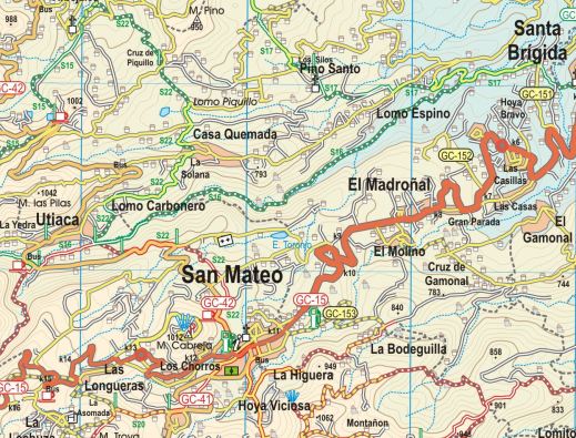
La Gomera – New Ferry Services Make Adventuring Easier

Simplified map of La Gomera by kind permission of David Brawn
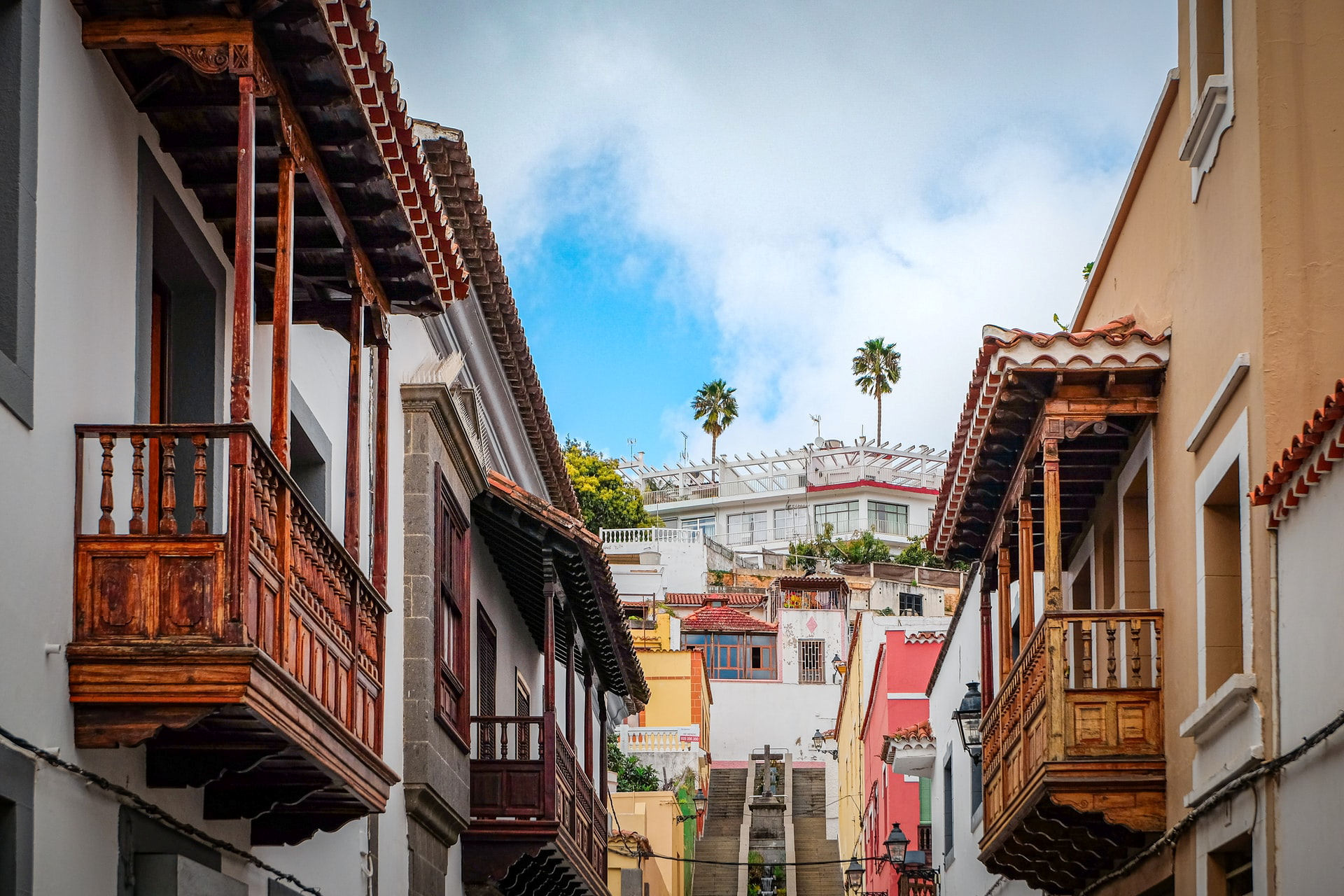
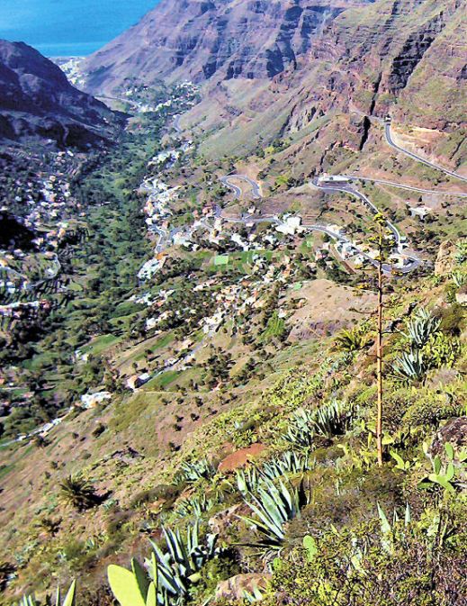
La Gomera is a remarkable, almost circular island, a hop away from Tenerife, (Canary Islands) which rises like a giant cake to central forest-cloaked rugged heights, cut by barrancos (ravines) running to the sea. The island is still largely unspoiled which makes it a wonderful destination for hikers and bikers, though getting around takes time as there are few roads. If you don’t wish to get too energetic, simply amble about, dropping into cafés and fish restaurants and breathing in the pure air and beautiful views, enjoying the contrast between this quiet island and its busier big sister Tenerife.
This makes the introduction of not just one but two new sets of ferry services opening up some of the island’s best coastal towns really interesting. You could, for example, take the new car ferry Volcán de Teno from Tenerife’s Los Cristianos at 08.45 and be in Valle Gray Rey 90 minutes later, making a day out in this wonderful ‘Great King’s Valley’ feasible, heading back to Tenerife on the 16.30.
For all the details and to make a booking, see Naviera Armas website.
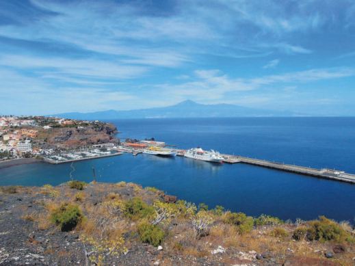
San Sebastian, La Gomera
It’s around five years since three of La Gomera’s most interesting and important coastal towns were linked by ferry services.
Now Fred Olsen has begun 3 services per day (becoming known as the ‘interior ferry line’), linking San Sebastián, Playa de Santiago and Valle Gran Rey, aboard the Benchi Express. If you’re starting from Tenerife you can do the first ferry hop from Los Cristianos. The Benchi can take bicycles, light motorbikes and pets! It also has a small cafeteria and is wheelchair accessible.
For details of the Fred Olsen services, look HERE.
La Gomera – in the south -Tenerife’s Teide visible
Valle Gran Rey
If you’re starting from Tenerife you can do the first ferry hop from Los Cristianos. The Benchi can take bicycles, light motorbikes and pets! It also has a small cafeteria and is wheelchair accessible. Take a look at their website for all the details and to book.
There’s a well- informed and highly readable blog with more La Gomera travel information here.
MAPS AND WALKING GUIDE BOOKS FOR LA GOMERA
For information about large-scale maps, digital mapping information and walking guidebooks, take a look HERE.
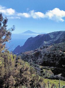
Island Hopping – Twice The Adventure Nº2 – Tenerife to La Gomera
Hop From Tenerife to La Gomera
There’s no doubt that Tenerife is one of the most popular island destinations, easily reached in around 5 hours from much of Europe and enticing with sunny skies, warm temperature, beaches and mountains and (if you want it) plenty of nightlife.
Looking down to San Sebastian (La Gomera), Pico del Teide on Tenerife in the distance
If you fancy a complete contrast, sample a day on the island of La Gomera, so close to Tenerife yet oh! so different – rugged, shaped like a well-risen circular cake topped by ancient laurel forests and with mighty ravines slicing down to the sea.
It’s laid back, offering astounding views and walks, little tipico cafés and restaurants, flamboyant plant life and stunning geology. Oh, and it has beaches.

Valle Gran Rey, La Gomera
Frequent ferries mean you can be there in under an hour from Los Cristianos, Tenerife, landing in Gomera’s capital San Sebastián, where public buses await in the harbour to take you onward. Car hire ofices and taxis are located here too.
Journey time: The fastest crossing from Tenerife to La Gomera goes via the harbours Los Cristianos de Tenerife to San Sebastián de La Gomera. The Benchijigua Express Ferry covers this distance in about 50 minutes. Other (slower) ferry services are offered by Naviera Armas. Pre-booking is essentail.
What to do? In one day, you’ll need to be selective. Take a look at these Trip Advisor suggestions.
For lots more information about La Gomera, including maps, look here.
There’s a brand-new edition of Walk! La Gomera, just published; look here.
Who got a Garmin for Christmas?
If you are one of the many who found a Garmin GPS in their Christmas stocking, this post is for you.
Get your hands on a free sample ‘real-time’ map and see your Garmin come to life. You can choose a sample map of Graciosa ( off Lanzarote, Canary Islands) or Sierra de Aracena (Andalucia, Spain).
What you’ll get is a highly detailed real-time Tour & Trail digital download map, which you can save on your hard drive, transfer to your Garmin GPS CustomMap memory or onto a micro-SD card; you can also use the maps in Garmin Basecamp and Google Earth.
CANARY ISLANDS
Sample segment, Gran Canaria.
Gran Canaria
Tenerife
La Palma
La Gomera
Lanzarote
Fuerteventura
MAINLAND SPAIN
Alpujarras (Sierra Nevada, Andalucia, southern Spain)
Costa Blanca Mountains (Alicante, southern Spain)
Axarquia (Andalucia, southern Spain)
Sierra de Aracena (Helva province, southern Spain)
BALEARIC ISLANDS
Mallorca
Menorca
Formentera
Ibiza
PORTUGUESE ISLANDS
Madeira
For more information about Tour & Trail Maps take a look HERE.
Choosing A Winter Walking Destination
What do you need for an enjoyable walking holiday when winter closes in on the northern hemisphere?
RELIABLE WARMTH AND SUNSHINE
On La Gomera – Tenerife’s Teide visible
A 5 hour flight south (from the UK) gets you to the Canary Islands, off the coast of Africa. You can expect about six hours of sunshine per day (average) with highs of 20C in December though of course there are variations depending on the island and location.

Levada Nova, Madeira
Madeira is a bit closer and almost as sunny (around 5 hours) and almost as warm though the chance or rain is higher. That’s why Madeira is so green and floriferous!
A GOOD CHOICE OF HOTELS, NIGHT LIFE, SHOPS and RESTAURANTS
The Canary Islands and Madeira don’t really have a ‘closed’ season for tourism so you will find a wide range of accommodation, eating places, shops and night life. There are quieter, smaller places to stay if you want to get away from the ‘bright lights’.
EASY TO GET TO
There are plenty of flights all year round to the Canaries and to Madeira.
WHAT’S THE WALKING LIKE?
Each of the Canaries is unique, offering a wide choice of walks and challenging hikes. If you are looking for a pleasant stroll for an hour or two, a coastal discovery route or a full day in the mountains (or something inbetween), the Canaries are an ideal choice.
Madeira is rugged and steep, though the many levada walks (mostly level walks alongside narrow water canals) make it a walking destination with plenty of choice for all.
FIND OUT MORE ABOUT CANARY ISLANDS WALKING HERE:-
FOR MORE ABOUT WALKING ON THE GARDEN ISLE OF MADEIRA, LOOK HERE:-
Madeira
Read Discovery Walking Guides’ latest ENewsletter
Check out Discovery Walking Guides’ latest ENewsletter.
It’s packed with plenty of ideas for escaping winter to wonderful warm walking destinations, plus features on the Isle of Wight and Fuerteventura.
See it all http://ymlp.com/zK1jmu
La Gomera – thanks to ‘Inspire Our Trip’
La Gomera – on Walk 31 (from Walk! La Gomera by Charles Davis). Image courtesy of ‘Inspire Our Trip’.
‘Inspire Our Trip’ on twitter said:-
“Brilliant hike and a great day walk. Thank you Charles Davis for Walk 31.”
Charles Davis is the author of Walk! La Gomera:- see http://www.dwgwalking.co.uk/walkla.htm
https://twitter.com/InspireOurTrip/status/455766577577988096/photo/1
La Gomera Update – thanks to Terry
It’s in the nature of walking trails that they may become impassable (usually temporarily) due to landslides, flood damage or forest fires. The good news is that nature and/or man usually repair the route before long.
Terry M just sent us this update which affects Walk 13 on the island of La Gomera:-
On 10 February 2014 Terry M wrote:
Hi,
We tried Walk 13, La Gomera but had to abandon it. A forest fire has made it impossible to follow the directions between waypoints 7,8,9 and 10. The trees are unrecognisable and the path obliterated. Herbs, mostly Cistus, have grown over the whole area and the donkey trail is unrecognisable. Even with GPS we could not find the way and had to retreat to the road.
Regards,
Terry
