
Lockdown Blues? Get ready to travel.
With vaccinations well under way in many parts of the world, there’s real belief that travel restrictions will gradually ease in the next few months. We make no apology for offering the information about our free digital maps once again; last time we posted this information we were pleased and surprised at how many people enjoyed them and started planning ahead to travel.
We’d like to help you get planning. Where to next? Why not start by getting your hands on our Free Digital Maps.
Read all about it HERE.
There are free maps to 19 tempting walking destinations to check out, including :
CANARY ISLANDS
La Gomera & El Hierro, Lanzarote, La Palma, Tenerife, Fuerteventura, Gran Canaria


BALEARIC ISLANDS
Mallorca, Menorca, Ibiza, Formentera

GREEK ISLANDS
Zakynthos (Zante), Corfu
SPANISH MAINLAND
Costa Blanca Mountains, Costa del Sol (Axarquia), Alpujarras, Sierra de Aracena

– and also:
Malta & Gozo
Madeira
Azores
To see more details about the free digital maps and how to get them, LOOK HERE
Plan Your Next Walking Adventure With our FREE Digital Maps
With the real hope of vaccines within reach, we can look forward to planning walking adventures again. Once travel freedom returns, there’s going to be a lot of pent-up desire to get away, so this could be the best time to make some plans.
We’d like to help you get planning. Where to next? Why not start by getting your hands on our Free Digital Maps.
Read all about it HERE.
There are free maps to 19 tempting walking destinations to check out, including :
CANARY ISLANDS
La Gomera & El Hierro, Lanzarote, La Palma, Tenerife, Fuerteventura, Gran Canaria
BALEARIC ISLANDS
Mallorca, Menorca, Ibiza, Formentera
GREEK ISLANDS
Zakynthos (Zante), Corfu
SPANISH MAINLAND
Costa Blanca Mountains, Costa del Sol (Axarquia), Alpujarras, Sierra de Aracena
– and also:
Malta & Gozo
Madeira
Azores
To see more details about the free digital maps and how to get them, LOOK HERE
Canary Islands – Here We Come!
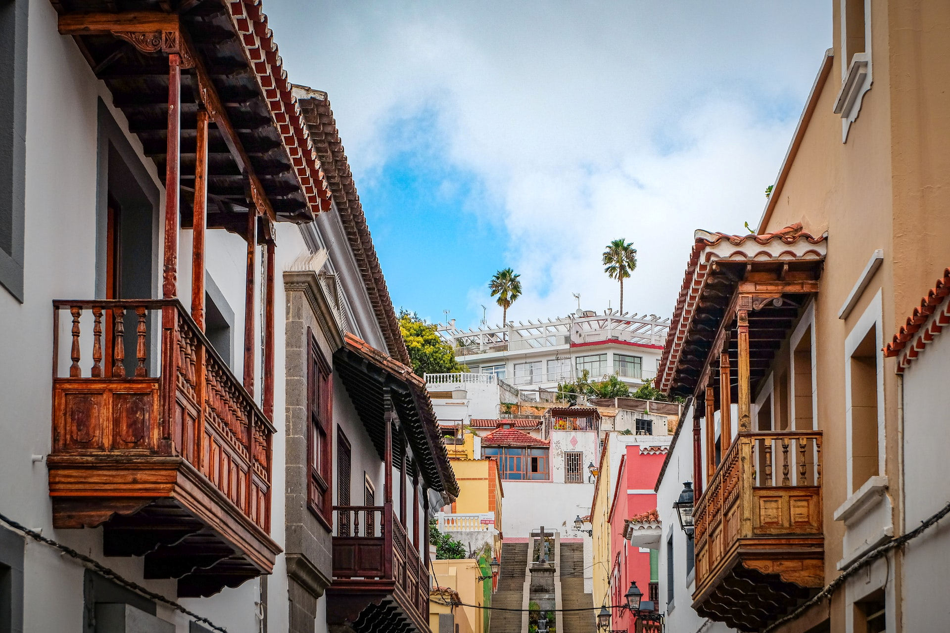
At last the Canary Islands are back on the British Government’s unrestricted travel list. The Canaries offer so much variety, each island unique and unforgettable, and with a warm, welcoming climate, the perfect choice as northern hemispheres feel the first shivers of winter.
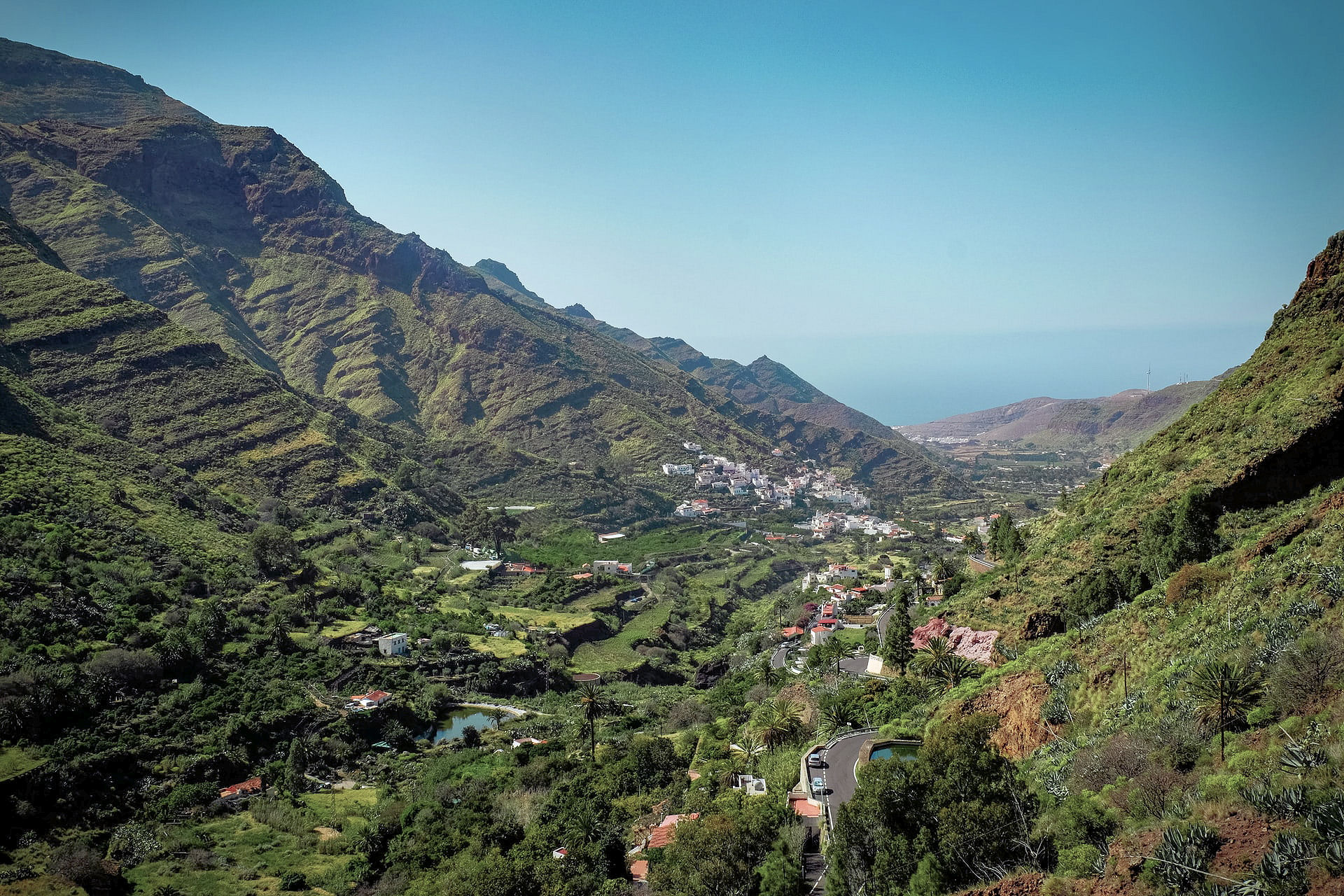
Gran Canaria – the miniature continent, a roughly circular island of ravines and 60 kilometres of beaches, winding forest roads and criss-crossed with walking routes. Plenty to discover, day and night.
For more information click here.
Want the Gran Canaria Tour & Trail Super-Durable Map? Look here.
La Gomera, just west of Tenerife and easily reached via a short ferry crossing – plunging barrancos and soaring forest-topped mountains sprinkled with hamlets and farmsteads clinging to the slopes. Walk, bike, swim, explore – enjoy.

El Hierro, small, fascinating, the most remote and westerly Canary Island promises rugged terrain, narrow winding roads and great walking. A world-class marine reserve, free island-wide wifi and electric car charge ports contrast with the traditional feel of the island. Yet, there are very few tourists – for now.

There’s more information on La Gomera and El Hierro here.
La Gomera and El Hierro Tour & Trail Super-Durable Maps can be bought onlime including HERE.
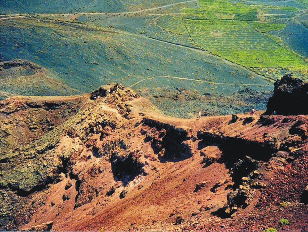
Lanzarote – the Fire Island; volcanic, mysterious and mesmerising terrain, lava seas and alpine meadows. Other-worldly. Once visited, never forgotten.


Find out more about Lanzarote here.
Buys the map from online selllers including HERE.
Fuerteventura, known for beautiful beaches and great water sports, also offers a surprising variety of fascinating walking adventures. Wild coastlines contrast with traditional towns and views across pristine seas.


See more information about Fuerteventura here.
Maps can be foundfrom online sellers including here.
La Palma – La Isla Bonita; dramatic landscapes; a breathtaking mountain spine splits this volcanic island. Black beaches, Lush vegetation and 1080 kilometres of waymarked walking paths.
There’s more information about walking on La Palma here.
Buy La Palma maps online including here.
Tenerife – a Walker’s Island There’s so much to Tenerife. 2034 square kilometres offer coastal adventures, mountain hikes, pine and laurel forest trails, strolls and strenuous challenges including Spain’s highest peak (Mount Teide).The choice is almost endless.


You can buy the walking guide, walking maps and bus map online.
A Little Good News – Free Digital Maps For Everyone
We may not be able to go adventuring for a while yet. However, we can plan ahead for when we can travel again. Have a look at our digital maps, clear and fully detailed for adventure planning of all kinds, including walking, climbing, biking or maybe daydreaming about your next big trip.

There’s a whole hatful of exciting free maps to be had. Take a look at this list of adventure destinations.
Balearic Islands
Mallorca
Menorca
Ibiza
Formentera
Madeira
Azores
Greek Islands
Corfu
Zante (aka Zakynthos)
Malta, Gozo & Comino
Spanish Mainland
Axarquia / Costa del Sol
Costa Blanca
Alpujarras
Sierra de Aracena

Canary Islands
Gran Canaria
La Palma
Tenerife
La Gomera & El Hierro
Lanzarote
Fuerteventura
We hope that we’ve inspired you to think about your next big adventure. To get your free digital maps, please look here https://www.dwgwalking.co.uk
Guess The Island

“The steepest island in the world, the deepest crater, the clearest skies: volcanoes you can climb without being shot into orbit; a subtropical forest minus the slimy things slinking up your trouser leg; black beaches, blue seas, high mountains, vegetation that is literally flamboyant, everything linked by 1080 kilometres of waymarked paths, and all virtually untouched by tourism.” (Author/researcher Charles Davis)

More clues? Okay then – it takes under 5 hours to fly there from the UK. It’s a whole lot warmer and sunnier than most of northern Europe, definitely so for more than half the year. Sometimes it is referred to as, ‘La Isla Bonita’.
 So, have you guessed the location of this alluring destination? Check if you are correct, or give in and find out by looking HERE.
Who got a Garmin for Christmas?
If you are one of the many who found a Garmin GPS in their Christmas stocking, this post is for you.
Get your hands on a free sample ‘real-time’ map and see your Garmin come to life. You can choose a sample map of Graciosa ( off Lanzarote, Canary Islands) or Sierra de Aracena (Andalucia, Spain).
What you’ll get is a highly detailed real-time Tour & Trail digital download map, which you can save on your hard drive, transfer to your Garmin GPS CustomMap memory or onto a micro-SD card; you can also use the maps in Garmin Basecamp and Google Earth.
CANARY ISLANDS
Sample segment, Gran Canaria.
Gran Canaria
Tenerife
La Palma
La Gomera
Lanzarote
Fuerteventura
MAINLAND SPAIN
Alpujarras (Sierra Nevada, Andalucia, southern Spain)
Costa Blanca Mountains (Alicante, southern Spain)
Axarquia (Andalucia, southern Spain)
Sierra de Aracena (Helva province, southern Spain)
BALEARIC ISLANDS
Mallorca
Menorca
Formentera
Ibiza
PORTUGUESE ISLANDS
Madeira
For more information about Tour & Trail Maps take a look HERE.
Choosing A Winter Walking Destination
What do you need for an enjoyable walking holiday when winter closes in on the northern hemisphere?
RELIABLE WARMTH AND SUNSHINE
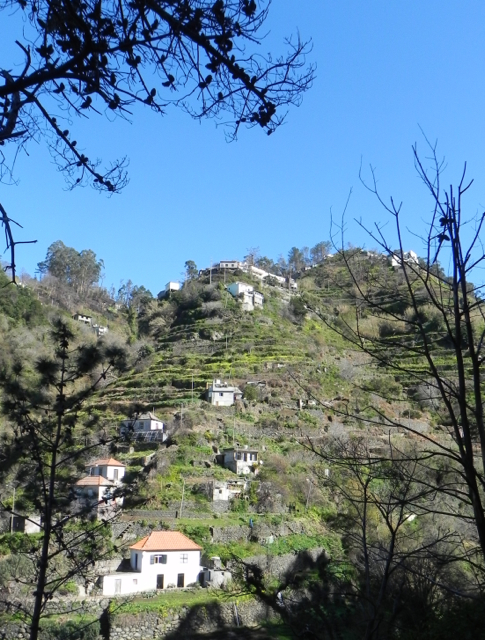
On La Gomera – Tenerife’s Teide visible
A 5 hour flight south (from the UK) gets you to the Canary Islands, off the coast of Africa. You can expect about six hours of sunshine per day (average) with highs of 20C in December though of course there are variations depending on the island and location.

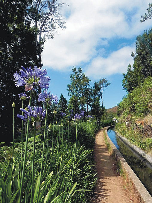
Levada Nova, Madeira
Madeira is a bit closer and almost as sunny (around 5 hours) and almost as warm though the chance or rain is higher. That’s why Madeira is so green and floriferous!
A GOOD CHOICE OF HOTELS, NIGHT LIFE, SHOPS and RESTAURANTS
The Canary Islands and Madeira don’t really have a ‘closed’ season for tourism so you will find a wide range of accommodation, eating places, shops and night life. There are quieter, smaller places to stay if you want to get away from the ‘bright lights’.
EASY TO GET TO
There are plenty of flights all year round to the Canaries and to Madeira.
WHAT’S THE WALKING LIKE?
Each of the Canaries is unique, offering a wide choice of walks and challenging hikes. If you are looking for a pleasant stroll for an hour or two, a coastal discovery route or a full day in the mountains (or something inbetween), the Canaries are an ideal choice.
Madeira is rugged and steep, though the many levada walks (mostly level walks alongside narrow water canals) make it a walking destination with plenty of choice for all.
FIND OUT MORE ABOUT CANARY ISLANDS WALKING HERE:-
FOR MORE ABOUT WALKING ON THE GARDEN ISLE OF MADEIRA, LOOK HERE:-
Madeira
Read Discovery Walking Guides’ latest ENewsletter
Check out Discovery Walking Guides’ latest ENewsletter.
It’s packed with plenty of ideas for escaping winter to wonderful warm walking destinations, plus features on the Isle of Wight and Fuerteventura.
See it all http://ymlp.com/zK1jmu
La Palma Updates 11 Feb 2014 – thanks to Chris S
Our thanks go to Chris S who has just sent us his observations after using Walk! La Palma on the island:- 
From: Chris S
Date: Tue, Feb 11, 2014 at 1:56 PM
Walk 1 : Coming from the west, there is now a turn-off just before the tunnel, which leads to the LP301 (presently in a very poor state of repair, like most of the island’s roads).
Walk 6 : The walk starts just west of Centro de Visitantes de El Paso (Caldera de Taburiente also prominently displayed on the building).
Walk 7 : Descent from Birigoyo now starts with some tight, but easy zig-zags where there is insufficient grit or steepness to skitter. It’s not until you get down to the crater that you encounter a few inches of grit underfoot.
Walk 10 : Walking the rim of San Antonio crater now 5 euros pp. You might be able to sneak past the ticket office if you ignore the sign forbidding pedestrian access to the car park from the Fuencaliente side, but you have to present tickets to the young lady at the entrance to the visitor centre : the only realistic gateway onto the path. There is now chain fencing along the rim and on the narrower bit, it’s on both sides of you.
Walk 14 : The road up to El Pinar was surprisingly the best surface we drove on and the tarmac now extends further than the start point.
Walk 20 : Where the narrow tarmac lane taken at wp2 bends to the right in less than a minute, a waymarked path heads off to the left, rejoining the lane just above wp3. According to the signpost at wp2, the distance to Don Pedro is 6.n km.
Walk 30 : There are 2 signs to Pico de la Nieve on the track by the start of the walk, but they don’t indicate distance.
Walk 32 : The track leading to the car park at start of walk is now only suitable for 4WD, imo. Most of the hire cars which attempt it ,don’t make it all the way. The alternative signposted, but not waymarked, route to/from the ridge is very worthwhile. It involves a little bit more ascent and is a bit longer, but there are several points where different aspects of the peak and caldera are seen. Shortly after the last signpost : ‘1400 metres to Pista de Valencia’, the track forks and it’s the left branch, which soon dwindles to a path that leads more directly to the tarmac.
I’m going to write a review on amazon to emphasise the practical superiority of your guide over *********. I will certainly be buying your guides to the other Canaries, rather than wasting money on “updated” versions of **** ********* efforts, good though they were at the time they were written.
Regards,
Chris
Get Away From Winter – there’s wall-to wall sunshine now in La Palma
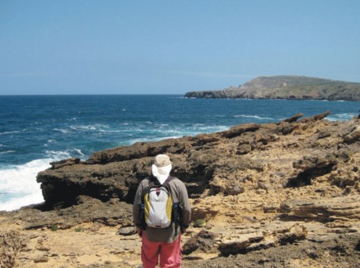
If you’re in the UK or northern Europe you have most likely had enough of gales, floods and dark skies. On the teardrop-shaped volcanic island of La Palma, Canary Islands, the forecast ahead is for almost wall-to-wall sunshine with daily highs of 20-22C and not much less than 16C in the night.
Even better, it offers dramatic and wonderful walking. And you could be there within 5 hours’ flight time from UK and many European airports.
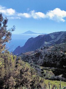
The image (right) was taken while following the Ruta de Los Volcanos.
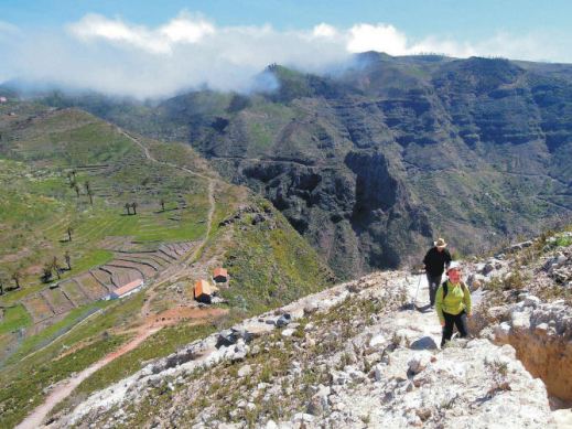
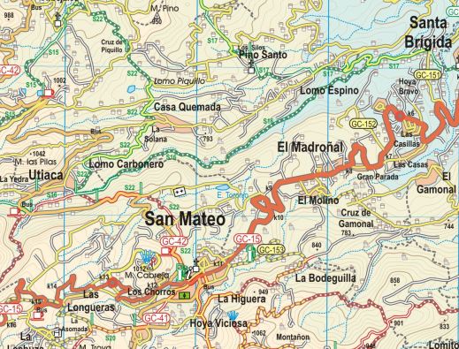
And how about following the route of the southern volcanoes (left)? Much of the walk is along the volcanic ridge that bisects the island west-east, offering super views. Here’s how it looks on the La Palma Tour & Trail Map.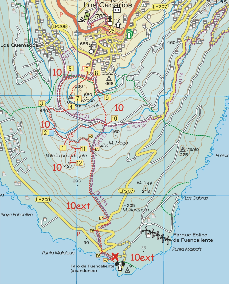
 The image below shows a walker starting out on the Roque Palermo route; La Palma’s famous observatory can be glimpsed in the background.
There’s more information here:- http://www.dwgwalking.co.uk/lap.htm
