
Brittany’s North – Wonderful Walking

Rollercoaster walking on Walk 10, Plougasnou
How do you like the sound of walking through bucolic countryside, or discovering an orchid-lined pilgrim’s way?
What about exploring a fairy-tale trail winding through ancient woodland, or strolling alongside an idyllic trout stream?
You could be scrambling across a cataract of rocks or following the airy contours of the spectacular coastal path, weaving between delicately sculpted dunes or wandering across the flat sands of the tideland.

Port de Ploumanach on Walk 19, Ploumanac’h
Gaze at the wide blue horizon from a wind battered headland or simply lounge about on a breathtakingly beautiful beach.
Brittany, (north-western France) is a perfect ‘get away from it all’ experience.

Abbaye du Tronchet cloisters, Walk 37

Rolling pastures on Walk 32, Langast
Boasting more than 3,000 kilometres of waymarked paths, a tourist infrastructure that is highly developed without being obtrusive, and regular budget flights, the region has all you need for a long-weekend away or a full walking holiday.
If walking in Brittany has you intrigued, we recommend you take a look at experienced walker/researcher/author Charles Davis’ guidebook, Walk! Brittany North.
There’s more information on Discovery Walking Guides’ pages also.
Maps for Corfu, Mallorca and Costa del Sol (Axarquia)

Costa del Sol (La Axarquia)
Are you off to any of these destinations soon?
Or maybe you’re thinking of planning a trip for later in the year, when the summer heat subsides and most visitors disappear, leaving all that space (almost) all yours.

Corfu Tour & Trail Map section
If so, then here’s a great opportunity to get hold of digital Custom Maps free to download.
If you’ve ever used (or seen) one of DWG’s Tour & Trail maps you already know how detailed, clear and up to date they are.

On Mallorca’s north-west coast
Take a look at Discovery Walking Guides’ latest ENews to get hold of yours!
Mallorca; sun, sea, mountains – and Bird Watching too
On Mallorca’s north-west coast
Say ‘Mallorca’ and most people think, “Sun, beaches, mountains, walks, sea-food, sangria …..

Avocet
There’s another excellent reason for visiting this beautiful Balearic island, set in the blue Mediterranean.
Mallorca is home to a surprising number of bird species and acts as a passing-through stop-off for even more bird groups.

Bee-eater
The island’s varied geography, from coastal cliffs to rugged mountains, from wetlands, reservoirs and coastal areas, offer bird life of many kinds a welcoming place to live, rest, feed and breed.

It’s an excellent and up-to-date detailed map (waterproof, tear resistant and guaranteed) perfect for touring the island, with a wealth of details such as best beaches, picnic areas, miradors – plus the locations of the best bird-spotting places.
The map reverse details 51 bird species together with photos and ID information.
Corfu – One in 6000
With approximately 6000 Greek islands and islets to choose from, why Corfu?

Just one of Corfu’s beautiful bays.
Well, it’s a lush green island with white beaches and azure seas, diverse landscapes and a long history, offering lovers of nature, Greek culture and

Rare Swallowtail, Corfu
water sports alike an unforgettable experience.
The coastline provides many ‘wow’ moments, with plunging cliffs, picture-postcard bays and inlets and impossibly blue seas.

Wild Tortoise, Corfu
Corfu has an enduring relationship with the sea, each sheltered inlet and harbour home to fishing boats or pleasure craft.
You’ll find plenty of choices on offer if you want a trip around Corfu’s dramatic coastline, best viewd from the water.
Of course, there are wonderful seafood restaurants, many modestly priced especially away from the resorts.

Lefkimis Bay, Corfu

The Kaiser’s Throne, Corfu
The mountainous north rolls down towards the south, cypress forests cloaking the hillsides while ancient olive groves and fruit orchards thrive at their feet.
There are walking trails and paths, with the icing on the cake being the Corfu Trail which you can choose to do in part or tackle the whole thing.

The ‘main road’ through Ano Korakiana, Corfu.
There’s a sprinkle of ancient, sleepy villages resonating with the island’s long history. If you’re driving yourself through in a hire car, prepare to breathe in!
Back in June 2016 we posted ‘Corfu – An Island In Need Of A Good Map’. Good news – here it is!
 Just published, this is the perfect map, whatever you plan to do on this lovely Greek island.
Find the best beaches and places of interest. Follow the Corfu Trail in whole or part). IF you plan to drive, this is the most up-to-date map showing all roads and junctions.
Corfu – once visited, never forgotten.
Island Hopping – Twice The Adventure Nº2 – Tenerife to La Gomera
Hop From Tenerife to La Gomera
There’s no doubt that Tenerife is one of the most popular island destinations, easily reached in around 5 hours from much of Europe and enticing with sunny skies, warm temperature, beaches and mountains and (if you want it) plenty of nightlife.

Looking down to San Sebastian (La Gomera), Pico del Teide on Tenerife in the distance
If you fancy a complete contrast, sample a day on the island of La Gomera, so close to Tenerife yet oh! so different – rugged, shaped like a well-risen circular cake topped by ancient laurel forests and with mighty ravines slicing down to the sea.
It’s laid back, offering astounding views and walks, little tipico cafés and restaurants, flamboyant plant life and stunning geology. Oh, and it has beaches.

Valle Gran Rey, La Gomera
Frequent ferries mean you can be there in under an hour from Los Cristianos, Tenerife, landing in Gomera’s capital San Sebastián, where public buses await in the harbour to take you onward. Car hire ofices and taxis are located here too.
Journey time: The fastest crossing from Tenerife to La Gomera goes via the harbours Los Cristianos de Tenerife to San Sebastián de La Gomera. The Benchijigua Express Ferry covers this distance in about 50 minutes. Other (slower) ferry services are offered by Naviera Armas. Pre-booking is essentail.
What to do? In one day, you’ll need to be selective. Take a look at these Trip Advisor suggestions.
For lots more information about La Gomera, including maps, look here.
There’s a brand-new edition of Walk! La Gomera, just published; look here.
Island Hopping – Twice The Adventure
Day Trip – Island Hopping Nº1
Going to Lanzarote? Hop to Fuerteventura!

Aloe Vera thrives in Fuerteventura’s desert conditions.
You’ve planned your trip to Lanzarote, booked flights, accommodation and maybe a hire car.
Why not plan a day trip to the next island south too, just a 25 to 45 minute ferry trip away?
Fuerteventura is Lanzarote’s big sister and has its own personality. Watersports are big here (think Fuerte+Ventura = Strong Wind) and there are biking and hiking routes too. Or hire a car for the day and take a look. At about 100 kilmetres in length, it’s too big to see everything in just one day, though you’ll get a taste of the place and may want to return for a longer visit.

Watersport heaven on Fuerteventura’s east coast
Things to do – Trip Advisor has good suggestions for beaches, cafes, museums and watersports.
It’s useful to get hold of a good map before you go. Take a look at this link for up-to-date map information:
http://www.dwgwalking.co.uk/fuerteventura.htm

Established in 1405, Fuerteventura’s origianl capital of Betancuria is a step back in time.
There’s a useful website for those wanting more information about hiking and biking on Fuerteventura; take a look at:
Who got a Garmin for Christmas?
If you are one of the many who found a Garmin GPS in their Christmas stocking, this post is for you.
Get your hands on a free sample ‘real-time’ map and see your Garmin come to life. You can choose a sample map of Graciosa ( off Lanzarote, Canary Islands) or Sierra de Aracena (Andalucia, Spain).
What you’ll get is a highly detailed real-time Tour & Trail digital download map, which you can save on your hard drive, transfer to your Garmin GPS CustomMap memory or onto a micro-SD card; you can also use the maps in Garmin Basecamp and Google Earth.
CANARY ISLANDS
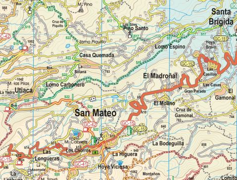
Sample segment, Gran Canaria.
Gran Canaria
Tenerife
La Palma
La Gomera
Lanzarote
Fuerteventura
MAINLAND SPAIN
Alpujarras (Sierra Nevada, Andalucia, southern Spain)
Costa Blanca Mountains (Alicante, southern Spain)
Axarquia (Andalucia, southern Spain)
Sierra de Aracena (Helva province, southern Spain)
BALEARIC ISLANDS
Mallorca
Menorca
Formentera
Ibiza
PORTUGUESE ISLANDS
Madeira
For more information about Tour & Trail Maps take a look HERE.
Madeira – news just in – Levada Nova
Thanks to Peter and Ginny, just back from a walking holiday on the isle of Madeira, we are passing on their update:
“Levada Nova has had rock falls along an extensive section near the start so that virtually all the safety barriers have disappeared. This makes the walk dangerous! We tried to carefully continue thinking the damage would be limited to a short section but it seemed to go on for a long distance so we turned back.”

Levada Nova, Madeira (Walk 73)
Levada Nova is a popular walking route; if you are using Madeira Walks Volume Two, it is Walk 73.
Do check before setting out, either by asking at Tourist Offices or by looking on the island’s official website walking pages.
Are You Off To Walk Madeira? Check Before You Walk.

Aloe aborescens clinging to Madeiran cliffs
Madeira! What a great desination, especially at this time of year.
Swapping the dark and cold of Northern Europe for Madeira’s green and spring-like mountains is a popular choice at this time of year.
If you are planning to walk there, it’s worth checking that the paths you’re planning on following are open. The best place to look for information is on the official ‘Visit Madeira’ tourism website. To see which routes are open or temporarily closed, LOOK HERE.
If you are already on the island, you can also ask in Tourist Offices who usually have up to date information on walks that are open/closed.

A spectaculat waterfall on the Levada da Ribeira da Janela
At the moment only three of the official routes are temporarily closed. The authorities are vigilant and usually restore routes quickly; often, the problem is a landslip after heavy rain.
The three routes to avoid at the time of writing this are:
PR1 – Vereda do Areeiro
Temporarily closed
PR12 – Caminho Real da Encumeada
Temporarily closed
PR19 – Caminho Real do Paul do Mar
Temporarily closed

Levada Nova, Madeira
There’s so much great walking on Madeira that you’ll find plenty to tempt you, from strolls to all-day high altitude challenges. Even if you aren’t keen to do much walking, it’s a great idea to use the local buses which give you brilliant (sometimes a bit hairy!) adventures around the island for pocket-money prices.
There’s a great bus map available, also really useful as a driving map; LOOK HERE for details of the Madeira Bus & Touring Map.
For more information including details our two Madeira Walks guidebooks Madeira Tour & Trail Map and digital mapping for Madeira, take a look at Discovery Walking Guides; Madeira pages.
Beaches, Snow-Capped Mountains and Wonderful Walking – has to be Tenerife

Majestic Mount Teide, Tenerife
One of the great things about Tenerife is that you can enjoy the snow-capped peaks in the morning and have time to watch the sun go down from a warm, sunny beach that same day.
If you like lively resorts, Tenerife has them; if you prefer quiet settlements and small towns, you’ll find plenty of choice also.

Tenerife Bus & Touring Map
The bus service on the island is pretty good. If you have to drive while back in your ‘real life’, it’ll be so relaxing to discover Tenerife by bus.
If you want to drive, there are car hire companies galore.
And the walking – it’s varied and surprising. If you fancy country strolls or want to scale the mighty Mount Teide (or anything in between), Tenerife will not disappoint you.
Tenerife’s south is drier than the north, mostly due to massive Mount Teide dominating the island’s centre and affecting the island’s micro-climates.
Teide stands above the vast volcanic peaks and plains of Las Cañadas. The easy way to get to this highest point on Spanish territory is via the exciting cable-car ride. On A clear day you’ll see for many kilometres with fine views of some of the other Canary Islands.
The verdant north includes the capital of Santa Cruz, home to some fine old buildings and modern shopping. One of the original resorts, Puerto de la Cruz, sits on the north coast with plenty to
occupy visitors. Further west along the coast lies the ancient settlement of Garachico. It’s a fascinating old town with an unusual black natural rock-pool coastal area and a swathe of petrified lava remaining from Mount Teide’s eruption in 1706.

The Anaga, Tenerife
To the north-east is the wild area of Anaga, a walker’s delight.

Masca, western Tenerife
Dramatic and extreme geology on the west coast makes for plenty of ‘wow’ factor. The tiny settlement of Masca has to be seen to be believed though only drive yourself there (and back) if you have nerves of steel and no fear of narrow, winding mountain roads.
Los Gigantes is farther down the west coast, a larger and more modern settlement with a huge vertical set of cliffs plunging seawards with a narrow beach at their feet.
Inland from the west coast are walking paths and small settlements far from the tourist crowds.

Inland from Tenerife’s west coast
The sun-baked south of the island offers wide choices of accommodation, beaches, night-life, sports facilities and shopping. There are also some great walks in this region too. For more information about the island of Tenerife take a look at Discovery Walking Guides’ website
There’s a brand-new edition of the highly recommended Tenerife Hikers’ Maps, out now. Find out more by clicking HERE.

Tenerife Hikers’ Maps (3rd Super-Durable edition)
