
Fuerteventura? Yes,please!
Surreal pastel hills in ice-cream hues form Fuerteventura’s backbone. It’s an island of golden beaches interspersed with rugged volcanic coastlines, turquoise seas and watercolour landscapes.

High above the resorts
If you simply must have forests and lush greenery, it’s best to look elsewhere. But, if you want to be seduced by out of this world views, Fuerteventura ticks the boxes.

Looking across to Corralejo, Fuerteventura
Discover the island by bus, on foot or by bike to get a real feel of authentic Fuerteventura’s countryside and little white villages.
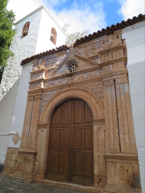
Iglesia de Nuestro Señora de Regla,Pájara
Watersports are really big here too; note that Fuerteventura translates as ‘strong winds’.
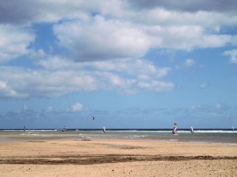
Watersport heaven on Fuerteventura’s east coast
Although the island is only around 5 hours’ flight away (from western Europe) it feels as if you’re on another planet. You’ll never forget Fuerteventura.

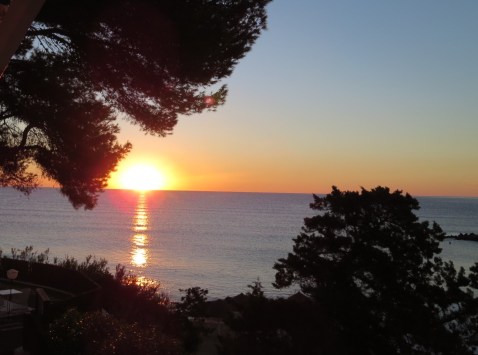
Nightfall, Fuerteventura
As winter’s grip takes hold, what better time to revel in the gentle twenty-something temperatures and blue skies of this unique Canary Island.
Take a look HERE for mapping information for Fuerteventura.
Tour and Trail Maps Go To Sea
We know that most people use our Tour & Trail maps for hiking and biking, for driving and occasionally while horse riding. Their strength, toughness, foldability and waterproof qualities make our maps ideal for all these pursuits.

Look at those magical blues! Paddle Boarding off Northern Menorca
But here’s a first! We received an interesting email from Oliver, a kayak, open canoe and paddle board guide. He uses our maps to navigate around coastlines and sent us a couple of photos showing how he does it.
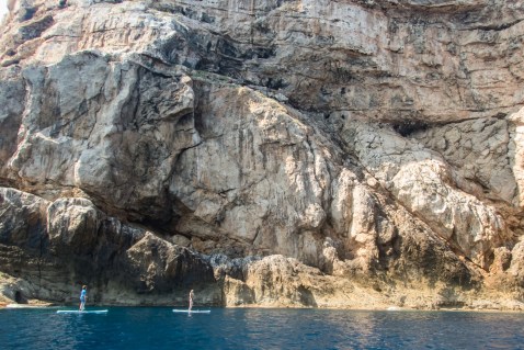
Paddle Boarding off Menorca’s North Coast
“Just wanted to say how impressed I am with the quality of your maps, I use them to navigate our way around coastlines, most recently around some of the awesome north coast of Menorca on Stand Up Paddle Boards, (I guide in both sea kayak and Open canoe too).
Your maps definitely make life easy while afloat …
Oliver”
(Received 24 August 2018)
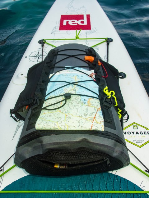
And here’s how to use your Tour & Trail map while paddle boarding.
Thanks Oliver!
You can see that map and many others from Discovery Walking Guides here.
Late summer – perfect for a trip to Ibiza

One of Ibiza’s beautiful coves (on the west coast)
Forget the tabloid image of all-night clubbing, loud music and young visitors in various states of inebriation and undress.
The real Ibiza is a beautiful place, blessed by a wonderful climate with many hours of sunshine each month.
Numerous fine white beaches and little coves tempt the swimmer and sun-worshipper, while walking/biking trails meander through wild flowers underneath a canopy of fragrant pine woods.
A few Ibizan facts:
- Ibiza is one of the Balearic Islands, in the Mediterranean east of the Spanish mainland.
- It’s a naturally beautiful island with white sand beaches, turquoise seas and verdant pine woods, olive groves and wild flowers.
- The island has a long history of invasion by various forces including the Ancient Romans, the Vandas, Byzantines, the Moors, the Norwegians and were finally claimed by Spain. Nowadays, the ‘invaders’ are tourists.
- Ibiza is 572.56 square kilometres (221.07 sq miles) land area.The highest point of the island is Sa Talaiassa, at 475 metres (1,558 ft).
- The population is estimated at approximately 132,500.
- Eivissenc, a dialect of Catalan, is spoken on Ibiza, as is Spanish. English is widely spoken in tourist areas.
- Though renowned for its clubbing scene, there are beautiful beaches, pine woods and walking/biking routes across the island.
Late summer, when most of the tourists have gone and the sun is kind rather than fierce, is a perfect time to explore this gem. Take the best map on your adventures – more info here.
Ibizan sunset
More Than A Coastline – Costa Blanca’s Mountains
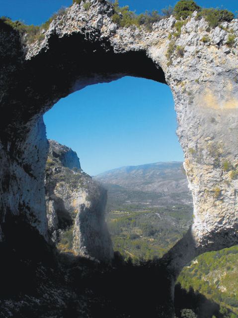
Costa Blanca Mountains – Castell de Castells
Behind Spain’s Costa Blanca with its tourist resorts lies a mountainous region waiting to be explored.
When you’ve had enough of beaches, turn and look inland. Those rugged peaks are more accessible then you might assume. First impressions might suggest an arid, austere region; prepare to be surprised.

Costa Blanca Mountains – Vall de Laguar
But, once you make the decision to explore on foot, bike or horseback, you’ll find green valleys between the rocky peaks. Villages and hamlets nestle in the mountain folds.

Costa Blanca Mountains – Puig Campana
There are many walking tracks and paths, some signposted. To get the most from adventuring here, get hold of Costa Blanca Mountains Tour & Trail Map and Walk! The Costa Blanca Mountains.
La Gomera – New Ferry Services Make Adventuring Easier
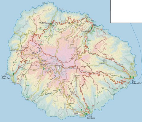
Simplified map of La Gomera by kind permission of David Brawn
La Gomera is a remarkable, almost circular island, a hop away from Tenerife, (Canary Islands) which rises like a giant cake to central forest-cloaked rugged heights, cut by barrancos (ravines) running to the sea. The island is still largely unspoiled which makes it a wonderful destination for hikers and bikers, though getting around takes time as there are few roads. If you don’t wish to get too energetic, simply amble about, dropping into cafés and fish restaurants and breathing in the pure air and beautiful views, enjoying the contrast between this quiet island and its busier big sister Tenerife.
This makes the introduction of not just one but two new sets of ferry services opening up some of the island’s best coastal towns really interesting. You could, for example, take the new car ferry Volcán de Teno from Tenerife’s Los Cristianos at 08.45 and be in Valle Gray Rey 90 minutes later, making a day out in this wonderful ‘Great King’s Valley’ feasible, heading back to Tenerife on the 16.30.
For all the details and to make a booking, see Naviera Armas website.

San Sebastian, La Gomera
It’s around five years since three of La Gomera’s most interesting and important coastal towns were linked by ferry services.
Now Fred Olsen has begun 3 services per day (becoming known as the ‘interior ferry line’), linking San Sebastián, Playa de Santiago and Valle Gran Rey, aboard the Benchi Express. If you’re starting from Tenerife you can do the first ferry hop from Los Cristianos. The Benchi can take bicycles, light motorbikes and pets! It also has a small cafeteria and is wheelchair accessible.
For details of the Fred Olsen services, look HERE.

La Gomera – in the south -Tenerife’s Teide visible

Valle Gran Rey
If you’re starting from Tenerife you can do the first ferry hop from Los Cristianos. The Benchi can take bicycles, light motorbikes and pets! It also has a small cafeteria and is wheelchair accessible. Take a look at their website for all the details and to book.
There’s a well- informed and highly readable blog with more La Gomera travel information here.
MAPS AND WALKING GUIDE BOOKS FOR LA GOMERA
For information about large-scale maps, digital mapping information and walking guidebooks, take a look HERE.
