
Maps for Corfu, Mallorca and Costa del Sol (Axarquia)

Costa del Sol (La Axarquia)
Are you off to any of these destinations soon?
Or maybe you’re thinking of planning a trip for later in the year, when the summer heat subsides and most visitors disappear, leaving all that space (almost) all yours.

Corfu Tour & Trail Map section
If so, then here’s a great opportunity to get hold of digital Custom Maps free to download.
If you’ve ever used (or seen) one of DWG’s Tour & Trail maps you already know how detailed, clear and up to date they are.

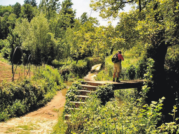
On Mallorca’s north-west coast
Take a look at Discovery Walking Guides’ latest ENews to get hold of yours!
Mallorca; sun, sea, mountains – and Bird Watching too
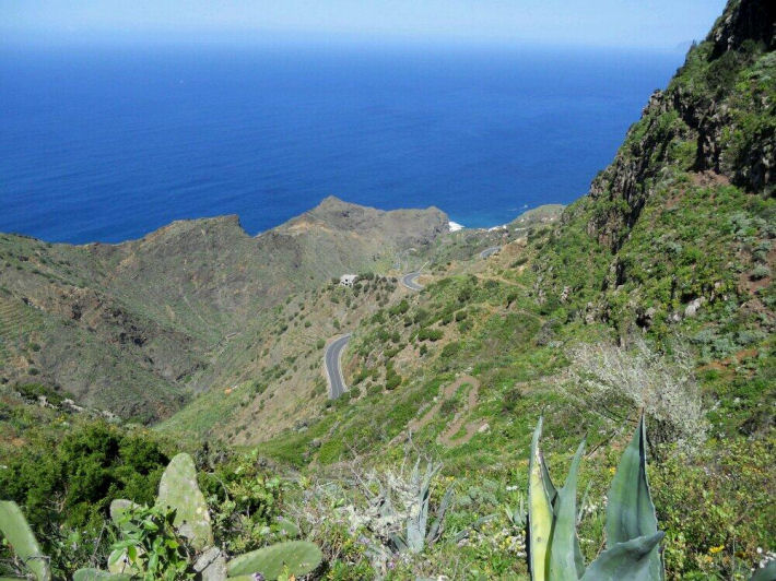
On Mallorca’s north-west coast
Say ‘Mallorca’ and most people think, “Sun, beaches, mountains, walks, sea-food, sangria …..

Avocet
There’s another excellent reason for visiting this beautiful Balearic island, set in the blue Mediterranean.
Mallorca is home to a surprising number of bird species and acts as a passing-through stop-off for even more bird groups.

Bee-eater
The island’s varied geography, from coastal cliffs to rugged mountains, from wetlands, reservoirs and coastal areas, offer bird life of many kinds a welcoming place to live, rest, feed and breed.

It’s an excellent and up-to-date detailed map (waterproof, tear resistant and guaranteed) perfect for touring the island, with a wealth of details such as best beaches, picnic areas, miradors – plus the locations of the best bird-spotting places.
The map reverse details 51 bird species together with photos and ID information.
Island Hopping – Twice The Adventure
Day Trip – Island Hopping Nº1
Going to Lanzarote? Hop to Fuerteventura!

Aloe Vera thrives in Fuerteventura’s desert conditions.
You’ve planned your trip to Lanzarote, booked flights, accommodation and maybe a hire car.
Why not plan a day trip to the next island south too, just a 25 to 45 minute ferry trip away?
Fuerteventura is Lanzarote’s big sister and has its own personality. Watersports are big here (think Fuerte+Ventura = Strong Wind) and there are biking and hiking routes too. Or hire a car for the day and take a look. At about 100 kilmetres in length, it’s too big to see everything in just one day, though you’ll get a taste of the place and may want to return for a longer visit.

Watersport heaven on Fuerteventura’s east coast
Things to do – Trip Advisor has good suggestions for beaches, cafes, museums and watersports.
It’s useful to get hold of a good map before you go. Take a look at this link for up-to-date map information:
http://www.dwgwalking.co.uk/fuerteventura.htm

Established in 1405, Fuerteventura’s origianl capital of Betancuria is a step back in time.
There’s a useful website for those wanting more information about hiking and biking on Fuerteventura; take a look at:
Who got a Garmin for Christmas?
If you are one of the many who found a Garmin GPS in their Christmas stocking, this post is for you.
Get your hands on a free sample ‘real-time’ map and see your Garmin come to life. You can choose a sample map of Graciosa ( off Lanzarote, Canary Islands) or Sierra de Aracena (Andalucia, Spain).
What you’ll get is a highly detailed real-time Tour & Trail digital download map, which you can save on your hard drive, transfer to your Garmin GPS CustomMap memory or onto a micro-SD card; you can also use the maps in Garmin Basecamp and Google Earth.
CANARY ISLANDS
Sample segment, Gran Canaria.
Gran Canaria
Tenerife
La Palma
La Gomera
Lanzarote
Fuerteventura
MAINLAND SPAIN
Alpujarras (Sierra Nevada, Andalucia, southern Spain)
Costa Blanca Mountains (Alicante, southern Spain)
Axarquia (Andalucia, southern Spain)
Sierra de Aracena (Helva province, southern Spain)
BALEARIC ISLANDS
Mallorca
Menorca
Formentera
Ibiza
PORTUGUESE ISLANDS
Madeira
For more information about Tour & Trail Maps take a look HERE.
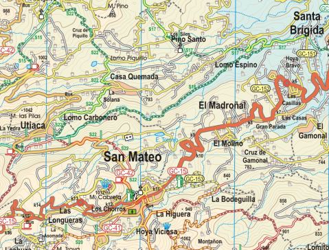
Gran Canaria, Canary Islands – New 3rd Edition Tour & Trail Map
It may not be as well-known as some of the other Canary Islands – that means there’s plenty of room for you to explore this bold, beautiful and dramatic island.
You want mountains and ravines? You want remote, unspoiled sleepy villages? You want abundant verdant woodlands, paths and tracks? You want endemic plant life found nowhere else? You’ve got them all on the island of Gran Canaria.
Map section, Gran Canaria
This third edition includes new walking routes, even clearer ways to show routes and other map features and all the detailed cartographic information that afficionadoes of the Tour & Trail series have come to expect and rely upon. Take a look at this small extract (left).
Detailed updating and addition of new walking routes and additional data have been researched by our ‘on the ground’ walking expert, ‘Rambling Roger‘ and his fellow walking researchers who know the island like the backs of their hands.
If you’re looking for an adventure away from the European winter, with almost guaranteed good weather and great walking (definitely guaranteed) then take a look at Gran Canaria.
(Custom Map digital edition for Garmin Users is available from Discovery Walking Guides’ website. Digital editions are available for 3G/4G GPS apps from Viewranger and My Trails.
Ibiza! Formentera!

Ibizan sunset
Hot off the press are two great new maps, highly detailed and just the thing whatever you want to do on this lovely isle; bikers, hikers and beach-lovers will find just what they seek on Ibiza and its little sister, Formentera.
There’s a special offer on for either (or both) maps :-

Just one of Formentera’s perfect beaches
Formentera? Where’s that? UPDATE
You’d be forgiven for not knowing the location of this little gem of an island. It’s surprisingly easy to reach and has a delightful personality all its own.
Formentera is one of the Balearic Islands to the east of mainland Spain, in the Meditteranean. It’s the little sister island to Ibiza and is only a 30-minute ferry trip away.
Here’s a few facts and figures:
- Beaches, beaches – so many of them for such a small island and white, clean and beautiful.
- The island had been occupied by the Carthaginians, then the ancient Romans, the Visigoths, the Byzantines, the Vandals, and the Arabs.
- Eventually the island added to the Crown of Aragon and later became part of the medieval Kingdom of Majorca.
- The main island of Formentera is 19 kilometres (12 miles) long and is located about 6 kilometres (4 miles) south of Ibiza in the Mediterranean Sea.

San Francesc, Formentera
- The major villages are Sant Francesc Xavier, Sant Ferran de ses Roques, El Pilar de la Mola and La Savina.
- Formentera comprises one municipality, also called Formentera, and has a population of 9,962 (as at 1 January 2010).
- Its land area is 83.24 square kilometres (32.1 sq mi).
- Cars are easily hired in the port and there’s a good choice of conventional or electric vehicles. There are more electric vehicle charging points here than anywhere else in the world, given its land area.
- Mopeds and bicycles are available to hire; the terrain is mostly flat and there are dedicated cycle lanes in some areas.
- The island has four Martello towers.
- Ferries to Formentera from Ibiza operate every half hour in high season.
- A local Ibizan (eivissenc) variant of the Balearic dialect of the Catalan language is spoken in Formentera though English and other European languages are frequently heard too.
Discovery Walking Guides carried out an intensive cartographic survey on Formentera a few weeks back and design of the new Formentera Tour & Trail Super-Durable Map is well under way.
For full details about the new Formen tera map, click here.
KICKSTARTER PROJECT
How would you like to be part of the launch of this exciting new map project? For a modest pledge you can help this project to fly – and receive free maps too.
There’s still time to be a part of this exciting project.
Take a look at DWG’s Kickstarter Project here.
Ibiza – white beaches, azure seas, verdant pine forests UPDATE
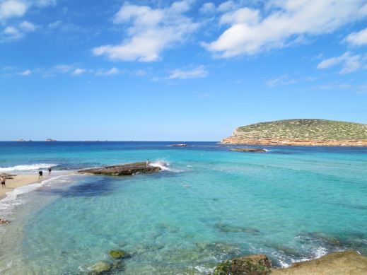
Forget the tabloid image of all-night clubbing, loud music and young visitors in various states of inebriation and undress.
The real Ibiza is a beautiful place, blessed by a wonderful climate with many hours of sunshine each month.
Numerous fine white beaches and little coves tempt the swimmer and sun-worshipper, while walking/biking trails meander through wild flowers underneath a canopy of fragrant pine woods.
A few Ibizan facts:
- Ibiza is one of the Balearic Islands, in the Mediterranean east of the Spanish mainland.
- It’s a naturally beautiful island with white sand beaches, turquoise seas and verdant pine woods, olive groves and wild flowers.
- The island has a long history of invasion by various forces including the Ancient Romans, the Vandas, Byzantines, the Moors, the Norwegians and were finally claimed by Spain. Nowadays, the ‘invaders’ are tourists.
- Ibiza is 572.56 square kilometres (221.07 sq miles) land area.
- The highest point of the island is Sa Talaiassa, at 475 metres (1,558 ft).
- The population is estimated at approximately 132,500.
- Eivissenc, a dialect of Catalan, is spoken on Ibiza, as is Spanish. English is widely spoken in tourist areas.
- Though renowned for its clubbing scene, there are beautiful beaches, pine woods and walking/biking routes across the island.
One of Ibiza’s beautiful coves (on the west coast)
Until now, the maps available for the island of Ibiza have been basic and without the kind of detail you need to enjoy exploring.
That’s all set to change as Discovery Walking Guides has completed their ‘on the ground’ mapping survey. Design of the new Ibiza Tour & Trail Super-Durable Map is well under way.
Click HERE for all the details of the new Ibiza map.

KICKSTARTER PROJECT
How would you like to be part of the launch of this exciting new map project? For a modest pledge you can help this project to fly – and receive free maps too.
There’s still time to part of this exciting project.
Take a look at DWG’s Kickstarter project here:
The Sierra de Aracena – walking in Spain
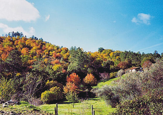
Uunspoiled, green countryside near Galaroza.
Having explored Spain’s Sierra de Aracena some years back for a walking guide and map, it was interesting to see a long and enticing piece in today’s Saturday Telegraph magazine about this little-visited region:-
Another green and beautiful walking route, near the little town of Fuenteheridos.
Spain offers so many wonderful walking regions, yet Sierra de Aracena remains little-known – which is of course, part of its charm. If you want dramatic mountains, look elsewhere. If you like wonderful green, natural walking interspersed with hamlets and little characterful towns, you’ll enjoy this area. It’s the perfect ‘get away from it all’ place.

The little town of Cortelazor.
If your interest has been sparked, take a look at map and walking information from DIscovery Walking Guides: http://www.dwgwalking.co.uk/sierradearacena.htm
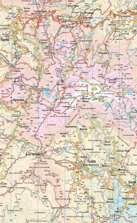
Walking on the Canary Island of La Gomera? Updates December 2014

On La Gomera – Tenerife’s Teide visible
Winter is a great time for walking in the Canary Islands. La Gomera is easily reached yet remains wild and natural with breathtaking scenery and the winter weather is usually fresh yet gentle, with plenty of blue skies; though there can be periods of rain it rarely lasts for long.
We thank Pamela and Malcolm Boura for these useful and detailed notes they made on their visit there this December; they were using the guidebook Walk! La Gomera and La Gomera Tour & Trail Map.
All of the new paths and those missing from your map, referred to below, are shown correctly on OpenStreetMap. You may need to use an editor to look at some of the tags for detailed information such as tarmac/unpaved.
Walk 1
Start of walk: OpenStreetMap shows a path running from a little way down the path to La Laja to Wp2. We did not walk this but the west end looks good and it looks clear on aerial photographs. It probably provides an alternative to the road. According to some rather uncertain contours, it adds about 30m of ascent.
Easy route first paragraph: new path avoiding buildings and noisy dogs to Wp5, see OpenStreetMap. Adds a few metres of ascent but is shorter and is the signed route.
We walked the first part of Walk 1 as the start of Walk 2.
Walk 3
If the start of this walk is not in La Laja, part of the descent to and ascent from the village can be avoided by taking a good donkey path, with fine views of the village, which starts as you cross the spur after Wp16 and emerges to rejoin the main route at the last houses of La Laga, where the sculptures are, after Wp2. This good and useful path is not shown on your map. See OpenStreetMap.
Walk 8
We think this walk should be done in reverse with the steeper and rougher paths as ascent and then the long, fast, gentle descent for the return. Climbing up Barranco do los Cocos would also be much safer than going down, especially in rain, as well as giving a better opportunity to appreciate this lovely valley.
The start of this walk in Playa Santiago has changed after recent works on the river bed. Now follow the east bank until scrambling up the road embankment at the end of the track at Wp2. The first zig and zag are tarmac. Alternatively, parking is available at the adjacent rest area.
There is a clear signposted path branching left before Wp7 which leads directly to the new wooden bungalow. This avoids the final part of the climb towards Targa and the short length of road. This good and useful shortcut is not shown on your map.
Walk 22
The track up Barranco del Valle Gran Rey at present can not be accessed from the lane which starts behind the bus station. This may be temporary.
Walk 23
We walked this in reverse and the start in this direction is confusing and needs instructions. Suggest “A few metres after leaving the road, head right up some rough rock cut steps.”
Walk 25
Some of the “path” is washed away crossing the gullies between Wp2 and Wp3. OpenStreetMap shows a path directly from the start to Wp6 which may provide a better alternative.
Just before reaching the road at the top of the barranco, the path goes to the north of the summit. This is not obvious on the ground and it is shown incorrectly on your map. The route shown on your map goes across a steep and dangerous hillside. See OpenStreetMap.
At Wp17, go slightly left across the road to a painted waymark on the crash barrier. The path from there goes directly to the cemetery.
Taking the alternative route in the last paragraph on your walk, turn right down a track just before the dirt track reaches the road. When the track reaches the bamboo, turn left on an overgrown but passable path to emerge on the road where the path entrance is marked by a cairn. NB This is a new road not shown on your map.
See OpenStreetMap for the extra paths and roads.
Walk 29
We very much enjoyed this straight forward walk but where the track junction is shown on your map between Wp7 and Wp8, we took the track forking left which continues as a good signposted path running parallel to your route but avoiding the road. This leads directly to the saddle between Mt Bianca and the masts and then along the ridge to the masts. See OpenStreetMap. We saw the ends of paths that probably bypass the masts to the NE, cutting the corner.
There is a signposted junction to the west of Wp8, at N28 10.802, W17 17.708, but the signpost has been sited sufficiently far from the junction (a few tens of metres east) to be misleading, especially if doing the walk in reverse. This needs checking on the ground before more can be said, as there were signs of a rough path north from the signpost, although I suspect that was due to people that had been misled!
La Gomera – on Walk 31 (from Walk! La Gomera by Charles Davis). Image courtesy of ‘Inspire Our Trip’.
Walk 31
Unfortunately, the dirt track up Barranco de la Palmita has become a tarmac lane for much of its length. See OpenStreetMap for details of which bits (you may need to look at the editor information to get details of the surface).
