
Fuerteventura – the wild, windy desert island
A surreal, wild and mostly empty landscape
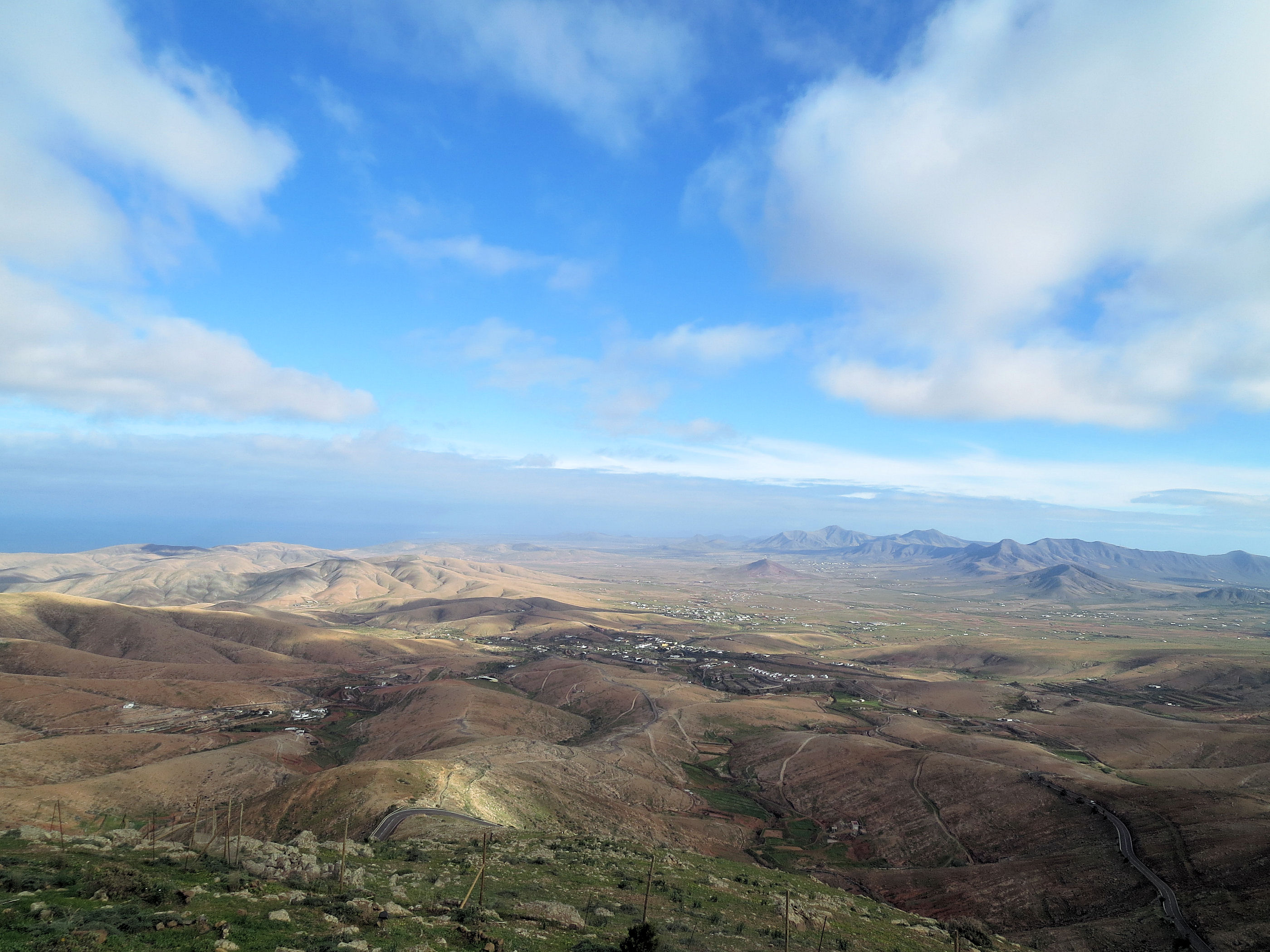
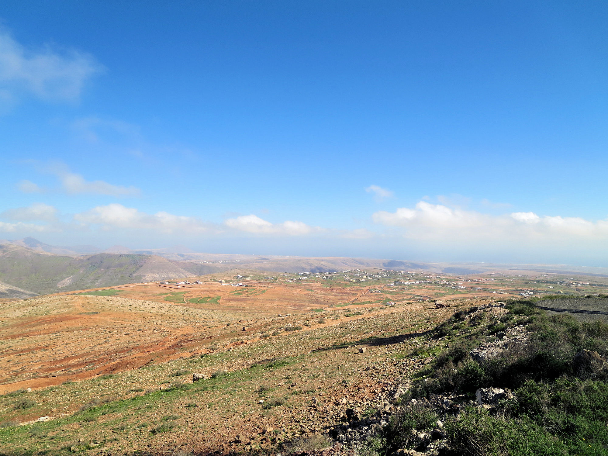
We’ve just returned from completing a cartographic survey of this surreal island. Once your eye and mind adjust to the fact that most of it is a vast, volcanic desert, you begin to appreciate its surreal beauty.
Central north Fuerteventura from the settlement of Time.
There are few towns and settlements, so if volcanic cones, calderas and barrancos are your thing, it is a ‘must-see’ destination.
Fuerte+ventura translates as ‘strong wind’ and this eastern Canary Island lives up to its name.
No wonder, then, that the island pulls in watersports people from all over the world, enjoying the challenge of the winds alongside the serene beauty of miles and miles of pure white beaches.

Watersport heaven on Fuerteventura’s east coast
The island has a long history. Wandering the streets of the original capital of Betancuria (founded 1405) is a journey back in time.

Established in 1405, Fuerteventura’s origianl capital of Betancuria is a step back in time.
Get up high on one of the mirador viewpoints to see amazing views of the scattering of volcanic cones with a few precious patches of green in the valleys. There’s very little rainfall here so agriculture is an uphill battle.

Aloe Vera thrives in Fuerteventura’s desert conditions.
Goat farmers (delicious white local cheeses) and growers of aloe vera are more in tune with the harsh terrain and climate.
Now we have the raw data, our cartographer David is working on Discovery Walking Guides ‘Fuerteventura Super-Durable Map’ which we hope to publish in April 2015.
Walk! Lanzarote :- Updates and Notes

Los Cocoteros to Costa Teguise – best views on route
Our thanks go to Howard and Penny who recently returned from a walking holiday on the Canary Island of Lanzarote and have sent us these useful notes and updates for those who walk after them.
For more information about the book and map they used, see http://www.dwgwalking.co.uk/lanz.htm
Dear David and Ros,We have just returned from 2 weeks in Lanzarote guided by your excellent version 3 of Walk! Lanzarote. (We visited in 2008 with version 1)
We had a wonderful time and really had no issues at all in finding our way though a few little changes have arisen which we suspect arose after your visit. We particularly enjoyed some of the new routes.
Walk 13 The path from wp13 to wp17 has now been bulldozed out as part of the Orzola to Playa Blanca formal route so is now very easy to follow
Walk 22 This has now been upgraded into a defined path with illustrative notice boards and you are advised that stepping off the path is punishable. The English version of the notices are written in best Brussels Eurocrat speak so it is quite entertaining but the beauty of the place is not lost.
Walk 36 After the quite treacherous drop down to wp6 it was clear we were not wanted on the stone wall so we made a direct line for the extreme right end of the wall where we picked up the path. Looking at the footsteps we were not alone.
Walk 33 We set off up the path from the Recycling Bins at the start only for a lady from one of the houses to shout across to say we were on the wrong path. Clearly we were not the first walkers she had re-routed. The bins have been moved ca 75m up the road. The route begins from the path by the bus stop. How you got to wp 4 in 29 minutes amazed us, we were fairly close to your timings throughout the island but it took us close to an hour for this part of the route. We also struggled from wp 4-6 turning left far too early, it would have been clearer if wp5 had not been detailed and the route was described simply as aiming from wp 4 to the right hand side of the saddle where the track is clear at wp6.
Walking in the Haria region
Walk 39 Wonderful.
For those with restricted time we would combine walks 29 and 30 starting at wp1 in Haria and going directly to wp13 (a quick trip up to wp12 is well worth while) then continue to wp17 where you join walk 29 at wp4 and complete walk 29 from there.
Finally we wondered if anyone else had the same experience as us in Ye (walk 36). We were met at the church by two delightful small dogs who befriended us for the day, sticking with us all the way round. Sitting with us when we stopped to eat and then on return trotted off. They seemed to treat us as their dog walkers for the day. Has anyone else performed this service?
We see you are planning Fuerteventura, we have not been there so look forward to you guiding us around that island soon. One request though, please can you publish this with a ring bound spine, they are so much easier to work with.
Many thanks again
Howard and Penny
PS. Note for David, there is a new roundabout on the LZ30 where the LZ402 joins from Famara – a Cartologists work is never done.

Walking on the Canary Island of La Gomera? Updates December 2014

On La Gomera – Tenerife’s Teide visible
Winter is a great time for walking in the Canary Islands. La Gomera is easily reached yet remains wild and natural with breathtaking scenery and the winter weather is usually fresh yet gentle, with plenty of blue skies; though there can be periods of rain it rarely lasts for long.
We thank Pamela and Malcolm Boura for these useful and detailed notes they made on their visit there this December; they were using the guidebook Walk! La Gomera and La Gomera Tour & Trail Map.
All of the new paths and those missing from your map, referred to below, are shown correctly on OpenStreetMap. You may need to use an editor to look at some of the tags for detailed information such as tarmac/unpaved.
Walk 1
Start of walk: OpenStreetMap shows a path running from a little way down the path to La Laja to Wp2. We did not walk this but the west end looks good and it looks clear on aerial photographs. It probably provides an alternative to the road. According to some rather uncertain contours, it adds about 30m of ascent.
Easy route first paragraph: new path avoiding buildings and noisy dogs to Wp5, see OpenStreetMap. Adds a few metres of ascent but is shorter and is the signed route.
We walked the first part of Walk 1 as the start of Walk 2.
Walk 3
If the start of this walk is not in La Laja, part of the descent to and ascent from the village can be avoided by taking a good donkey path, with fine views of the village, which starts as you cross the spur after Wp16 and emerges to rejoin the main route at the last houses of La Laga, where the sculptures are, after Wp2. This good and useful path is not shown on your map. See OpenStreetMap.
Walk 8
We think this walk should be done in reverse with the steeper and rougher paths as ascent and then the long, fast, gentle descent for the return. Climbing up Barranco do los Cocos would also be much safer than going down, especially in rain, as well as giving a better opportunity to appreciate this lovely valley.
The start of this walk in Playa Santiago has changed after recent works on the river bed. Now follow the east bank until scrambling up the road embankment at the end of the track at Wp2. The first zig and zag are tarmac. Alternatively, parking is available at the adjacent rest area.
There is a clear signposted path branching left before Wp7 which leads directly to the new wooden bungalow. This avoids the final part of the climb towards Targa and the short length of road. This good and useful shortcut is not shown on your map.
Walk 22
The track up Barranco del Valle Gran Rey at present can not be accessed from the lane which starts behind the bus station. This may be temporary.
Walk 23
We walked this in reverse and the start in this direction is confusing and needs instructions. Suggest “A few metres after leaving the road, head right up some rough rock cut steps.”
Walk 25
Some of the “path” is washed away crossing the gullies between Wp2 and Wp3. OpenStreetMap shows a path directly from the start to Wp6 which may provide a better alternative.
Just before reaching the road at the top of the barranco, the path goes to the north of the summit. This is not obvious on the ground and it is shown incorrectly on your map. The route shown on your map goes across a steep and dangerous hillside. See OpenStreetMap.
At Wp17, go slightly left across the road to a painted waymark on the crash barrier. The path from there goes directly to the cemetery.
Taking the alternative route in the last paragraph on your walk, turn right down a track just before the dirt track reaches the road. When the track reaches the bamboo, turn left on an overgrown but passable path to emerge on the road where the path entrance is marked by a cairn. NB This is a new road not shown on your map.
See OpenStreetMap for the extra paths and roads.
Walk 29
We very much enjoyed this straight forward walk but where the track junction is shown on your map between Wp7 and Wp8, we took the track forking left which continues as a good signposted path running parallel to your route but avoiding the road. This leads directly to the saddle between Mt Bianca and the masts and then along the ridge to the masts. See OpenStreetMap. We saw the ends of paths that probably bypass the masts to the NE, cutting the corner.
There is a signposted junction to the west of Wp8, at N28 10.802, W17 17.708, but the signpost has been sited sufficiently far from the junction (a few tens of metres east) to be misleading, especially if doing the walk in reverse. This needs checking on the ground before more can be said, as there were signs of a rough path north from the signpost, although I suspect that was due to people that had been misled!
La Gomera – on Walk 31 (from Walk! La Gomera by Charles Davis). Image courtesy of ‘Inspire Our Trip’.
Walk 31
Unfortunately, the dirt track up Barranco de la Palmita has become a tarmac lane for much of its length. See OpenStreetMap for details of which bits (you may need to look at the editor information to get details of the surface).
The Garden Isle of Madeira – escape from winter!
Winter has finally arrived in northern Europe and the days are short and dark. It’s the ideal time to enjoy Madeira. Lush vegetation, mountains and levadas await your discovery.

Aloe aborescens

Madeira Tour & Trail Map
Discovery Walking Guides have released their 8th editions of their Tour & Trail Maps to the Garden Isle (a choice of map-paper or Super-Durable polymer). Walkers keep on buying these for their accuracy, clarity and wealth of up-to-date detail.
Ask for them in your favourite bookshop or get them online from your choice of stockists.
Here’s a link to amazon UK’s information page about the Super-Durable edition:

Isle Of Wight Adventure Package – now released
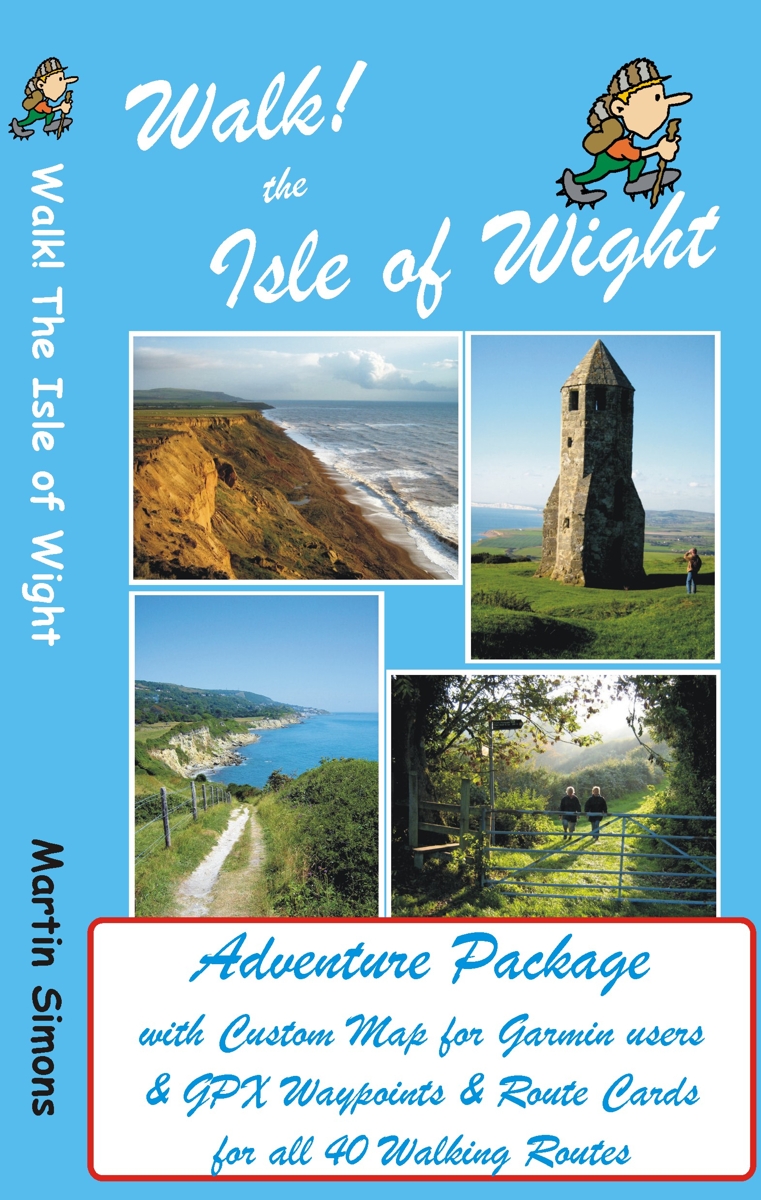
GPS users take note; our latest edition Walk! The Isle of Wight walks have been transformed into pdf route cards and re-packaged with ‘OSlike’ digital mapping for the Isle of Wight and gpx waypoints.
This is a great time to explore the Isle Of Wight; school holidays are almost over and there’s always the chance of some late summer sunshine.
Isle of Wight Adventure Package:-
Isle of Wight ‘OSlike’ Custom Map
gpx waypoints,
pdf ebook of 41 A4 pages
– all delivered as a ZIP file download for £11.99
See all the details here:-
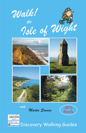
Walk! The Isle Of Wight – new edition is here!
 There’s no doubt that the Isle Of Wight is a wonderful place to visit and the best way to experience the island is on foot and by bus.
Walk! The Isle Of Wight (3rd edition) details 40 step-by-step walking routes, most accessed using public bus services.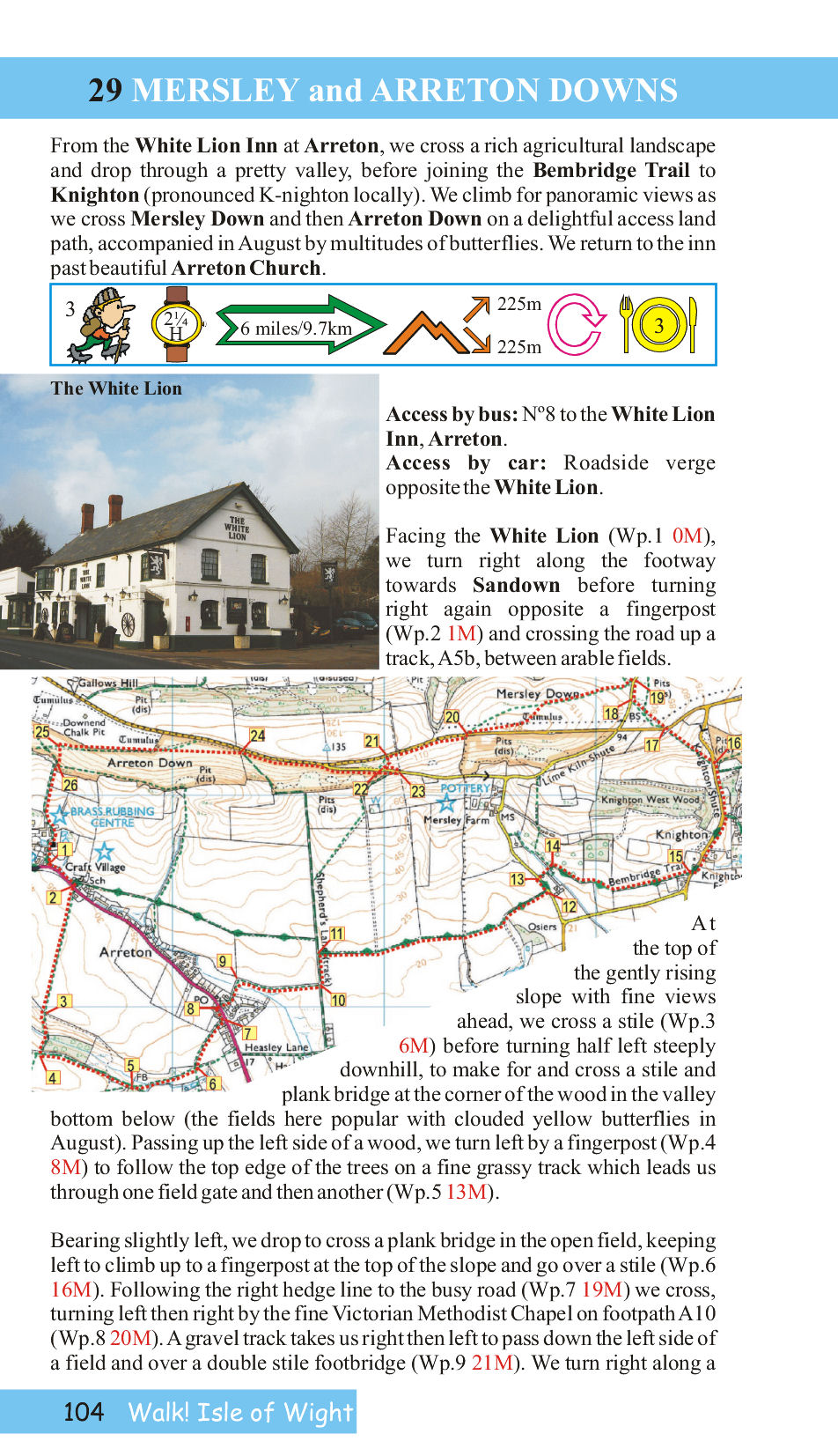
Each walk has its own colour OS Map, with the walking route and waypoints highlighted.
Here’s a sample page from the book so you can see what you’re getting:-
Good pubs (author tested) are recommended at the end of many of the routes.
See all the info here:-
Spring! The Perfect Time Of Year For Walking In The UK
![]()
After a few false starts, it really is Spring in the UK. It’s a beautiful time of year to get out and about walking.
Here’s a bit of inspiration – the Brecon Beacons offer wonderful walking for everyone from leisure strollers to all-day-in-the-wild wanderers. Here’s a pic to whet your appetite, taken on route ‘Crib y Garth’ researched, recorded and photographed by author Bob Greaves who knows this area like the back of his hand.
This route climbs steadily up the Olchon Valley and returns along the narrow, most easterly, of the Black Mountain ridges which is popularly known as The Cat’s Back. The pic was taken half way along this ridge. It could be you in that landscape!
More info at http://www.dwgwalking.co.uk/brecon%20beacons.htm
La Gomera – thanks to ‘Inspire Our Trip’
La Gomera – on Walk 31 (from Walk! La Gomera by Charles Davis). Image courtesy of ‘Inspire Our Trip’.
‘Inspire Our Trip’ on twitter said:-
“Brilliant hike and a great day walk. Thank you Charles Davis for Walk 31.”
Charles Davis is the author of Walk! La Gomera:- see http://www.dwgwalking.co.uk/walkla.htm
https://twitter.com/InspireOurTrip/status/455766577577988096/photo/1
Mallorca: Update on the GR221 – thanks Eryk Grant
These notes were sent by Eryk Grant re the GR221, while using Charles Davis’ book ‘The GR221 – Mallorca’s Drystone Way’
http://www.dwgwalking.co.uk/mallGR221Spec.htm , notably the stretch between Esporles and Valldemossa.
“Hi Charles
Walked this section last Sunday (6th April) without any problem.
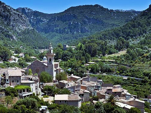
The Mallorcan town of Valldemossa
There were five other walkers on the route and it looks like the obstructions placed by the landowner (notices and fence) are largely ignored. I saw no attempt to ‘repair’ the fence and it was easy to negotiate-there are cairns galore and helpful green/yellow spots on rocks. The track has not become overgrown suggesting it is really well used. There is also a shiny new GR route map in Esporles town centre showing the route going through and all the subsequent wayposts except one refer to it. I guess there may be some tacit acceptance that walking will continue and I would not hesitate to walk this part again.
Up by the Tossals refuge there is a fair amount of building material but not much sign that anything is happening! Last time we stayed there in 2012 we had a conversation with a Dutch couple who were using your DWG guide, and making their way based on “what does Charles say?” – your directions and supporting commentary have never let us down either and in fact have really added to the enjoyment in places.”
Thanks Erik – feedback from walkers who’ve been there is valuable both for those who come after you, as well as providing us with valuable information for new editions.
Madeira: Good news – PR1 high altitude route re-opens
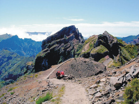
The route to Pico Ruivo
Madeira’s majestic high-level mountain route, the PR1 – Vereda do Areeiro to Pico Ruivo, has re-opened to walkers.
Landslides that had damaged the route have been cleared and fencing replaced.
This is the BIG one for high altitude afficionades!
(Image, thanks to Shirley Whitehead, walking researcher and author) – see http://www.dwgwalking.co.uk/mad.htm
