
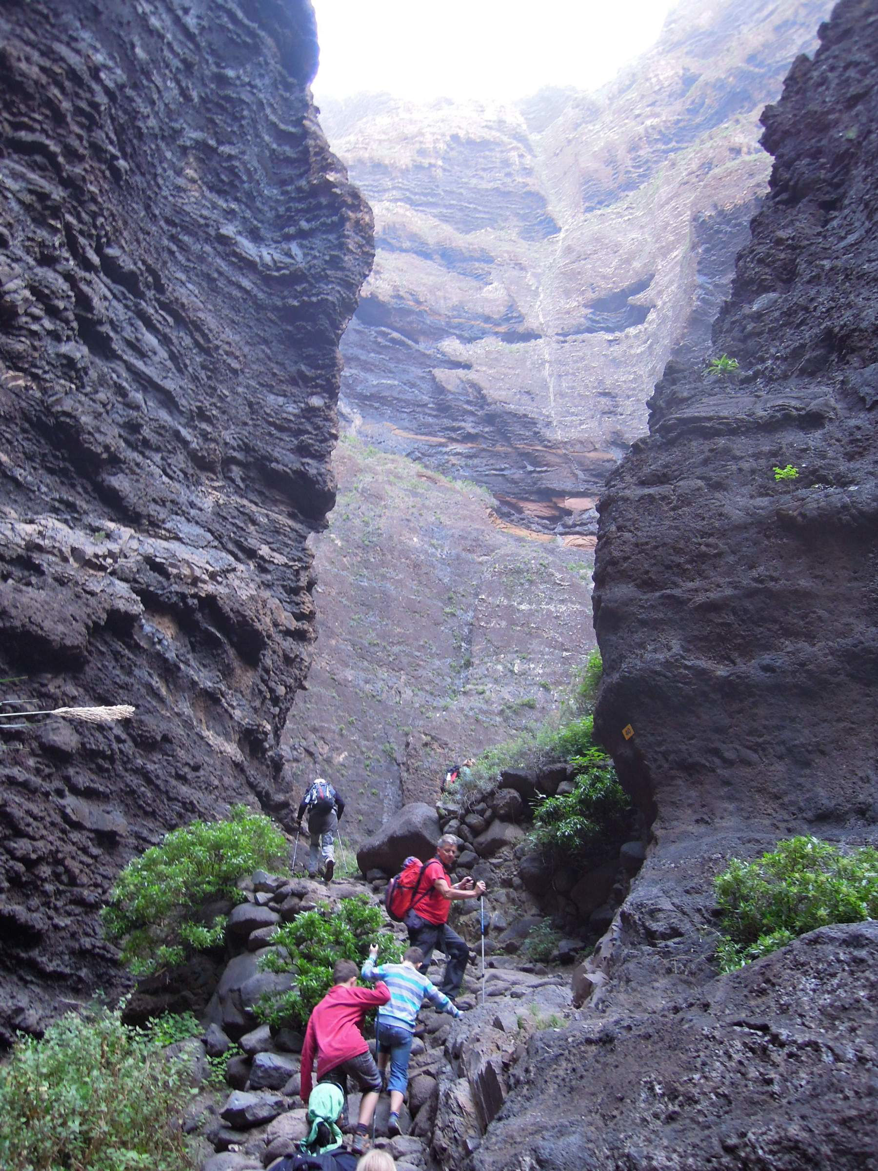
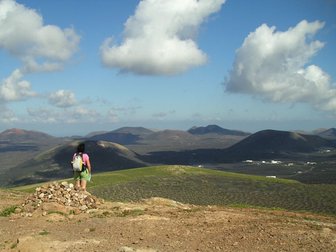
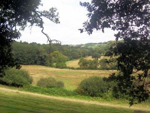
Majestic Barranco de Masca (Tenerife) Reopens!
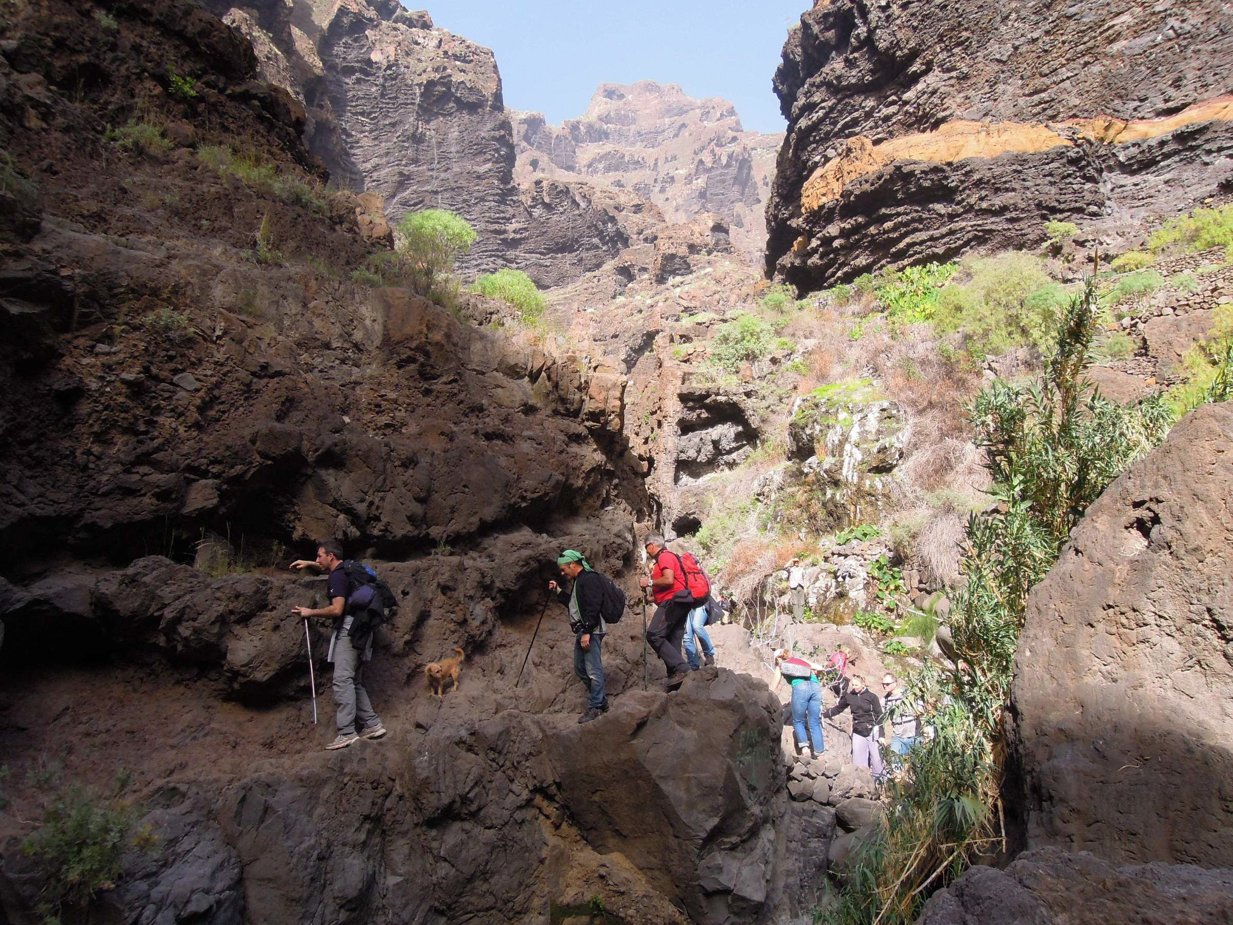
27 March is the long awaited date for the re-opening of this majestic and challenging barranco (ravine) walk on Tenerife’s north-west coast.
However, the option of doing only the downhill walk from Masca village to the beach and hopping on a boat to get back to civilisation is not (for now) available as the jetty isn’t yet refurbished. This means you need to be fit enough to walk it both ways and this is challenging for many.

To walk the ravine, Masca can be accessed in public transport from Buenavista del Norte or from Santiago del Teide.
In order to access the ravine, pre-booking is advised at http://www.barrancodemasca.com.
You can also book at the Masca Visitors Center, although availability is not guaranteed for walking the ravine on the same day.
At the moment, entry is free, although in the future (presumably when all work is completed on the jetty), a fee of 8 euros (residents) and 16 euros (visitors) will be charged (Check the official website for the latest entry information.)
The ravine is not recommended for under 8 year olds.
Safety helmets must be worn.
Access will be in groups of 25 walkers, every half hour.
Opening hours of the ravine will be 8:00 to 18:00 in summer, and from 8:00 to 17:00 in winter (though for now, it will only be open weekends and holidays).
Three checkpoints have been established at the beginning, halfway point and on the beach.
Active tourism companies will be allocated 50 % of tickets. For more information and to book your place, go to the official website HERE.
Lockdown Blues? Get ready to travel.
With vaccinations well under way in many parts of the world, there’s real belief that travel restrictions will gradually ease in the next few months. We make no apology for offering the information about our free digital maps once again; last time we posted this information we were pleased and surprised at how many people enjoyed them and started planning ahead to travel.
We’d like to help you get planning. Where to next? Why not start by getting your hands on our Free Digital Maps.
Read all about it HERE.
There are free maps to 19 tempting walking destinations to check out, including :
CANARY ISLANDS
La Gomera & El Hierro, Lanzarote, La Palma, Tenerife, Fuerteventura, Gran Canaria


BALEARIC ISLANDS
Mallorca, Menorca, Ibiza, Formentera

GREEK ISLANDS
Zakynthos (Zante), Corfu
SPANISH MAINLAND
Costa Blanca Mountains, Costa del Sol (Axarquia), Alpujarras, Sierra de Aracena

– and also:
Malta & Gozo
Madeira
Azores
To see more details about the free digital maps and how to get them, LOOK HERE
Plan Your Next Walking Adventure With our FREE Digital Maps
With the real hope of vaccines within reach, we can look forward to planning walking adventures again. Once travel freedom returns, there’s going to be a lot of pent-up desire to get away, so this could be the best time to make some plans.
We’d like to help you get planning. Where to next? Why not start by getting your hands on our Free Digital Maps.
Read all about it HERE.
There are free maps to 19 tempting walking destinations to check out, including :
CANARY ISLANDS
La Gomera & El Hierro, Lanzarote, La Palma, Tenerife, Fuerteventura, Gran Canaria
BALEARIC ISLANDS
Mallorca, Menorca, Ibiza, Formentera
GREEK ISLANDS
Zakynthos (Zante), Corfu
SPANISH MAINLAND
Costa Blanca Mountains, Costa del Sol (Axarquia), Alpujarras, Sierra de Aracena
– and also:
Malta & Gozo
Madeira
Azores
To see more details about the free digital maps and how to get them, LOOK HERE
Greece? You’re welcome!
Zakynthos (Zante) is one of the Greek islands that’s back on the green travel list for Travellers in the UK England, Wales, Northern Ireland (not Scotland). As the UK autumn takes hold, how does the idea of warm sunshine and beautiful islands appeal?

Other Greek islands that were already on the British Government’s ‘green’ good to go travel list include Kefalonia and Corfu.


Kefalonia Tour & Trail Super-Durable Map published by Discovery Walking Guides Ltd
Updated lists of countries exempted from quarantine on return to the UK can be found HERE.
If you plan to go overseas, it’s a good idea to also check your destination country’s regulations for arriving visitors.

Corfu Tour & Trail Super-Durable Map published by Discovery Walking Guides Ltd
For information about each of these three beautiful islands and how to get the detailed maps to enhance your adventures, take a look at Zante Kefalonia and Corfu.
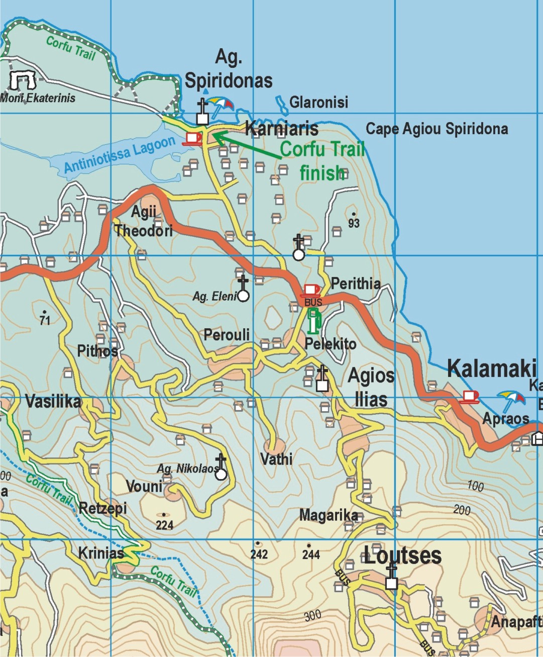
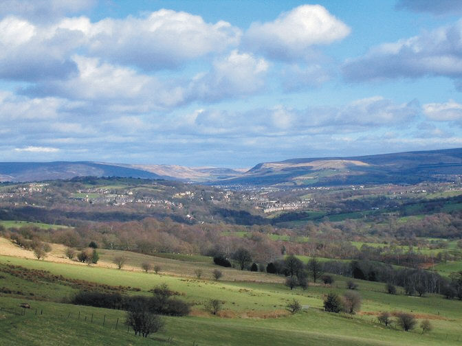
The South Pennines – a Little-Known Walker’s Delight
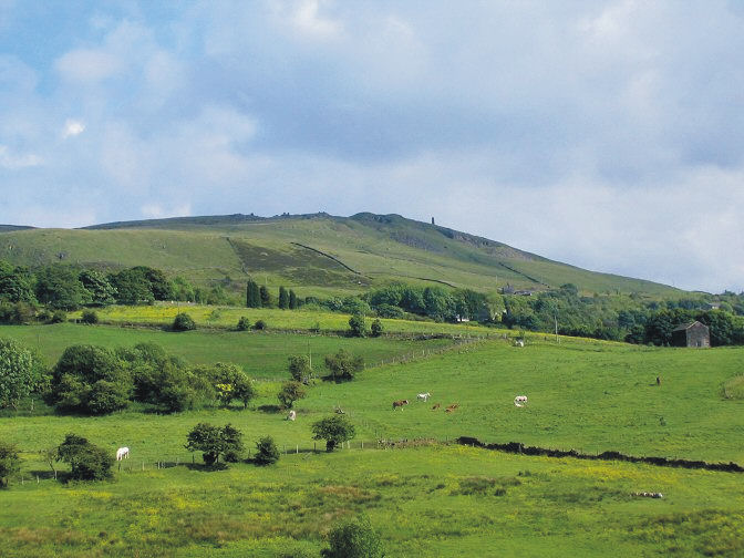
Several well-known walking areas of Britain have been almost overwhelmed by visitor numbers in 2020. Why not take a look at somewhere less crowded, offering a unique experience?
England’s South Pennines are not usually on most walkers’ ‘top ten’ lists. Well, those walkers are missing out on a fascinating region combining beautiful countryside with history.
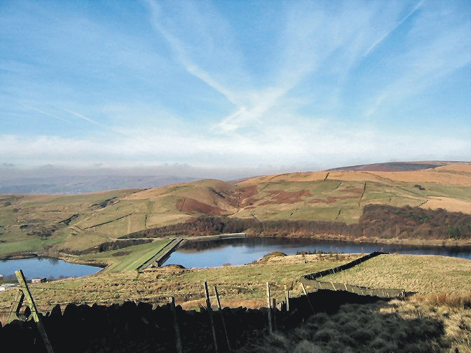
Old paths and trails dating back generations beckon, revealing the unique character of a region shaped by hundreds of years of human toil and creativity. Canals, railways, mills, bridges, viaducts and reservoirs are testaments to humankind’s work.
Many of the walks can be reached by train, making for a varied day out, punctuated with refreshment breaks in pubs or cafes, while making the area feasible even for those not living in the area. For example, within 20 minutes of leaving the hustle and bustle of central Manchester you can be in the wildest and most lovely countryside. Most of the walks lie within a rough rectangle contained by Walsden in the north, Bollington in the south, Oldham and Stockport in the west and Glossop in the east.
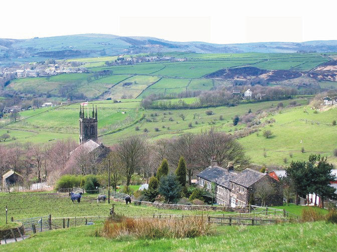
Anyone who has a mental image of soot-blackened towns and dull countryside is mistaken. Many of the old industrial buildings that remain have been converted into heritage centres or living accommodation. Farms dot the countryside where flora and fauna flourish; bird watchers will find plenty to discover.

For more information on wonderful walks in the South Pennines, take a look HERE.
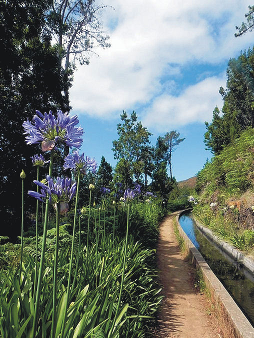
Madeira – good to go!
Although many parts of the UK enjoyed some warm sunny September days, the switch seems to have suddenly flipped to full Autumn. Chilly, windy and rain that sets in for hours on end. Overseas travel is still tricky to plan, though Madeira remains one of the Government’s ‘green list’ destinations.
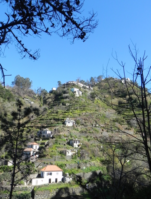
How does the weather in Madeira compare to London’s at this time of year? A quick check of BBC weather services for October 03 2020 has London’s temperature range as 10C – 15C, heavy rain, zero sun. Madeira should enjoy 19C to 25C, little chance of a shower and plenty of sunny intervals. Madeira gets plenty of rain too; look at those beautiful forests, trees and flowers. But the island’s sunshine and temperature figures look tempting as winter beckons.

Madeira is a classic destination for keen walkers, though you don’t need to be an expert. There are plenty of lovely strolls as well as high end challenges for experts, with plenty of variety in between. Or, why not explore by bus, a pocket-money way to experience the island. For plenty more information on discovering Madeira, take a look HERE.
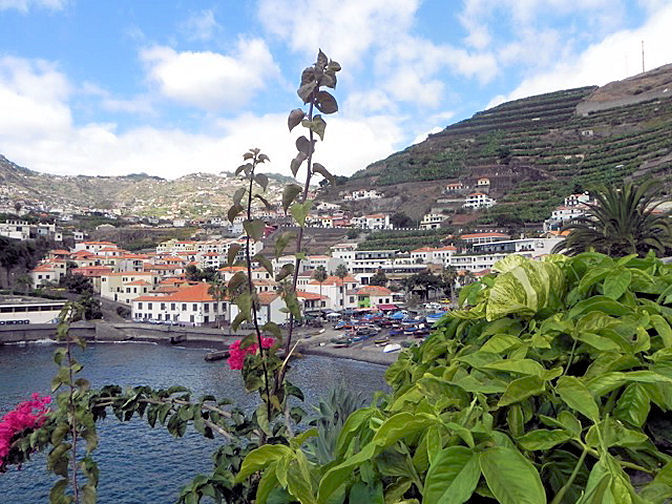
Thanks to author-researcher Shirley Whitehead for these beautiful photos of her home island.
Lanzarote, the Alpujarras and Cape Verde
Until these strange days are over, we can think about places we would like to visit once we have the freedom to travel. Here at Discovery Walking Guides, we’re working on new maps and walking guidebooks that will be ready to go when travel becomes possible again.
One destination that has its own unique attraction is Lanzarote (Canary Islands). There’s plenty of walking to keep you busy for a couple of weeks’ visit.
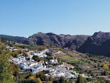
For somewhere more mountainous, with white Moorish villages, how about the Alpujarras (Spain)? It’s a rugged area with a timeless quality, with marvellous landscapes and history.
We’ve just released our latest Enewsletter which includes information about Lanzarote, the Alpujarras and Cape Verde. The Enews also includes links to free digital maps, which are highly detailed especially for walkers, hikers and mountain bikers. Once you’ve chosen your destinations you can see the area and the walking routes in Google Maps, for a ‘virtual tour’.
There’s a bit of fun too, with a walking destinations crossword puzzle.
MADEIRA WALKS, UPDATES

MADEIRA WALKS VOLUME ONE AND VOLUME TWO
IMPORTANT CHANGES TO WALKING ROUTES
20th FEBRUARY 2020
Volume One – Walk 10 – Levada dos Tornos – Monte – Curral Romeiros – Circular
Whilst this route remains open, is it should be noted that the forest section between Wp.3 and Wp.4 is currently in a poor condition. Therefore it is recommended that anyone finding difficulty ascending this path should turn back immediately and follow the lower route via the João Gomez valley. Once in Romeiros there is an option to walk out and back along Levada dos Tornos between Wp.7 and Wp.4 before returning again via the João Gomez valley. This is an extremely pretty section of levada and remains in good condition but does retain the grade 3 risk of vertigo due to a number of unprotected sections. There is also a very short section at Wp.4 where the channel shoulder has suffered some erosion, but this can be totally avoided by walking on the opposite banking crossing and re-crossing the two concrete slabs over the channel.
Volume Two – Walk 55 – Levada do Caldeirão Verde
This route is shown as ‘Conditioned’ on the official Tourism website due to a substantial rock fall around the green pool. Therefore at the present time walkers can either continue along the suggested extension to reach Caldeirão do Inferno or turn around after Wp.9 and return to the starting point where a new café facility has recently been opened in the Parque das Queimadas
Volume Two – Walk 58 – Camacha to Monte
After reaching the Choupana Hills Resort (this hotel was closed in 2016 following the fires in that area), we follow the path through the gardens, which remain open and continue along the levada to Romeiros, where you leave the channel descending steps at (Wp.13). Here follow the road right for a short distance to reach more steps ascending back to the levada. At this point we recommend that you consider the options for continuing on to Monte, either via the levada or by following the trail into the João Gomez valley. Both these options are described clearly in Madeira Walks Volume Two. However, you should note that due to some problems on the descent after leaving the levada (Wp.4) until reaching the point where both options rejoin at (Wp.3) it may be preferable, and much safer for some people, to take the lower route back to Monte. (Refer to the update above for Walk 10)

Volume Two – Walk 65 – Rabaçal Lagoa do Vento
This trail has recently been refurbished providing stepped ascents and descents along its whole length making for a much easier terrain. The upgrade also includes new signage and diverts the path away from the previous wet and slippery sections referred to in the original text in Madeira Walks Volume Two.
Madeira Walks – important updates
Things change, of course and our walking guidebooks for the garden island of Madeira are no exception. From time to time, erosion or weather events mean that parts of a walking route need to be changed, or other safety issues prompt the authorities to make route changes. If you have either of our guidebooks ‘Madeira Walks’ volume one or two, please take a look at these notes sent to us by our resident author/researcher, Shirley Whitehead.
Volume One – Walk 35 – Levada das 25 Fontes – Via Calheta Tunnel (PR6)
Volume Two – Walk 68 – Rabaçal – Levada das 25 Fontes & Levada do Risco (PR 6.1)
The following update applies to both the above routes along the final section between the Ribeira Grande Bridge and the 25 Fontes.
“Around 400m beyond the Ribeira Grande Bridge, a stairway appears on our right; this is a new return route recently constructed to improve safety to walkers by reducing the volume of traffic along the narrowest part of the levada which is subject to serious erosion.

Walkers are therefore asked to respect this safer diversion on their return to Casa do Rabaçal. The new route starts around 120 metres from the 25 Fontes. The stairway is approximately 250m in length with an ascent and descent of 50m therefore reducing the original return journey by around one kilometre.”
Volume Two – Walk 76 – Loreto to Madalena do Mar
Due to a large landslide below the levada around Wp.8, the right hand pathway descending to Lombo da Achada is now closed. As an alternative route to connect with Wp.10 and enable continuation down to Madalena do Mar, we suggest the following:
Just beyond Wp.2, turn right following the cobbled lane as it descends through the woodland. Around 100 m ahead, swing right onto a tarred road. This is “Impasso de Cova da Arco” which winds down the hillside towards Arco da Calheta. Shortly after a right and left bend around 800m ahead, go left down “Caminho das Paredes” to rejoin with “Impasso de Cove da Arco”. Turning left here, follow the road for around 500 metres to reach a T-junction. The total descent to this point is around 263 m. You are now on “Rua da Achada do Santa Antonio” and turning left the route ascends towards Santa Antonio. 700 m ahead take a left turn following “Caminho do Lombo” the lane bends left around100m ahead. Another 50m ahead, you will arrive at a well on your left.

This is Wp.10 of the original route where you now drop down steps on the right of the road to continue on to Madalena do Mar. The variances in timings and distance between the original route and this detour are negligible. The increase in ascents and descents is around 25m.”
Brittany’s North – Wonderful Walking
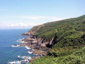
Rollercoaster walking on Walk 10, Plougasnou
How do you like the sound of walking through bucolic countryside, or discovering an orchid-lined pilgrim’s way?
What about exploring a fairy-tale trail winding through ancient woodland, or strolling alongside an idyllic trout stream?
You could be scrambling across a cataract of rocks or following the airy contours of the spectacular coastal path, weaving between delicately sculpted dunes or wandering across the flat sands of the tideland.

Port de Ploumanach on Walk 19, Ploumanac’h
Gaze at the wide blue horizon from a wind battered headland or simply lounge about on a breathtakingly beautiful beach.
Brittany, (north-western France) is a perfect ‘get away from it all’ experience.
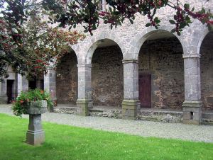
Abbaye du Tronchet cloisters, Walk 37
Rolling pastures on Walk 32, Langast
Boasting more than 3,000 kilometres of waymarked paths, a tourist infrastructure that is highly developed without being obtrusive, and regular budget flights, the region has all you need for a long-weekend away or a full walking holiday.
If walking in Brittany has you intrigued, we recommend you take a look at experienced walker/researcher/author Charles Davis’ guidebook, Walk! Brittany North.
There’s more information on Discovery Walking Guides’ pages also.
