
Lanzarote – what an experience!

Walking in the Haria region of Lanzarote
Each of the Canary Islands has its own unique personality. Lanzarote is strangely surreal. There’s plenty of wide open unspoiled places ideal for exploring by car, bike or on foot.

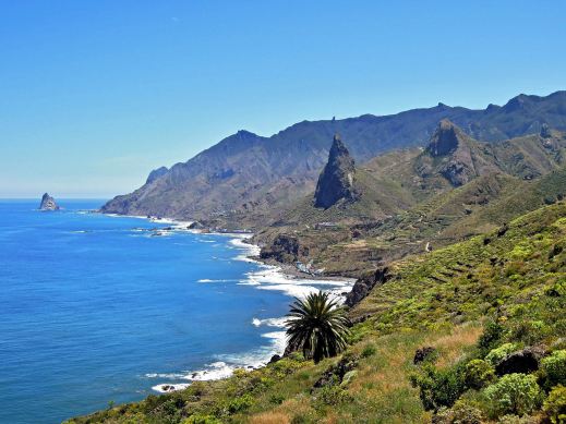
Lanzarote coastal adventure
Before you visit, get a really good map – and perhaps a walking guidebook.
The best map by a long way is Lanzarote Tour & Trail Super-Durable Map.
But don’t take our word for it – there are dozens of user reviews on line. Here’s a few of them:

Lanzarote Toast Rack Thingy
Kung Fu Panda
5.0 out of 5 stars Highly recommended if planning a driving holiday on Lanzarote
Compared to many “travel” maps this map is very good with an impressive level of detail, including different road types, paths and tracks, contouring, etc. The map itself is printed on a very durable (and ultimately recyclable) plastic sheet material. I would highly recommend this to anyone planning to drive around Lanzarote and perhaps to combine that with some walking. I have just driven around 500 miles during a 10-day holiday and found this invaluable.
Amazon Customer
5.0 out of 5 stars Great product.
I’m a regular user of OS maps & wanted a map of Lanzarote for our forthcoming holiday. This map, with the accompanying book, looks just the job. I particularly like the way the map & book cross-reference each other & the useful information about the walks.
Dylan
5.0 out of 5 stars great product
Fantastic map at a very reasonable price. Large scale shows walking trails etc. Great for research prior to our planned trip.
Freddie
5.0 out of 5 stars Excellent
Excellent map, a must for driving around as road signs are atrocious on Lanzarote for independent motorist! Very good for walks too. Also, yes bended, folded, chucked on back seat & footwell several times, and not a single tear of hole on the folds. Would recommend & will buy for other Canaries when we visit them.
Lanzarote for sunshine, blue seas, amazing huge skies and volcanic sci-fi landscapes. See it for yourself. You’ll never forget it.

Los Cocoteros, Costa Teguise
Tenerife – antidote to the winter blues

Some folk don’t mind the short, dark days of northern European winters. If you’re like me and you really DO mind them, how about hopping over to Tenerife? With temperatures to 23C and 6 hours of sunshine daily, it’s just the place to recharge your batteries. If you’re able to travel just before or just after the Christmas and New Year rush, you can get good value all-inclusive or full board deals that won’t cost much more than paying your home heating costs and food bills at home.
Ifyou tire of the sun and sea of the coastal resorts, you can visit the mountainous interior of Tenerife where there’s often snow in the winter months on the highest peaks, then go back down to the coast by sunset to warm up again.
Tenerife is a great destination for relaxing – and for hiking and biking too.

For more information and reasons to be on Tenerife this winter, take a look HERE.
Gran Canaria – it’s a whole new world
They don’t call it the ‘mini-continent’ for nothing!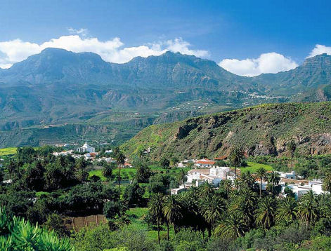
Though it’s under a 5 hour flight away (from the UK and western Europe), it feels like a different world.
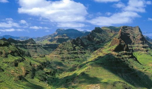
There’s plenty to see and do, though the best thing of all is to walk the trails and marvel at the views, the forests, flora and fauna and the ancient villages.
Gran Canaria Tour & Trail Super-Durable Map is now in its 5th edition. This is the level of detail you need when exploring the island.
Here at Discovery Walking Guides, we’ve watched the rise and rise of this fascinating island as a hiking/biking/touring destination over the past few years. Gran Canaria has emerged from the shadows to become a ‘must walk’ destination in the Canary Islands.
There’s wonderful dramatic scenery and unspoilt villages, plus clean, spacious beaches for the days you don’t want to walk (or bike or drive).

To get the best from your visit, get the best map. Here’s a small segment – look at that clarity and detail. To find out more about the map look here.
There’s plenty of walking information from Rambling Roger, who lives there and knows the island like the back of his hand.
If you fancy 18-23C and mostly sunny days from December to April, hop over to Gran Canaria.
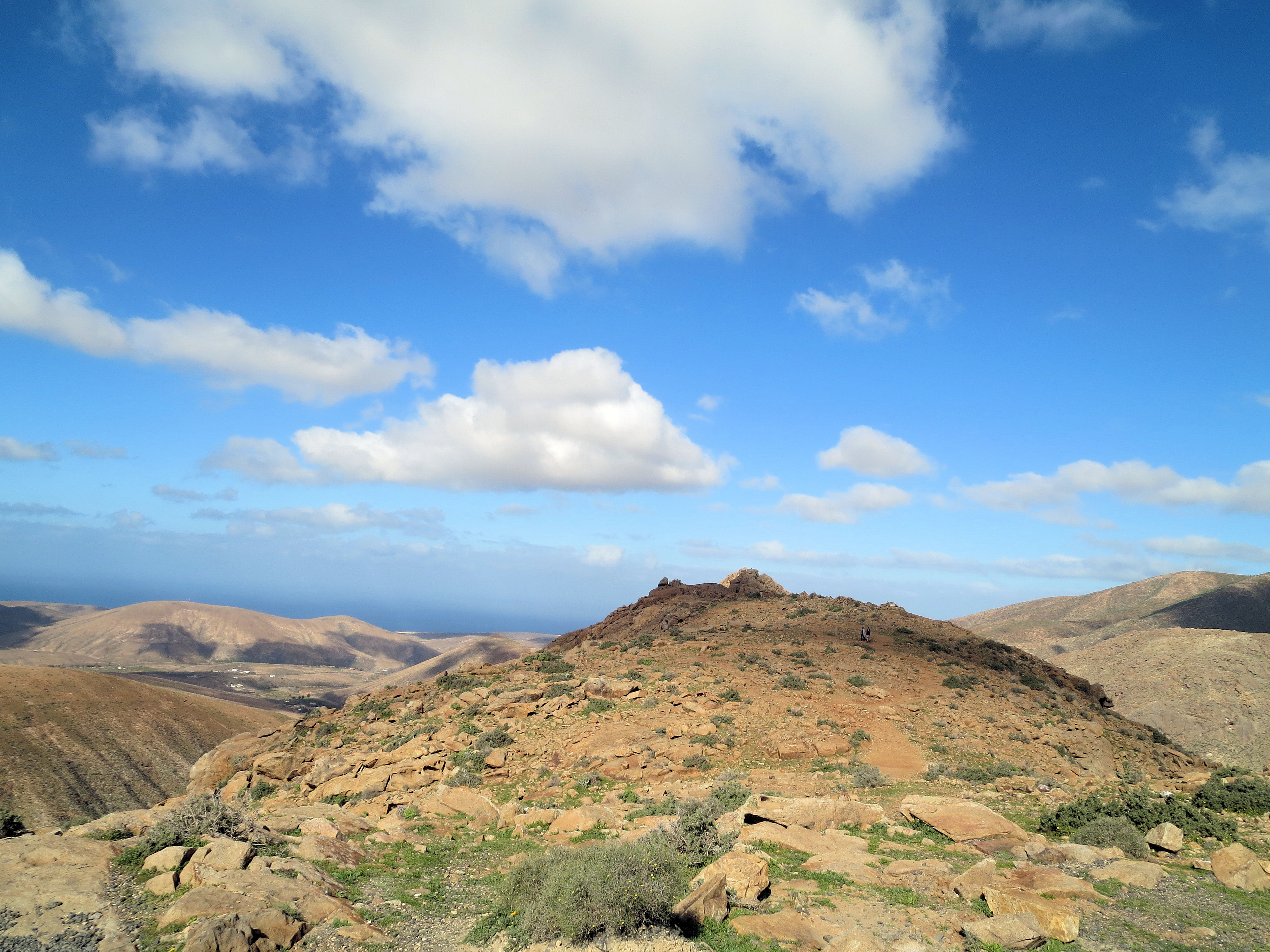
Fuerteventura? Yes,please!
Surreal pastel hills in ice-cream hues form Fuerteventura’s backbone. It’s an island of golden beaches interspersed with rugged volcanic coastlines, turquoise seas and watercolour landscapes.
High above the resorts
If you simply must have forests and lush greenery, it’s best to look elsewhere. But, if you want to be seduced by out of this world views, Fuerteventura ticks the boxes.
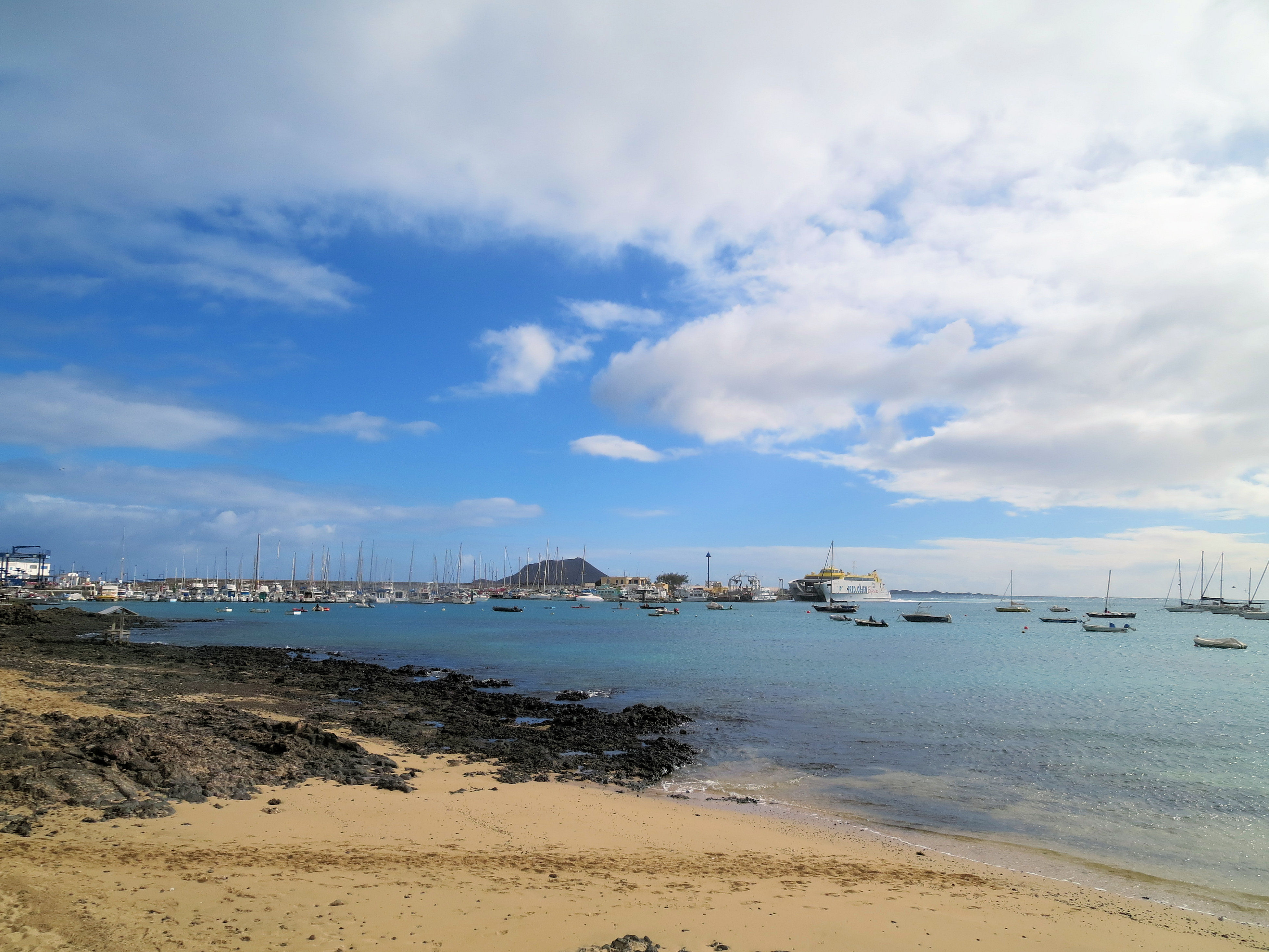
Looking across to Corralejo, Fuerteventura
Discover the island by bus, on foot or by bike to get a real feel of authentic Fuerteventura’s countryside and little white villages.
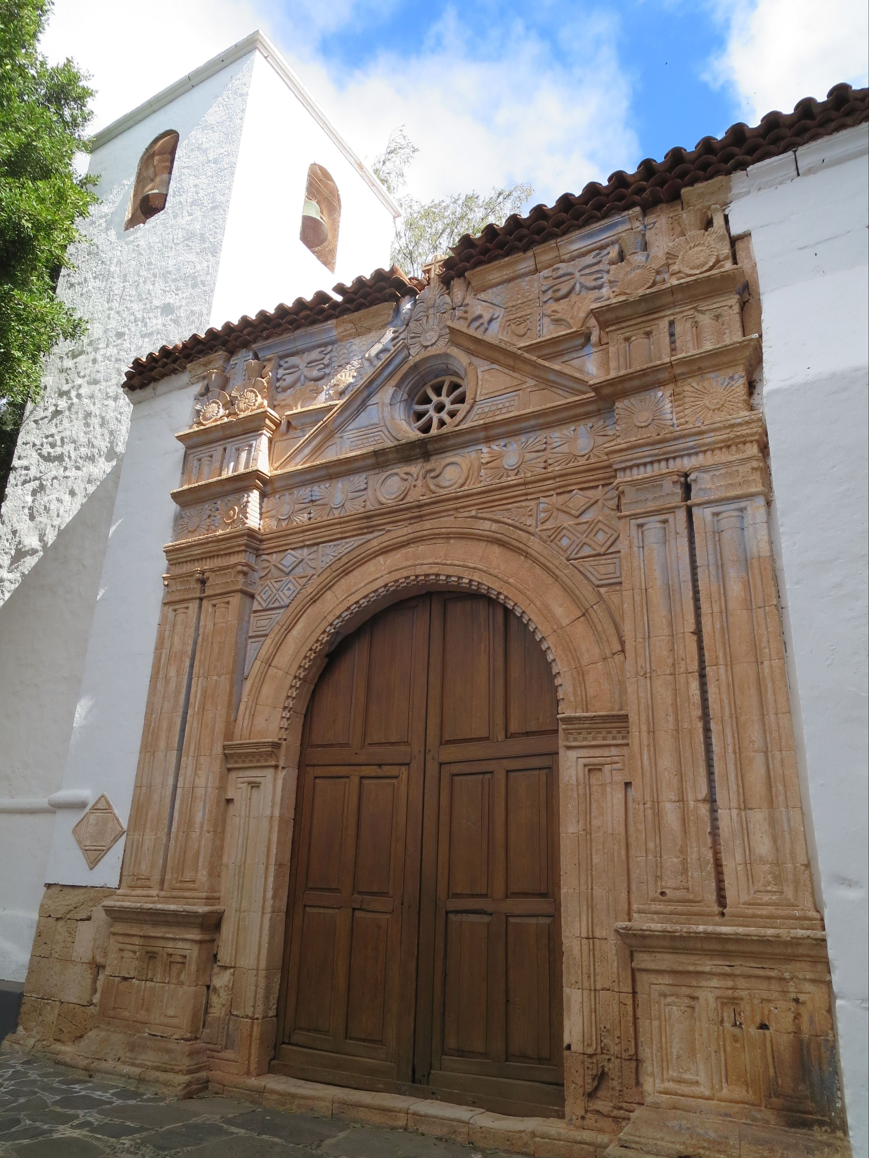
Iglesia de Nuestro Señora de Regla,Pájara
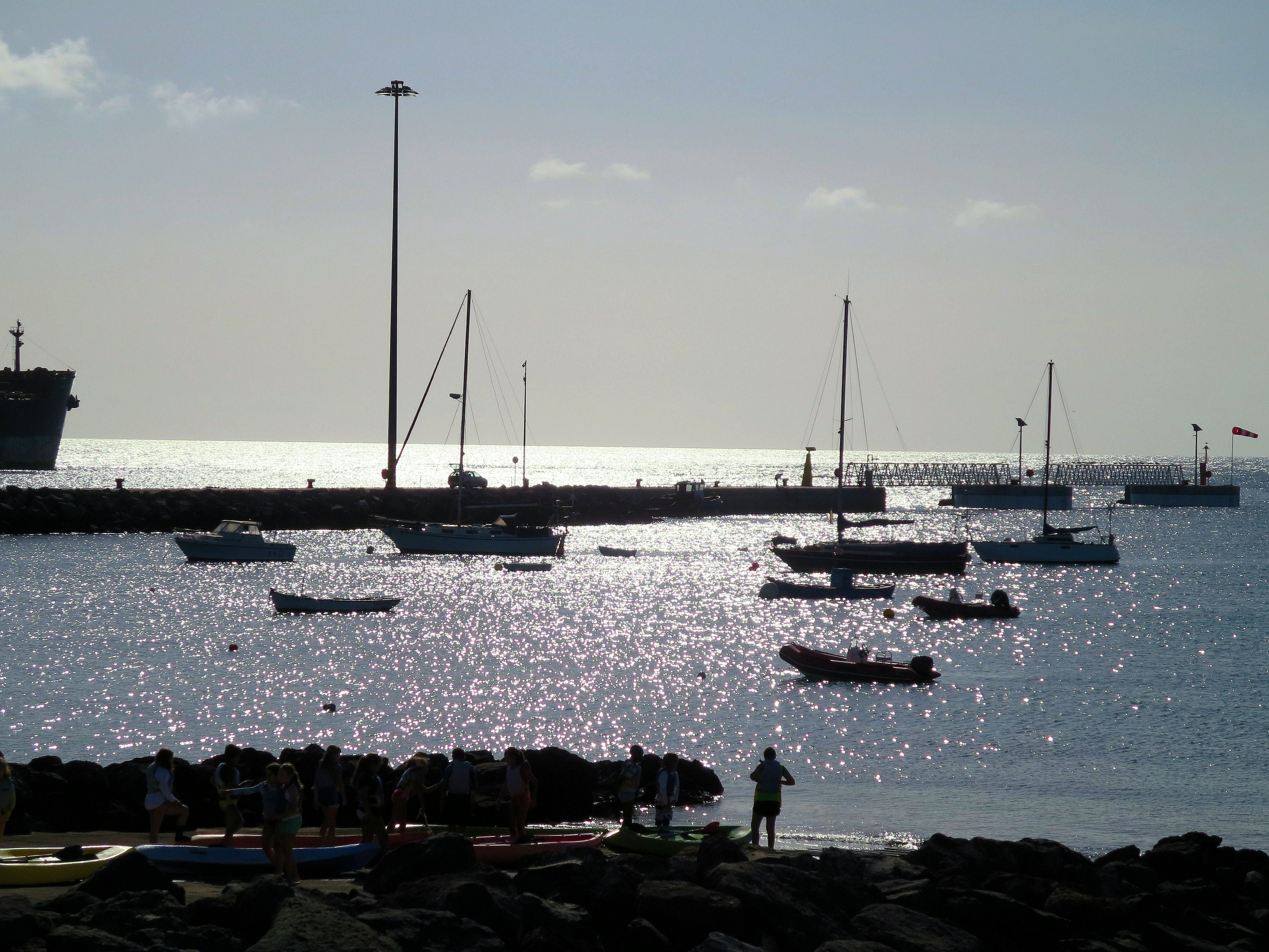
Watersports are really big here too; note that Fuerteventura translates as ‘strong winds’.

Watersport heaven on Fuerteventura’s east coast
Although the island is only around 5 hours’ flight away (from western Europe) it feels as if you’re on another planet. You’ll never forget Fuerteventura.
Nightfall, Fuerteventura
As winter’s grip takes hold, what better time to revel in the gentle twenty-something temperatures and blue skies of this unique Canary Island.
Take a look HERE for mapping information for Fuerteventura.
Madeira Walking – get the latest updates
MADEIRA WALKS VOLUME ONE AND VOLUME TWO

High above the world on Madeira’s peaks
The good news is that there are dozens of excellent walks of all types on this beautiful island. As the summer heat abates and the August visitors leave, it’s an ideal time for a walking holiday. Our resident researcher/author on the island, Shirley Whitehead, has just sent in the following important updates affecting a few routes; some changes are temporary while Shirley suggests alternative detours for some of the walks.
Volume One – Walk 9 – Monte – Bom Sucesso – Funchal
This trail is temporarily closed due to erosion of the pathways and levada following severe fire damage in 2016. Unlike most other water channels, this levada is privately owned and therefore repair work is not at the discretion of the authorities.
Volume Two – Walk 6l – Pico do Areeiro – Pico Ruivo (PR1 Vereda do Areeiro)
This route is shown as ‘Conditioned’ on the official Tourism website describing the trail as accessible along the whole length of the western footpath which passes through tunnels to arrive at Pico Ruivo. However, the route along the eastern part of the trail via Pico das Torres is temporarily closed. This situation has been apparent for some considerable time but our notes will be updated as and when the alternative route reopens.
Volume One and Volume Two – Walks 27 – 64 – 66
Due to the construction of a large reservoir on the Paúl da Serra plateau, scheduled for completion in 2020, the following walking routes are shown as amended or closed. Those affected are as follows:
Walk 27 – Levada do Paúl – Cristo Rei – Fatima Chapel, Rabaçal
This route is closed from Wp.7 where the channel crosses the regional road until it reaches the chapel of Nossa Senhora de Fátima and the Rabaçal car park on the ER105 at Wp.8.
As an alternative route, follow the notes until reaching the regional road at Wp.7 turning right for 300 metres to the junction with the ER105. Turning left from here, it’s around 1 kilometre to Wp.8 at the Rabaçal car park.
Note: the changes to the timings and distance from the original notes are negligible.
Walk 64 – Calheta Slopes – Levada da Rocha Vermelha – Levada Nova – Estrela da Calheta
This route is temporarily closed due to extensive construction work around Wp.3 where the trail becomes impassable in the area of the riverbed and Levada da Rocha Vermelha.
Walk 66 – Rabaçal: Ribeira Grande -Lajeado – Paúl da Serra
This walking trail is impassable beyond Wp. 10. As an alternative we suggest two options: (1) to follow the trail to Pico Rabaçal as a (linear out and back) or, (2) to head in an easterly direction from Wp.9 following the broad moorland path until it reaches the ER209. Turning right here, it is around 800 metres to the cross roads with the ER105 and turning right, passing the Jungle Rain Restaurant, the original trail can be picked up again from Wp.17 to return to the starting point. This alternative section is around 4.8 kms in total making the timings and distances with the original notes negligible.
For further information of closures and conditioned sections of the Officially Recommended Walking Routes go to www.visitmadeira.pt “Notice to Walkers”
For walking map and guidebook information, look here.

A spectacular waterfall on the Levada da Ribeira da Janela
Spain’s ‘forgotten corner’? Really?
Last weekend, the Sunday Times Travel called this ‘the forgotten corner of Spain’. Not forgotten by us! (read the Sunday Times article here though you will need to sign in (free) to read it).

The ancient bell-tower, Aracena Castle
We were intrigued by the Sierra de Aracena (Huelva), north-west of Seville, several years back while looking for lesser-known walking areas of Spain.

The plaza, Alájar
- It’s green, natural, not too rugged and with fascinating villages and small towns.
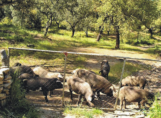
Iberian pigs
- There are inquisitive herds of pigs, wonderful flora and a laid-back air.
- Little rustic bars and restaurants serve local foods at pocket-money prices.
The mezquita at Almonaster la Real
- There are castles and a sense of history, with the Moorish legacy clearly apparent.

Los Madroñeros
- The walking isn’t too vigorous overall though many routes will whip up a healthy appetite for sampling those hearty home-made dishes.
Cortelazor
If you’re intrigued, find out what to see, where to stay and what to do (other than walking): HERE’s a USEFUL LINK.
More? Take a look HERE where you’ll find the Map and Guide Book information.
Tenerife South Walks – Back To The Future
Tenerife is a fantastic choice for walkers, as the island offers a huge number of walks in a wide variety of terrains, with choices for all levels of fitness and endurance.
Walking high above Tenerife’s southern resorts
While this is great, it also throws up a problem when researching and putting together a comprehensive walking guidebook that’s portable. Some walks had to be left out of later editions of Walk! Tenerife, but many walkers let us know that they wanted them back.
Now Discovery Walking Guides has revisited some of their early and easily accessed southern routes that many walkers remember with fondness. These have been compiled into a free pdf book. The routes are ideal for families as they are not too challenging and are easy to reach from the resort areas. Tenerife South pdf walking book is free to download.

View over Tenerife’s south coast from ‘Walkers Who Lunch’ route
For more information take a look at our latest ENews. Or go to Discovery Walking Guides website where you’ll find lots of walking information.
Almost 2018
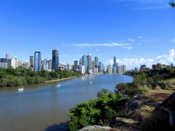
View from the clifftop walk, Brisbane River’s south bank
There are a few great walks alongside the Brisbane River. This morning we took a ‘down the cliff-face’ old path, then walked along the south bank.
There were a few others about, yet in a few hours’ time, this area will be packed with tens of thousands of New Year revellers watching the fireworks launched from huge barges in the centre of the river.
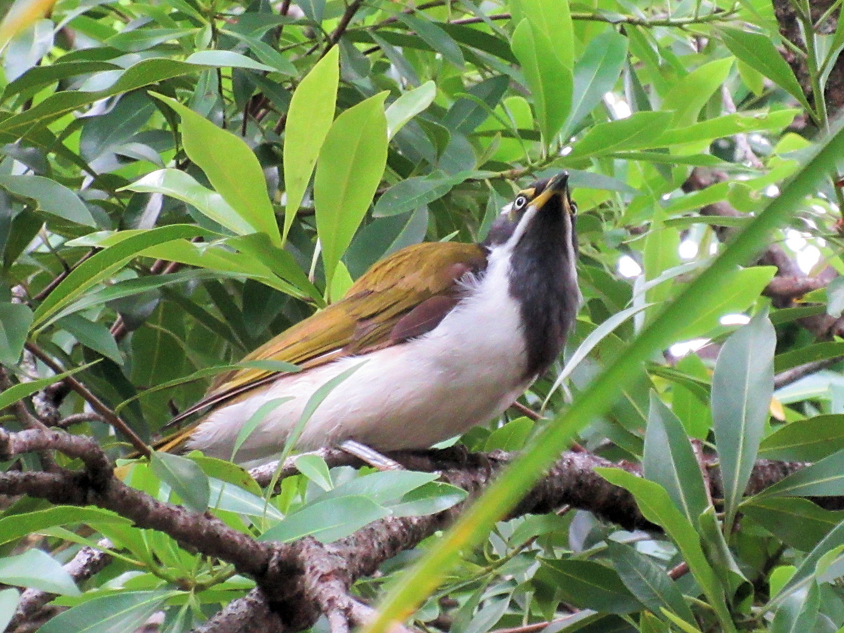
Blue-faced Honeyeaters feeding from trees lining the route
For now, it was an enjoyable walk, wildlife adorning the route here and there.

Eastern Water Dragons sunbathe along the walk along Brisbane River’s south bank.
So, almost 2018. Wishing all a happy, healthy 2018.
Warm Weather Walker – or Intrepid Snow-Hopper?

Blackstone Ridge, England’s South Pennines
On flicking through outdoor activity magazines, you’ll see plenty of photographs of fit-looking intrepid types posing on rugged, windswept mountain peaks wearing plenty of layers. Is this you? Do you wish you were here? Or do you long to get away to kinder climates?
Do you fit fairly neatly into one of the following groups?
THE INTREPIDS, striding through winter landscapes, dealing with biting winds and snow-capped hills in full weather-defying gear, and feeling invigorated as you finally reach a cosy country pub for a well-earned lunch.
How about England’s rugged and beautiful South Pennines? They’ve had quite a bit of a snow-dusting already this winter, although this pic taken on Corn Du was taken in summer.
Tenerife, walking above the west coast
WARM WEATHER WALKERS, escaping to warmer climes when winter bites at home, exploring in t-shirt, shorts, sunhat and sun-cream under a blue sky, sweating as they gain the heights, then
relaxing on a beach as the sun goes down.
There’s a whole lot of destinations within a 4-6 hour flight from northern Europe; Tenerife is ideal for pretty reliable gentle temperatures with several sunny hours per day.
For lots of walking destination ideas and inspiration, take a look HERE.
Of course, you might well have a boot in each camp so to speak, getting the best of all walking worlds. It would be great to know your opinions.
Beautiful Madeira – Walking Route Updates (Oh, and Porto Santo)
Madeira – a firm favourite

Stunning views to Encumeada, Madeira (copyright author/researcher Shirley Whitehead)
Madeira is beautifully green and floriferous but sometimes the necessary abundant rainfall (or in high summer, forest fires) lead to temporary walking route closures. Thankfully, the island authorities are quick to pinpoint problem sections and repair them. In any case, there are so many great walks that you’ll always find plenty to choose from anytime that you visit.
Have a look HERE for walking information and suggested walking guidebooks and detailed walking maps.
Approaching Ribeira Fundo, Madeira (copyright author/researcher Shirley Whitehead)
At the time of writing, the official PR walking routes currently affected by temporary closures are:
PR12 – Caminho Real da Encumeada
PR14 – Levada dos Cedros
PR16 – Levada Fajã do Rodrigues
PR17 – Caminho do Pináculo e Folhadal
PR19 – Caminho Real do Paul do Mar
Go to the official pages for up-to-date information regarding route closures.
-0-
Descent to the land Bridge, São Lourenço Madeira (copyright author/researcher Shirley Whitehead).
Going to Madeira? Hop to Porto Santo
If you’re going to Madeira, why not take a day or two take a look at little sister island Porto Santo?
Walkers can try the two official PR walking routes, PS PR1 – Vereda do Pico Branco e Terra Chã and the PS PR2 – Vereda do Pico Castelo
For the official Porto Santo tourist information including walking look HERE.
The ferry from Funchal, Madeira to Porto Santo takes about 2 hours 15 minutes. Please check the freey information website for departure times and note that in early January each year ferries are often out of service for regular maintenance. Ferry information HERE.
-0-
Porto Santo Nature Trail Event 03/04 March 2018
This event is the 5th stage of the “Circuit Trail Madeira 2017/2018”. As you can see, the adult routes look pretty challenging – though you do have until March 2018 to get into shape!
- Porto Santo Nature Trail (PSNT) – 42.3 km and 1926m climb (circular format);
- Trail do Porto Santo (TPS) – 21.9 km and 107m climb (linear format);
- Mini Trail do Porto Santo (MTPS) – 8.9 km and 395m climb (linear format);
There’s also a children’s event:
Kids Trail do Porto Santo (KTPS) between 1 km and 3 km (linear format).
For all the information, look HERE.
-0-
You might also find this post useful for getting out and about on Madeira.
