
A Little Good News – Free Digital Maps For Everyone
We may not be able to go adventuring for a while yet. However, we can plan ahead for when we can travel again. Have a look at our digital maps, clear and fully detailed for adventure planning of all kinds, including walking, climbing, biking or maybe daydreaming about your next big trip.


There’s a whole hatful of exciting free maps to be had. Take a look at this list of adventure destinations.
Balearic Islands
Mallorca
Menorca
Ibiza
Formentera
Madeira
Azores
Greek Islands
Corfu
Zante (aka Zakynthos)
Malta, Gozo & Comino
Spanish Mainland
Axarquia / Costa del Sol
Costa Blanca
Alpujarras
Sierra de Aracena

Canary Islands
Gran Canaria
La Palma
Tenerife
La Gomera & El Hierro
Lanzarote
Fuerteventura
We hope that we’ve inspired you to think about your next big adventure. To get your free digital maps, please look here https://www.dwgwalking.co.uk
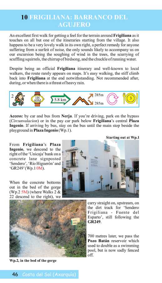
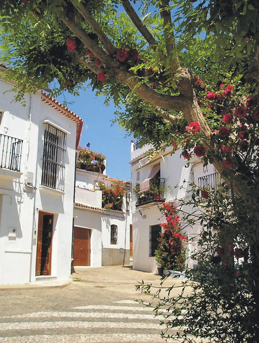
Axarquia? Think Costa del Sol
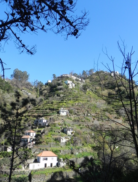
There’s so much more to Spain’s Costa del Sol than sun, sea and sangria. Turn inland and you’re looking at the Axarquia, an unspoiled wildly beautiful and rugged area, waiting for you to explore it. Mountains, wooded hills and plunging gorges, dotted with small towns, tiny settlements and farmsteads give a sense of the true heart of this unique region.


Almond, olive, lemon and orange groves thrive in valleys fed by springs and from streams descending from the mountains, fertile land carved into terraces to maximise the best agricultural areas.
The best way to explore is on foot or by mountain bike. Let’s get started with this free sample circular walk, quite short and not too energetic.


Find out lots more from Discovery Walking Guides HERE.
You’ll also find information about using your device for accessing walks in the Axarquia as well as how to get your hands on the area’s most detailed guidebook and map. There’s also another free walk (pdf format) for you to download.
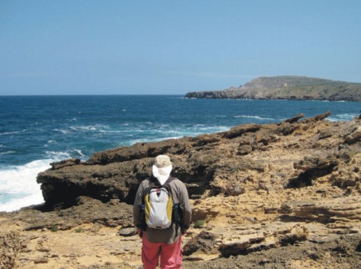
Lanzarote – what an experience!

Walking in the Haria region of Lanzarote
Each of the Canary Islands has its own unique personality. Lanzarote is strangely surreal. There’s plenty of wide open unspoiled places ideal for exploring by car, bike or on foot.

Lanzarote coastal adventure
Before you visit, get a really good map – and perhaps a walking guidebook.
The best map by a long way is Lanzarote Tour & Trail Super-Durable Map.
But don’t take our word for it – there are dozens of user reviews on line. Here’s a few of them:

Lanzarote Toast Rack Thingy
Kung Fu Panda
5.0 out of 5 stars Highly recommended if planning a driving holiday on Lanzarote
Compared to many “travel” maps this map is very good with an impressive level of detail, including different road types, paths and tracks, contouring, etc. The map itself is printed on a very durable (and ultimately recyclable) plastic sheet material. I would highly recommend this to anyone planning to drive around Lanzarote and perhaps to combine that with some walking. I have just driven around 500 miles during a 10-day holiday and found this invaluable.
Amazon Customer
5.0 out of 5 stars Great product.
I’m a regular user of OS maps & wanted a map of Lanzarote for our forthcoming holiday. This map, with the accompanying book, looks just the job. I particularly like the way the map & book cross-reference each other & the useful information about the walks.
Dylan
5.0 out of 5 stars great product
Fantastic map at a very reasonable price. Large scale shows walking trails etc. Great for research prior to our planned trip.
Freddie
5.0 out of 5 stars Excellent
Excellent map, a must for driving around as road signs are atrocious on Lanzarote for independent motorist! Very good for walks too. Also, yes bended, folded, chucked on back seat & footwell several times, and not a single tear of hole on the folds. Would recommend & will buy for other Canaries when we visit them.
Lanzarote for sunshine, blue seas, amazing huge skies and volcanic sci-fi landscapes. See it for yourself. You’ll never forget it.

Los Cocoteros, Costa Teguise
Gran Canaria – it’s a whole new world
They don’t call it the ‘mini-continent’ for nothing!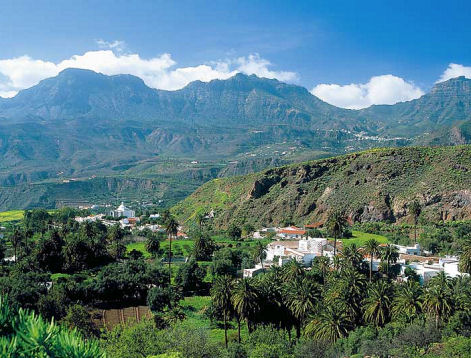
Though it’s under a 5 hour flight away (from the UK and western Europe), it feels like a different world.
There’s plenty to see and do, though the best thing of all is to walk the trails and marvel at the views, the forests, flora and fauna and the ancient villages.
Gran Canaria Tour & Trail Super-Durable Map is now in its 5th edition. This is the level of detail you need when exploring the island.
Here at Discovery Walking Guides, we’ve watched the rise and rise of this fascinating island as a hiking/biking/touring destination over the past few years. Gran Canaria has emerged from the shadows to become a ‘must walk’ destination in the Canary Islands.
There’s wonderful dramatic scenery and unspoilt villages, plus clean, spacious beaches for the days you don’t want to walk (or bike or drive).

To get the best from your visit, get the best map. Here’s a small segment – look at that clarity and detail. To find out more about the map look here.
There’s plenty of walking information from Rambling Roger, who lives there and knows the island like the back of his hand.
If you fancy 18-23C and mostly sunny days from December to April, hop over to Gran Canaria.
Guess The Island

“The steepest island in the world, the deepest crater, the clearest skies: volcanoes you can climb without being shot into orbit; a subtropical forest minus the slimy things slinking up your trouser leg; black beaches, blue seas, high mountains, vegetation that is literally flamboyant, everything linked by 1080 kilometres of waymarked paths, and all virtually untouched by tourism.” (Author/researcher Charles Davis)

More clues? Okay then – it takes under 5 hours to fly there from the UK. It’s a whole lot warmer and sunnier than most of northern Europe, definitely so for more than half the year. Sometimes it is referred to as, ‘La Isla Bonita’.
 So, have you guessed the location of this alluring destination? Check if you are correct, or give in and find out by looking HERE.
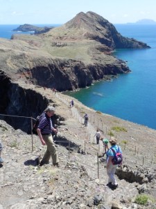
Madeira – Garden Isle

Taken by author/researcher Shirley Whitehead – stunning views from Encumeada.
Ah, Madeira! It’s an island that draws visitors back again and again, with its unique plant life, a wide range of wonderful walking from strolls to challenging mountain routes, and a benign climate, making it a year-round destination.
One of the best things about walking here is the sheer variety of routes. If you want gentle, level paths, there are many levada-side routes taking you through lush, natural green scenery. Mountain-lovers have a wealth of inspiring options to choose from. You want views? Wild flowers? Unspoilt villages? Short strolls? Challenging all-day routes? They’re all here.
Madeiran island authorities are well aware of the importance of walking to many of their visitors and do a great job of maintaining routes, keeping them open and safe.

If you’re thinking of a visit to the island, you’ll get much more value from your visit with a good guide book and map in your pocket. Have a look HERE for recommendations.
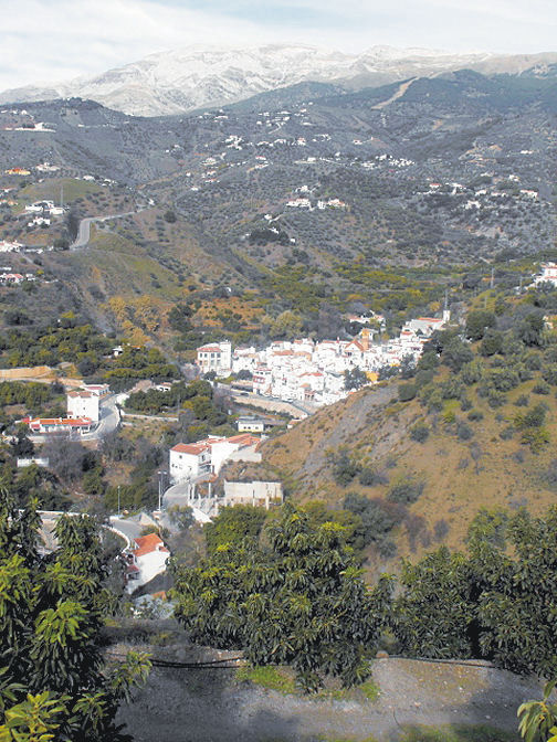
Spain’s ‘forgotten corner’? Really?
Last weekend, the Sunday Times Travel called this ‘the forgotten corner of Spain’. Not forgotten by us! (read the Sunday Times article here though you will need to sign in (free) to read it).

The ancient bell-tower, Aracena Castle
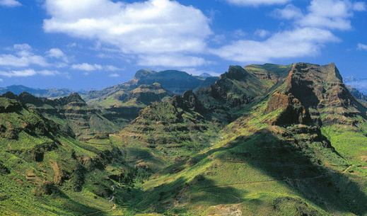
We were intrigued by the Sierra de Aracena (Huelva), north-west of Seville, several years back while looking for lesser-known walking areas of Spain.

The plaza, Alájar
- It’s green, natural, not too rugged and with fascinating villages and small towns.
Iberian pigs
- There are inquisitive herds of pigs, wonderful flora and a laid-back air.
- Little rustic bars and restaurants serve local foods at pocket-money prices.
The mezquita at Almonaster la Real
- There are castles and a sense of history, with the Moorish legacy clearly apparent.

Los Madroñeros
- The walking isn’t too vigorous overall though many routes will whip up a healthy appetite for sampling those hearty home-made dishes.
Cortelazor
If you’re intrigued, find out what to see, where to stay and what to do (other than walking): HERE’s a USEFUL LINK.
More? Take a look HERE where you’ll find the Map and Guide Book information.
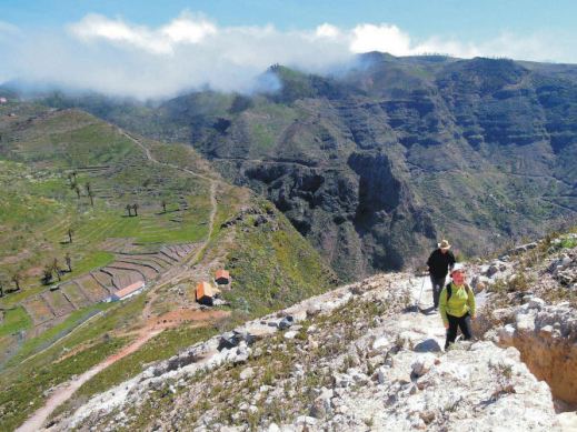
Where In The World? Pampaneira and Bubión
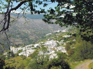
Bubión village, seen on Walk 3
The Telegraph Travel 15.12.17) wrote an article entitled ‘15 beautiful villages in Spain you’ve probably never heard of‘

Both villages lie in the Poqueira valley, Alpujarras.
We’ve certainly heard of most of them and two in particular took our attention; Pampaneira and Bubión. They are both ‘white villages’ in Spain’s Alpujarras, east of Granada.
 What a place to walk! Spring is a great time to visit. There’s likely to be snow on the mighty peaks to the north, while Spring flowers burst through on the lower slopes and in the valleys.

Section from ‘Alpujarras Tour & Trail Map’
There’s more Alpujarras walking, mapping and digital information here.
Walking on La Gomera, Canary Islands – a User Review
Thanks go to David L, just back from walking (and golfing) on the Canary Island of La Gomera. He’s been there before and knows the walking pretty well, and has sent us a detailed review of some of the walks he did (self-adapted in part) using Walk! La Gomera guidebook and La Gomera Tour & Trail map along with digital mapping which he accessed on his smart phone.
Here’s part of David’s walking report:
On 18 December 2017 at 20:24 David L wrote:
“Where? La Gomera – Jardin Tecina Hotel
Walks 2017.11-12.
We did three – or perhaps more accurately, 2.5. We took golf clubs and tennis rackets, too – and my wife is not a bad walker, but not as keen as I am.
We were looking for walks with the least amount of travelling possible, avoiding those with vertigo warnings, and ideally, in the sun.
The walks we did were:
- Playa Santiago to Targa With Variation (Walk 10)
- Degollada de Peraza to San Sebastian (Walk 1)
- Playa Santiago – Baja de Guane – El Aguila – La Trinchera – Playa Santiago (Short Walk)
- Navigational Aids
All walks were undertaken with benefit of the digital version of the Tour & Trail Map on iphone via Memory Map, and hard copy print of the relevant area – one side with route marked – the other unmarked. Full hard copy Tour & Trail Map and Walk! La Gomera Book taken but not referred to en route.
- Weather
Previous visits/walks have been in February and December. In comparison, the countryside was far more burnt up on this occasion, with virtually no greenery, and noticeably warmer than Christmas, but cooler than Feb. We have had NE Alisio weather patterns on previous visits, but, on this occasion, the wind was between south and west.
- Walks
4.1 Playa Santiago To Targa With Variation (Walk 10)

Looking down to Playa Santiago
I had done this walk twice previously, so knew roughly what was involved. The part through the former cultivation terraces is probably fair enough for one experience but, in my view, not more.
So we headed up your down route, which was hot work in mid 20s C, but OK.
The route to the climb up the Playa Santiago cliff is completely different to the map – but more similar to the blow up on the reverse.
Had lunch in the shade close to the FRANCISCO DIAZ BARROSO NAMEPLATE Waypoint. Waypoint beyond this particularly useful as otherwise not clear when to head up the hill to the right – though clearer looking back on it.
Turned left to Targa itself and then along a couple of paths to Alajero. Bar where second path joins road up from Playa Santiago closed. Turned off into central Alajero, where found an open bar with Bus Stop opposite. Perfect! Bus turned up on time and dropped us off by Jardin Tecina for next to nothing.
Conclusion on 1. I think the route we did is better than the one in the book – but I was looking for something different to the route through the cultivation terraces. Probably worth including as an alternative. The variation at the top was not planned in advance, but evolved when we got there.
The leg adjacent to the stream south of Targa is tricky/ steep sided in places with few foot/handholds.
An unexpected hazard was the local authority painting some of the bus stop benches – but not warning of this! My wife wrote off a pair of trousers! Not sure whether this is a seasonal event!
Overall, an enjoyable and rewarding walk. Nice to get up into the cool – and amongst some genuine village life.
4.2 Degollada de Peraza to San Sebastian (Walk 1)

San Sebastian port, La Gomera
This is one of the more accessible walks from Jardin Tecina without vertigo risk- although, by analysis of non-vertigo walks, I have since found a more accessible one, at least to start.
We had toyed with which is gazetted as a’ vertigo trial’ but I had done the bottom 75% of this on my own on a previous visit, and had backed off when I reached a very sheer slope; furthermore, a section of this looked very sheer on Google Earth. It also looked pretty aggressive from the top of Degollada de Peraza.
Up here, we were in cloudy conditions, but the cloud base was well above us.
Shortly after the start, there was no observable issue with the landslide you mention. The path is quite steep sided in places and flat sided in others. Throughout the first 75 % or so, it is dominated by views of the main road from San Sebastian up to Degollada – and traffic noise from it, which was a pity.
On the plus side, we had some good views, and encountered a watchful raven, which I had not previously seen on the island.
The run down into San Sebastian was hard work, along a made up but very uneven ‘donkey’ track.
To return, we had the options of buses or the Fred. Olsen Ferry. We chose the latter, to give us a chance to relax a bit, an opportunity to see this section of coast, and avoid the lengthy/somewhat tedious road route.
We enjoyed the ferry ride, albeit that it was late starting by half an hour, it appeared because of a mechanical issue.
Conclusion on 2. We enjoyed the walk, but were disappointed by the main road/traffic noise impact and the extent of uneven donkey tracks on the descent. Probably good for anyone to do once, but I do not think we would do it again.
4.3 Playa Santiago – Baja de Guane – El Aguila – La Trinchera – Playa Santiago (Short Walk)
This was really a ‘fill in’ while my wife wanted to sunbathe – which I cannot do. I have a friend who has a holiday Property Bond Investment and had stayed at ‘Balcon de Santa Anna’ – and wanted to have a look at this – and the walk round the cliffs outside shown on the map looked interesting.
All went according to plan – having your map on my iphone proved ever useful, as I was not sure how long I was along the walk, on several occasions. Good views of the cliffs and breaking seas – and a pleasantly made up path. Also a short link at the end down to Playa Santiago.
Conclusion on 3. An enjoyable and worthwhile short walk which it might be worth mentioning.
- Overall Conclusion On Walks
We expanded our horizons – though did not visit the Valle Gran Rey/El Cercado area this time.
We enjoyed our walks – which were much aided by your materials and, particularly, the digital functions, which had either not been available or we hadn’t been aware of before. The map on the iphone with the flashing curser and marked waypoints really is a massive help.
We were surprised how warm the weather was – particularly having experienced quite a cool Christmas here once. The countryside was much the most frazzled we had ever seen it.
I am quite a keen bird watcher. I missed the plain swifts over the mountains and villages, normally in abundance. On checking, I see they return to Africa for November and most of December. On the plus side, we had a hoopoe in the hotel grounds, where there were singing chiffchaff and blackcap, and the aforementioned raven.
I attach copies of our tracks, in case of interest. As your book suggests, we took a good bit longer than you did! I also include some vehicle/ferry tracks and one round of the golf course, in case of interest. The speed the ferries travel at is notable – and the time saving from San Sebastian to Playa Santiago by sea, as opposed to land. The golf round was quicker than for an average UK course – because the hole sequence was downhill?”
-0-
Thanks David! User feedback is like gold!
Beautiful Madeira – Walking Route Updates (Oh, and Porto Santo)
Madeira – a firm favourite
Stunning views to Encumeada, Madeira (copyright author/researcher Shirley Whitehead)
Madeira is beautifully green and floriferous but sometimes the necessary abundant rainfall (or in high summer, forest fires) lead to temporary walking route closures. Thankfully, the island authorities are quick to pinpoint problem sections and repair them. In any case, there are so many great walks that you’ll always find plenty to choose from anytime that you visit.
Have a look HERE for walking information and suggested walking guidebooks and detailed walking maps.
Approaching Ribeira Fundo, Madeira (copyright author/researcher Shirley Whitehead)
At the time of writing, the official PR walking routes currently affected by temporary closures are:
PR12 – Caminho Real da Encumeada
PR14 – Levada dos Cedros
PR16 – Levada Fajã do Rodrigues
PR17 – Caminho do Pináculo e Folhadal
PR19 – Caminho Real do Paul do Mar
Go to the official pages for up-to-date information regarding route closures.
-0-
Descent to the land Bridge, São Lourenço Madeira (copyright author/researcher Shirley Whitehead).
Going to Madeira? Hop to Porto Santo
If you’re going to Madeira, why not take a day or two take a look at little sister island Porto Santo?
Walkers can try the two official PR walking routes, PS PR1 – Vereda do Pico Branco e Terra Chã and the PS PR2 – Vereda do Pico Castelo
For the official Porto Santo tourist information including walking look HERE.
The ferry from Funchal, Madeira to Porto Santo takes about 2 hours 15 minutes. Please check the freey information website for departure times and note that in early January each year ferries are often out of service for regular maintenance. Ferry information HERE.
-0-
Porto Santo Nature Trail Event 03/04 March 2018
This event is the 5th stage of the “Circuit Trail Madeira 2017/2018”. As you can see, the adult routes look pretty challenging – though you do have until March 2018 to get into shape!
- Porto Santo Nature Trail (PSNT) – 42.3 km and 1926m climb (circular format);
- Trail do Porto Santo (TPS) – 21.9 km and 107m climb (linear format);
- Mini Trail do Porto Santo (MTPS) – 8.9 km and 395m climb (linear format);
There’s also a children’s event:
Kids Trail do Porto Santo (KTPS) between 1 km and 3 km (linear format).
For all the information, look HERE.
-0-
You might also find this post useful for getting out and about on Madeira.
