
Are You Off To Walk Madeira? Check Before You Walk.

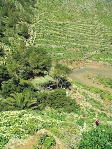
Aloe aborescens clinging to Madeiran cliffs
Madeira! What a great desination, especially at this time of year.
Swapping the dark and cold of Northern Europe for Madeira’s green and spring-like mountains is a popular choice at this time of year.
If you are planning to walk there, it’s worth checking that the paths you’re planning on following are open. The best place to look for information is on the official ‘Visit Madeira’ tourism website. To see which routes are open or temporarily closed, LOOK HERE.
If you are already on the island, you can also ask in Tourist Offices who usually have up to date information on walks that are open/closed.

A spectaculat waterfall on the Levada da Ribeira da Janela
At the moment only three of the official routes are temporarily closed. The authorities are vigilant and usually restore routes quickly; often, the problem is a landslip after heavy rain.
The three routes to avoid at the time of writing this are:
PR1 – Vereda do Areeiro
Temporarily closed
PR12 – Caminho Real da Encumeada
Temporarily closed
PR19 – Caminho Real do Paul do Mar
Temporarily closed

Levada Nova, Madeira
There’s so much great walking on Madeira that you’ll find plenty to tempt you, from strolls to all-day high altitude challenges. Even if you aren’t keen to do much walking, it’s a great idea to use the local buses which give you brilliant (sometimes a bit hairy!) adventures around the island for pocket-money prices.
There’s a great bus map available, also really useful as a driving map; LOOK HERE for details of the Madeira Bus & Touring Map.
For more information including details our two Madeira Walks guidebooks Madeira Tour & Trail Map and digital mapping for Madeira, take a look at Discovery Walking Guides; Madeira pages.
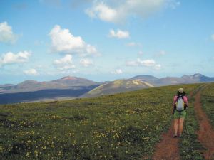
Lanzarote; rains bring the desert to colourful life!
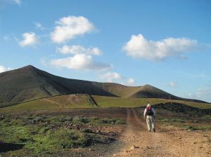
Barranco del Malpaso, Lanzarote
Residents on the Island of Lanzarote tell us that more visitors than usual have been enjoying the great outdoors on this unique island during November and December this year. The dramatic volcanic landscape is unforgettable, though is usually desert-dry with little natural green to see.
It doesn’t rain much (or often) on this arid Canary Island, so recent falls have been most welcome, bringing colour and plant life back to otherwise arid areas.

Helechos, Lanzarote
What a great time to visit! Warm days and sunshine (average of six hours per day in December, even more in January), plus the chance to see the colourful green swathes and flower carpets that happen for only a few weeks each year. Walk, hire a bike or car, or jump on a bus.
La Geria, Lanzarote
There’s plenty of interesting information about the island on the Lanzarote Information website; use the link below.
Take a look at the really useful Lanzarote Information website.
For more on this fascinating and often surprising island, including printed and digital mapping and walking information, take a look here:-
Montaňa Corona, Lanzarote
Gran Canaria, Canary Islands – New 3rd Edition Tour & Trail Map
It may not be as well-known as some of the other Canary Islands – that means there’s plenty of room for you to explore this bold, beautiful and dramatic island.
You want mountains and ravines? You want remote, unspoiled sleepy villages? You want abundant verdant woodlands, paths and tracks? You want endemic plant life found nowhere else? You’ve got them all on the island of Gran Canaria.
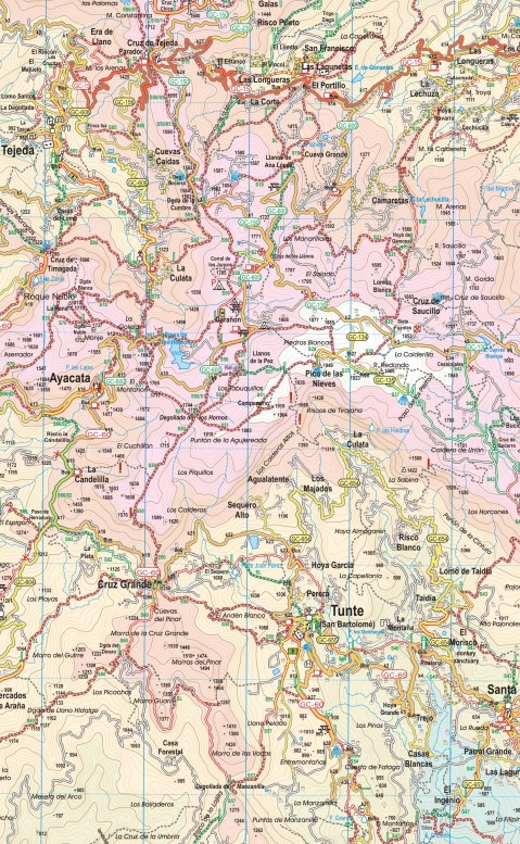
Map section, Gran Canaria
This third edition includes new walking routes, even clearer ways to show routes and other map features and all the detailed cartographic information that afficionadoes of the Tour & Trail series have come to expect and rely upon. Take a look at this small extract (left).
Detailed updating and addition of new walking routes and additional data have been researched by our ‘on the ground’ walking expert, ‘Rambling Roger‘ and his fellow walking researchers who know the island like the backs of their hands.
If you’re looking for an adventure away from the European winter, with almost guaranteed good weather and great walking (definitely guaranteed) then take a look at Gran Canaria.
(Custom Map digital edition for Garmin Users is available from Discovery Walking Guides’ website. Digital editions are available for 3G/4G GPS apps from Viewranger and My Trails.
Walking Newsletter Now Available
Take a look at Discovery Walking Guides latest newsletter; topics include Menorca, Lanzarote, free digital maps and Walk! books and more. Click the link to read all about it.
Formentera? Where’s that? UPDATE
You’d be forgiven for not knowing the location of this little gem of an island. It’s surprisingly easy to reach and has a delightful personality all its own.
Formentera is one of the Balearic Islands to the east of mainland Spain, in the Meditteranean. It’s the little sister island to Ibiza and is only a 30-minute ferry trip away.
Here’s a few facts and figures:
- Beaches, beaches – so many of them for such a small island and white, clean and beautiful.
- The island had been occupied by the Carthaginians, then the ancient Romans, the Visigoths, the Byzantines, the Vandals, and the Arabs.
- Eventually the island added to the Crown of Aragon and later became part of the medieval Kingdom of Majorca.
- The main island of Formentera is 19 kilometres (12 miles) long and is located about 6 kilometres (4 miles) south of Ibiza in the Mediterranean Sea.

San Francesc, Formentera
- The major villages are Sant Francesc Xavier, Sant Ferran de ses Roques, El Pilar de la Mola and La Savina.
- Formentera comprises one municipality, also called Formentera, and has a population of 9,962 (as at 1 January 2010).
- Its land area is 83.24 square kilometres (32.1 sq mi).
- Cars are easily hired in the port and there’s a good choice of conventional or electric vehicles. There are more electric vehicle charging points here than anywhere else in the world, given its land area.
- Mopeds and bicycles are available to hire; the terrain is mostly flat and there are dedicated cycle lanes in some areas.
- The island has four Martello towers.
- Ferries to Formentera from Ibiza operate every half hour in high season.
- A local Ibizan (eivissenc) variant of the Balearic dialect of the Catalan language is spoken in Formentera though English and other European languages are frequently heard too.
Discovery Walking Guides carried out an intensive cartographic survey on Formentera a few weeks back and design of the new Formentera Tour & Trail Super-Durable Map is well under way.
For full details about the new Formen tera map, click here.
KICKSTARTER PROJECT
How would you like to be part of the launch of this exciting new map project? For a modest pledge you can help this project to fly – and receive free maps too.
There’s still time to be a part of this exciting project.
Take a look at DWG’s Kickstarter Project here.
Gran Canaria – wonderful walking
 Thanks to Chris Kurton who has just had a wonderful walking holiday on the dramatic Canary Island of Gran Canaria.
Here’s one of Chris’ photos taken while walking; a view from a col towards Gui Gui.
See the GPS record of one of Chris’ routes, a circuit of Mount Tauro, http://connect.garmin.com/modern/activity/695801198/share/0?lang=en
See lots more images taken by Chris while walking the island in Walking The World group on Facebook; click https://www.facebook.com/groups/discovery.walking/
And for information on maps and walking on Gran Canaria see http://www.dwgwalking.co.uk/gcan.htm
Isle Of Wight Adventure Package – now released
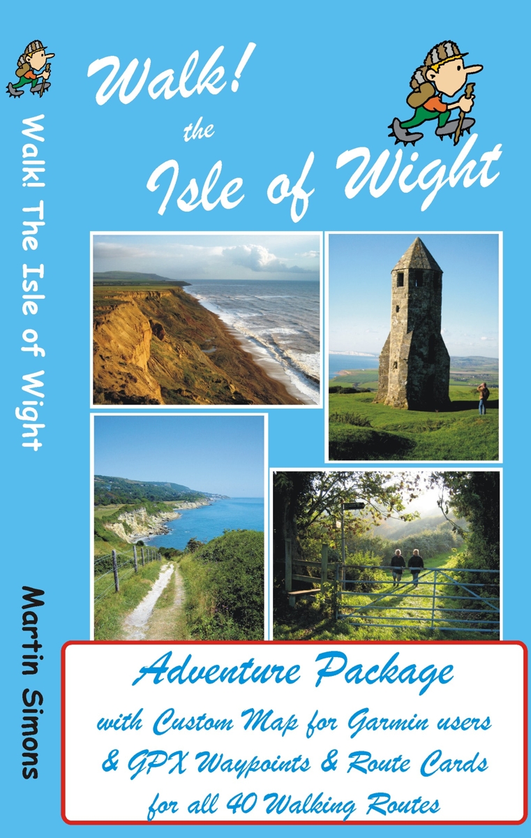
GPS users take note; our latest edition Walk! The Isle of Wight walks have been transformed into pdf route cards and re-packaged with ‘OSlike’ digital mapping for the Isle of Wight and gpx waypoints.
This is a great time to explore the Isle Of Wight; school holidays are almost over and there’s always the chance of some late summer sunshine.
Isle of Wight Adventure Package:-
Isle of Wight ‘OSlike’ Custom Map
gpx waypoints,
pdf ebook of 41 A4 pages
– all delivered as a ZIP file download for £11.99
See all the details here:-
Walking the Yorkshire Dales – Just the Thing for Spring
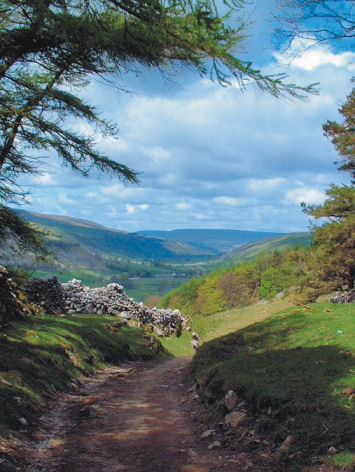
Wharfedale – following Walk 5

The village of Gayle, visited on Walk 25
The Yorkshire Dales is deservedly well-loved for its history, the beauty of its landscapes and its many unspoilt little stone villages, most with tempting pubs.
The best way to appreciate the Dales is on foot – and one of the very best times of year to do so is Springtime – right now!
If you have a Garmin GPS you can download Yorkshire Dales Custom Maps (there are two to cover the area) and get going on the trails.
For more information about the digital mapping for the Yorkshire Dales, see:- http://www.dwgwalking.co.uk/garminydalesnecustommap.htm
– and http://www.dwgwalking.co.uk/garminydalesnwcustommap.htm

The spectacular River Strid (Walk 1)
We recommend the book Walk! The Yorkshire Dales (North and Central) for the best walks (and the best pubs on route too)
See:- http://www.dwgwalking.co.uk/yorkshire%20dales%20N&C.htm
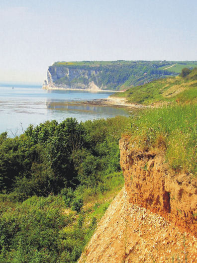
Worth A Read – article on the Isle of Wight in the Weekend Telegraph

Expansive views on Week Down (walk 27, Walk! The Isle of Wight)
There’s a good article on the Isle Of Wight in ‘Coastal England’, a supplement with yesterday’s (15 March 2014) Weekend Telegraph.
Looking towards Whitecliff Bay from the clifftop path (Walk 40, Walk! The Isle of Wight)
The article homes in on the rich history of the island and offers plenty of ideas of things to do. For such a small place it has a wealth of festivals, including the Isle of Wight Walking Festival.
Find it here: http://www.telegraph.co.uk/sponsored/travel/visit-england/10676115/things-to-do-on-the-isle-of-wight.html
For details of walking there see http://www.dwgwalking.co.uk/isleofwight.htm
For information on mapping look here: http://www.dwgwalking.co.uk/garminisleofwightcustommap.htm
La Axarquia, Costa del Sol: Thanks Bill L for your report

Taken while on the Loma de Las Quadrillas
Inland of Spain’s Costa del Sol rises the magnificent Sierras de Tejeda and Almijara. Mountains, ravines, streams and rivers await the adventurer.
This area, La Axarquia, is a gem for anyone looking for an unforgettable walking experience.
We’ve just received this report from Bill L who has been using the Axarquia Tour & Trail Custom Map and Walk! The Axarquia guidebook; see http://www.dwgwalking.co.uk/axarquia.htm
On 15 March 2014 10:05, Bill L wrote:
Hi David,
Have now used your Axarquia map for several weeks and get even more impressed.
Not only can you use it for your walks but you can also combine walks and tracks from, for example, GR 249 GR 242. Did Walk 22 yesterday and GR 242 Frigliana to Maro the day before.
Going to try some combinations next week. Amazing! It makes it very easy to walk these hills using GPS.
Regards
Bill
