Spain’s Costa Del Sol: Sierra Almijara + Sierra Tejeda = La Axarquia

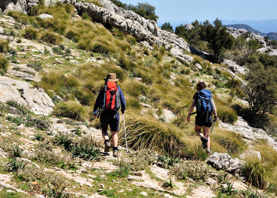
Dramatic coastlines on the Torre Caleta walk.
Author/researcher Charles Davis sums up this beautiful, unspoilt region thus:
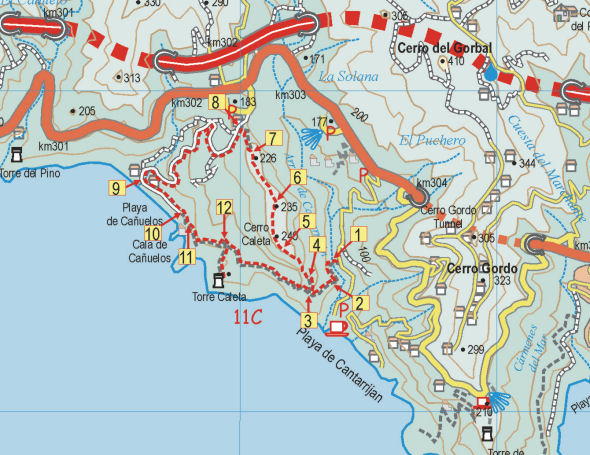
Map segment for the Torre Caleta walk.
“The Axarquía is one of Spain’s great places, and among the greatest places within it are the Sierras Tejeda and Almijara, which form the backbone both of the region and the present publication. Blessed with high summits, dizzying pinnacles, dramatic crags, deep ravines, dozens of springs, delightful rivers and the best coves on the Costa del Sol, this is an area that has something for everyone. And the only prerequisites for benefitting from all this are a desire to get off the beaten track and a set of relatively, sometimes very, sturdy legs.
If you’ve not seen them already, you can get an idea of how dramatic these mountains are from one simple fact, that the high peaks, including Lucero (1775 metres), Navachica (1832 metres) and La Maroma (2070 metres), are all within ten kilometres of the coast, rising out of the sea like a succession of immense pedestals, just waiting for humankind to enthrone whoever or whatever we find most sacred or simply most lacking in our quotidian lives.”

Axarquia; Las Cuadrillas, Walk 24.
You can see a sample walk here:- http://www.dwgwalking.co.uk/axarquiasamplewalk25.pdf
There’s information about the book Walk! The Axarquia (available as a printed book or as a pdf download book in A4 format) and the maps available for the region (printed, on paper and on Super-Durable material); there are also Custom Maps for Garmins for GPS users.
The Other South of France – The Cathar Way

On the Peyrepertuse Ridge, Cathar Way
“Threading its way through dramatic gorges carved out by tumbling mountain torrents and traversing a patchwork of oak mantled hills, Alpine pastures, dense pine forests, lush meadows, rocky plateaux, and regimented vineland, the Sentier Cathare stitches together drovers’ trails, logging tracks, smugglers’ paths, and winding country lanes to link some of the principal sites associated with the dissident Christian movement from which it takes its name.
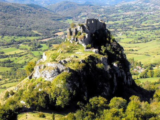
Roquefixade Castle, Cathar Way
Above all, we visit a succession of castles, each perched more improbably than the last on craggy peaks, castles whose evocative ruins have proved so compelling that they have conspired with history to stimulate our collective appetite for quests, mysteries and quixotic exploits.
This is a protean path, offering something for everybody, from the lover of wild
places to the aficionado of old stones, from the hearty athlete looking for a challenge to the New Age mystic seeking enlightenment, but whatever your motive for embarking on such an adventure, walking the Sentier Cathare is a hugely rewarding experience, in the course of which petty cares slip away, replaced by a headful of mountains, meetings, and vistas, and walking becomes a way of being, so that come the end there is every chance that you will want only one thing, to turn round and do it all over again.”
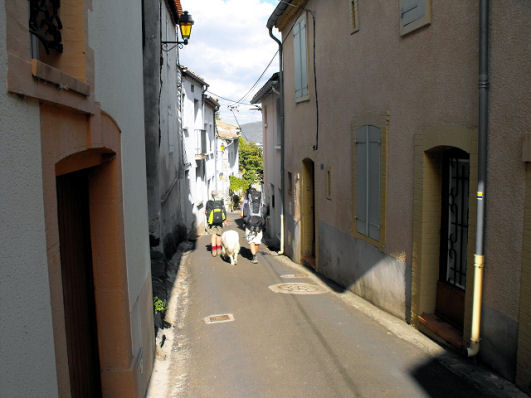
Rue Principale, Ginoles, Cathar Way
~ these are the inspiring words of Charles Davis, author and researcher of wonderful walking, including The Cathar Way, a 250 kilometre trail crossing the Languedoc region of southern France from the foothills of the Pyrenees to the shores of the Mediterranean.
Want to know more? Take a look here: http://www.dwgwalking.co.uk/catharway.htm
The Garden Isle of Madeira – Beautiful in Spring

Aloe aborescens
Springtime! The northern hemisphere’s Spring is well under way now. For those interested in flora, there’s nowhere quite like Madeira in the Springtime.
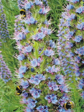
Echium candicans – popular with bees
Madeira is always green – now it bursts into colour and perfume. Many of the plants you’ll come across while walking its levadas and country paths are endemic and exclusive to the island.
Two of the many beauties to look out for are orchids and the rare Yellow Foxglove. If you enjoy seeing wonderful plants growing strong and free, Madeira is the place to visit.
For information about the Garden Island, including books and maps, see http://www.dwgwalking.co.uk/mad.htm
(The plant images here were taken by Shirley & Mike Whitehead, authors and researchers resident on the island of Madeira.)

Yellow foxglove (Isoplexus sceptrum)

Orchis maderensis
Gran Canaria – what a destination! And The Gran Canaria Tour & Trail Super-Durable Map is Here!
Never been? This is one of the less-visited Canary Islands but that could be set to change. The digital version of Gran Canaria Tour & Trail Map has been available for a few weeks – now comes the Super-Durable printed version. For more information see: http://www.dwgwalking.co.uk/gcan.htm
Go soon before the summer visitors arrive and have those wonderful mountains and ancient walking trails just about to yourself.
Rambling Roger knows the island like the back of his hand – see his website here: http://www.ramblingroger.com/hiking_maps/index.html
Walk Spain’s Alpujarras: download the guide

One of the White VIllages
Walk! The Alpujarras is now also available in pdf format.
This beautiful region of southern Spain offers high peaks, long ridges, clear mountain streams, woodland, amazing views and picturesque white villages.
‘Walk! The Alpujarras’ takes you through 34 detailed routes with the expert guidance of author/researcher Charles Davis.
Try a free sample walk here: http://www.dwgwalking.co.uk/178walkalpujarrassample.pdf
To see details of the printed book, the Alpujarras Tour & Trail Map and the book as a pdf, look here: http://www.dwgwalking.co.uk/alp34walks.htm
Mallorca (Balearic Islands) Author Update
 From Charles Davis, author/researcher
20 February 2014 17:39
Bit of vital information for our updates pages:
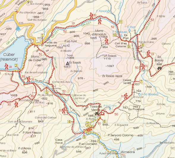
Anybody planning on walking the Dry Stone Way, Mallorca (GR221) has a slightly surreal and stunningly irritating headache coming their way.
The refuge at Tossals Verds is closed on safety grounds and won’t be open before October if then. There is no comparable accommodation between Soller and Lluc. The ‘alternatives’ (such as they are) proposed by the authorities can be found here:
http://www.conselldemallorca.net/media/34483/alternatives_tossals_ANG.pdf
Taxiing back and forth between Cuber and Lluc rather spoils the point of doing a LDP*. Staying at Cuber would be lovely, though it might be a bit Spartan for some tastes and implies carrying extra weight. To get an idea of what this unmanned refuge is like, see
https://www.youtube.com/watch?v=bwweVJtw1fE or google ‘refugio cuber’ for photos.
*LDP = Long Distance Path
The map section above shows a section of Walk! Mallorca Tour & Trail Map to illustrate the relative locations of Tossals Verd and Cuber. For more information on Mallorca maps and walking see http://www.dwgwalking.co.uk/mall.htm
Madeira – the Garden Isle
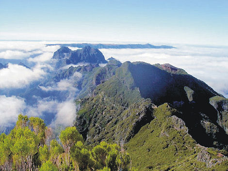 If you were standing, right now, on the Pico do Ruivo, Madeira, and looked west, this is the view you’d be seeing. After one of the gloomiest, darkest northern European winters on record, wouldn’t this do your soul good, not to mention your fitness 🙂 ?
Madeira has long been an A-grade walking destination, offering levada walking along man-made water canals as well as trails for the most adventurous mountain hiker. Then there’s the wonderful endemic plant life too. The best thing is – simply go and see for yourself.
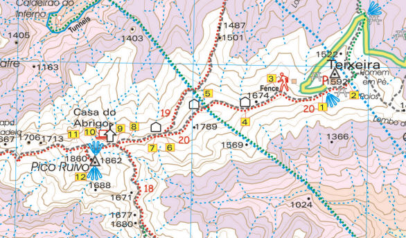 Here’s the map that goes with the photo.
There’s more information here :- http://www.dwgwalking.co.uk/mad.htm
Field Test Report – Gran Canaria Tour & Trail Map
Our thanks go to Andrew who field tested the beta version of Gran Canaria Tour & Trail Map:-
On 2 February 2014 Andrew K wrote:
Hi both,
Just a quick note to thank you both for giving me access to the beta Tour & Trail map for Gran Canaria.
We didn’t come across any issues whilst using it around the central and southern parts of the island. I used it on my Android smartphone and loaded the gpx track files which matched up perfectly to the map.
Looking forward to purchasing the final version when it’s available.
All the best,
Andrew
More information about this amazing island can be found here;
Thank you Chris Kurton – in Mallorca
Chris adventuring in Mallorca.