
Walking Newsletter Now Available
Take a look at Discovery Walking Guides latest newsletter; topics include Menorca, Lanzarote, free digital maps and Walk! books and more. Click the link to read all about it.
Ibiza! Formentera!

Ibizan sunset
Hot off the press are two great new maps, highly detailed and just the thing whatever you want to do on this lovely isle; bikers, hikers and beach-lovers will find just what they seek on Ibiza and its little sister, Formentera.
There’s a special offer on for either (or both) maps :-

Just one of Formentera’s perfect beaches
Ibiza – white beaches, azure seas, verdant pine forests UPDATE
Forget the tabloid image of all-night clubbing, loud music and young visitors in various states of inebriation and undress.
The real Ibiza is a beautiful place, blessed by a wonderful climate with many hours of sunshine each month.
Numerous fine white beaches and little coves tempt the swimmer and sun-worshipper, while walking/biking trails meander through wild flowers underneath a canopy of fragrant pine woods.
A few Ibizan facts:
- Ibiza is one of the Balearic Islands, in the Mediterranean east of the Spanish mainland.
- It’s a naturally beautiful island with white sand beaches, turquoise seas and verdant pine woods, olive groves and wild flowers.
- The island has a long history of invasion by various forces including the Ancient Romans, the Vandas, Byzantines, the Moors, the Norwegians and were finally claimed by Spain. Nowadays, the ‘invaders’ are tourists.
- Ibiza is 572.56 square kilometres (221.07 sq miles) land area.
- The highest point of the island is Sa Talaiassa, at 475 metres (1,558 ft).
- The population is estimated at approximately 132,500.
- Eivissenc, a dialect of Catalan, is spoken on Ibiza, as is Spanish. English is widely spoken in tourist areas.
- Though renowned for its clubbing scene, there are beautiful beaches, pine woods and walking/biking routes across the island.
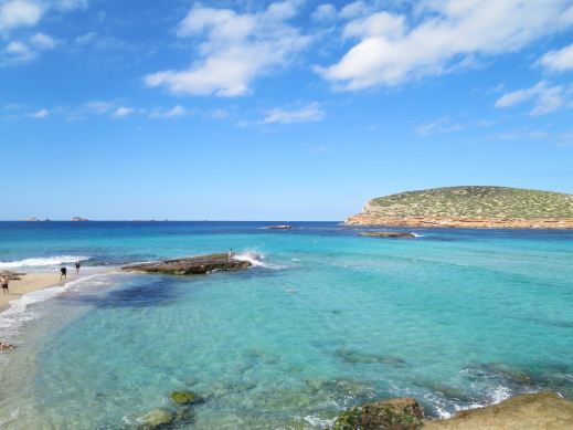
One of Ibiza’s beautiful coves (on the west coast)
Until now, the maps available for the island of Ibiza have been basic and without the kind of detail you need to enjoy exploring.
That’s all set to change as Discovery Walking Guides has completed their ‘on the ground’ mapping survey. Design of the new Ibiza Tour & Trail Super-Durable Map is well under way.
Click HERE for all the details of the new Ibiza map.

KICKSTARTER PROJECT
How would you like to be part of the launch of this exciting new map project? For a modest pledge you can help this project to fly – and receive free maps too.
There’s still time to part of this exciting project.
Take a look at DWG’s Kickstarter project here:
Fuerteventura Super-Durable Map is here!
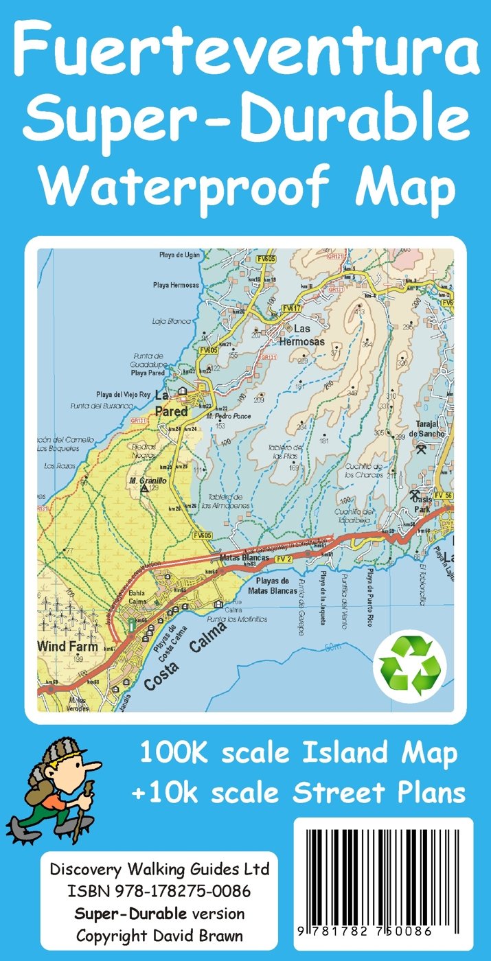
Fuerteventura Super-Durable Map 2015
Just arrived – Fuerteventura Super-Durable Map. HIghly detailed and right up-to-date and printed on a special polymer withstanding rain, wind and folding many times. The island appeals to windsurfers, cyclists, walkers and adventurers, and has miles and miles of pure, clean beaches too.
It’s an intriguing island with a timeless quality, the raw bones of the island shaped by a volcanic past. Unique – once experienced, never forgotten. Read more here

Aloe Vera thrives in Fuerteventura’s desert conditions.
http://www.dwgwalking.co.uk/fuerteventura.htm

On Fuerteventura’s east coast

Wind and Watersports on Fuerteventura
Walking on the Canary Island of La Gomera? Updates December 2014

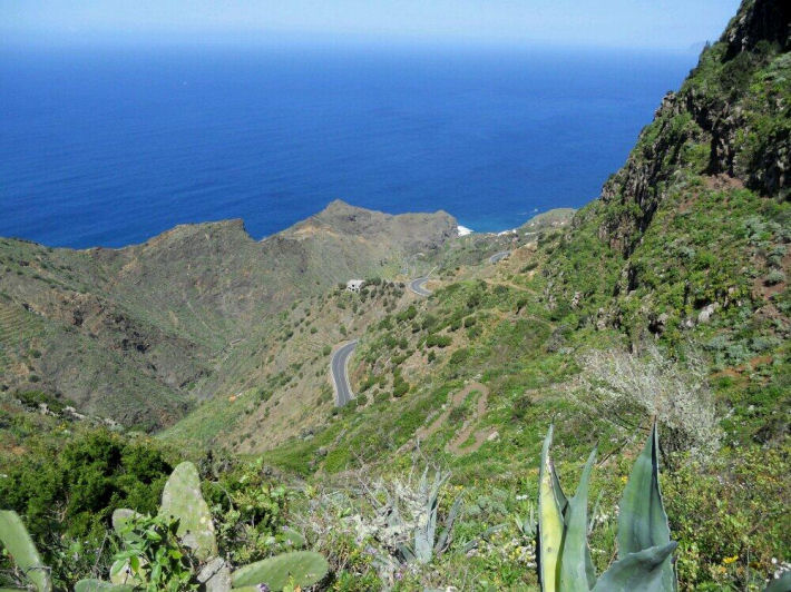
On La Gomera – Tenerife’s Teide visible
Winter is a great time for walking in the Canary Islands. La Gomera is easily reached yet remains wild and natural with breathtaking scenery and the winter weather is usually fresh yet gentle, with plenty of blue skies; though there can be periods of rain it rarely lasts for long.
We thank Pamela and Malcolm Boura for these useful and detailed notes they made on their visit there this December; they were using the guidebook Walk! La Gomera and La Gomera Tour & Trail Map.
All of the new paths and those missing from your map, referred to below, are shown correctly on OpenStreetMap. You may need to use an editor to look at some of the tags for detailed information such as tarmac/unpaved.
Walk 1
Start of walk: OpenStreetMap shows a path running from a little way down the path to La Laja to Wp2. We did not walk this but the west end looks good and it looks clear on aerial photographs. It probably provides an alternative to the road. According to some rather uncertain contours, it adds about 30m of ascent.
Easy route first paragraph: new path avoiding buildings and noisy dogs to Wp5, see OpenStreetMap. Adds a few metres of ascent but is shorter and is the signed route.
We walked the first part of Walk 1 as the start of Walk 2.
Walk 3
If the start of this walk is not in La Laja, part of the descent to and ascent from the village can be avoided by taking a good donkey path, with fine views of the village, which starts as you cross the spur after Wp16 and emerges to rejoin the main route at the last houses of La Laga, where the sculptures are, after Wp2. This good and useful path is not shown on your map. See OpenStreetMap.
Walk 8
We think this walk should be done in reverse with the steeper and rougher paths as ascent and then the long, fast, gentle descent for the return. Climbing up Barranco do los Cocos would also be much safer than going down, especially in rain, as well as giving a better opportunity to appreciate this lovely valley.
The start of this walk in Playa Santiago has changed after recent works on the river bed. Now follow the east bank until scrambling up the road embankment at the end of the track at Wp2. The first zig and zag are tarmac. Alternatively, parking is available at the adjacent rest area.
There is a clear signposted path branching left before Wp7 which leads directly to the new wooden bungalow. This avoids the final part of the climb towards Targa and the short length of road. This good and useful shortcut is not shown on your map.
Walk 22
The track up Barranco del Valle Gran Rey at present can not be accessed from the lane which starts behind the bus station. This may be temporary.
Walk 23
We walked this in reverse and the start in this direction is confusing and needs instructions. Suggest “A few metres after leaving the road, head right up some rough rock cut steps.”
Walk 25
Some of the “path” is washed away crossing the gullies between Wp2 and Wp3. OpenStreetMap shows a path directly from the start to Wp6 which may provide a better alternative.
Just before reaching the road at the top of the barranco, the path goes to the north of the summit. This is not obvious on the ground and it is shown incorrectly on your map. The route shown on your map goes across a steep and dangerous hillside. See OpenStreetMap.
At Wp17, go slightly left across the road to a painted waymark on the crash barrier. The path from there goes directly to the cemetery.
Taking the alternative route in the last paragraph on your walk, turn right down a track just before the dirt track reaches the road. When the track reaches the bamboo, turn left on an overgrown but passable path to emerge on the road where the path entrance is marked by a cairn. NB This is a new road not shown on your map.
See OpenStreetMap for the extra paths and roads.
Walk 29
We very much enjoyed this straight forward walk but where the track junction is shown on your map between Wp7 and Wp8, we took the track forking left which continues as a good signposted path running parallel to your route but avoiding the road. This leads directly to the saddle between Mt Bianca and the masts and then along the ridge to the masts. See OpenStreetMap. We saw the ends of paths that probably bypass the masts to the NE, cutting the corner.
There is a signposted junction to the west of Wp8, at N28 10.802, W17 17.708, but the signpost has been sited sufficiently far from the junction (a few tens of metres east) to be misleading, especially if doing the walk in reverse. This needs checking on the ground before more can be said, as there were signs of a rough path north from the signpost, although I suspect that was due to people that had been misled!
La Gomera – on Walk 31 (from Walk! La Gomera by Charles Davis). Image courtesy of ‘Inspire Our Trip’.
Walk 31
Unfortunately, the dirt track up Barranco de la Palmita has become a tarmac lane for much of its length. See OpenStreetMap for details of which bits (you may need to look at the editor information to get details of the surface).
Spain’s Costa Del Sol: Sierra Almijara + Sierra Tejeda = La Axarquia

Dramatic coastlines on the Torre Caleta walk.
Author/researcher Charles Davis sums up this beautiful, unspoilt region thus:
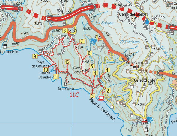
Map segment for the Torre Caleta walk.
“The Axarquía is one of Spain’s great places, and among the greatest places within it are the Sierras Tejeda and Almijara, which form the backbone both of the region and the present publication. Blessed with high summits, dizzying pinnacles, dramatic crags, deep ravines, dozens of springs, delightful rivers and the best coves on the Costa del Sol, this is an area that has something for everyone. And the only prerequisites for benefitting from all this are a desire to get off the beaten track and a set of relatively, sometimes very, sturdy legs.
If you’ve not seen them already, you can get an idea of how dramatic these mountains are from one simple fact, that the high peaks, including Lucero (1775 metres), Navachica (1832 metres) and La Maroma (2070 metres), are all within ten kilometres of the coast, rising out of the sea like a succession of immense pedestals, just waiting for humankind to enthrone whoever or whatever we find most sacred or simply most lacking in our quotidian lives.”

Axarquia; Las Cuadrillas, Walk 24.
You can see a sample walk here:- http://www.dwgwalking.co.uk/axarquiasamplewalk25.pdf
There’s information about the book Walk! The Axarquia (available as a printed book or as a pdf download book in A4 format) and the maps available for the region (printed, on paper and on Super-Durable material); there are also Custom Maps for Garmins for GPS users.
9 Hours of daily sunshine in March? 22C tomorrow? It’s Gran Canaria, right now!
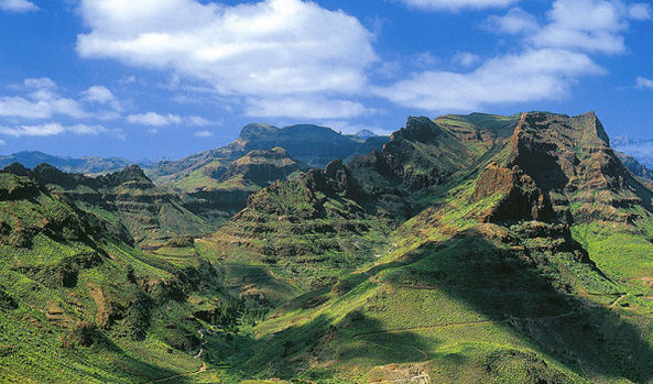 They don’t call it the ‘mini-continent’ for nothing!
Though it’s under a 5 hour flight away (from the UK and western Europe) it feels like a different world.
There’s plenty to see and do, though the best thing of all is to walk the trails and marvel at the views, the forests, flora and fauna and the ancient villages.
 Discovery Walking Guides launched their Gran Canaria Tour & Trail Super-Durable map only a week ago, and the demand has been exceptional. It certainly looks as if Gran Canaria is emerging from the shadows to become this year’s ‘must walk’ destination in the Canary Islands.
There’s wonderful dramatic scenery and unspoilt villages, plus clean, spacious beaches for the days you don’t want to walk (or bike or drive).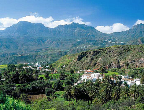
To find out more about the map look here: http://www.dwgwalking.co.uk/gcan.htm
There’s plenty of walking information from Rambling Roger who lives there and knows the island like the back of his hand; look here: http://www.ramblingroger.com/
If you fancy 22C and nine hours of sun in March, hop over to Gran Canaria.
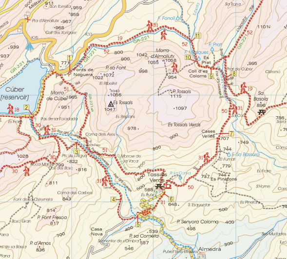
Gran Canaria – mapping update
For those itching to get their hands on the first really detailed and up-to-date map for walkers/hikers/bikers on the island of Gran Canaria (Canary Islands, Spain), see this report from the cartographer (27 January 2014):-
David Brawn
“I’ve just today reclassified the roads after chatting with Rambling Roger, and then added the island’s beaches. Just a couple of corrections, add a Lat/Long 1 minute grid, add flower symbols for all the gardens and garden centres, then design a new legend and I think I’m nearly there with the new Gran Canaria Tour & Trail Super-Durable Map.”
David Brawn, Cartographer, DWG Ltd
