
Another Challenge?
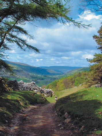
Challenge No.2 The Yorkshire 3 Peaks
Great Britain offers many opportunities for discovering the outdoors, from gentle strolls to big challenges. Here’s one of the big ones. You could plan to tackle the Yorkshire 3 Peaks yourself, or simply lose yourself in the experiences of others who’ve planned and completed the climbs and descents, following them step by step from your own armchair.

Key to success in completing the Challenge Routes in good time is planning, down to the finest details. It’s fascinating to find out how it’s done.

A good large scale map, rip-proof and waterproof is an essential tool. Find out about the most helpful ‘how to’ guide and the best map for the job here.

Heading towards Whernside
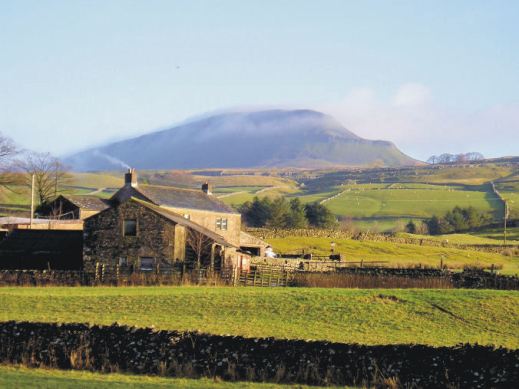
Pen y Ghent in the early morning

Our last peak – Pen y Ghent crags
Are You Up For A Challenge?
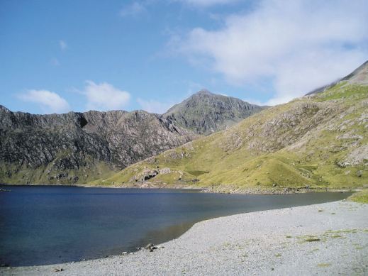
Challenge No.1 The National 3 Peaks
With the Christmas/New Year break coming up for many, why not plan to complete the National 3 Peaks Challenge. If that’s a bit too energetic, experience these iconic ascents and descents from your armchair. Here’s a few images to tempt you.
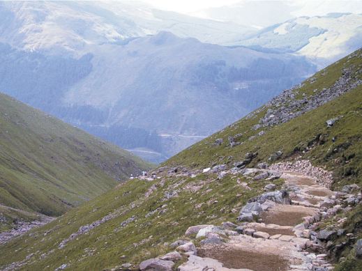
Find out how to plan your own Challenge. Get the best ‘how to’ advice from those who have completed it. Get the best, detailed up-to-date maps to keep you on track.

Post-Christmas Walks – Marvellous Malverns
After all the turkey, pud, mince pies and drinks, wouldn’t it feel good to get out in the fresh air and get moving?
Walk 17, The Worcestershire Beacon
If you’re in reach of the Malvern Hills you’re spoilt for walking choices. How about climbing the Worcestershire Beacon? It only takes an hour and a half, ending at a café at St. Ann’s Well. It’s a circular walk so you end up back at your transport.
Walk 21, Eastnor Park
Or perhaps a delightful, gentle stroll that skirts Midsummer Hill then climbs to the landmark obelisk in Eastnor Park before descending to Eastnor village?
Field and woodland paths drop us close to Ledbury and a charming back route through the town to The Market House.
It’s a 2 hour linear walk with taxis available at the end if needed; just the right length to get moving again post-Christmas.
Warm Weather Walker – or Intrepid Snow-Hopper?

Blackstone Ridge, England’s South Pennines
On flicking through outdoor activity magazines, you’ll see plenty of photographs of fit-looking intrepid types posing on rugged, windswept mountain peaks wearing plenty of layers. Is this you? Do you wish you were here? Or do you long to get away to kinder climates?
Do you fit fairly neatly into one of the following groups?
THE INTREPIDS, striding through winter landscapes, dealing with biting winds and snow-capped hills in full weather-defying gear, and feeling invigorated as you finally reach a cosy country pub for a well-earned lunch.
How about England’s rugged and beautiful South Pennines? They’ve had quite a bit of a snow-dusting already this winter, although this pic taken on Corn Du was taken in summer.

Tenerife, walking above the west coast
WARM WEATHER WALKERS, escaping to warmer climes when winter bites at home, exploring in t-shirt, shorts, sunhat and sun-cream under a blue sky, sweating as they gain the heights, then
relaxing on a beach as the sun goes down.
There’s a whole lot of destinations within a 4-6 hour flight from northern Europe; Tenerife is ideal for pretty reliable gentle temperatures with several sunny hours per day.
For lots of walking destination ideas and inspiration, take a look HERE.
Of course, you might well have a boot in each camp so to speak, getting the best of all walking worlds. It would be great to know your opinions.
Isle Of Wight Adventure Package – now released
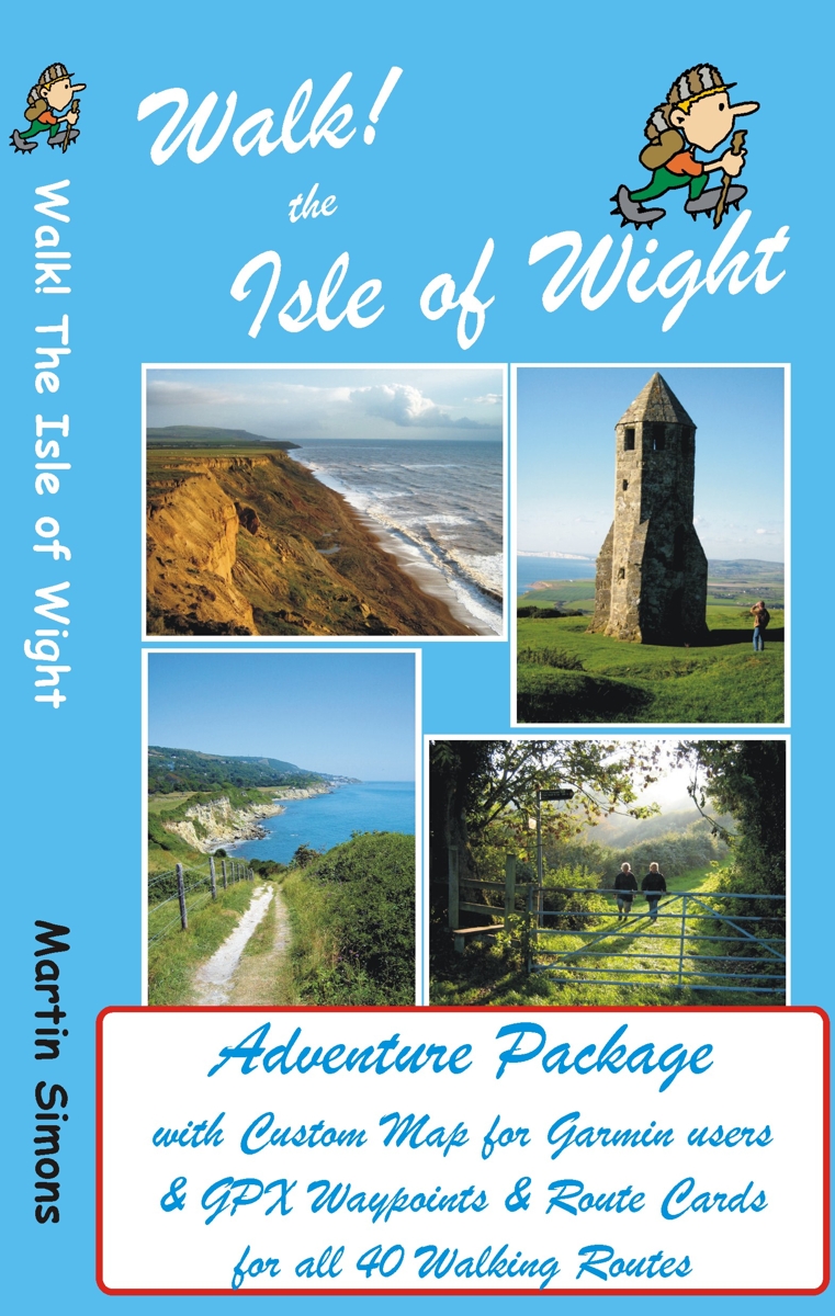
GPS users take note; our latest edition Walk! The Isle of Wight walks have been transformed into pdf route cards and re-packaged with ‘OSlike’ digital mapping for the Isle of Wight and gpx waypoints.
This is a great time to explore the Isle Of Wight; school holidays are almost over and there’s always the chance of some late summer sunshine.
Isle of Wight Adventure Package:-
Isle of Wight ‘OSlike’ Custom Map
gpx waypoints,
pdf ebook of 41 A4 pages
– all delivered as a ZIP file download for £11.99
See all the details here:-
Walk! The Isle Of Wight – new edition is here!
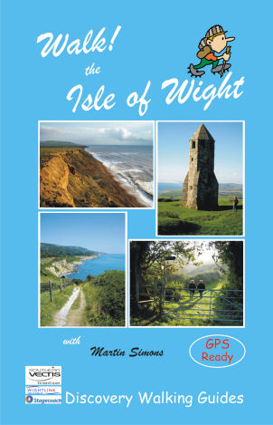 There’s no doubt that the Isle Of Wight is a wonderful place to visit and the best way to experience the island is on foot and by bus.
Walk! The Isle Of Wight (3rd edition) details 40 step-by-step walking routes, most accessed using public bus services.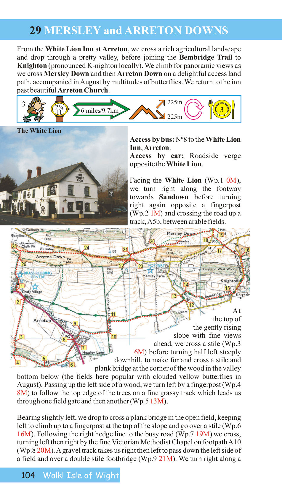
Each walk has its own colour OS Map, with the walking route and waypoints highlighted.
Here’s a sample page from the book so you can see what you’re getting:-
Good pubs (author tested) are recommended at the end of many of the routes.
See all the info here:-
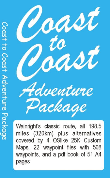
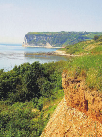
Walk England Coast to Coast – a new approach to a classic adventure
 This classic route, pioneered by Alfred Wainwright, crosses northern England from – you guessed it – coast to coast. There are other books available – so what makes this one different?
Here’s what the author and researcher of this new take on a favourite challenge, has to say:-
“On a fortnight’s adventure with my mates Keith and Nigel from St Bees to Robin Hood’s Bay (July 2012) I talked to loads of C2Cers subtly asking what would make the route better. What everyone wanted was accurate navigation along the route, especially if it included ‘real time’ mapping.
There are loads of guide books about the Coast to Coast so rather than adding another book I have produced what every C2Cer wants:-
A system of accurate navigation for the whole route using ‘real time’ mapping on a Garmin gps or Viewranger phone app.
The result is a Stage by Stage guide, with alternatives, that gives you a real time mapping gps unit showing exactly where you are on the route along with the walking instructions that will ensure that you stay on the correct route.
On your Garmin, or Viewranger app, you will be on the right track every step of the way for all of the 198.5 miles (320km) from St Bees until you arrive at The Bay Hotel in Robin Hood’s Bay; where you will find the Wainright Bar with its C2C ‘sign in’ book.” David Brawn, author/researcher
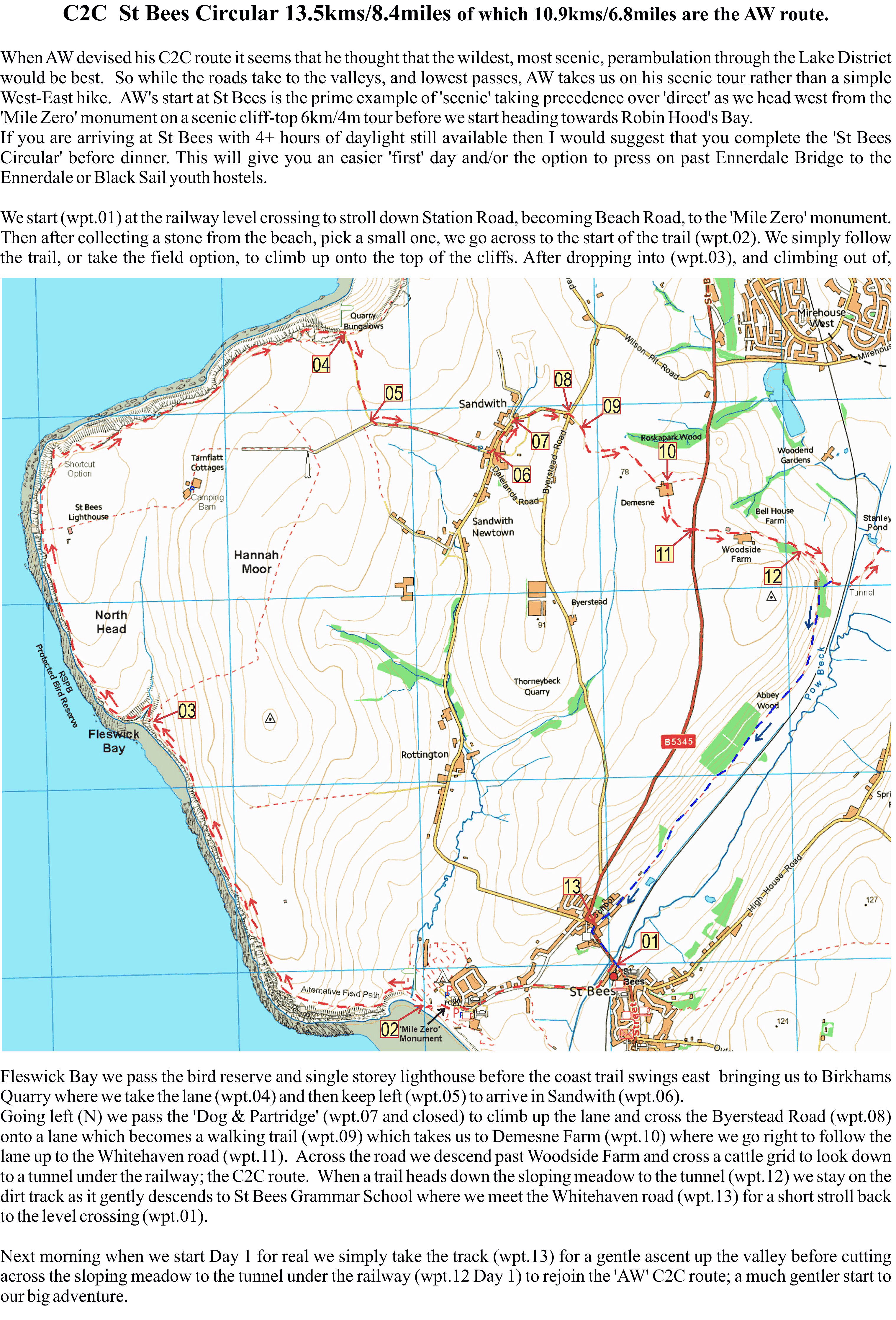
A sample page from the start of the adventure.David Brawn, author/researcher
For more information go to http://www.dwgwalking.co.uk/c2coast.htm
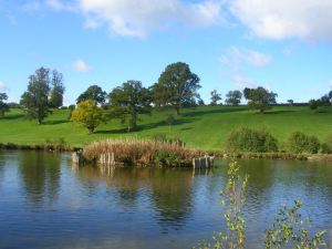
Walking the Yorkshire Dales – Just the Thing for Spring
Wharfedale – following Walk 5

The village of Gayle, visited on Walk 25
The Yorkshire Dales is deservedly well-loved for its history, the beauty of its landscapes and its many unspoilt little stone villages, most with tempting pubs.
The best way to appreciate the Dales is on foot – and one of the very best times of year to do so is Springtime – right now!
If you have a Garmin GPS you can download Yorkshire Dales Custom Maps (there are two to cover the area) and get going on the trails.
For more information about the digital mapping for the Yorkshire Dales, see:- http://www.dwgwalking.co.uk/garminydalesnecustommap.htm
– and http://www.dwgwalking.co.uk/garminydalesnwcustommap.htm

The spectacular River Strid (Walk 1)
We recommend the book Walk! The Yorkshire Dales (North and Central) for the best walks (and the best pubs on route too)
See:- http://www.dwgwalking.co.uk/yorkshire%20dales%20N&C.htm
Worth A Read – article on the Isle of Wight in the Weekend Telegraph

Expansive views on Week Down (walk 27, Walk! The Isle of Wight)
There’s a good article on the Isle Of Wight in ‘Coastal England’, a supplement with yesterday’s (15 March 2014) Weekend Telegraph.
Looking towards Whitecliff Bay from the clifftop path (Walk 40, Walk! The Isle of Wight)
The article homes in on the rich history of the island and offers plenty of ideas of things to do. For such a small place it has a wealth of festivals, including the Isle of Wight Walking Festival.
Find it here: http://www.telegraph.co.uk/sponsored/travel/visit-england/10676115/things-to-do-on-the-isle-of-wight.html
For details of walking there see http://www.dwgwalking.co.uk/isleofwight.htm
For information on mapping look here: http://www.dwgwalking.co.uk/garminisleofwightcustommap.htm
Exmoor – wonderful walking and now OSlike Custom Maps too
Wonderful walking in Britain’s Exmoor!
Here’s just one splendid view overlooking Lynton and Lynmouth while following Walk 16 from ‘Walk! Exmoor’ with David and Carol Hitt. For more information about walks here, see : http://www.dwgwalking.co.uk/exmoor.htm
And now – for Garmin users – download OSlike Custom maps for Exmoor, overlaid with the 40 varied routes from Walk! Exmoor.
OSlike Custom Maps can be used in Google Earth, Garmin Basecamp and Garmin gps units.
There’s east and west sections to download, (£3.99 each) which can be found here: http://www.dwgwalking.co.uk/garminexmoorecustommap.htm
and here: http://www.dwgwalking.co.uk/garminexmoorwcustommap.htm
