
Tenerife – How About A Free Sample Walk?
 Here’s a great idea – download a free sample walk taken from Walk! Tenerife. You’ll get the full walk description, mapping and images. There are 46 walks in the book, covering the island’s best walking areas.
Your free download is Walk 41 ‘Las Mercedes – Llano de Los Loros’. Our pic shows one of the great views from the route, over the Tahoido Dam and down to Tenerife’s north coast.
Here’s the link you need to access your free download; print it out on one sheet of A4 or save the pdf to your computer:- http://www.dwgwalking.co.uk/ten35walks.htm
Nearly Spring In Menorca
 Menorca might not be the first destination you think of for a walking holiday. We find it surprising and fascinating. It has beautiful wild countryside and great walking. The island is full of interest, especially if you have an interest in ancient history, archaeology, geology, birds or flora.
And if you’d like to escape the winter, you’ll find Spring starts a little earlier here.
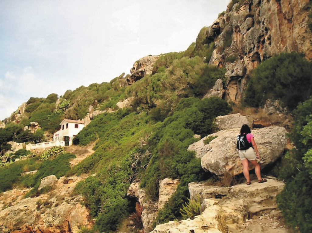
Above; on the Cales Coves route, Walk 30.
This pic (right) was taken on a coastal route (Walk 8) in the island’s south-east, crossing limestone ‘tables’.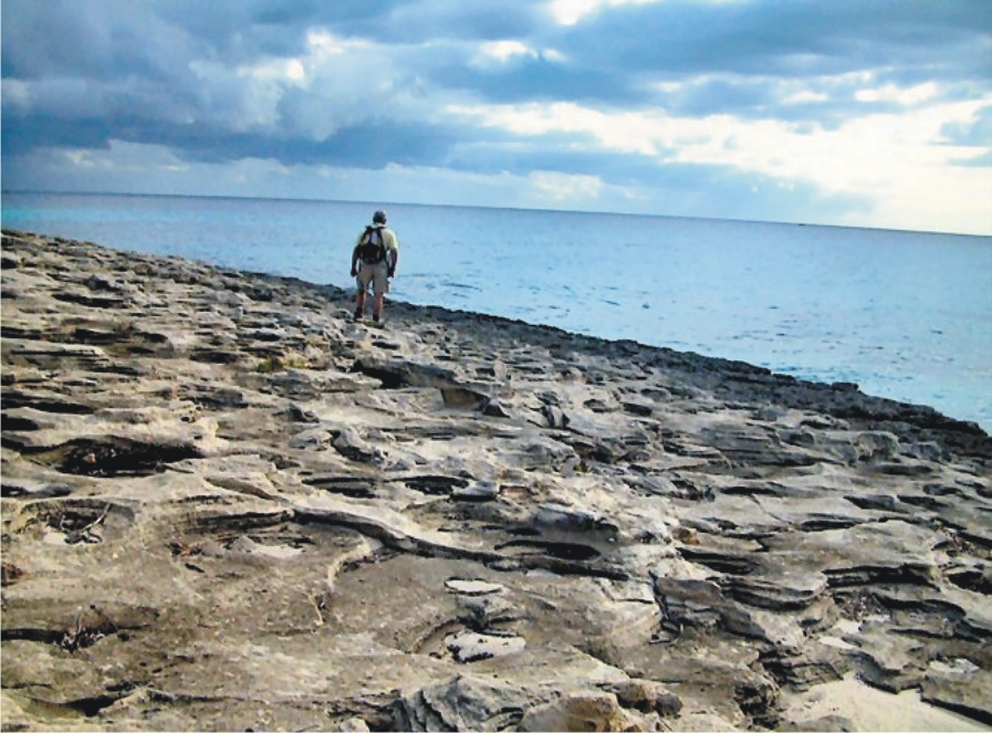
 – and here’s a view (below) along the rugged north coast on Walk 39.
More about walking on Menorca at http://dwgwalking.co.uk/men.htm
Gran Canaria Tour & Trail Super-Durable Map – design complete!
We’re excited to anounce that Gran Canaria Tour & Trail Super-Durable Map design is complete and  the print files are now with our specialist map printer. We’ll let you know when they’re ready to buy.
If you’ve never visited – why not? It’s a dramatic, beautiful island and only around 4 hours’ flight time from much of Europe. See more information http://www.dwgwalking.co.uk/gcan.htm
We’ve been working with Rambling Roger, resident on the island, who knows the island’s walking like the back of his hand. More about Roger here http://www.ramblingroger.com/
If you are a Garmin user you don’t even have to wait! Get the downloadable map for Garmin here http://www.dwgwalking.co.uk/garminGranCanaria.htm and you could be on those trails within hours.

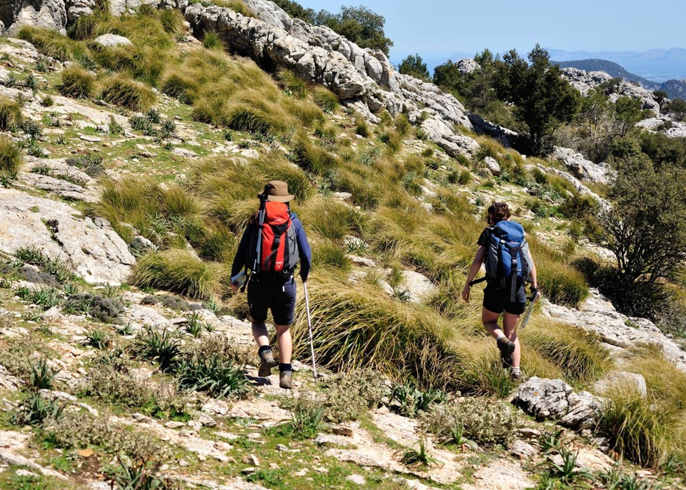
Mallorca – what a magical island!
The western half of Mallorca, (Balearic Islands, Spain) offers wonderul walking and breathtaking views.
Want to be here? See more: http://www.dwgwalking.co.uk/mall.htm

It’s worth getting up high to appreciate the views. Here’s the island of Sa Dragonera, viewed from La Trapa, Mallorca.
Lanzarote – important update – Tabayesco circular walk
Another update from Neil C, for the start (and end) of Walk 33 Tabayesco circular in Walk!

This is the track you follow at the start of the walk.
Lanzarote guidebook. Thanks Neil!
“We parked for Tabayesco circular (33) at the recycle bins (noting they were perhaps 70 or 80 metres from the bus stop).
There was a very clear unmapped track leading away from the bins in the direction shown on the map – I wasn’t entirely happy that it was the correct track which seemed to be mapped nearer the road junction, but we set off anyway (a car came down the track [shows how major it was] from nearby houses and the driver waved a friendly greeting to us).
After about 200 metres of walking and surprised not to have found the jeep track on the left, we were shouted at from a house garden above by an English voice: “You are going the wrong way!”. “Sorry?” I said, not quite clear how someone could know where we were going.
“This is the wrong way! Are you doing the Tabayesco Circular walk?”
“Yes”
“Then this is the wrong way. The recycle bins have moved since the book was printed – you want to go back to the bus stop and the track that leads up towards the broad ridge over there”
“Thanks”.
We returned to the bins and beyond them to the bus stop and found the real track correctly mapped.
Future walkers (until the book is re-published) should note that the walk starts from the bus stop and you walk on the coast side of it to access the first track mentioned. Thanks for a great time in Lanzarote – the book and map are invaluable!”
Neil C
If you’re doing Walk 33, note that the walk also ends at the bus shelter (where it starts). Disregard references to the bins at the start and the end of the route description.
Lanzarote – thanks Neil for this update
Walk! Lanzarote – thank you Neil for this feedback for Walk 26 (Uga to La Geria) and Walk 33 (Tabayesco Circular)
On 27 January 2014 Neil C wrote:
“We have just returned from nearly two weeks in Lanzarote, walking every day using the 3rd edition you kindly sent us.
It had to happen eventually! We walked 26 (Uga to La Geria) in reverse (because we had walked part of it the recommended way on a previous trip) and saw a group approaching us down the road from La Asomada, one of whom was carrying a blue walk booklet exactly the same as I was!
We exchanged notes and continued. I thought you’d be amused to learn of this. However, I will not do 33 that way round again! As well as having long steep ascents, the wind was blowing a gale into our faces on both the main upward sections making forward movement next to impossible.
I will e-mail you shortly with a few observations about the new edition’s contents, but meanwhile I will mention a wry smile that I had when I read that you said “there were four or five wet days when you surveyed for the book”. We had rain or drizzle almost every day! Also, when we did walk 33 and were about 1/4 way up the unpathed ridge, the sun went in, the strong wind grew even stronger and was then accompanied by very heavy, virtually horizontal rain: even our boots clogged with the mud from the ground! We arrived very cold and bedraggled at Los Helechos restaurante, and although I agree with your scathing comments, it was a haven of warmth and dryness for us that day!
More feedback shortly.
Regards
Neil
PS Greatly enthused by your new Majorca book which we’ll order ASAP and are even now planning when in 2015 we’ll go to try it!”
Gran Canaria – mapping update
For those itching to get their hands on the first really detailed and up-to-date map for walkers/hikers/bikers on the island of Gran Canaria (Canary Islands, Spain), see this report from the cartographer (27 January 2014):-
David Brawn
“I’ve just today reclassified the roads after chatting with Rambling Roger, and then added the island’s beaches. Just a couple of corrections, add a Lat/Long 1 minute grid, add flower symbols for all the gardens and garden centres, then design a new legend and I think I’m nearly there with the new Gran Canaria Tour & Trail Super-Durable Map.”
David Brawn, Cartographer, DWG Ltd
Gran Canaria – almost there …
Are you waiting for our new Tour & Trail Map before heading off to adventure on the wonderful island of Gran Canaria? Not long to wait now. Our cartographer, David is checking the design through and it will soon be off to the printers. A downloadable version will also be available. Want to know more? Look http://www.dwgwalking.co.uk/gcan.htm
In the meantime, check out Rambling Roger’s website – this man knows walking on GC like the back of his hand and we thank him for his valuable input into the map detail.
See his site http://www.ramblingroger.com/
Thank you Chris Kurton – in Mallorca
Chris adventuring in Mallorca.
Gran Canaria – new Tour & Trail Map approaches the finishing post
David, our cartographer, has been working on what will be the most detailed and up-to-date map of the dramatic island of Gran Canaria, Canary Islands. Keep checking here for the release date.
