
The Other South of France – The Cathar Way

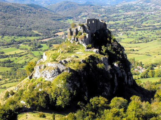
On the Peyrepertuse Ridge, Cathar Way
“Threading its way through dramatic gorges carved out by tumbling mountain torrents and traversing a patchwork of oak mantled hills, Alpine pastures, dense pine forests, lush meadows, rocky plateaux, and regimented vineland, the Sentier Cathare stitches together drovers’ trails, logging tracks, smugglers’ paths, and winding country lanes to link some of the principal sites associated with the dissident Christian movement from which it takes its name.
Roquefixade Castle, Cathar Way
Above all, we visit a succession of castles, each perched more improbably than the last on craggy peaks, castles whose evocative ruins have proved so compelling that they have conspired with history to stimulate our collective appetite for quests, mysteries and quixotic exploits.
This is a protean path, offering something for everybody, from the lover of wild
places to the aficionado of old stones, from the hearty athlete looking for a challenge to the New Age mystic seeking enlightenment, but whatever your motive for embarking on such an adventure, walking the Sentier Cathare is a hugely rewarding experience, in the course of which petty cares slip away, replaced by a headful of mountains, meetings, and vistas, and walking becomes a way of being, so that come the end there is every chance that you will want only one thing, to turn round and do it all over again.”
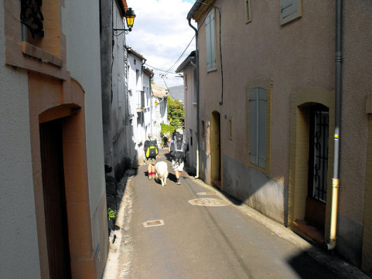
Rue Principale, Ginoles, Cathar Way
~ these are the inspiring words of Charles Davis, author and researcher of wonderful walking, including The Cathar Way, a 250 kilometre trail crossing the Languedoc region of southern France from the foothills of the Pyrenees to the shores of the Mediterranean.
Want to know more? Take a look here: http://www.dwgwalking.co.uk/catharway.htm
The Garden Isle of Madeira – Beautiful in Spring

Aloe aborescens
Springtime! The northern hemisphere’s Spring is well under way now. For those interested in flora, there’s nowhere quite like Madeira in the Springtime.

Echium candicans – popular with bees
Madeira is always green – now it bursts into colour and perfume. Many of the plants you’ll come across while walking its levadas and country paths are endemic and exclusive to the island.
Two of the many beauties to look out for are orchids and the rare Yellow Foxglove. If you enjoy seeing wonderful plants growing strong and free, Madeira is the place to visit.
For information about the Garden Island, including books and maps, see http://www.dwgwalking.co.uk/mad.htm
(The plant images here were taken by Shirley & Mike Whitehead, authors and researchers resident on the island of Madeira.)

Yellow foxglove (Isoplexus sceptrum)

Orchis maderensis
Worth A Read – article on the Isle of Wight in the Weekend Telegraph

Expansive views on Week Down (walk 27, Walk! The Isle of Wight)
There’s a good article on the Isle Of Wight in ‘Coastal England’, a supplement with yesterday’s (15 March 2014) Weekend Telegraph.
Looking towards Whitecliff Bay from the clifftop path (Walk 40, Walk! The Isle of Wight)
The article homes in on the rich history of the island and offers plenty of ideas of things to do. For such a small place it has a wealth of festivals, including the Isle of Wight Walking Festival.
Find it here: http://www.telegraph.co.uk/sponsored/travel/visit-england/10676115/things-to-do-on-the-isle-of-wight.html
For details of walking there see http://www.dwgwalking.co.uk/isleofwight.htm
For information on mapping look here: http://www.dwgwalking.co.uk/garminisleofwightcustommap.htm
La Axarquia, Costa del Sol: Thanks Bill L for your report

Taken while on the Loma de Las Quadrillas
Inland of Spain’s Costa del Sol rises the magnificent Sierras de Tejeda and Almijara. Mountains, ravines, streams and rivers await the adventurer.
This area, La Axarquia, is a gem for anyone looking for an unforgettable walking experience.
We’ve just received this report from Bill L who has been using the Axarquia Tour & Trail Custom Map and Walk! The Axarquia guidebook; see http://www.dwgwalking.co.uk/axarquia.htm
On 15 March 2014 10:05, Bill L wrote:
Hi David,
Have now used your Axarquia map for several weeks and get even more impressed.
Not only can you use it for your walks but you can also combine walks and tracks from, for example, GR 249 GR 242. Did Walk 22 yesterday and GR 242 Frigliana to Maro the day before.
Going to try some combinations next week. Amazing! It makes it very easy to walk these hills using GPS.
Regards
Bill
Costa Blanca Mountains – thank you Erik, for your valuable feedback.
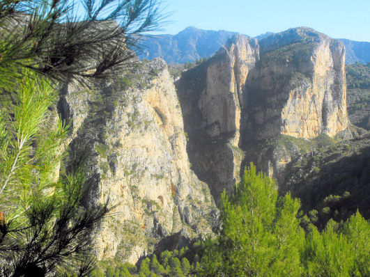
A tour of Raco Roig (Walk 20)
We welcome all user feedback – and in particular for our new downloadable maps for Garmin GPS.
Erik is a Costa Blanca Mountains expert and guides walks in the region. https://www.walking-holiday-in-spain.com
See the maps he’s referring to here:-http://www.dwgwalking.co.uk/CBM.htm
Here’s what he told us about his experiences using both our printed maps and our maps for Garmin GPS:-
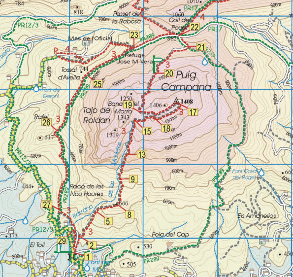 “Over the last month my walking customers have been testing the Discovery Walking Guides sheet map (Costa Blanca Mountains Tour & Trail Map) and downloadable basemaps on the eTrek Garmin 20 GPS for the treks and walking holidays we organise in the Costa Blanca Mountains.
The sheet maps are useful, although the 1:40,000 scale in the Spanish countryside is at the limit for precise navigating, the roads on the map translate as 55 metres wide on the ground – easily enough to get misplaced for a while. Some of what appear as roads are overgrown dirt tracks that are now footpaths, you can still get through but it can be a bit confusing so if you want to go off the marked routes you will need to be patient.
The marking of existing official routes and recommended routes is very good, there are some minor omissions and in one case replicating an error found on the local 1:20,000 topo. Not perfect but a very good approximation and an improvement on the local maps. The problem here is still the abysmal way marking of routes on the ground.
The area covered is quite extensive, although some of my routes fall outside the eastern margin of the coverage.
The basemaps for the Garmin GPS are very good, despite an initial problem with the download (for some reason Windows 7 stripped off the filetype which you had to add manually) they are now installed on all my Garmins. The image is very clear, much better than my own 1:25,000 basemaps that blur on zooming in.
The maps load relatively quickly on start-up and as you are walking the change from one tile to another is very smooth, in fact it is barely perceptible.
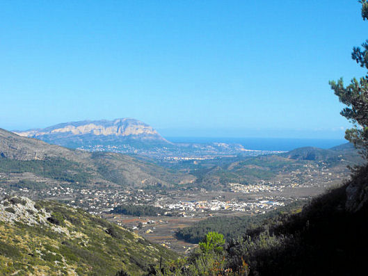
View over the coastal plain from the Costa Blanca Mountains
All in all a great improvement for those of us who have been struggling with Spanish maps for years, My only reservation is the 1:40,000 scale, I would love it if you would considering publishing 1:20,000 or 1:25,000 maps as a future upgrade.”
9 Hours of daily sunshine in March? 22C tomorrow? It’s Gran Canaria, right now!
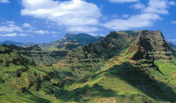 They don’t call it the ‘mini-continent’ for nothing!
Though it’s under a 5 hour flight away (from the UK and western Europe) it feels like a different world.
There’s plenty to see and do, though the best thing of all is to walk the trails and marvel at the views, the forests, flora and fauna and the ancient villages.
 Discovery Walking Guides launched their Gran Canaria Tour & Trail Super-Durable map only a week ago, and the demand has been exceptional. It certainly looks as if Gran Canaria is emerging from the shadows to become this year’s ‘must walk’ destination in the Canary Islands.
There’s wonderful dramatic scenery and unspoilt villages, plus clean, spacious beaches for the days you don’t want to walk (or bike or drive).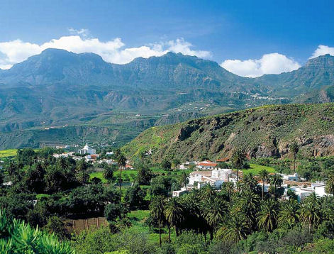
To find out more about the map look here: http://www.dwgwalking.co.uk/gcan.htm
There’s plenty of walking information from Rambling Roger who lives there and knows the island like the back of his hand; look here: http://www.ramblingroger.com/
If you fancy 22C and nine hours of sun in March, hop over to Gran Canaria.
Gran Canaria – what a destination! And The Gran Canaria Tour & Trail Super-Durable Map is Here!
Never been? This is one of the less-visited Canary Islands but that could be set to change. The digital version of Gran Canaria Tour & Trail Map has been available for a few weeks – now comes the Super-Durable printed version. For more information see: http://www.dwgwalking.co.uk/gcan.htm
Go soon before the summer visitors arrive and have those wonderful mountains and ancient walking trails just about to yourself.
Rambling Roger knows the island like the back of his hand – see his website here: http://www.ramblingroger.com/hiking_maps/index.html
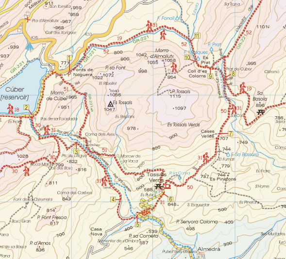
Exmoor – wonderful walking and now OSlike Custom Maps too
Wonderful walking in Britain’s Exmoor!
Here’s just one splendid view overlooking Lynton and Lynmouth while following Walk 16 from ‘Walk! Exmoor’ with David and Carol Hitt. For more information about walks here, see : http://www.dwgwalking.co.uk/exmoor.htm
And now – for Garmin users – download OSlike Custom maps for Exmoor, overlaid with the 40 varied routes from Walk! Exmoor.
OSlike Custom Maps can be used in Google Earth, Garmin Basecamp and Garmin gps units.
There’s east and west sections to download, (£3.99 each) which can be found here: http://www.dwgwalking.co.uk/garminexmoorecustommap.htm
and here: http://www.dwgwalking.co.uk/garminexmoorwcustommap.htm
Thanks William L for Your Feedback (Axarquia, Costa del Sol, Spain)
William L sent the following message to us, after using our Axarquia (Costa del Sol) Custom Map for Garmin:-
From: William L, Date: 25 February 2014 19:00
Subject: Walking Axarquia
Hi David
I used your your map in my Montana today and was impressed, I loaded it directly to the GPS memory so it could overlay my Topo Spain.
This worked very well for me so I could switch maps in seconds and compare. Must say I’m impressed, not being a fan of 1.40,000.
Thanks for your help with the file,
Regards
Bill
Sent from my iPad
For info look here :-
Walk Spain’s Alpujarras: download the guide

One of the White VIllages
Walk! The Alpujarras is now also available in pdf format.
This beautiful region of southern Spain offers high peaks, long ridges, clear mountain streams, woodland, amazing views and picturesque white villages.
‘Walk! The Alpujarras’ takes you through 34 detailed routes with the expert guidance of author/researcher Charles Davis.
Try a free sample walk here: http://www.dwgwalking.co.uk/178walkalpujarrassample.pdf
To see details of the printed book, the Alpujarras Tour & Trail Map and the book as a pdf, look here: http://www.dwgwalking.co.uk/alp34walks.htm
